
What is CSSL Weather Intelligence?

CSSL Weather Intelligence is a central access point for weather data across Canada, bringing surface observations, radar, satellite, lightning, and forecast models together in a single view. It is organized into three sections: Observations, Forecasting, and Historical.
Observations
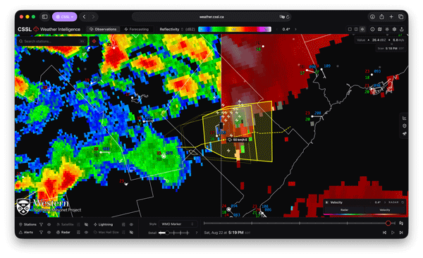 Accurate, timely surface data is essential to understanding severe convective storms, particularly in a country with climates as varied as Canada's. In-situ observations (those collected directly at ground level) measure temperature, precipitation, wind speed, humidity, and other variables where storms affect people and property.
The portal aggregates publicly available station networks from across Canada and the United States, alongside the specialized high-density networks installed and maintained by the Northern Mesonet Project (NMP). These NMP networks serve a dual purpose: evaluating new techniques and technologies, and capturing weather events at high temporal resolution in underserviced areas prone to severe convective storms.
No single instrument captures a storm in full, so surface data sits alongside remote sensing. Satellite imagery tracks large-scale atmospheric processes. Weather radar (including individual Canadian radar sites and a selection of U.S. radars near the border) reveals precipitation and storm development aloft. Lightning detection sharpens severe weather identification, and interactive alerts from Environment and Climate Change Canada (ECCC) add situational context. All of it is tied to a common timeline, so any point in the day can be scrubbed through.
Forecasting
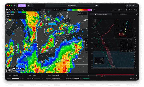 Observations describe what is happening now; forecast models project what comes next. CSSL Weather Intelligence carries HRDPS, HRRR, RDPS, GFS, and ICON, along with a range of storm-related parameters calculated in-house by CSSL. Vertical profiles (soundings and hodographs) can be generated at a single point or across a selected area, and forecasts from CSSL, ECCC, and Nadocast sit alongside the raw model output. Forecasters can also draw and export their own outlooks directly in the portal.
Historical
Severe weather is easier to understand in hindsight. The Historical section holds CSSL's Severe Storm Summaries, where past events can be replayed in full; stations, radar, lightning, alerts, and hail reports all moving together along the timeline. Station data can be downloaded for further analysis.





