Two tornadoes in southern QC on July 21
The NTP has confirmed two tornadoes in southern Quebec on July 21. The first occurred at Harrington, northwest of Montreal, snapping power poles and trees and causing some damage to structures. It was assigned a rating of EF1. Note that further analysis of high-resolution images of the tree damage could result in an upgrade to EF2.
The second tornado occurred with the same storm but approx. 50 km to the northeast at Saint-Donat. The damage was mainly to trees, and rated at EF0.
Full details are available with the event summaries below, along with a regional map, survey summary maps, and survey photos. The events can also be plotted on a map using the NTP Dashboard here.
====
Event Name: Harrington, QC
Date: July 21, 2026
Start Time: 5:30 PM EDT (2130 UTC)
Final Classification: Tornado (over land)
Preliminary EF-Scale Rating: EF1
EF-Scale Damage Indicator / Degree of Damage: C-ETL/DOD-4
End of damage track: 45.8865N, 74.5628W
Location of worst damage: 45.8488N, 74.6033W
Description: Damage to trees, power poles, several buildings including barns, homes and a shed was reported in the Harrington and Lakeview areas after a storm passed through. No injuries were reported. An NTP ground and drone survey was completed on July 23-24, 2026, documenting the reported damage and additional tree damage. Satellite imagery review revealed a visible tornado damage path in the area. Damage assessed as preliminary EF1 tornado, with an estimated max. wind speed of 175 km/h, track length of 14.5 km and max. path width of 1.08 km. Tornado motion was from the SSW (approx. 210 degrees). Start time is radar estimated.
Event Name: Saint-Donat, QC
Date: July 21, 2026
Start Time: 6:40 PM EDT (2240 UTC)
Final Classification: Tornado (over land)
Final EF-Scale Rating: EF0
EF-Scale Damage Indicator / Degree of Damage: C-T/DOD-3
Start of damage track: 46.2896N, 74.1974W
End of damage track: 46.2973N, 74.1929W
Location of worst damage: 46.2934N, 74.1953W
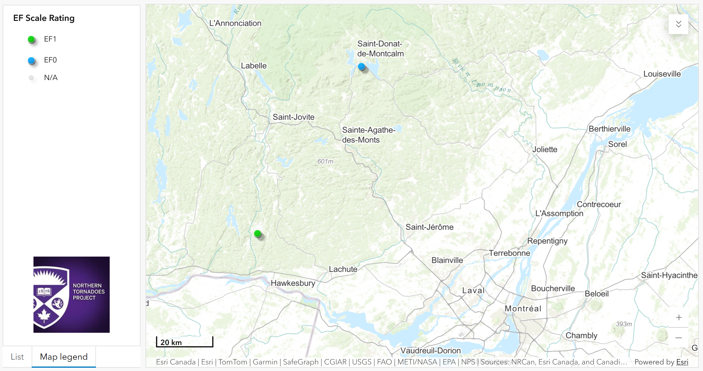
Regional map showing the start locations for the Harrington EF1 and Saint-Donat EF0 tornadoes.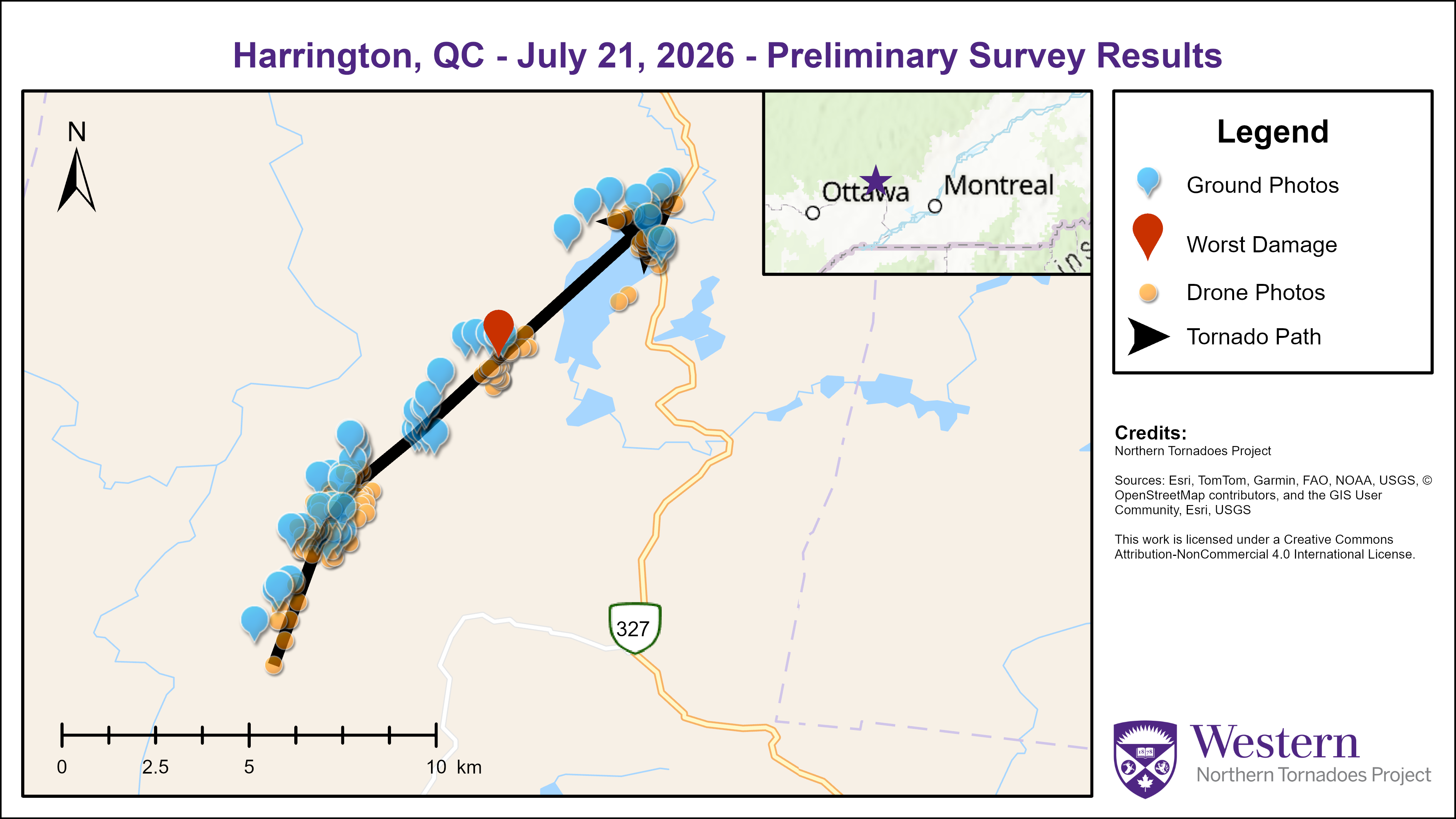
Survey summary map showing the track of the Harrington EF1 tornado.
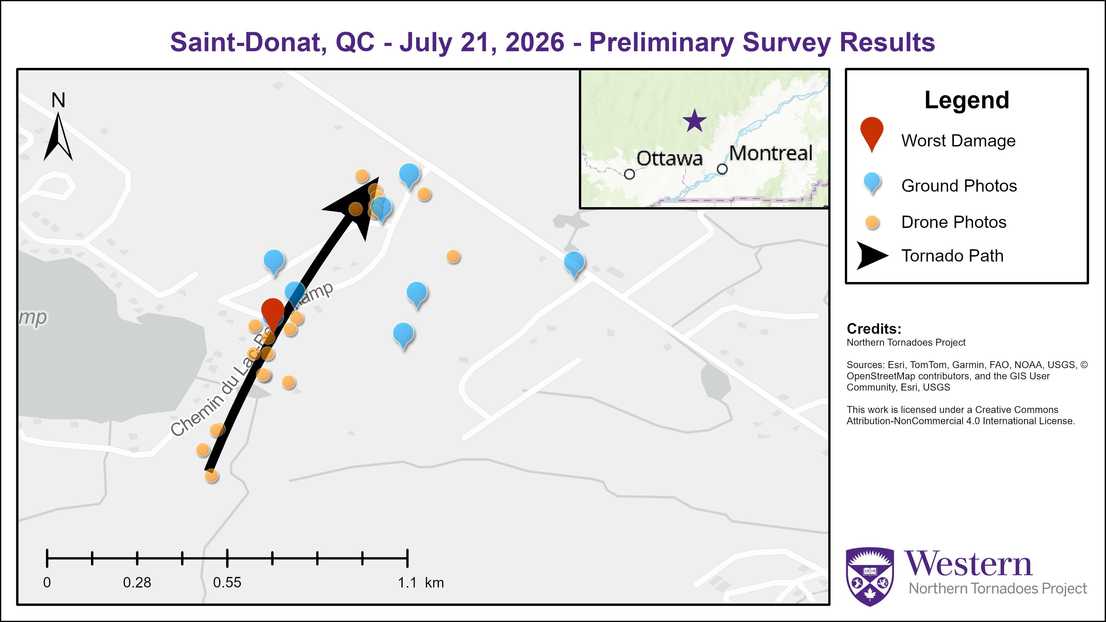
Survey summary map showing the track of the Saint-Donat EF0 tornado.
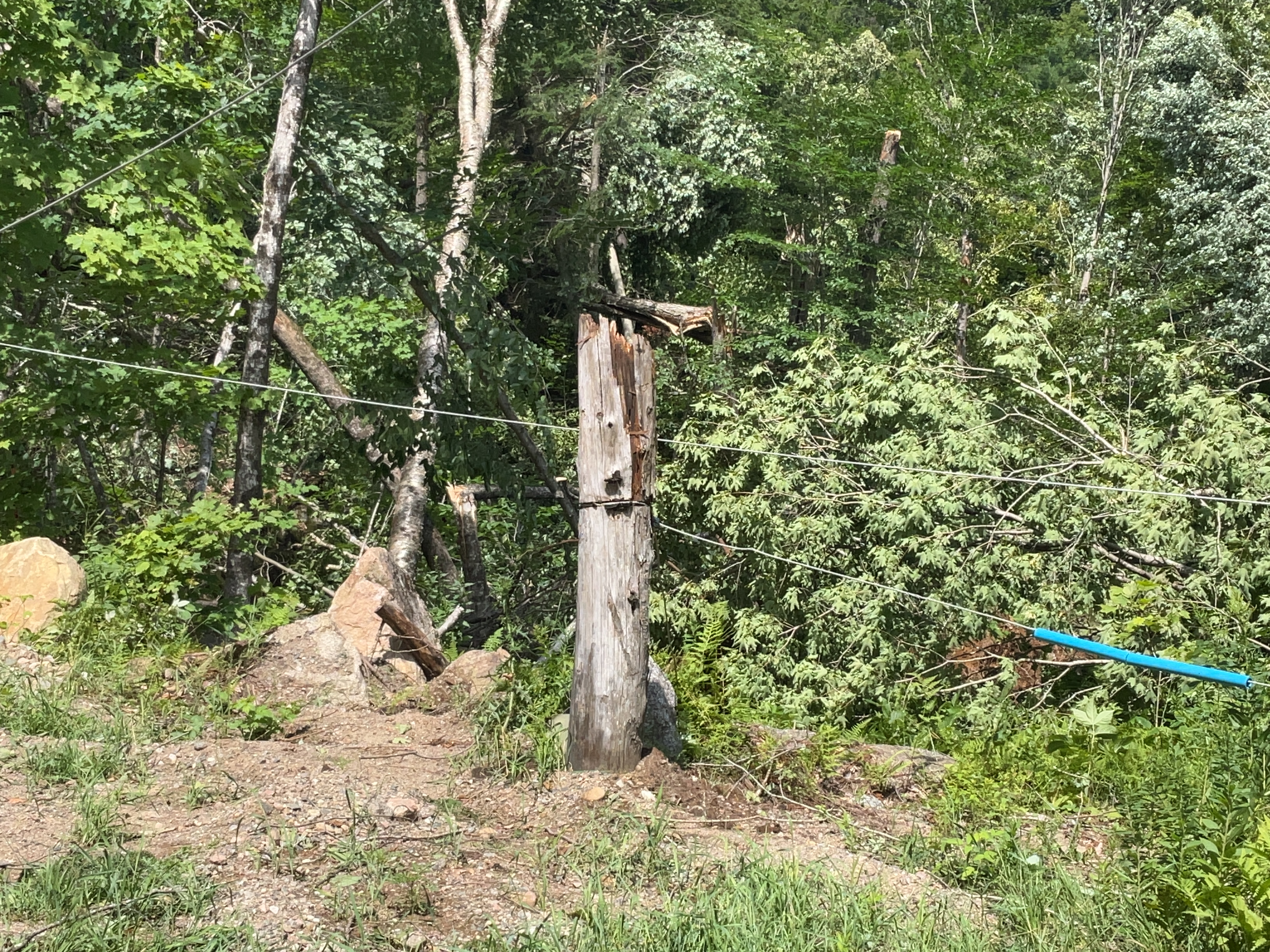
Ground photo showing one of a dozen or so wooden power poles snapped by the Harrington tornado. When the main tornado winds are roughly perpendicular to the power lines, the extra load on the lines leads to earlier failure of the power poles. The estimated maximum wind speed with the snapped power poles is 175 km/h, which is the upper end of EF1.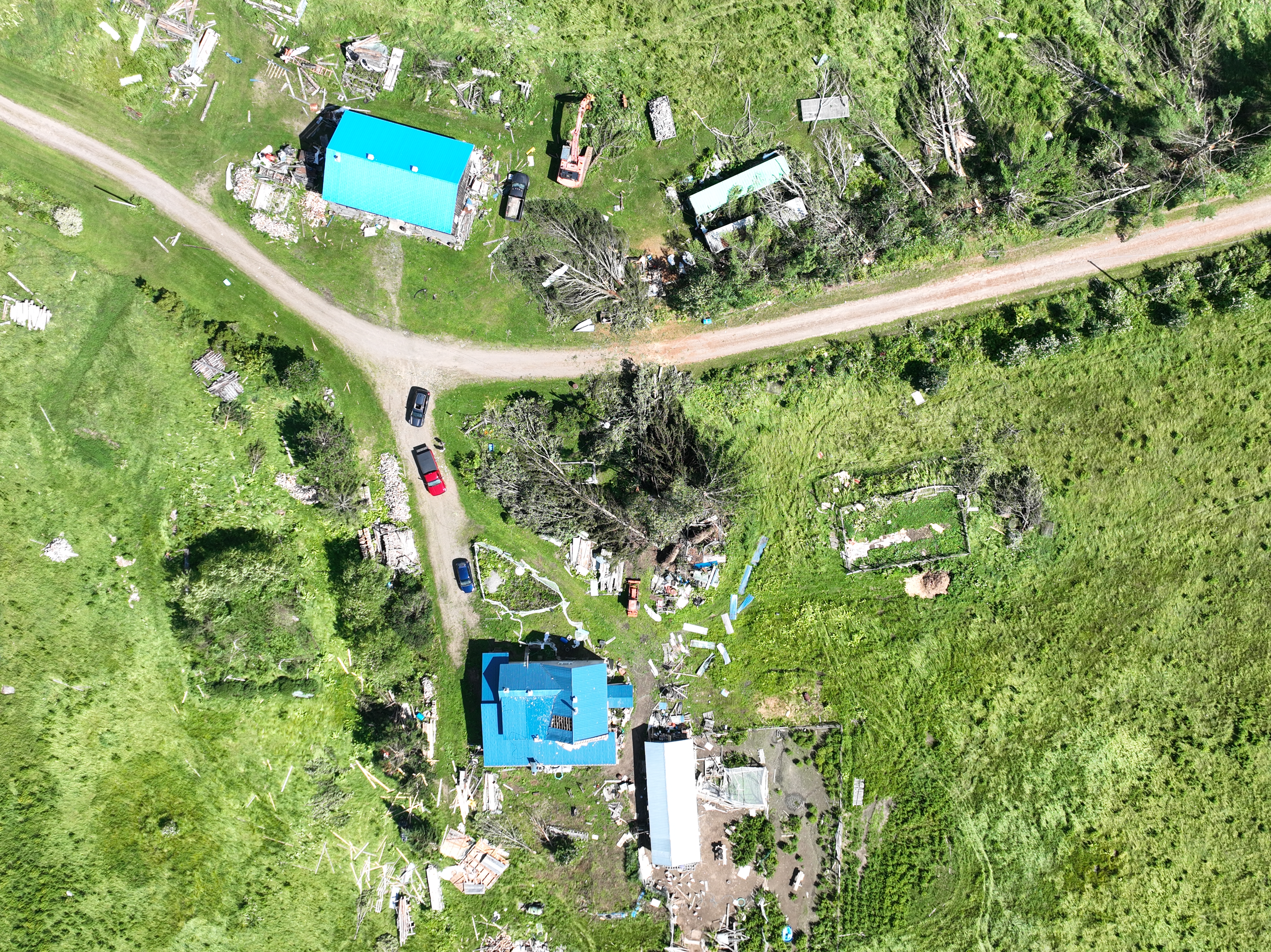
Nadir drone image showing an area along the track of the Harrington EF1 tornado with some tree and structural damage.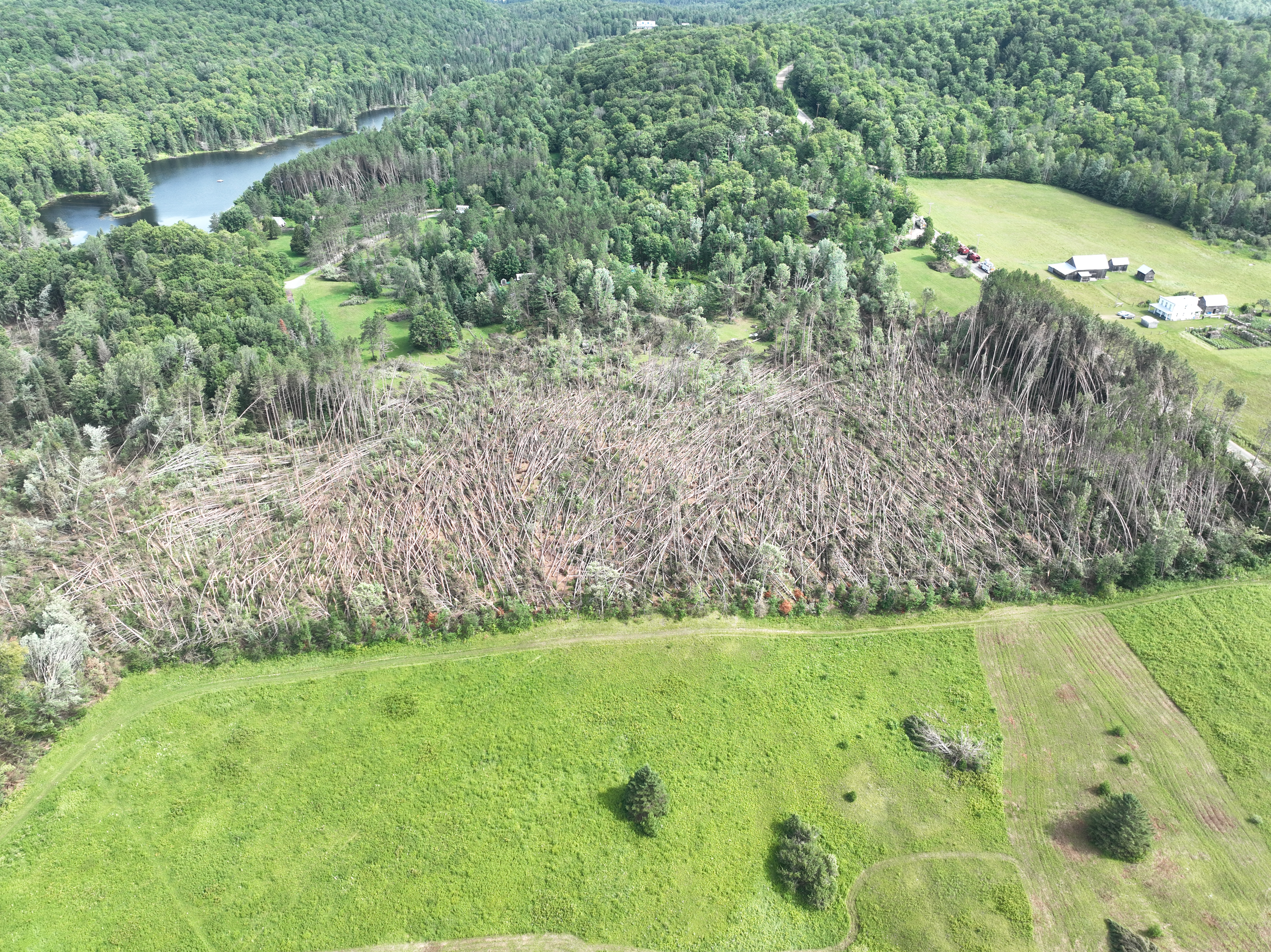
Oblique drone image showing nearly all trees down in a plantation at centre, while non-plantation trees just to the north along the track of the Harrington tornado have far less damage. Trees in an an even-aged, monoculture plantation have less than typical wind resistance.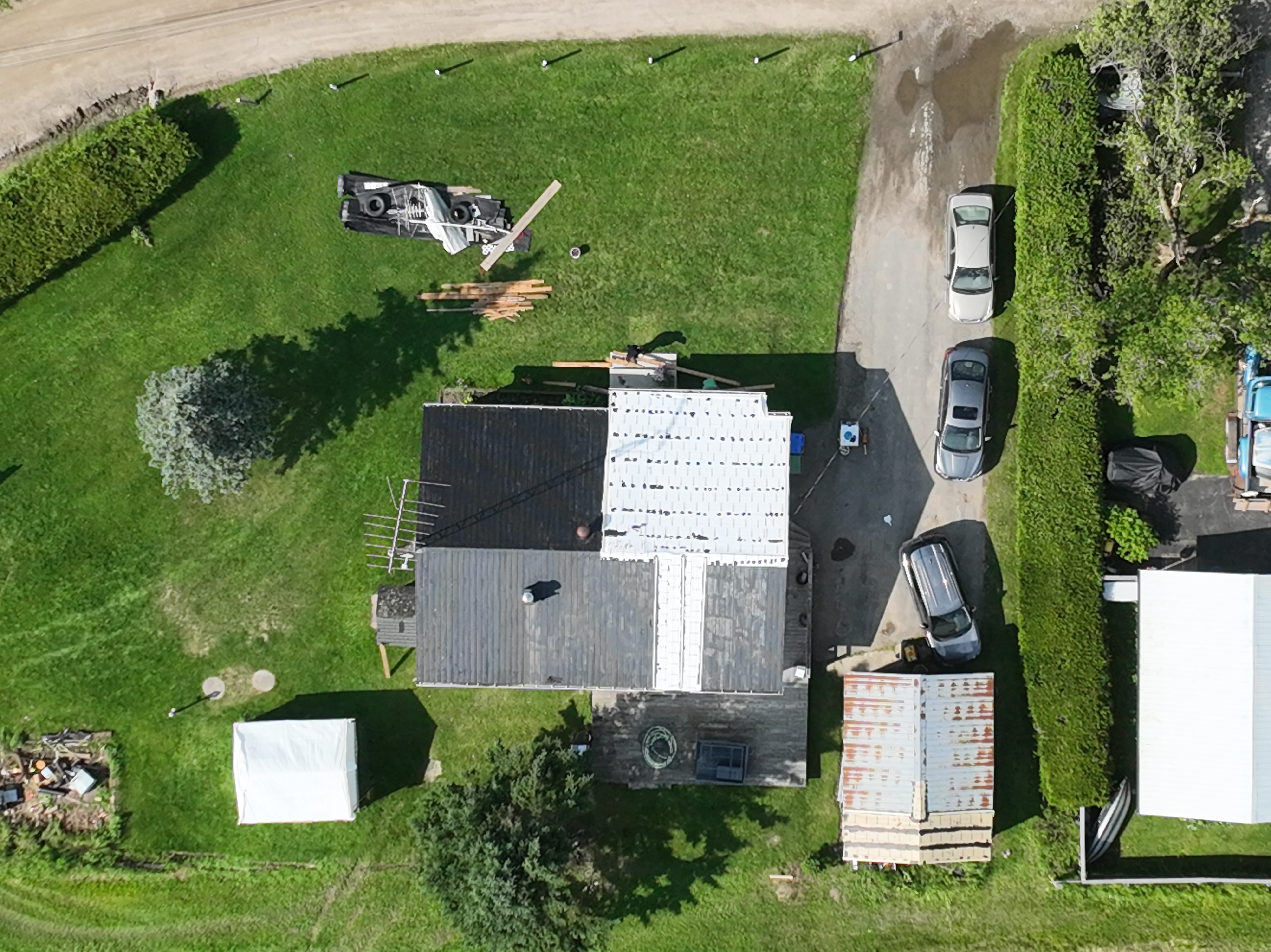
Nadir drone image showing house with roofing material removed by the Harrington EF1 tornado.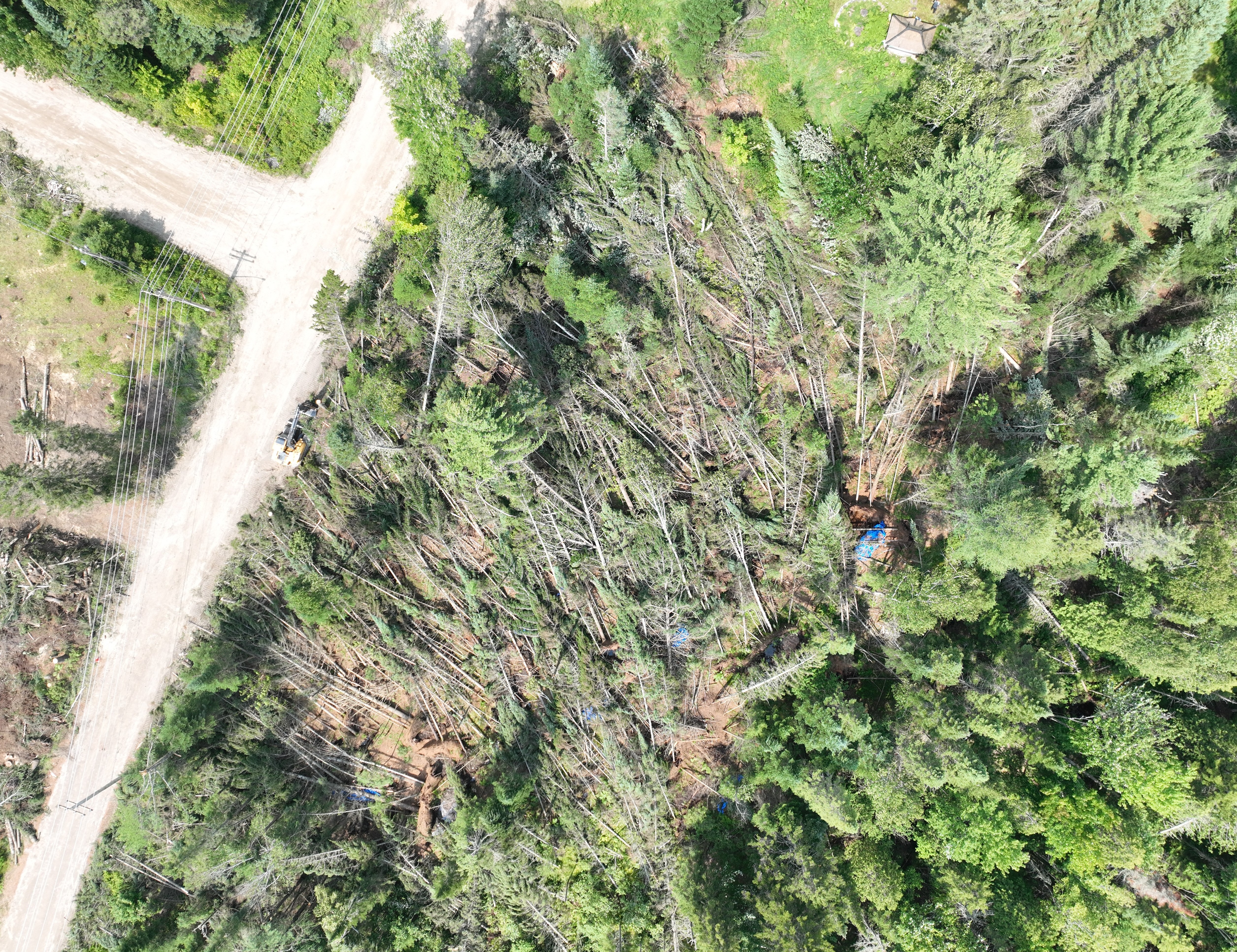
Nadir drone image showing area of worst tree damage for the Saint-Donat EF0 tornado.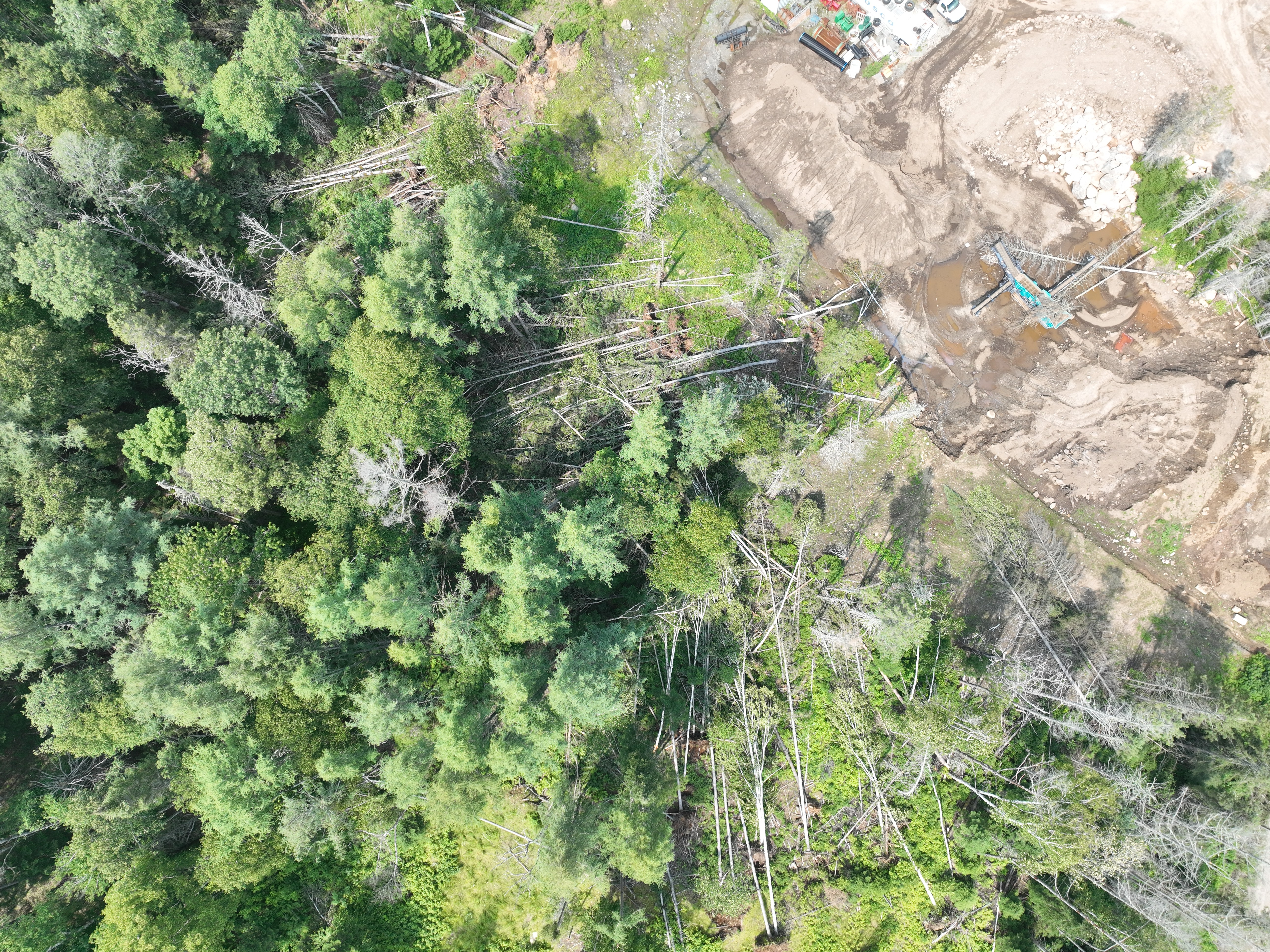
Nadir drone image showing trees down from multiple directions with the EF0 tornado.





