Two tornadoes in eastern ON on June 30
The NTP has confirmed two weak tornadoes in eastern Ontario on June 30. The tornadoes formed under a mesovortex along the leading edge of a bow-echo thunderstorm that moved southeast from the Verona area to Kingston.
Full details are provided in the event summaries below, along with a regional map, a surveys summary map, survey photos and radar imagery. The events can also be plotted on a map using the NTP Dashboard here.
====
Event Name: Verona, ON
Date: June 30, 2026
Start Time: 12:35 PM EDT (1635 UTC)
Final Classification: Tornado (over land)
Final EF-Scale Rating: EF1
EF-Scale Damage Indicator / Degree of Damage: SBO/DOD-5
Start of damage track: 44.4640N, 76.7289W
End of damage track: 44.3447N, 76.5823W
Location of worst damage: 44.4409N, 76.7011W
Description: Damage to farm properties and trees was reported in the areas of Verona, Hartington and Harrowsmith after a storm passed through. No injuries were reported. An NTP ground and drone survey was completed on July 3, 2026, documenting the reported damage. Satellite imagery review revealed some visible tree damage. Damage assessed as an EF1 tornado, with an estimated max. wind speed of 150 km/h, track length of 18.2 km and max. path width of 510 m. Tornado motion was from the NW (approx. 320 degrees). Start time is radar estimated.
Event Name: Kingston, ON
Date: June 30, 2026
Start Time: 12:50 PM EDT (1650 UTC)
Final Classification: Tornado (over land)
Final EF-Scale Rating: EF0
EF-Scale Damage Indicator / Degree of Damage: C-T/DOD-3
Start of damage track: 44.3020N, 76.5386W
End of damage track: 44.2347N, 76.4395W
Location of worst damage: 44.2372N, 76.4523W
Description: Tree damage was reported in the Kingston area after a storm passed through. No injuries were reported. An NTP ground and drone survey was completed on July 3, 2026, documenting a long path of tree damage from Silver Corners southeastward to CFB Kingston. Satellite imagery review revealed some visible tree damage. Damage assessed as an EF0 tornado, with an estimated max. wind speed of 115 km/h, track length of 10.9 km and max. path width of 250 m. Tornado motion was from the NW (approx. 315 degrees). Start time is radar estimated.
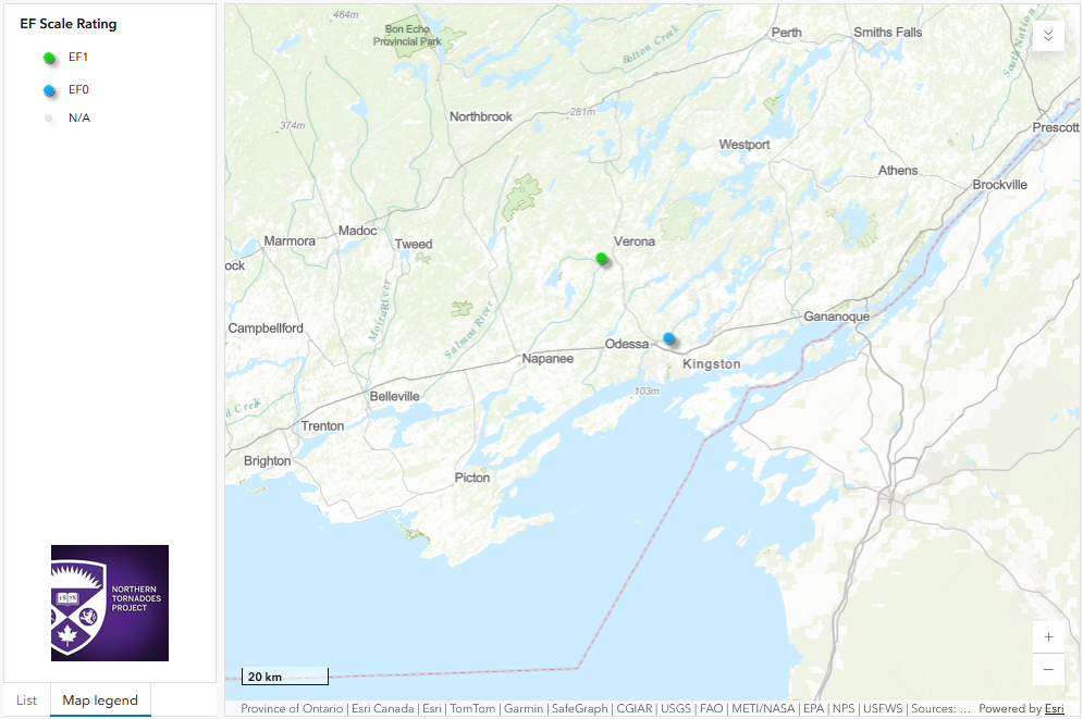
Regional map showing the start locations of the Verona EF1 and Kingston EF0 tornadoes.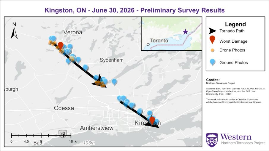
Survey summary map showing the tracks for the Verona EF1 and Kingston EF0 tornadoes.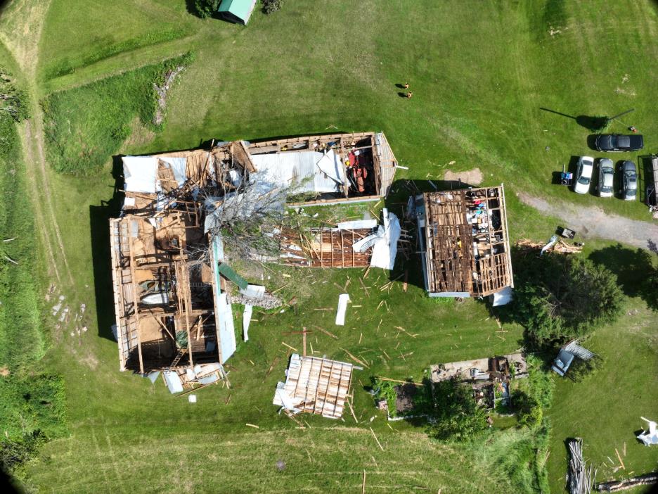
Drone photo of roof damage to two barns (worst damage for the Verona EF1 tornado). Parts of the roof structure from the large barn being carried well southeast into the neighbouring field.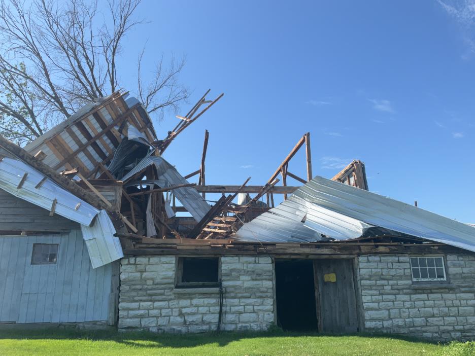
Ground photo of the roof damage to the large barn.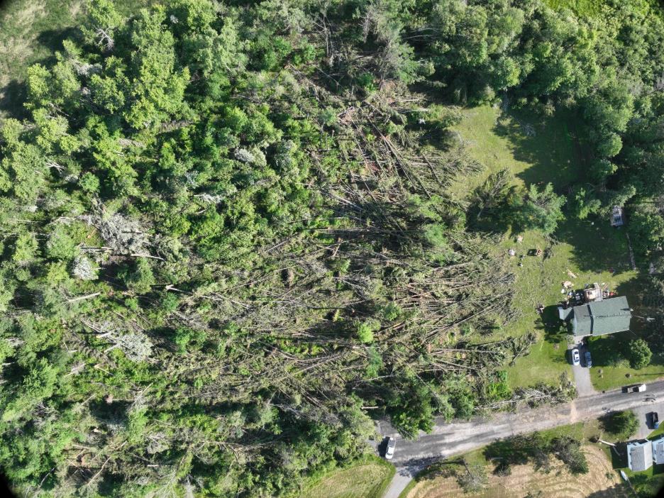
Convergent treefall along the damage path of the Verona EF1 tornado.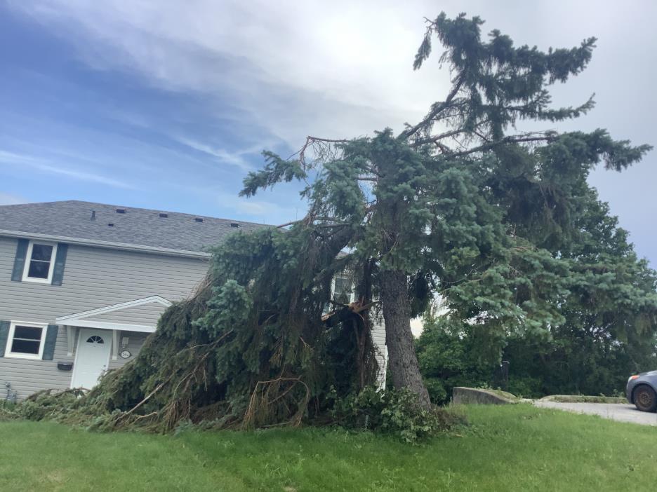
Large tree snapped along the path of the Kingston EF0 tornado.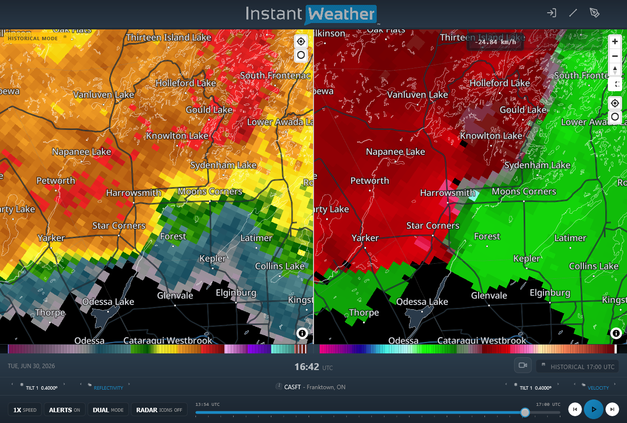
Radar image during the Verona EF1 tornado showing the mesovortex rotation near Harrowsmith, ON (right).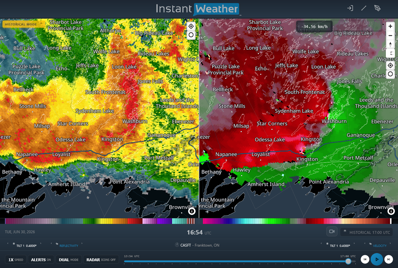
Radar image during the Kingston EF0 tornado showing the mesovortex rotation in the northeastern part of Kingston, ON (right). At left, the full structure of the bow-echo thunderstorm is shown.