Two tornadoes from SK / MB on June 28
The NTP has confirmed two weak tornadoes that occurred with the storms of on June 28 in southeastern Saskatchewan and southwestern Manitoba.
The first tornado at Stornaway, SK was confirmed based on visual evidence and no damage was reported or found by an NTP damage survey team. An EF0-Default rating has been assigned.
The second tornado started at Lake of the Prairies, MB, near Roblin. An NTP survey team found damage to structures and trees at several properties, resulting in an EF1 rating.
Full details are provided in the event summaries below, along with a regional map, a survey summary map, and survey photos. The event can also be plotted on a map using the NTP Dashboard here.
====
Event Name: Stornoway, SK
Date: June 28, 2026
Start Time: 3:21 PM CST (2121 UTC)
Final Classification: Tornado (Over Land)
Preliminary EF-Scale Rating: EF0-Default
Estimated Tornado Location: 51.40N, 101.95W
Description: Witnesses captured video of a tornado north of Stornoway. No damage has been reported and an NTP survey team visiting the area did not discover any damage. The preliminary EF-Scale assessment is EF0-Default. Start time is based on witness report. Satellite imagery review is pending.
Event Name: Lake of the Prairies, MB
Date: June 28, 2026
Start Time: 8:05 PM CDT (0105 UTC)
Final Classification: Tornado (over land)
Final EF-Scale Rating: EF1
EF-Scale Damage Indicator / Degree of Damage: C-T/DOD-4
Start of damage track: 51.0324N, 101.3632W
End of damage track: 51.1014N, 101.3142W
Location of worst damage: 51.0555N, 101.3523W
Description: Damage to trees and buildings at a farm property was reported near Lake of the Prairies (south of Roblin) after a storm passed through the area. An NTP ground and drone survey was completed on July 1, 2026, documenting the reported damage, and damage to additional outbuildings, grain bins and minor damage to a home. No injuries were reported. Damage assessed as an EF1 tornado, with an estimated max. wind speed of 150 km/h, track length of 8.91 km and max. path width of 630 m. Tornado motion was from the SSW (approx. 205 degrees). Start time is radar estimated. Satellite imagery review is pending.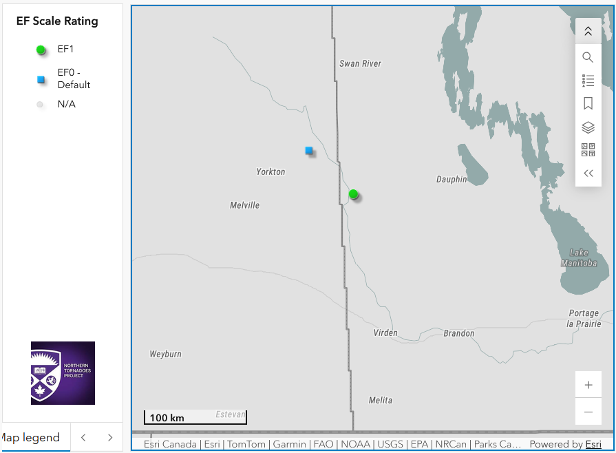
Regional map showing the locations of the two new tornadoes in SK (left) and MB (right).
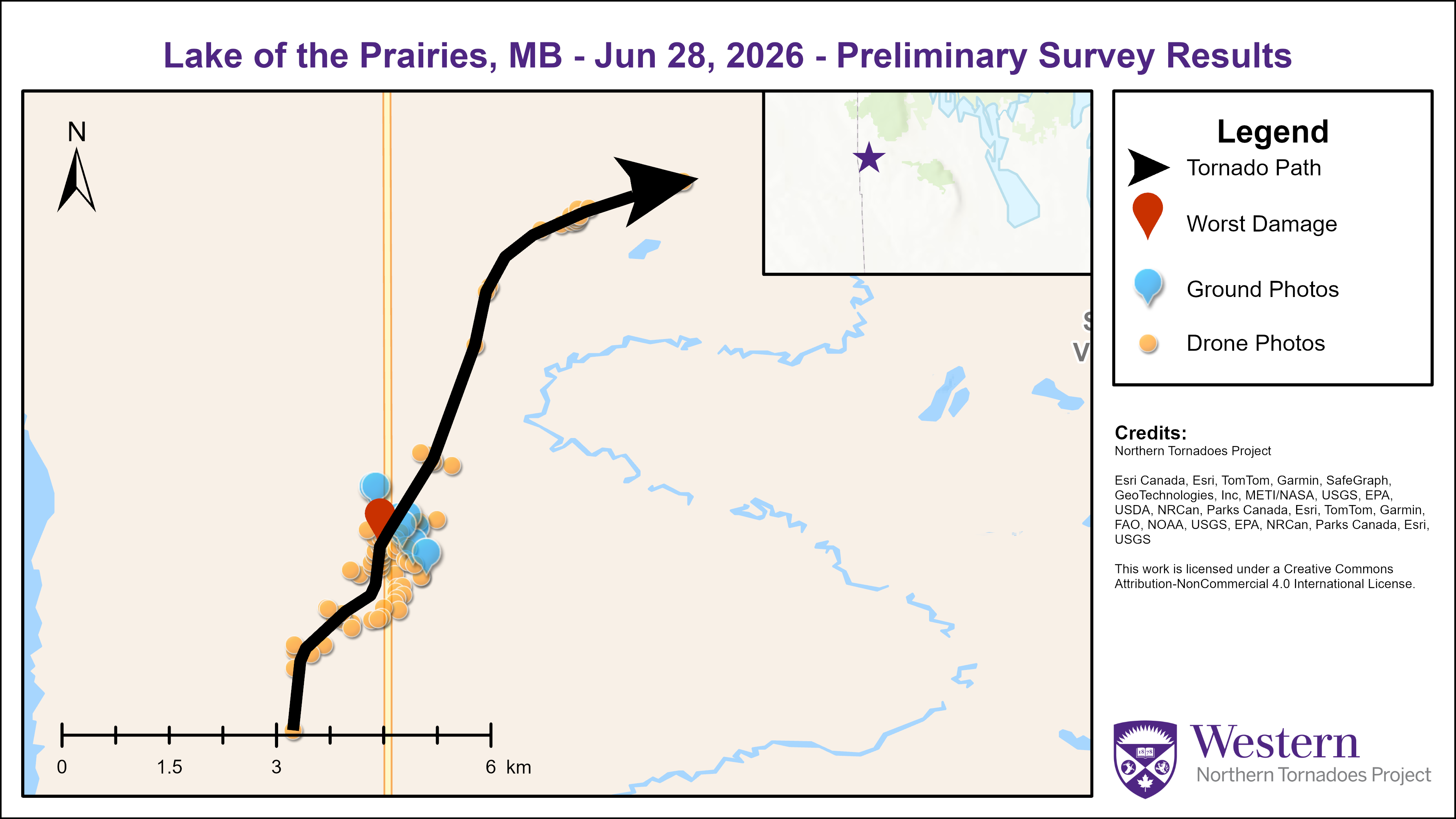
Survey map showing the track of the Lake of the Prairies EF1 tornado.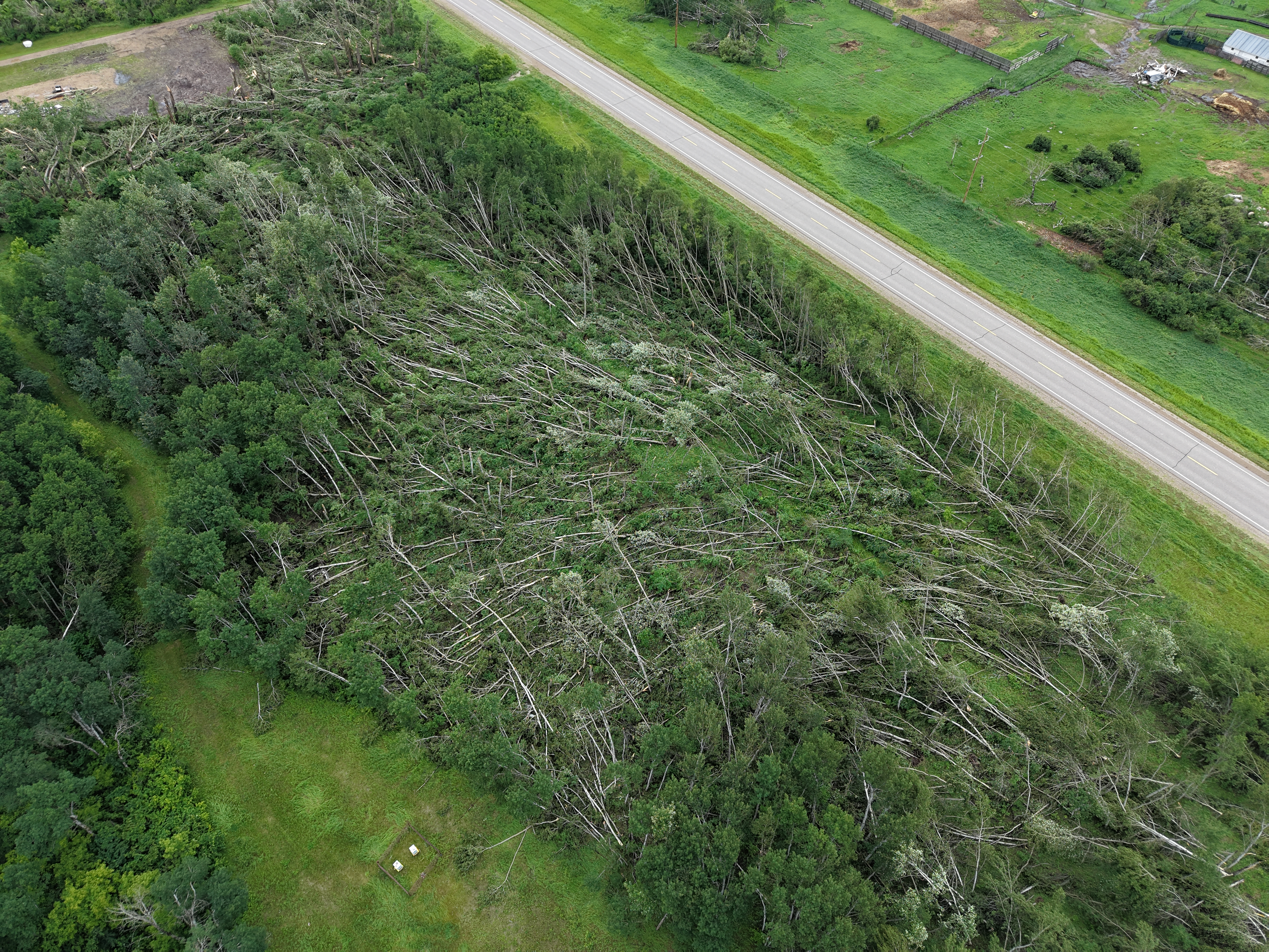
Oblique drone image showing significant convergent tree damage in the worst-damaged area. Areas of trees were toppled on both sides of the highway but missed the houses.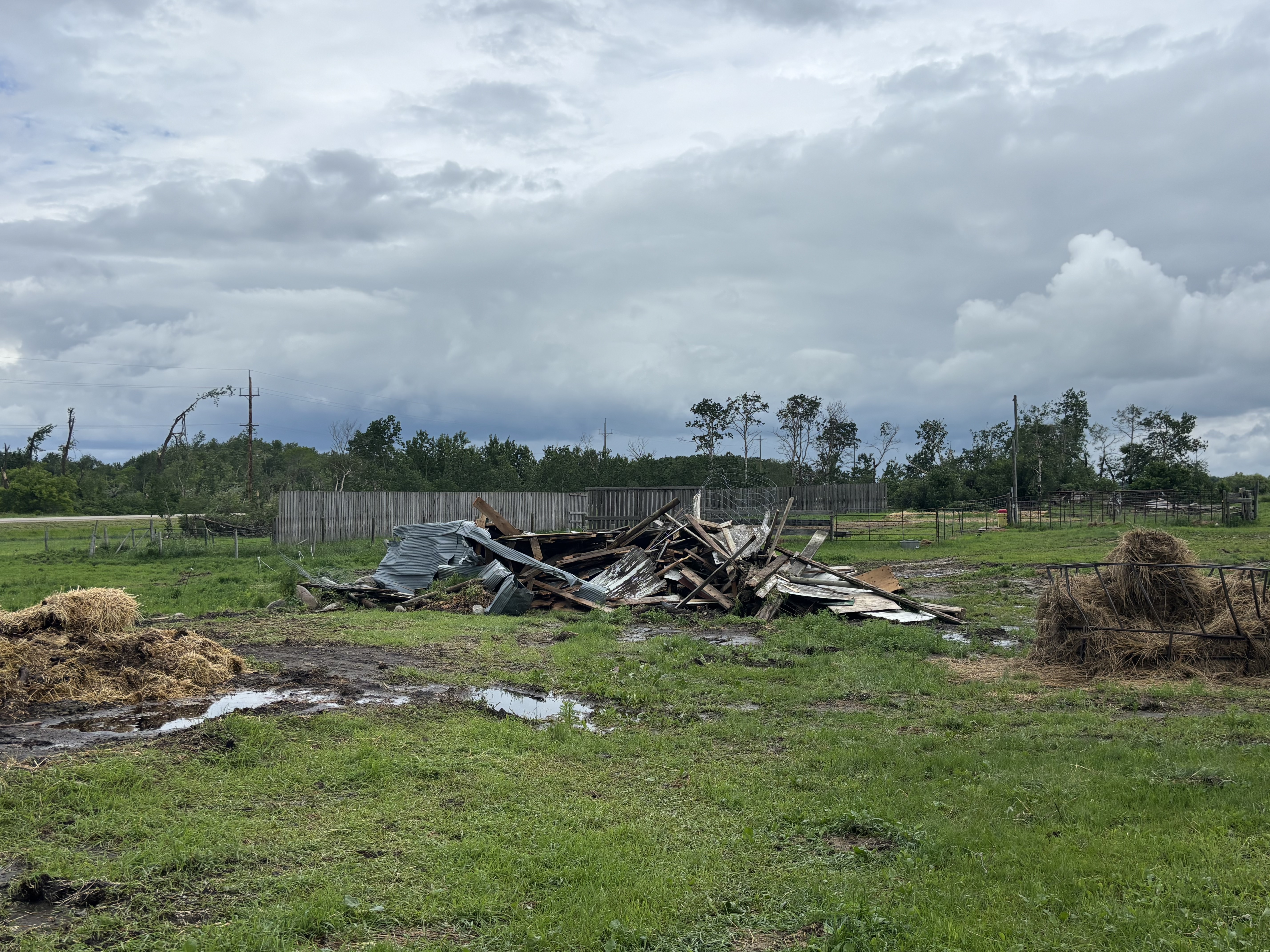
Ground photo of a destroyed outbuilding. Sheet metal from this outbuilding was found in the field and to the property to its northwest. Other nearby outbuildings and sheds were also damaged.
Facebook video of Stornaway tornado: https://www.facebook.com/reel/1721395662510662