Two more tornadoes in NW AB on June 15
The NTP has confirmed two more EF1 tornadoes in the Peace River region of NW Alberta with the supercell storms of June 15. The two tornadoes occurred in the Eaglesham, AB area northwest of Girouxville and damage was discovered during review of satellite imagery. A small area of EF0 damage near Culp was also found but evidence is insufficient to confirm the event type there.
This brings the total number of tornadoes with this outbreak to eight. Six of the eight tornadoes occurred with one long-track supercell thunderstorm.
Full details are provided in the event summaries below, along with a regional map. The events can also be plotted on a map using the NTP Dashboard here.
====
Event Name: Eaglesham (1), AB
Date: June 15, 2026
Start Time: 7:00 PM MDT (0100 UTC)
Final Classification: Tornado (over land)
Final EF-Scale Rating: EF1
EF-Scale Damage Indicator / Degree of Damage: C-T/DOD-5
Start of damage track: 55.8869N, 117.9549W
End of damage track: 55.8868N, 117.9131W
Location of worst damage: 55.8892N, 117.9396W
Description: Satellite imagery review of a storm track of interest revealed a tornado damage path in forested areas northwest of Eaglesham. Damage assessed as EF1 tornado, with an estimated max. wind speed of 145 km/h, track length of 2.73 km and max. path width of 290 m. Tornado motion was from the W (approx. 270 degrees). Start time is radar estimated. A second tornado later developed northeast of Eaglesham, also causing EF1 damage.
Event Name: Eaglesham (2), AB
Date: June 15, 2026
Start Time: 7:18 PM MDT (0118 UTC)
Final Classification: Tornado (over land)
Final EF-Scale Rating: EF1
EF-Scale Damage Indicator / Degree of Damage: C-T/DOD-5
Start of damage track: 55.8558N, 117.8169W
End of damage track: 55.8509N, 117.7857W
Location of worst damage: 55.8549N, 117.8126W
Description: Satellite imagery review of a storm track of interest revealed a tornado damage path in forested areas northeast of Eaglesham. Damage assessed as EF1 tornado, with an estimated max. wind speed of 170 km/h, track length of 2.05 km and max. path width of 230 m. Tornado motion was from the WNW (approx. 285 degrees). Start time is radar estimated. An earlier tornado developed northwest of Eaglesham, also causing EF1 damage.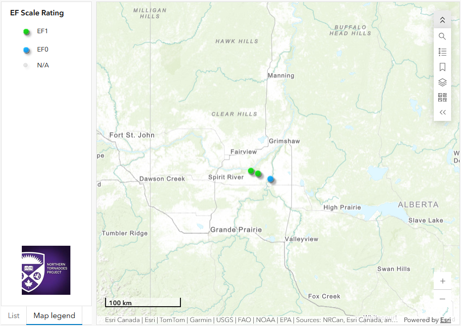
Regional map showing the locations of the two EF1 tornadoes and the unclassified EF0 damage.