Two EF2 tornadoes in southern AB on July 18
The NTP has confirmed two EF2 tornadoes in the Rocky Mountain House area of southern Alberta on July 18. The two tornadoes, occurring simultaneously for a short time, caused significant tree damage. As well, the first tornado destroyed a well-constructed outbuilding and swept away the debris, while the second tornado cause damage to the roof structure of a home. No injuries were reported.
Full details are available with the event summaries below, along with a regional map, survey summary maps, survey photos and radar imagery. The event can also be plotted on a map using the NTP Dashboard here.
Special thanks to Brad Kraychy, to Instant Weather, to the Prairie and Arctic Storm Prediction Centre and to numerous witnesses for providing useful and timely information and images.
====
Event Name: Rocky Mountain House (1), AB
Date: July 18, 2026
Start Time: 6:18 PM CST (0018 UTC)
Final Classification: Tornado (over land)
Final EF-Scale Rating: EF2
EF-Scale Damage Indicator / Degree of Damage: C-T/DOD-5
Start of damage track: 52.3401N, 114.9619W
End of damage track: 52.3722N, 114.8721W
Location of worst damage: 52.3552N, 114.9159W
Description: Witnesses captured video and photos of two tornadoes in the Rocky Mountain House area. The first tornado developed southwest of Rocky Mountain House and tracked to the southern limits of the town. Damage to several properties, including homes, barns and outbuildings, garages, vehicles and trees was reported. No injuries were reported. An NTP ground and drone survey was completed on July 19, 2026, documenting the reported damage. Damage assessed as EF2 tornado, with an estimated max. wind speed of 190 km/h, track length of 7.43 km and max. path width of 1.04 km. Tornado motion was from the WSW (approx. 245 degrees). Start time is based on witness report. Satellite imagery review is pending. A second tornado developed just east of Rocky Mountain House before the first tornado dissipated, and tracked further eastward, also causing EF2 damage.
Event Name: Rocky Mountain House (2), AB
Date: July 18, 2026
Start Time: 6:36 PM CST (0036 UTC)
Final Classification: Tornado (over land)
Final EF-Scale Rating: EF2
EF-Scale Damage Indicator / Degree of Damage: C-T/DOD-5
Start of damage track: 52.3841N, 114.8719W
End of damage track: 52.4132N, 114.7254W
Location of worst damage: 52.3965N, 114.7979W
Description: Witnesses captured video and photos of two tornadoes in the Rocky Mountain House area. The second tornado developed east of Rocky Mountain House and tracked eastward before dissipating northwest of Leslieville. Damage to several properties, including homes, barns and outbuildings and trees was reported. No injuries were reported, though two animals were reportedly injured. An NTP ground and drone survey was completed on July 20, 2026, documenting the reported damage. Damage assessed as EF2 tornado, with an estimated max. wind speed of 190 km/h, track length of 10.6 km and max. path width of 600 m. Tornado motion was from the WSW (approx. 250 degrees). Start time is based on witness report. Satellite imagery review is pending. A earlier tornado developed southwest of Rocky Mountain House, which also caused EF2 damage and dissipated soon after the second tornado developed.
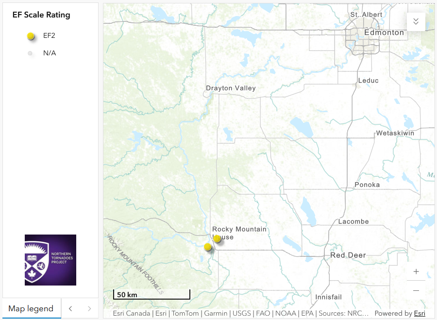
Regional map showing the first (left) and second (right) EF2 tornadoes in the Rocky Mountain House area.
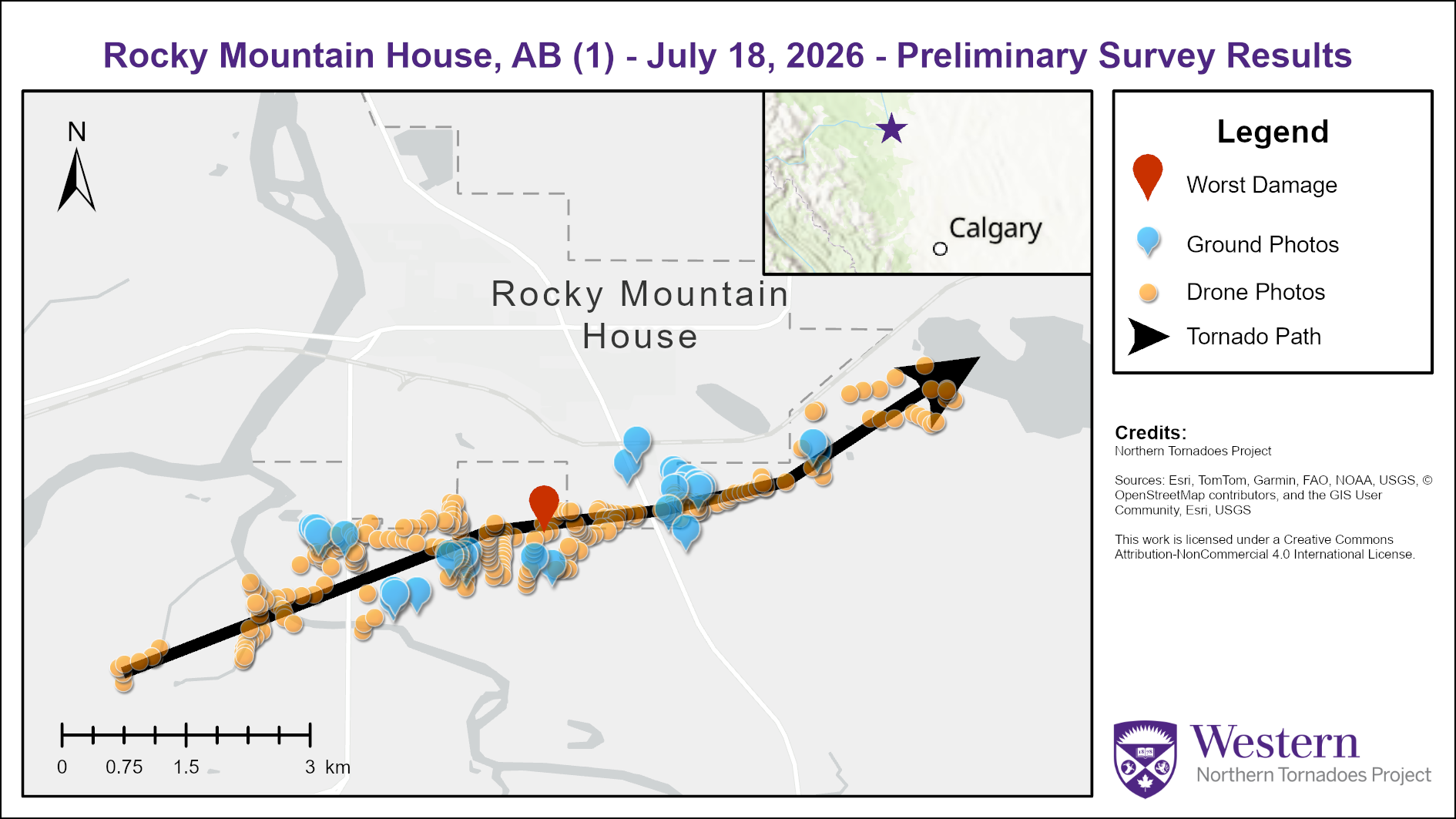
Survey summary map for the first Rocky Mountain House EF2 tornado.
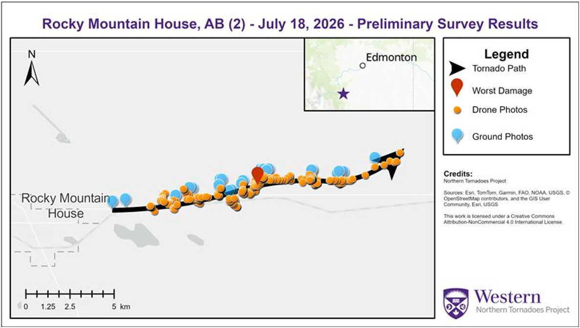
Survey summary map for the second Rocky Mountain House EF2 tornado.
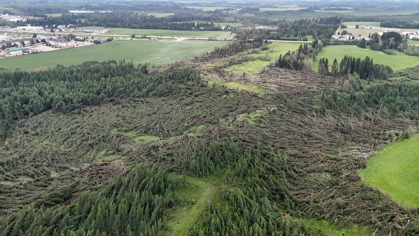
For the first EF2 tornado, oblique drone showing extensive tree damage (at least C-T DOD5) with convergent debris patterns and a high damage gradient.
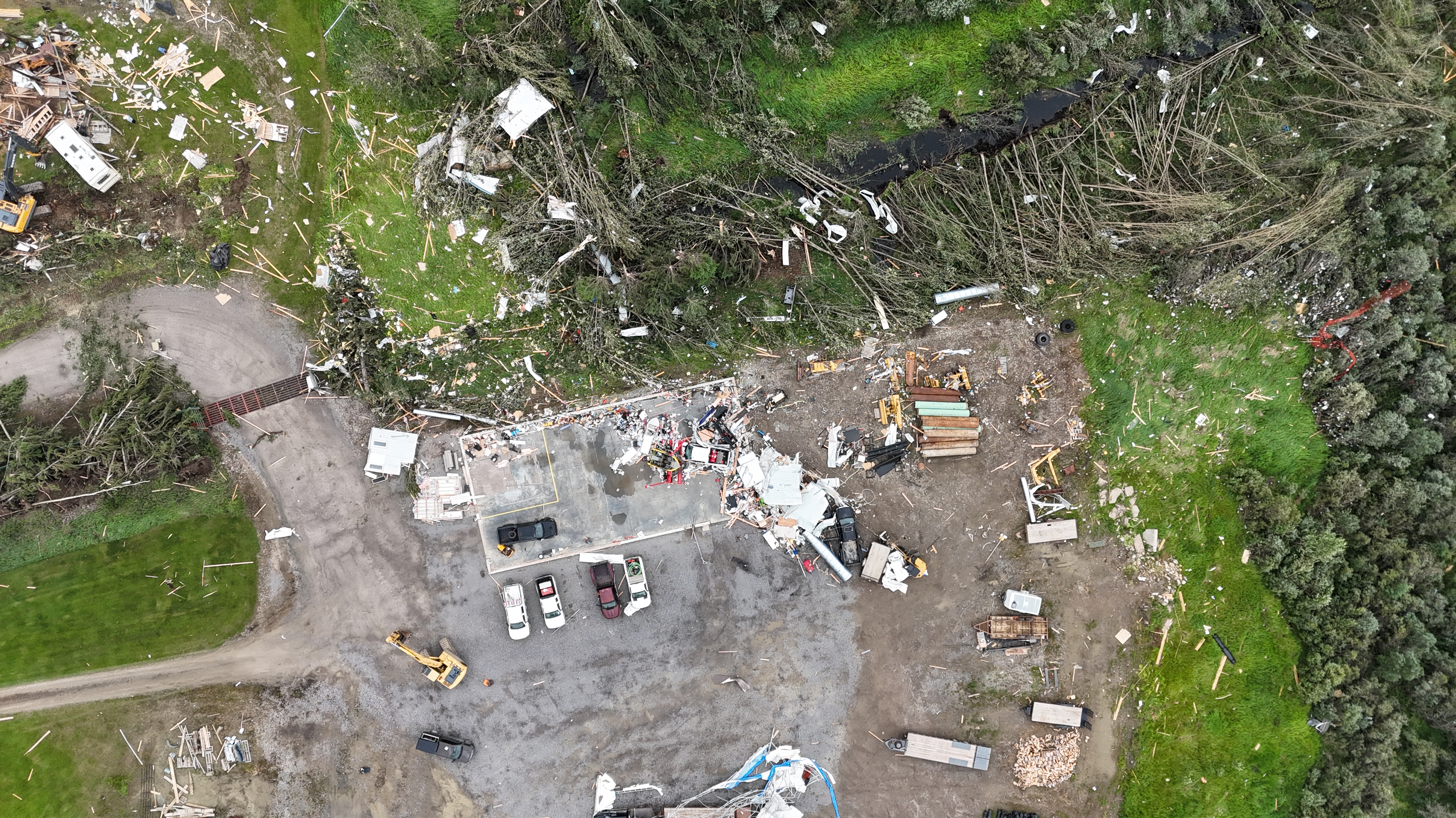
Nadir drone photo showing severe damage and dispersed debris from a well-constructued outbuilding, warranting a choice of SBO DOD8 EXP. Numerous snapped and uprooted trees can also be seen.
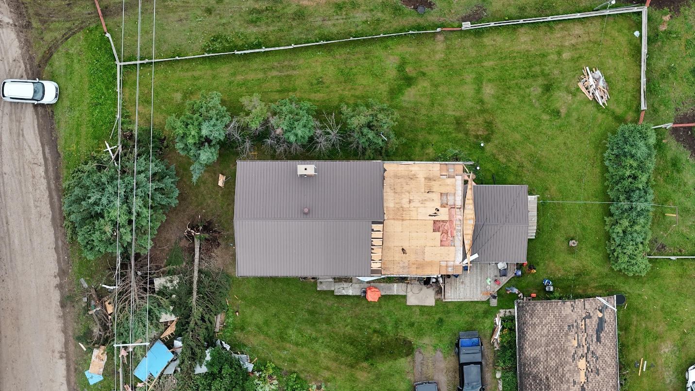
Nadir drone photo displaying loss of sheathing to a house warranting FR12 DOD4.
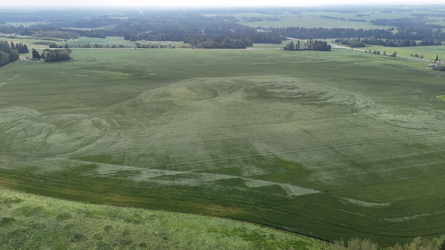
Oblique drone photo exhibiting definitive swirl marks caused by tornadic winds over a crop.
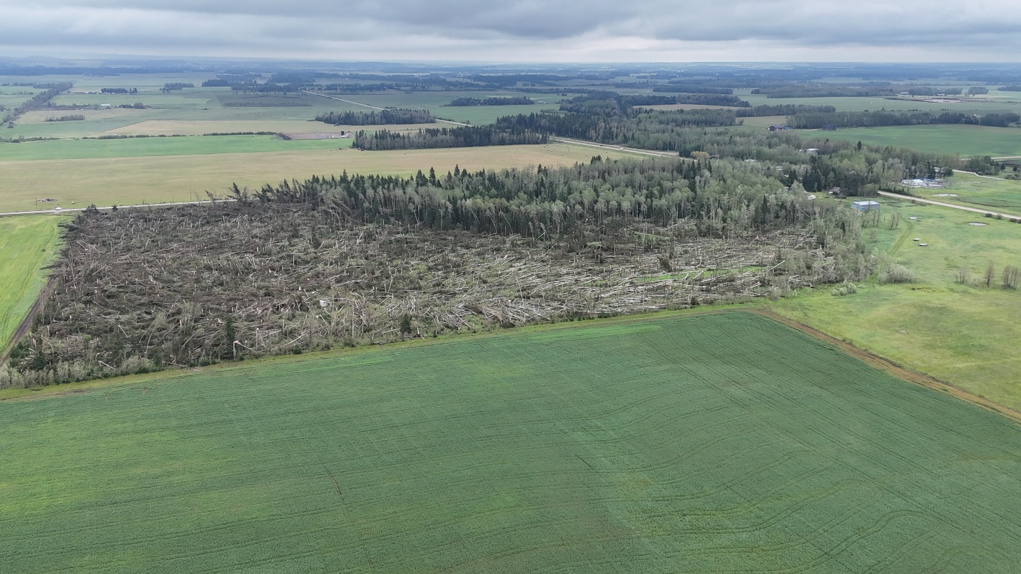
For the second EF2 tornado, oblique drone photo of a large swath of mature trees swept down in multiple directions.
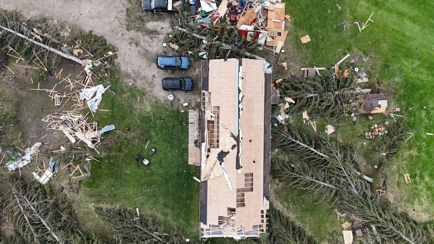
Nadir drone photo of FR-12 DOD 4 (EXP) damage caused by the Rocky Mountain House (2) tornado.
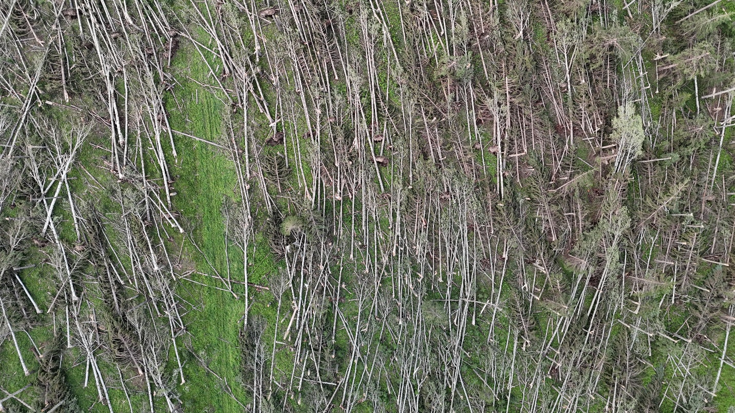
Nadir drone photo of worst tree damage caused by the Rocky Mountain House (2) tornado.
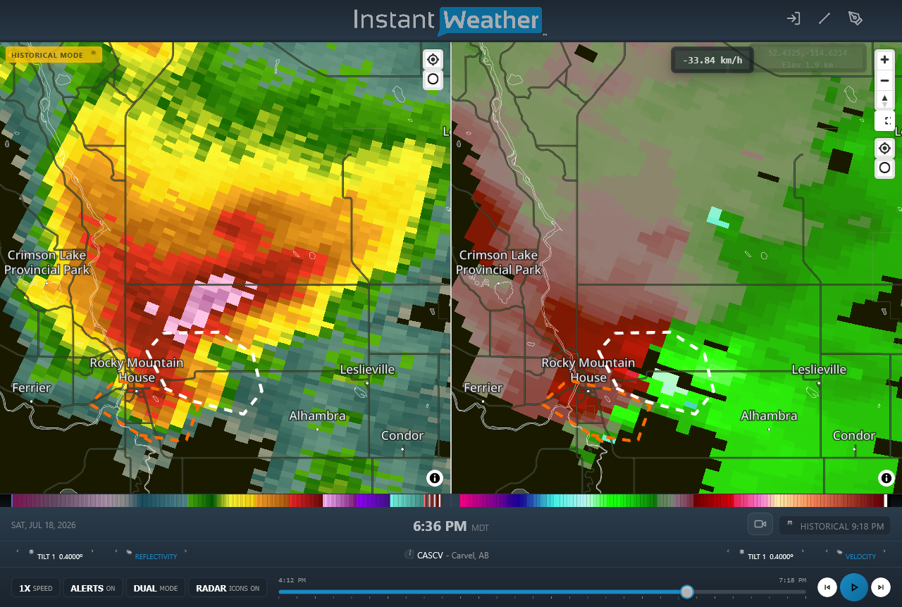
Radar image of the tornadic supercell showing the reflectivity at left and the radial velocity at right. At this time (6:36 PM MDT), the first tornado was dissipating while the second tornado had just developed. Ignoring the numerous dropouts in radial velocity, one can make out two areas of rotation. These are the mesocyclones associated with the first tornado (orange dotted line) and the second tornado (white dotted line). Witness photos and video also suggest two areas of rotation (e.g. https://x.com/_CoreyRobertson/status/2079063353805390263).





