Two EF1 tornadoes in southern Manitoba on Sep 6
Following analysis of NTP damage survey results, the NTP has confirmed two tornadoes in southern Manitoba on September 6. The first was at Bénard with damage to several buildings and grain bins rated at EF1. There was one injury.
The second tornado occurred in the River Heights area of Winnipeg. There was roof damage to homes, sheds, trees and vehicles, including a car that was moved. The damage there was also rated at EF1.
Full details are available with the event summaries below, along with a regional map, survey summary maps, and survey photos. Radar imagery is also included for the Bénard tornado. The events can also be plotted on a map using the NTP Dashboard here.
====
Event Name: Bénard, MB
Date: September 6, 2026
Start Time: 5:50 PM CDT (2250 UTC)
Final Classification: Tornado (over land)
Final EF-Scale Rating: EF1
EF-Scale Damage Indicator / Degree of Damage: WHB/DOD-4
Start of damage track: 49.9212N, 97.8664W
End of damage track: 49.9072N, 97.7806W
Location of worst damage: 49.9148N, 97.8490W
Description: Damage to several buildings and grain bins at a large farm property in Bénard was reported after a storm. One injury was reported. An NTP ground and drone survey was completed on September 8, 2026, documenting the reported damage along with tree damage. Damage assessed as EF1 tornado, with an estimated max. wind speed of 165 km/h, track length of 6.45 km and max. path width of 460 m. Tornado motion was from the WNW (approx. 285 degrees). Start time is based on witness report. Satellite imagery review is pending.
Event Name: Winnipeg (River Heights), MB
Date: September 6, 2026
Start Time: 6:31 PM CDT (2331 UTC)
Final Classification: Tornado (over land)
Final EF-Scale Rating: EF1
EF-Scale Damage Indicator / Degree of Damage: FR12/DOD-4
Start of damage track: 49.8517N, 97.1951W
End of damage track: 49.8677N, 97.1830W
Location of worst damage: 49.8535N, 97.1945W
Description: Roof damage to homes, sheds, trees and a car (moved across a lawn) was reported in the River Heights neighbourhood of Winnipeg after a storm passed through. No injuries were reported. An NTP ground and drone survey was completed on September 8-9, 2026, documenting the reported damage. Satellite imagery review revealed some visible tree damage. Damage assessed as EF1 tornado, with an estimated max. wind speed of 155 km/h, track length of 2.00 km and max. path width of 150 m. Tornado motion was from the SSW (approx. 205 degrees). Start time is based on witness report.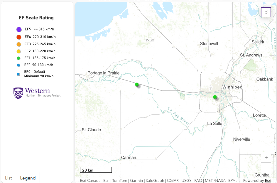
Regional map showing the start locations for the two EF1 tornadoes in southern Manitoba on September 6.
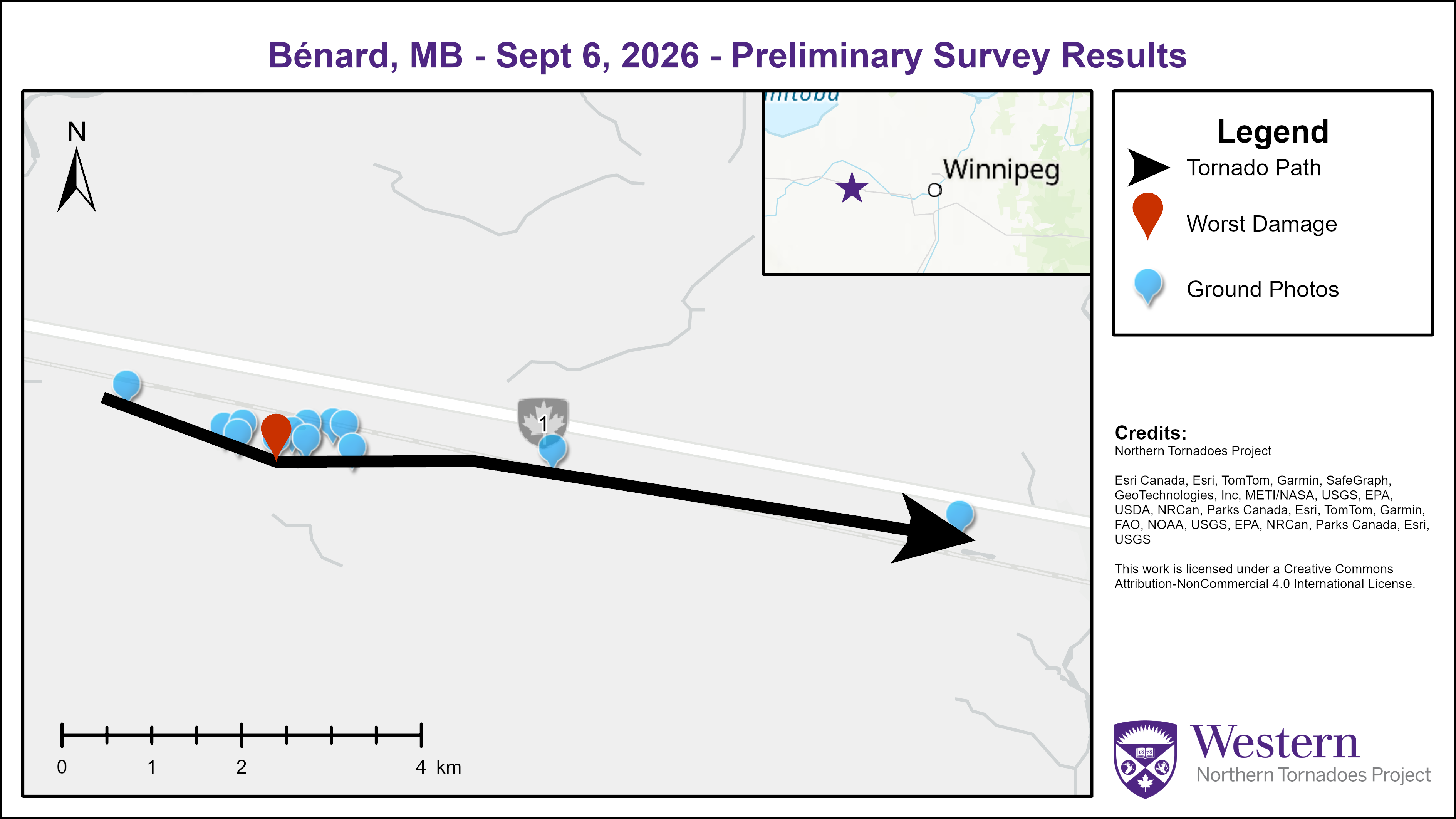
Survey map showing the track of the Bénard, MB EF1 tornado.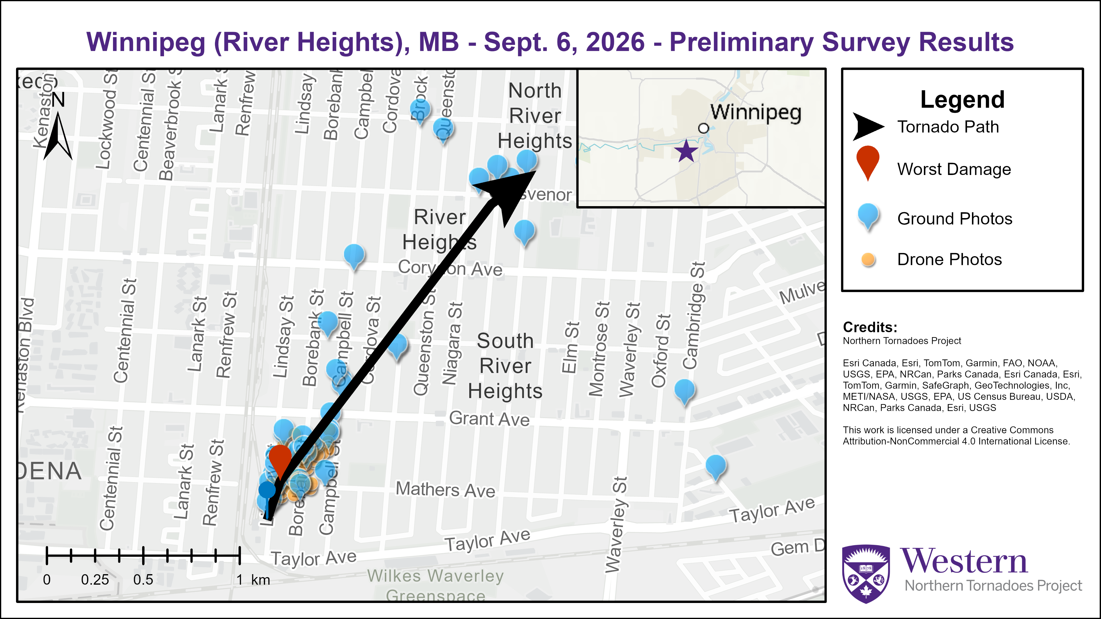
Survey map showing the track of the Winnipeg, MB EF1 tornado.
Ground photo of roof damage done to a warehouse building at Bénard - this was the point of worst damage along the tornado’s path.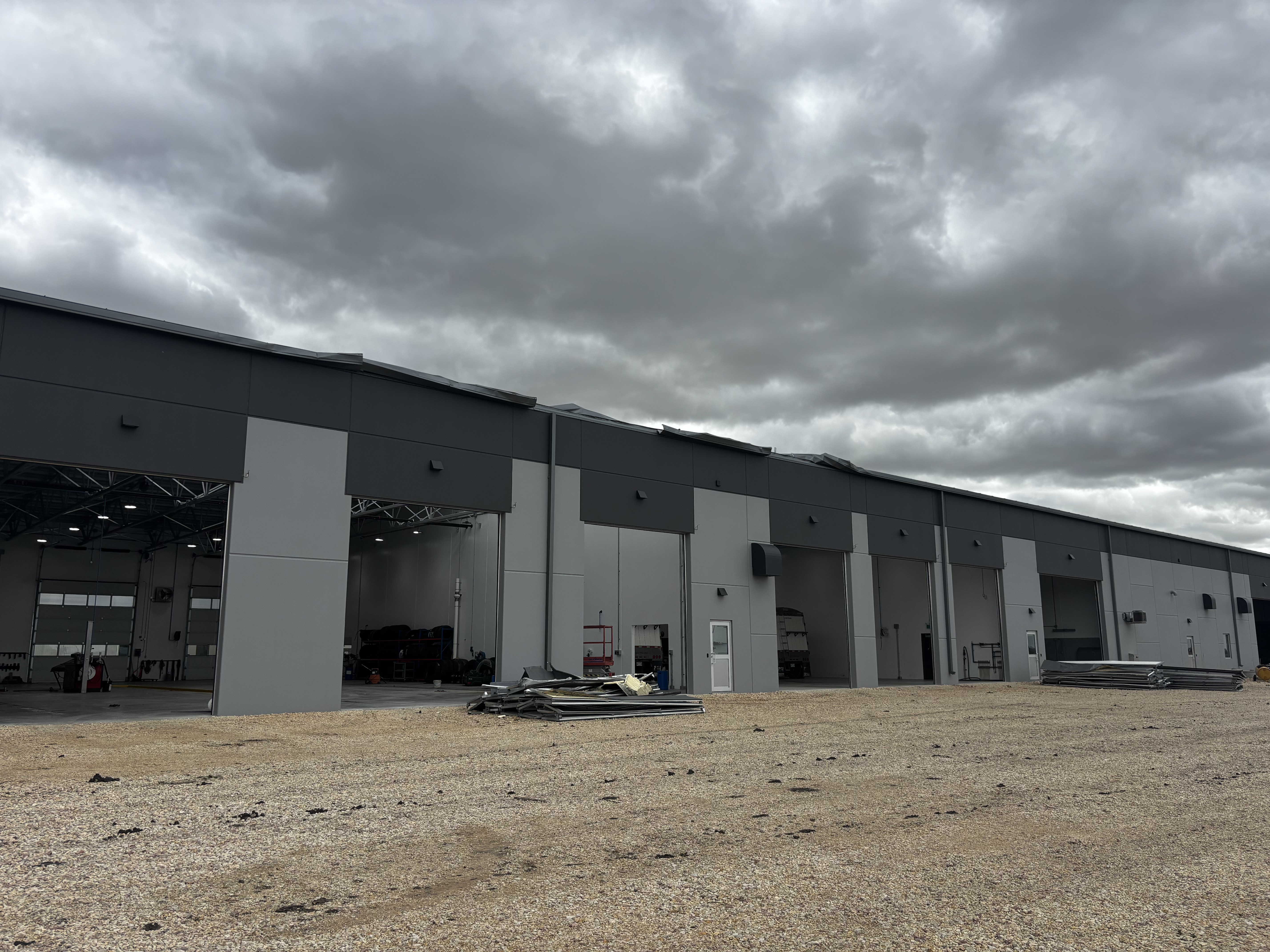
Ground photo of same building with seven of eight large doors blown in - this was the point of worst damage along the tornado’s path.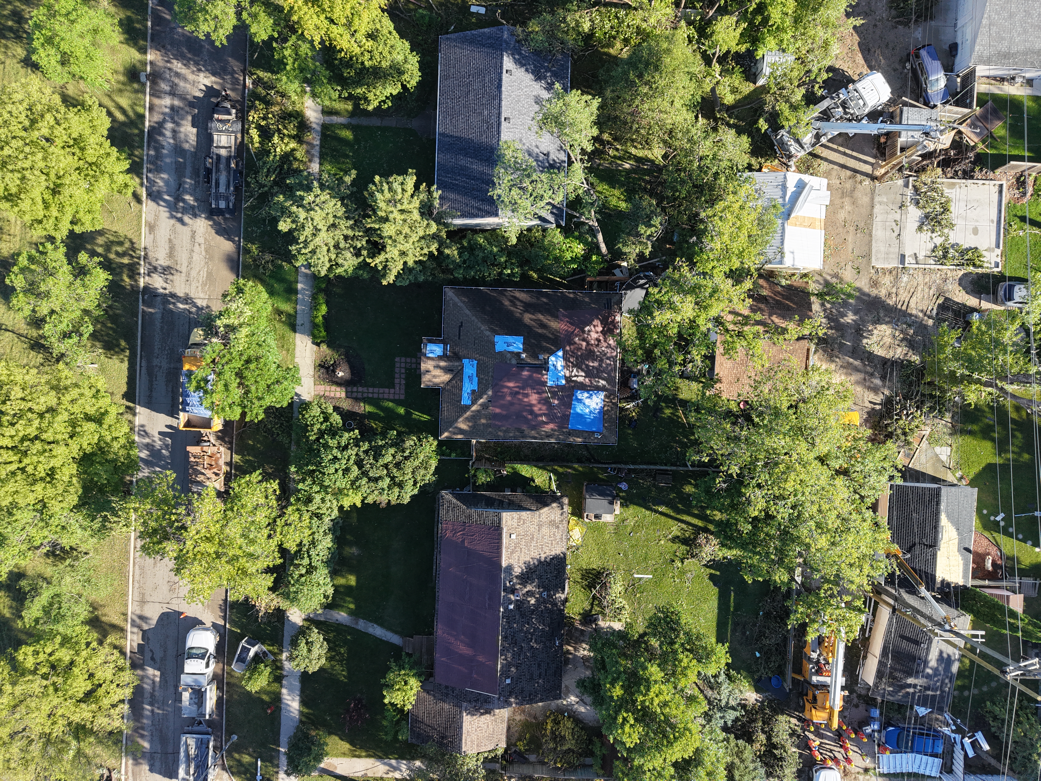
Drone photo of roof damage at worst damage location in Winnipeg, MB. Note tarps covering missing shingles on multiple sides of the roof of house at centre, and a tarp over nearly half the roof of the house below that. There are also many missing shingles on the roof of the detached garage at right.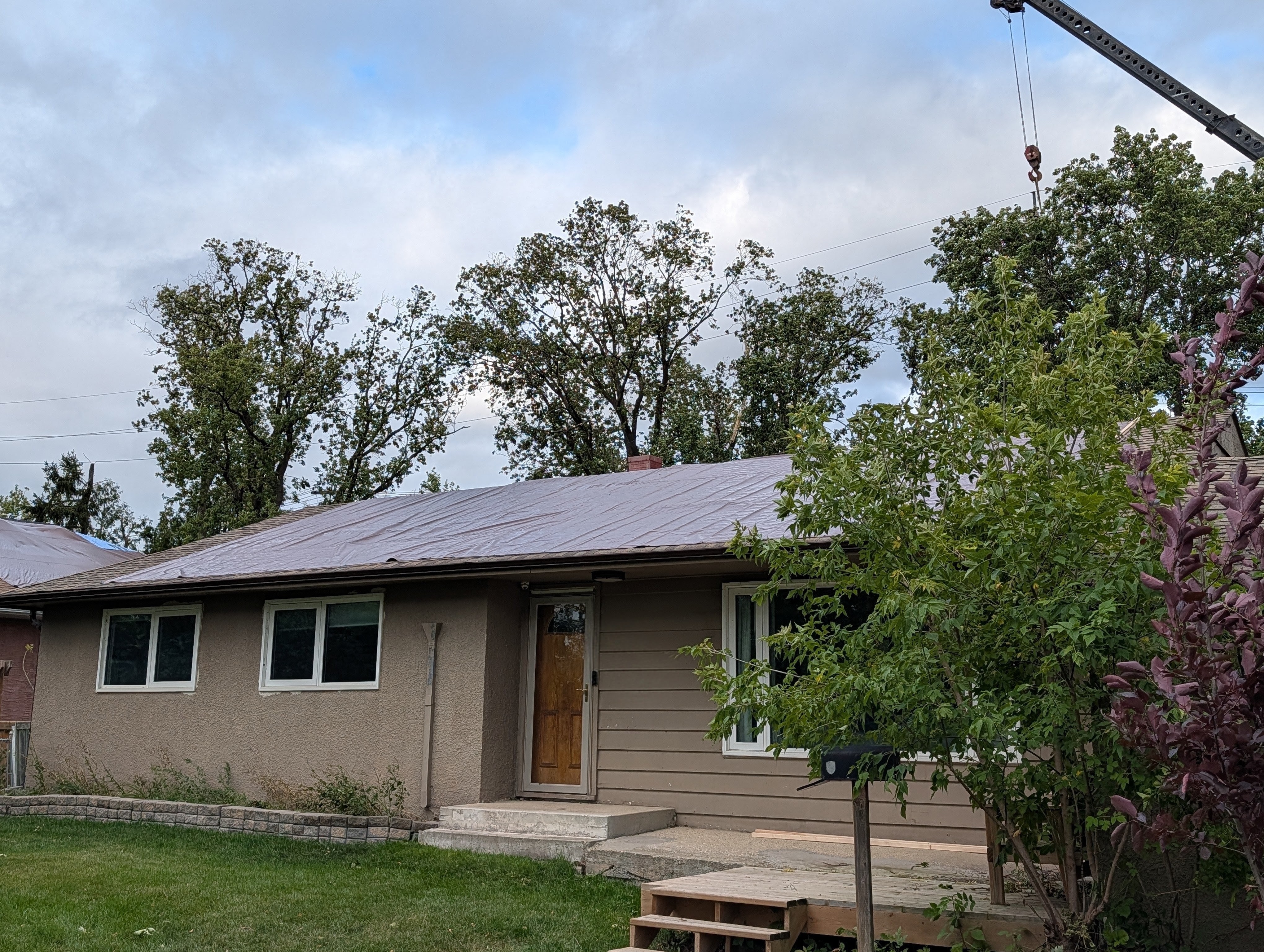
Ground photo showing house with a large portion of its roof covering removed and covered by a tarp (same house as in previous photo in worst damage location).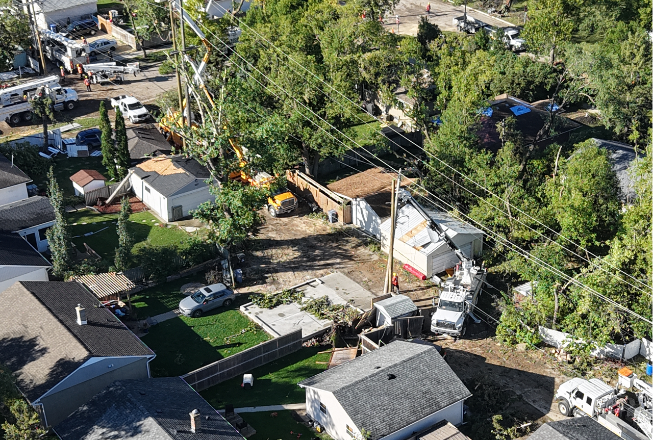
Oblique drone image showing damage to roof coverings, trees and utility poles (in process of being replaced).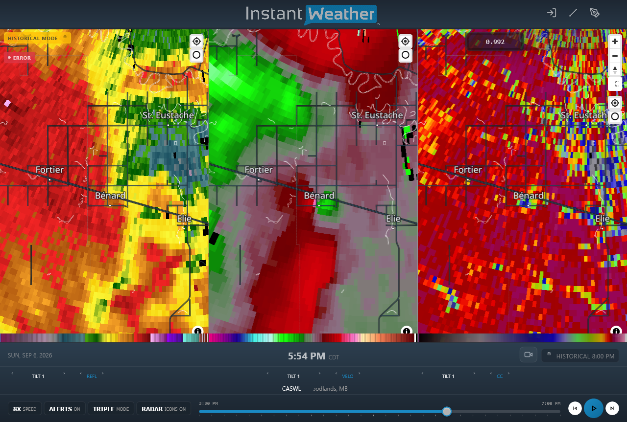
CASWL radar image showing reflectivity (left), radial velocity (centre) and correlation coefficient (right) products at the time and location of the Bénard EF1 tornado. A brief tornado debris signature can be seen with the tornado (e.g. blue pixels on right panel).





