Two additional tornadoes in southwest MB on June 28
The NTP has confirmed two additional tornadoes in southwest Manitoba with the storms of June 28. These tornadoes were generated by the same supercell thunderstorm that generated the Rossburn, MB EF3 tornado earlier.
An EF1-rated tornado occurred first, heading NNE. Then a new tornado formed under a new area of storm rotation nearby and both moved off to the NW. That tornado generated EF2-rated tree damage. High-resolution satellite imagery was used to confirm both of these tornadoes.
Full details are provided in the summaries below, along with a regional map. The events can also be plotted on a map using the NTP Dashboard here.
====
Event Name: Little Menzie Lake (Riding Mountain), MB
Date: June 28, 2026
Start Time: 8:40 PM CDT (0140 UTC)
Final Classification: Tornado (over land)
Final EF-Scale Rating: EF1
EF-Scale Damage Indicator / Degree of Damage: C-T/DOD-5
Start of damage track: 50.7691N, 100.6228W
End of damage track: 50.8211N, 100.5657W
Location of worst damage: 50.7910N, 100.6019W
Description: Tree damage was reported in Riding Mountain National Park after a storm passed through. Satellite imagery review revealed a tornado damage path through forested areas starting near Little Menzie Lake. Damage assessed as EF1 tornado, with an estimated max. wind speed of 145 km/h, track length of 7.08 km and max. path width of 330 m. Tornado motion was from the SSW (approx. 210 degrees). Start time is radar estimated. A second tornado later developed near Roynick Lake, causing EF2 damage.
Event Name: Roynick Lake (Riding Mountain), MB
Date: June 28, 2026
Start Time: 8:52 PM CDT (0152 UTC)
Final Classification: Tornado (over land)
Final EF-Scale Rating: EF2
EF-Scale Damage Indicator / Degree of Damage: C-T/DOD-6
Start of damage track: 50.8353N, 100.5599W
End of damage track: 50.8832N, 100.6131W
Location of worst damage: 50.8772N, 100.6015W
Description: Tree damage was reported in Riding Mountain National Park after a storm passed through. Satellite imagery review revealed a tornado damage path through forested areas starting near Roynick Lake. Damage assessed as EF2 tornado, with an estimated max. wind speed of 190 km/h, track length of 6.79 km and max. path width of 440 m. Tornado motion was from the SE (approx. 145 degrees). Start time is radar estimated. An earlier tornado developed near Little Menzie Lake, causing EF1 damage.
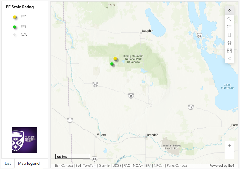
Regional map showing the start locations for the EF1 and EF2 tornadoes at Riding Mountain National Park in southwestern Manitoba.





