Two more tornadoes in southern SK on June 28
The NTP has confirmed two additional tornadoes that occurred in southern Saskatchewan on June 28.
The first developed north of Badgerville, causing EF2-rated damage while travelling north before veering northwest. The second developed as the Badgerville tornado was dissipating and caused EF1 damage while moving northeast into Pelly. No injuries were reported.
Full details are provided in the event summaries below, along with a regional map, a survey summary map, survey photos and radar imagery. The events can also be plotted on a map using the NTP Dashboard here.
====
Event Name: Badgerville, SK
Date: June 28, 2026
Start Time: 5:40 PM CST (2340 UTC)
Final Classification: Tornado (over land)
Final EF-Scale Rating: EF2
EF-Scale Damage Indicator / Degree of Damage: C-ETL/DOD-4
Estimated start of tornado: 51.674N, 101.929W
End of damage track: 51.8540N, 102.0051W
Location of worst damage: 51.8009N, 101.9315W
Description: Witnesses captured video and photos of a tornado that developed north of Badgerville, tracked northward and ended west of Pelly. Damage to homes and barns on several properties was reported, along with several snapped power poles and tree damage. No injuries were reported. An NTP ground and drone survey was completed on July 1, 2026, documenting the reported damage. Damage assessed as an EF2 tornado, with an estimated max. wind speed of 195 km/h, track length of 22.2 km and max. path width of 1.05 km. Tornado motion was from the SSE (approx. 160 degrees). Start time is radar estimated. Satellite imagery review pending. A second tornado later developed just south of Pelly, causing EF1 damage in the community.
Event Name: Pelly, SK
Date: June 28, 2026
Start Time: 6:11 PM CST (0011 UTC)
Final Classification: Tornado (over land)
Final EF-Scale Rating: EF1
EF-Scale Damage Indicator / Degree of Damage: FR12/DOD-4
Start of damage track: 51.8365N, 101.9467W
End of damage track: 51.8632N, 101.9285W
Location of worst damage: 51.8528N, 101.9332W
Description: Witness captured video of a tornado that developed just south of Pelly. Damage to trees and several homes was reported in the community. No injuries were reported. An NTP ground and drone survey was completed on July 1, 2026, documenting the reported damage. Damage assessed as an EF1 tornado, with an estimated max. wind speed of 155 km/h, track length of 3.40 km and max. path width of 100 m. Tornado motion was from the SSW (approx. 205 degrees). Start time is based on witness report. Satellite imagery review pending. An earlier tornado developed further south near Badgerville, causing up to EF2 damage along the path that ended west of Pelly.
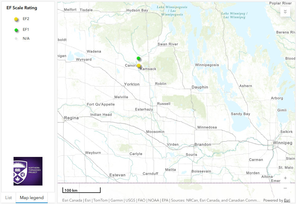
Regional map showing the locations of the EF2 and EF1 tornadoes in Saskatchewan.
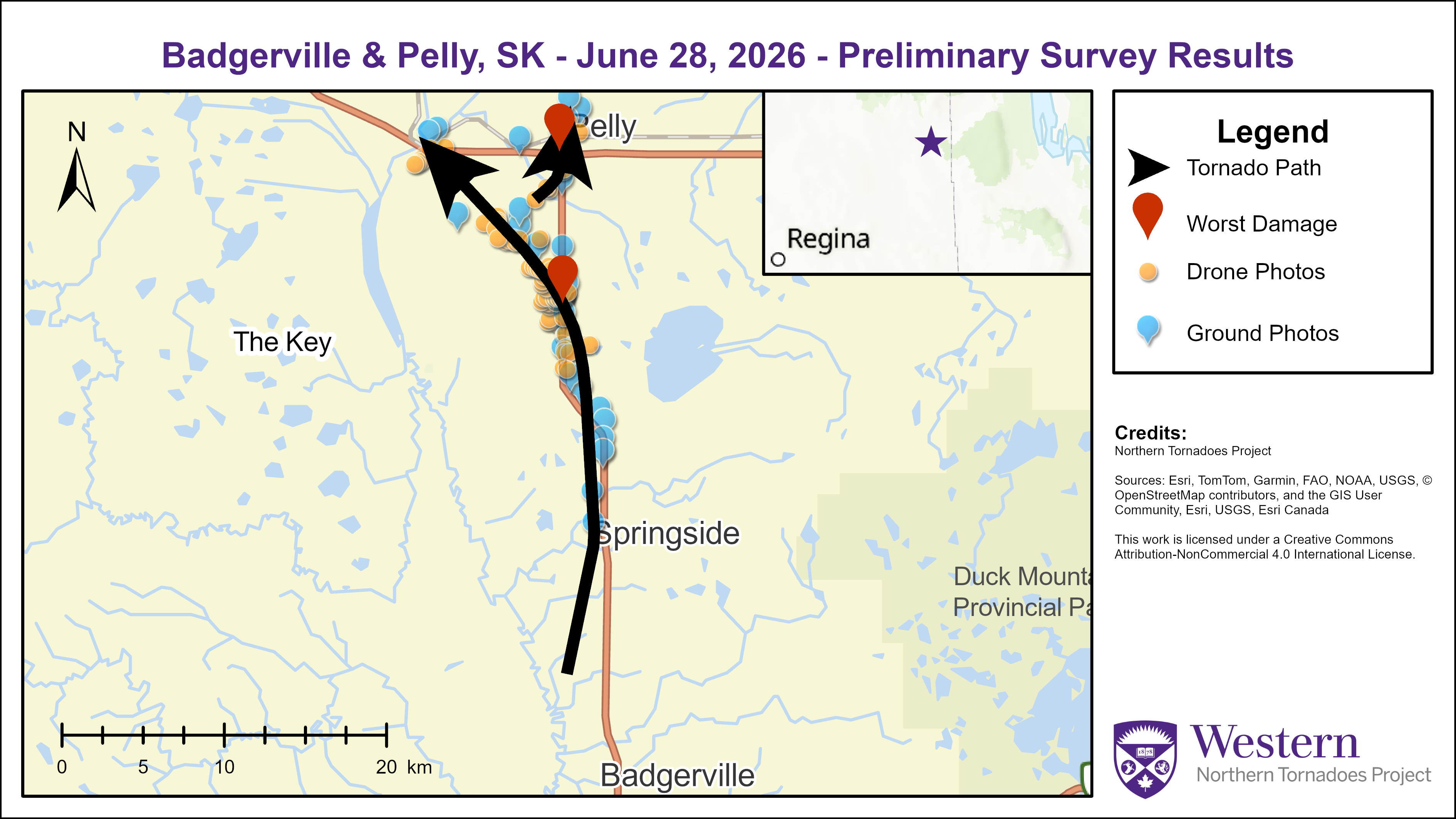
Survey summary map showing the tracks for the Badgerville EF2 tornado and the Pelly EF1 tornado.
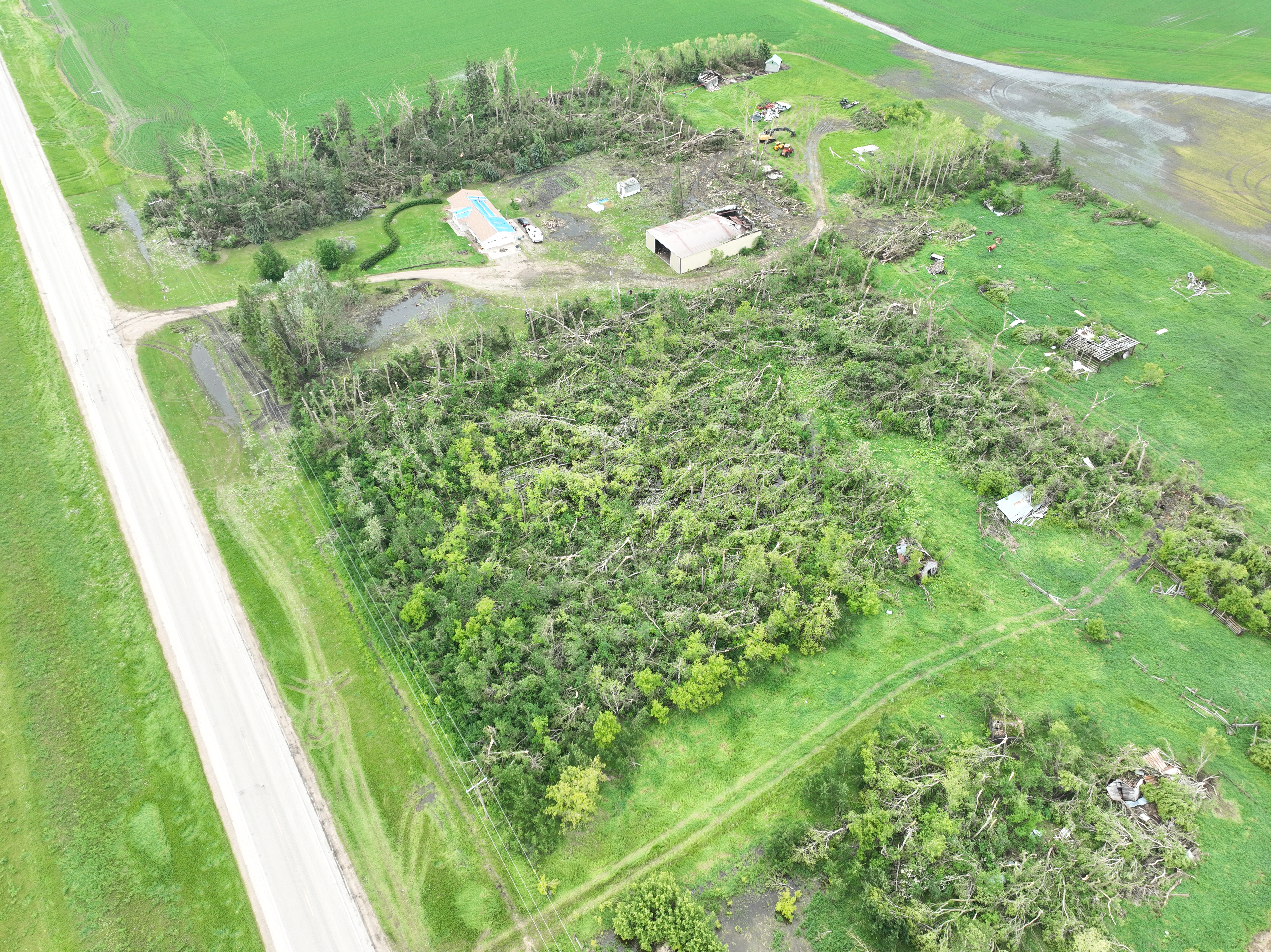
Drone photo of significant damage to trees, as well as damage to a house, barn, and other structures at a property near the worst damage location for the Badgerville EF2 tornado.
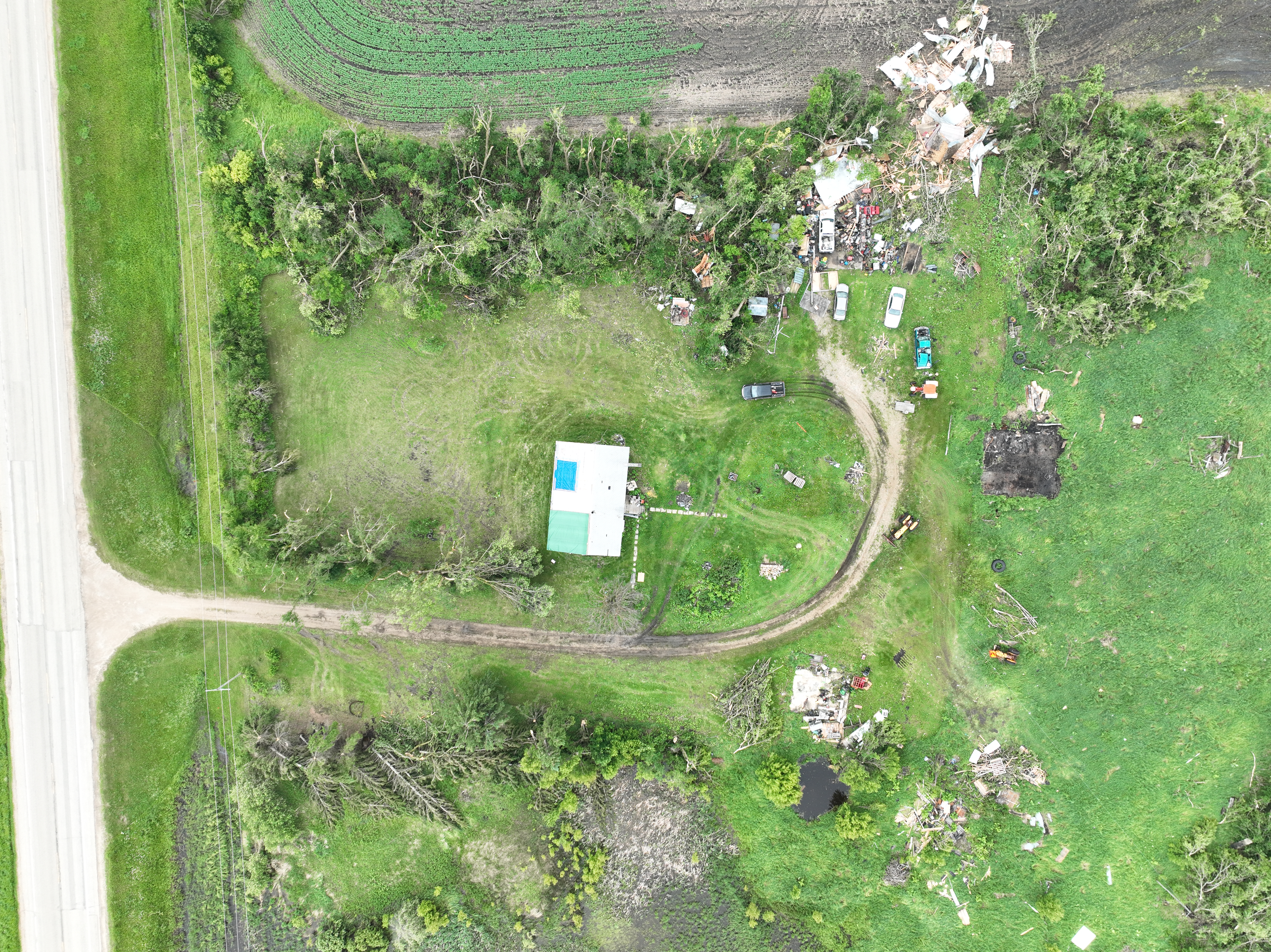
Drone photo of a property with significant roof covering loss on a house, many trees snapped or uprooted, and several sheds destroyed.
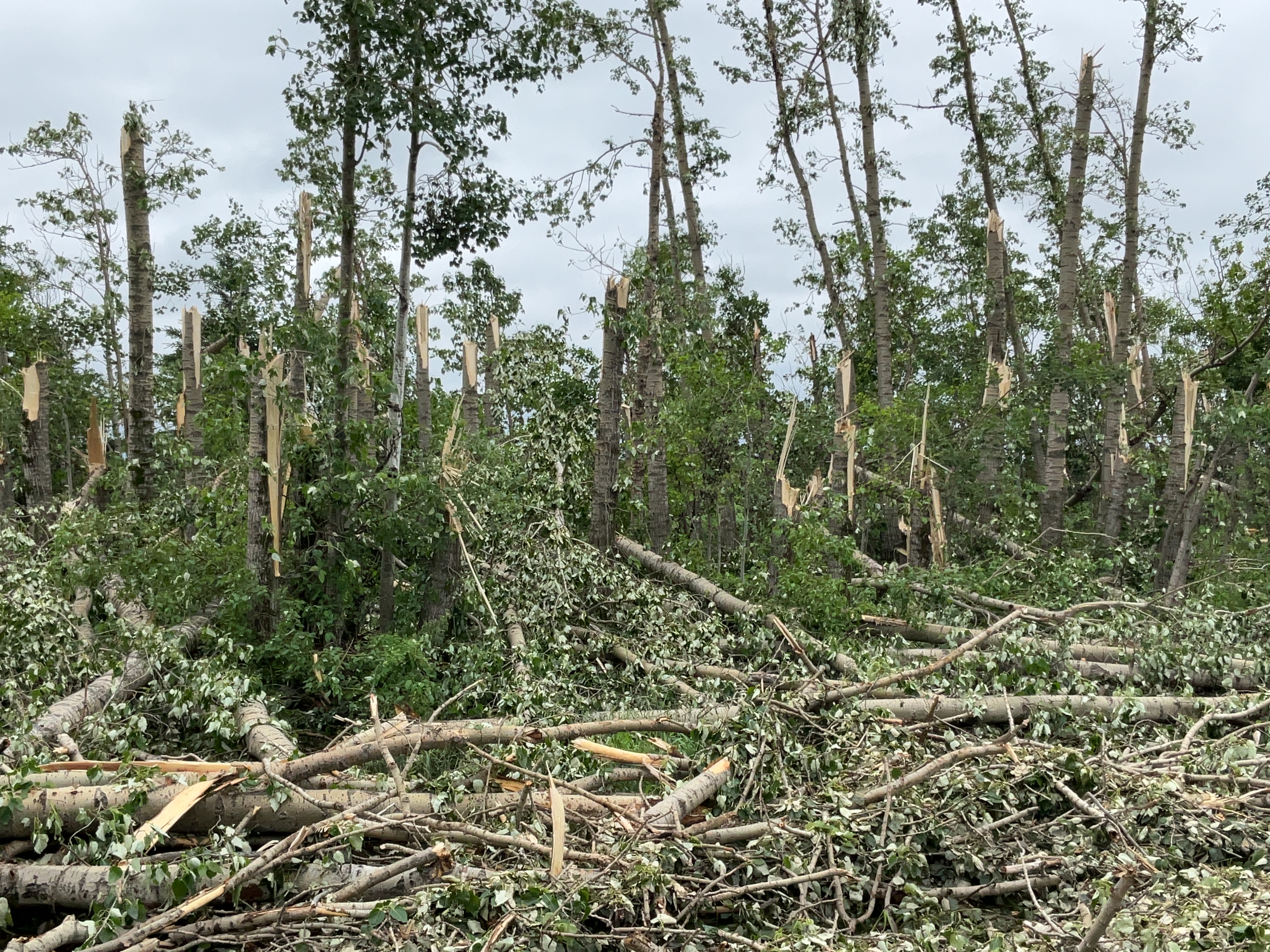
Significant tree damage, with many trees snapped along Range Road 1324, just south of Township Road 332.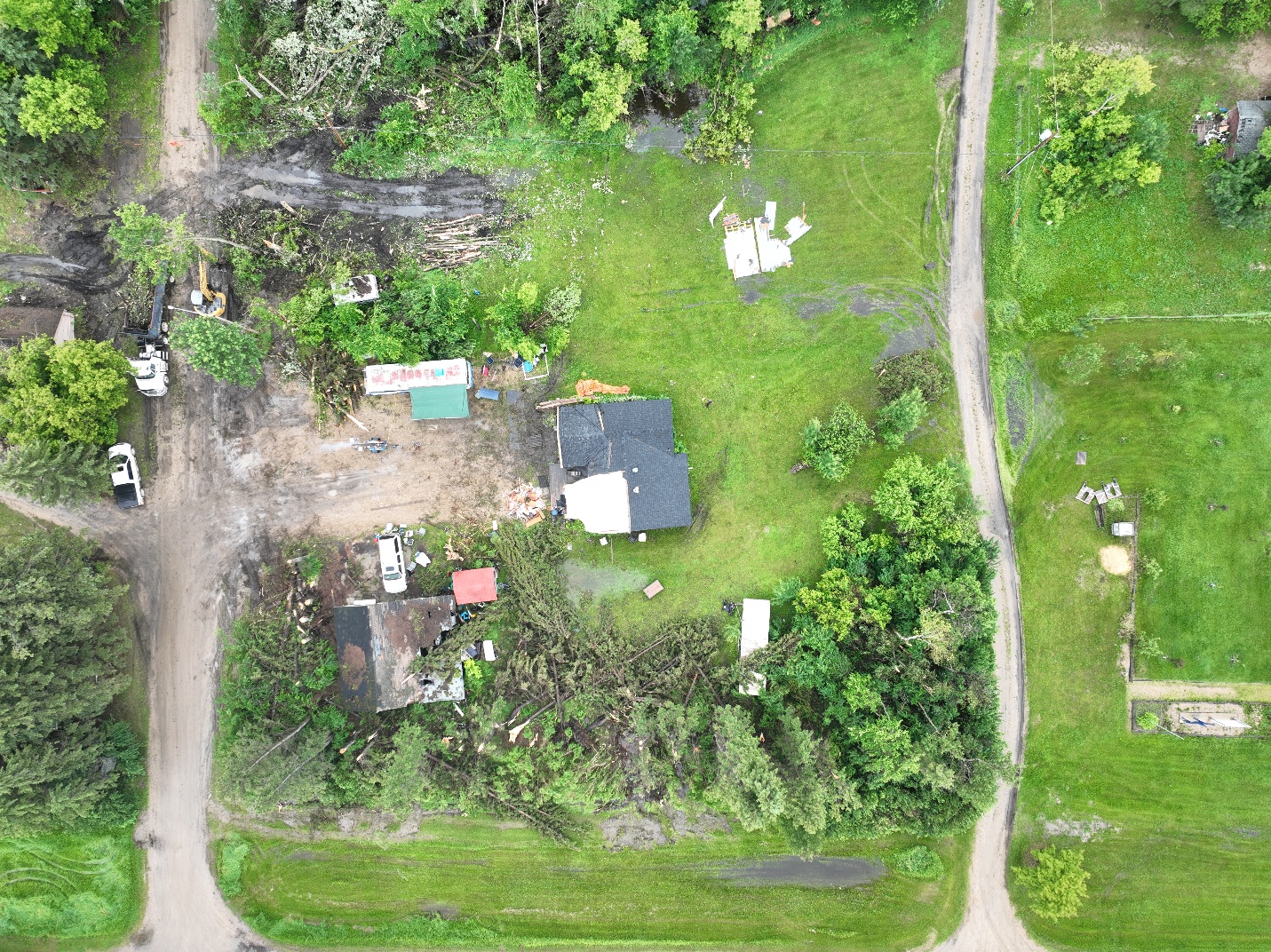
Drone photo of the worst damaged property for the Pelly EF1 tornado. Among the damage is a house with shingle and sheathing damage as well as many trees snapped in a convergent pattern.
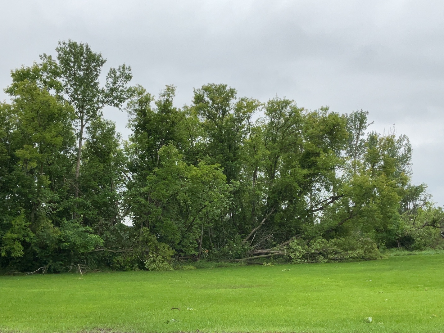
Ground photo of several down trees towards the end of the damage path on the north side of Pelly, SK.
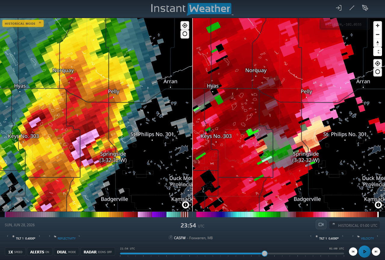
Radar image showing the supercell with hook echo in reflectivity (left) and wide mesocyclone in radial velocity (right) at the time of the strongest damage with the Badgerville EF2 tornado.





