Tornado outbreak on June 15 in NW Alberta
Based on results from extensive damage surveys and analysis of visual evidence and radar, the NTP has confirmed that a six-tornado outbreak occurred on June 15 in northwest Alberta. The tornadoes occurred with three different supercell thunderstorms, with four tornadoes occurring with one long-track supercell. The highest-rated damage was EF2. No injuries were reported.
Note that this is the first F/EF2+ tornado in this region since the 2003 tornado at Grimshaw, AB.
Full details are provided in the event summaries below, along with a regional map, survey summary maps, survey photos and links to tornado visuals on social media. The events can also be plotted on a map using the NTP Dashboard here.
====
Event Name: Hines Creek, AB
Date: June 15, 2026
Start Time: 5:08 PM MDT (2308 UTC)
Final Classification: Tornado (over land)
Final EF-Scale Rating: EF0
EF-Scale Damage Indicator / Degree of Damage: C-T/DOD-3
Start of damage track: 56.2754N, 118.8039W
End of damage track: 56.2795N, 118.7620W
Location of worst damage: 56.2753N, 118.7964W
Description: Tree damage was reported northwest of Hines Creek after a storm passed through the area. No injuries were reported. An NTP ground and drone survey was completed on June 19, 2026, documenting the reported damage. Damage assessed as an EF0 tornado, with an estimated max. wind speed of 115 km/h, track length of 2.73 km and max. path width of 330 m. Tornado motion was from the W (approx. 260 degrees). Start time is based on witness report. Satellite imagery review is pending.
Event Name: Girouxville, AB
Date: June 15, 2026
Start Time: 8:03 PM MDT (0203 UTC)
Final Classification: Tornado (over land)
Final EF-Scale Rating: EF2
EF-Scale Damage Indicator / Degree of Damage: C-T/DOD-5
Start of damage track: 55.7754N, 117.4802W
End of damage track: 55.7483N, 117.3126W
Location of worst damage: 55.7640N, 117.3777W
Description: Witnesses captured video of a tornado that developed west of Girouxville and later tracked through the community before dissipating. Structural damage to homes and small buildings and trees was reported in the town, as well damage to a farm property nearby. No injuries were reported. An NTP ground and drone survey was completed on June 17 and 19, 2026, documenting the reported damage and damage to additional farm properties. Damage assessed as an EF2 tornado, with an estimated max. wind speed of 190 km/h, track length of 11.1 km and max. path width of 600 m. Tornado motion was from the WNW (approx. 285 degrees). Start time is based on witness report. Satellite imagery review is pending.
Event Name: Nampa, AB
Date: June 15, 2026
Start Time: 8:27 PM MDT (0227 UTC)
Final Classification: Tornado (over land)
Final EF-Scale Rating: EF0
EF-Scale Damage Indicator / Degree of Damage: C-T/DOD-3
Start of damage track: 56.0649N, 116.9448W
End of damage track: 56.0725N, 116.8481W
Location of worst damage: 56.0665N, 116.9373W
Description: Witnesses captured video of a tornado near Harmon Valley (east of Nampa). Tree damage was reported in the area. No injuries were reported. An NTP ground and drone survey was completed on June 19, 2026, documenting the reported damage. Damage assessed as an EF0 tornado, with an estimated max. wind speed of 115 km/h, track length of 6.13 km and max. path width of 140 m. Tornado motion was from the W (approx. 260 degrees). Start time is based on witness report. Satellite imagery review is pending.
Event Name: Falher, AB
Date: June 15, 2026
Start Time: 8:30 PM MDT (0230 UTC)
Final Classification: Tornado (over land)
Final EF-Scale Rating: EF0
EF-Scale Damage Indicator / Degree of Damage: C-T/DOD-3
Tornado damage area: 55.7088N, 117.1835W
Description: Witnesses captured video of a tornado south of Falher. No damage and no injuries were reported. An NTP ground and drone survey was completed on June 18, 2026, discovering a few areas of tree damage. Damage assessed as an EF0 tornado, with an estimated max. wind speed of 115 km/h. Due to limited damage indicators in the area, the information available is insufficient to accurately estimate track details, through the tornado persisted for several minutes and the parent storm motion was from NW to SE. Start time is based on witness reports. Satellite imagery review is pending.
Event Name: McLennan, AB
Date: June 15, 2026
Start Time: 8:55 PM MDT (0255 UTC)
Final Classification: Tornado (over land)
Prelimnary EF-Scale Rating: EF0-default
Estimated tornado location: 55.66N, 116.92W
Description: Witnesses captured video of a tornado south of McLennan. No damage and no injuries were reported. The preliminary EF-Scale assessment is EF0-Default. Start time is radar estimated. Satellite imagery review is pending.
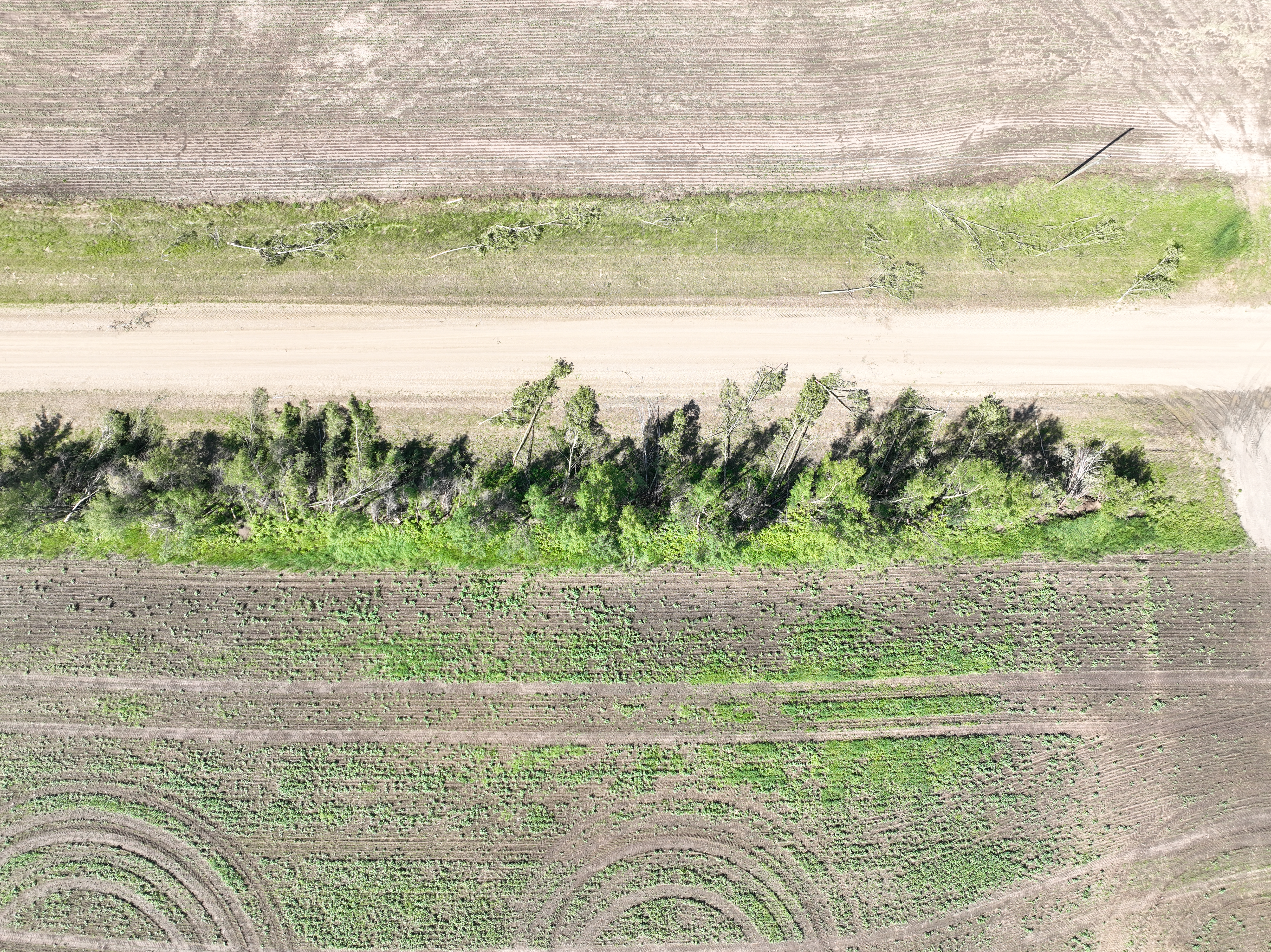
Event Name: Enilda, AB
Date: June 15, 2026
Start Time: 9:42 PM MDT (0342 UTC)
Final Classification: Tornado (over land)
Final EF-Scale Rating: EF1
EF-Scale Damage Indicator / Degree of Damage: C-T/DOD-4
Start of damage track: 55.4535N, 116.3240W
End of damage track: 55.4082N, 116.2357W
Location of worst damage: 55.4371N, 116.2970W
Description: Witnesses captured video and photos of a tornado that tracked from north of Enilda southeastward into the Sucker Creek Fist Nation area. Tree damage was reported along with damage to a fench and recreational trailer. No injuries were reported. An NTP ground and drone survey was completed on June 18, 2026, documenting the reported damage. Damage assessed as an EF1 tornado, with an estimated max. wind speed of 150 km/h, track length of 7.60 km and max. path width of 200 m. Tornado motion was from the NW (approx. 310 degrees). Start time is based on witness report. Satellite imagery review is pending.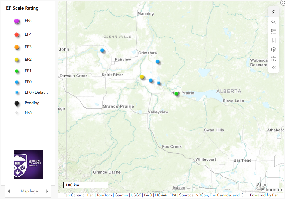
Regional map showing the locations and ratings for the six tornado in NW Alberta on June 15.
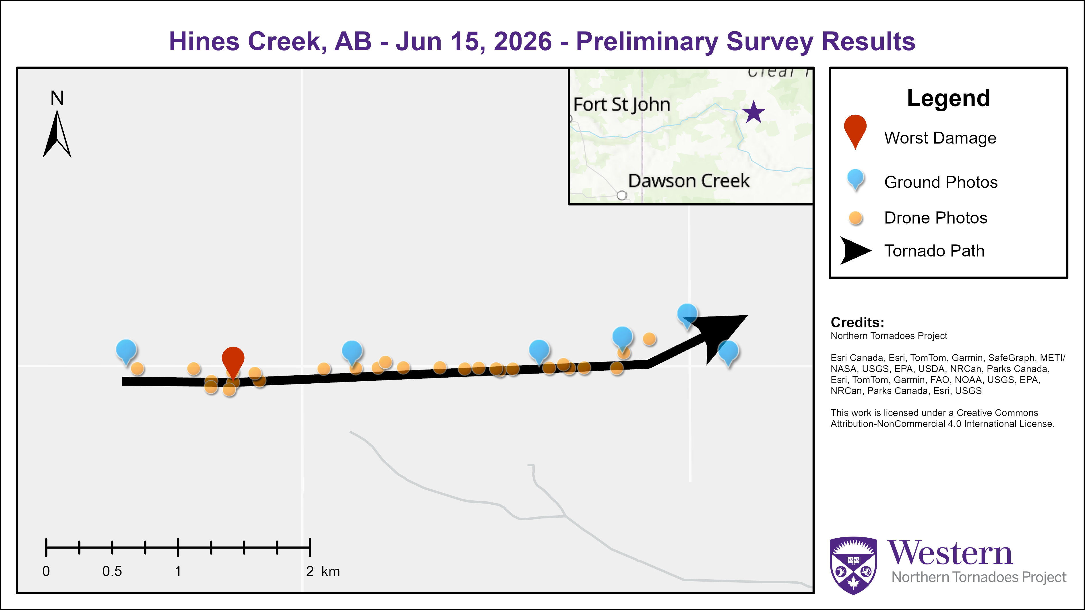
Survey summary map for the Hines Creek EF0 tornado.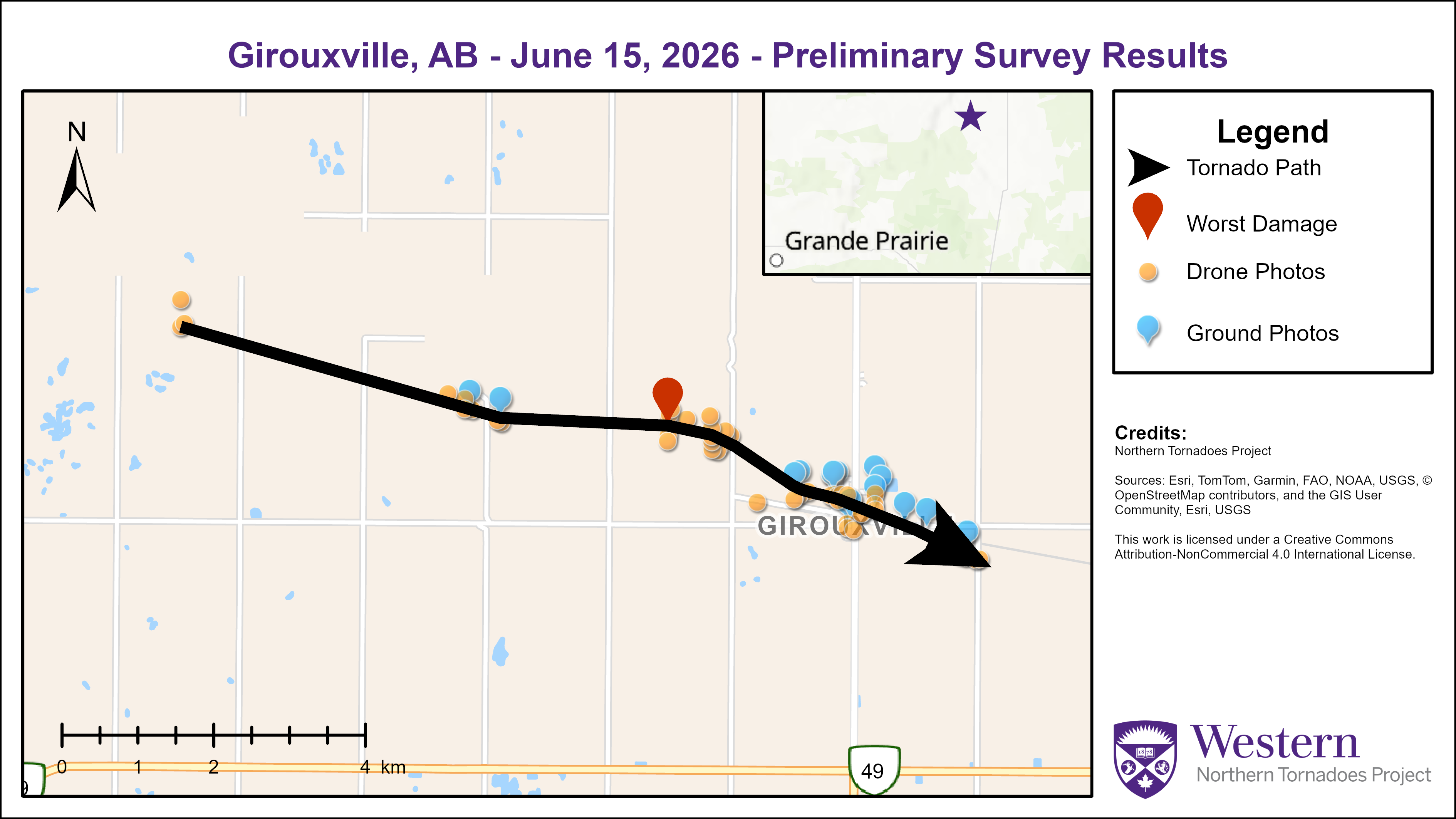
Survey summary map for the Girouxville EF2 tornado.
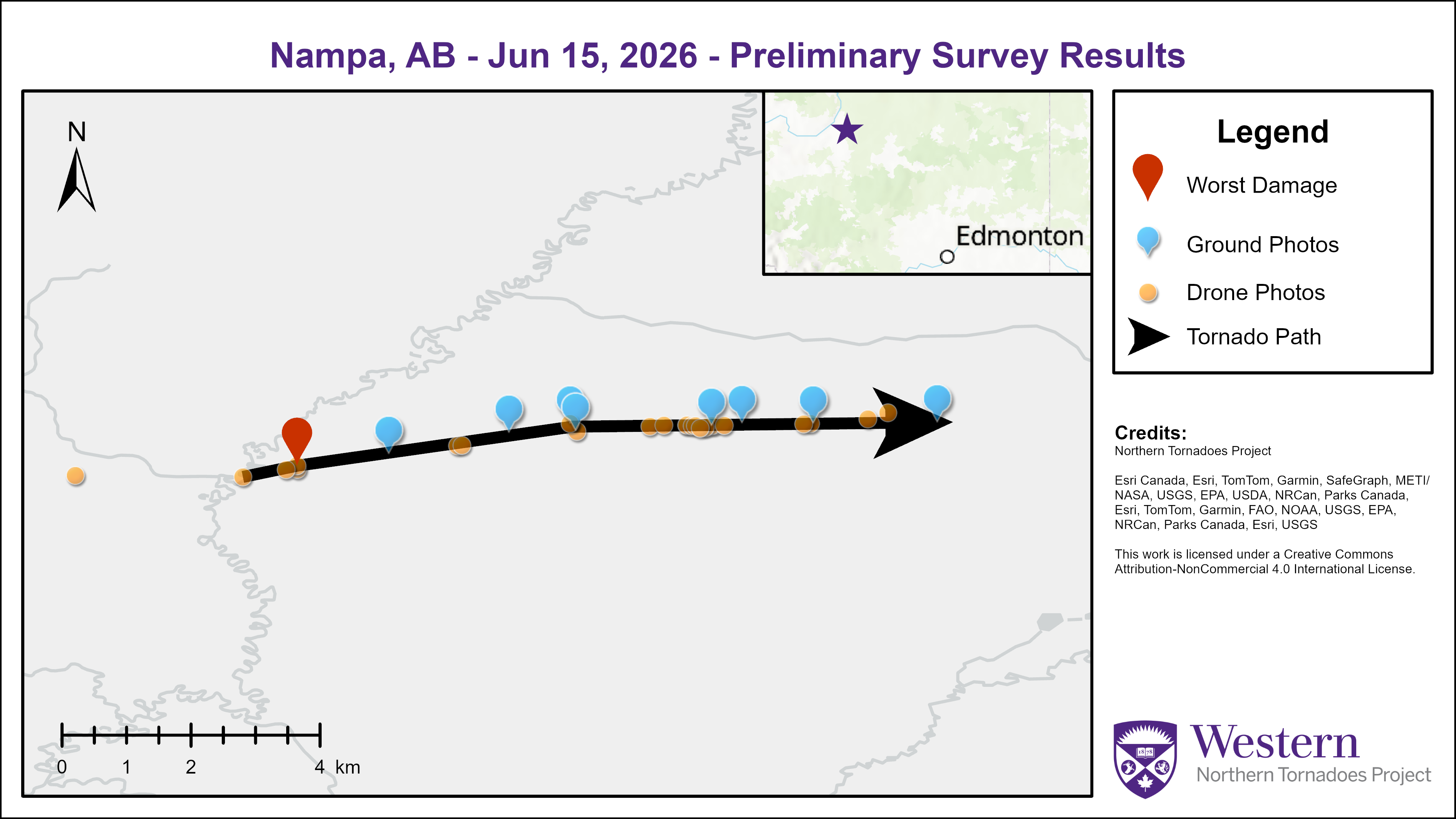
Survey summary map for the Nampa EF0 tornado.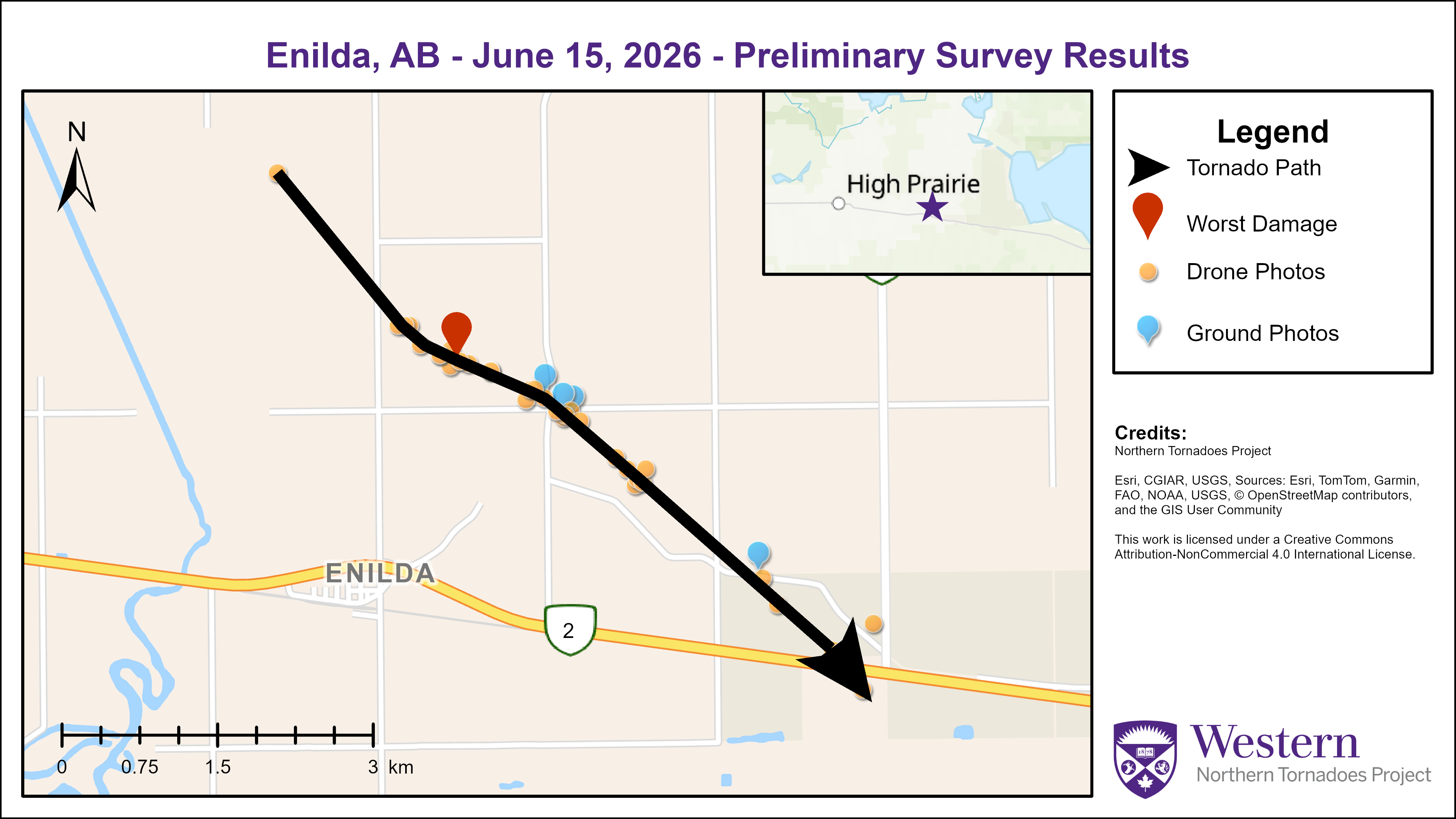
Survey summary map for the Enilda EF1 tornado.
Drone image showing tree damage with the Hines Creek EF0 tornado.

Drone image showing location with worst damage for the Girouxville EF2 tornado.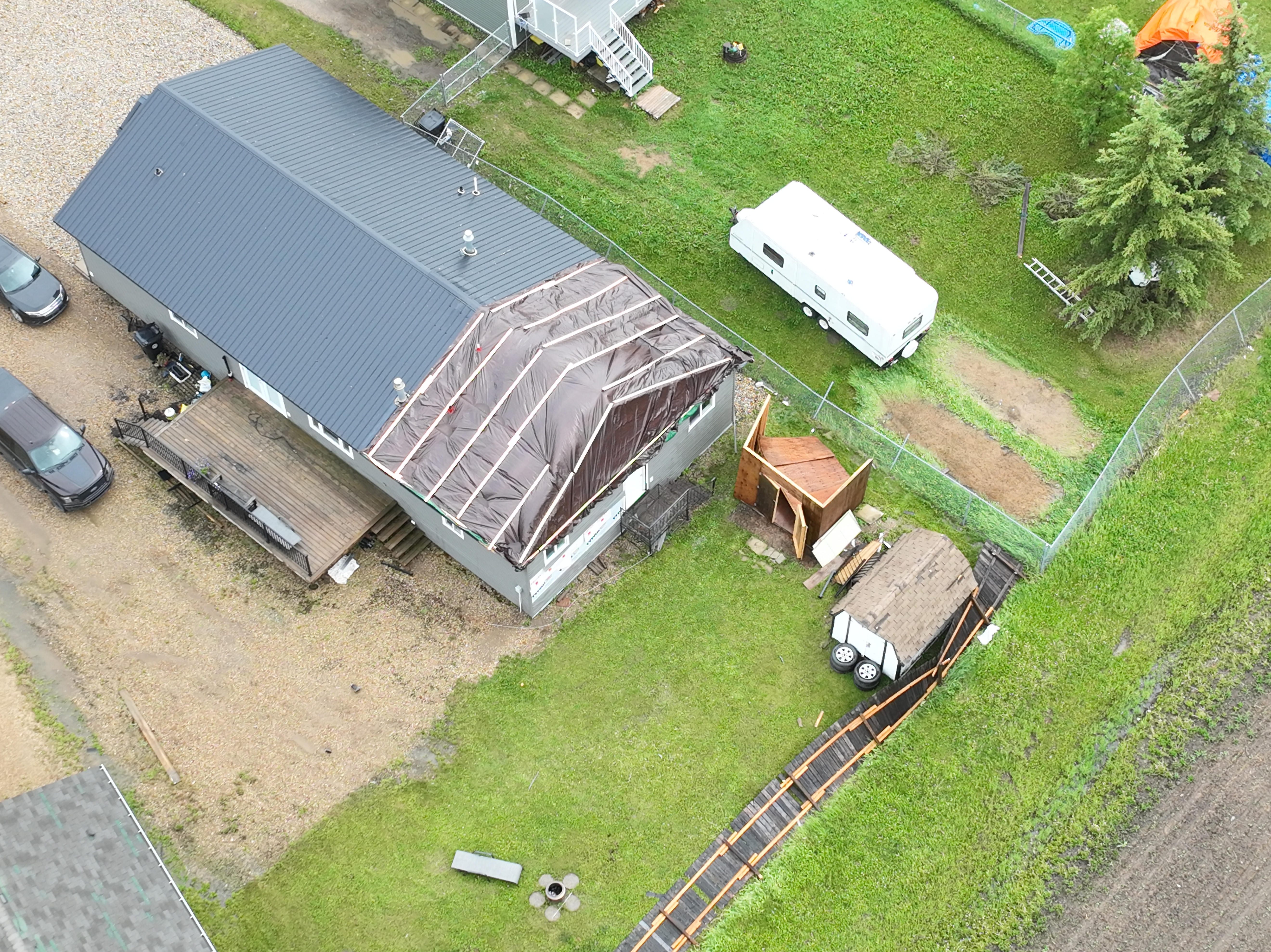
Drone image showing roof damage and other property damage for the Girouxville EF2 tornado.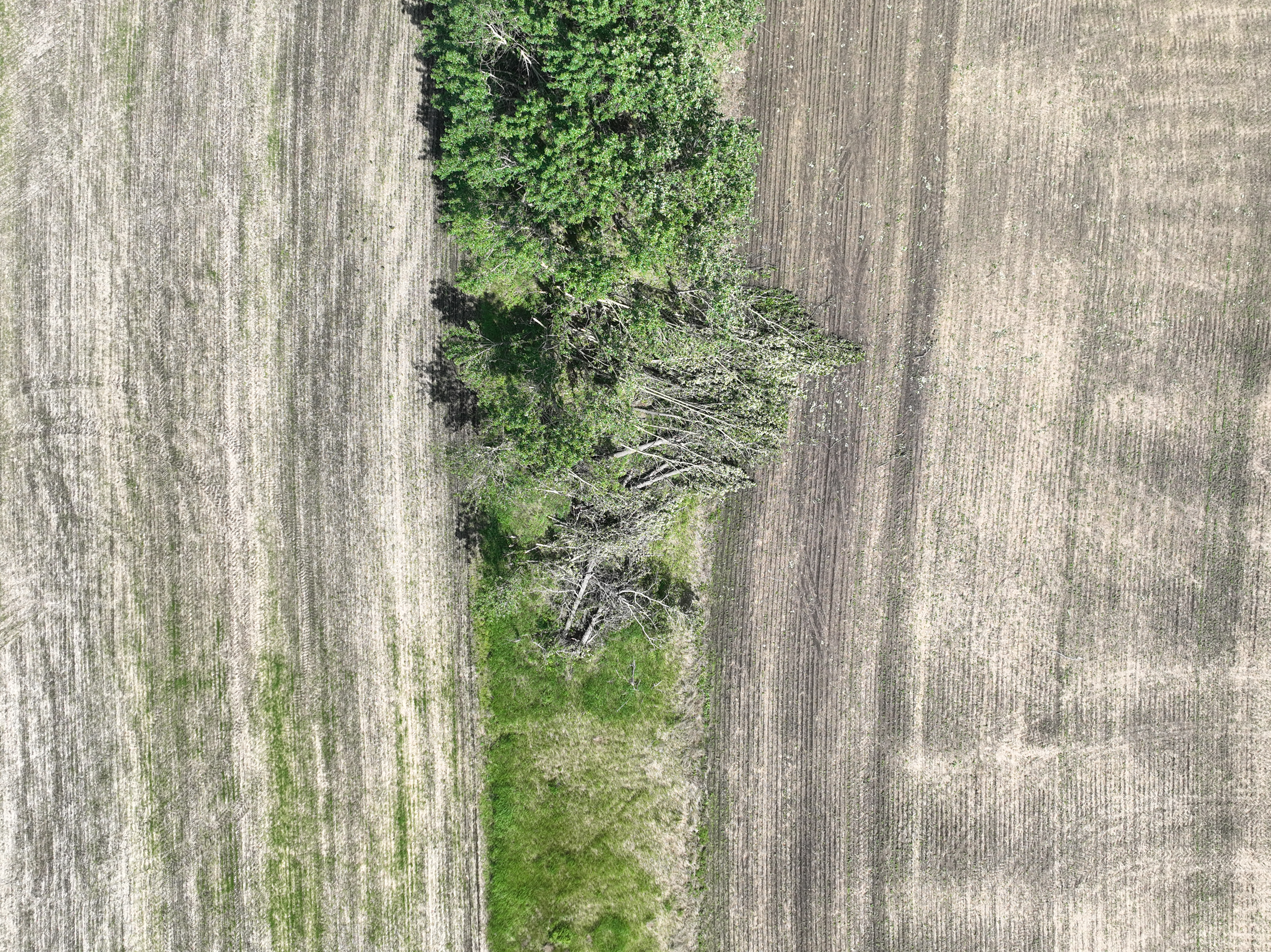
Drone image showing tree damage for the Nampa EF0 tornado.
Drone image showing the location with the worst damage for the Enilda EF1 tornado.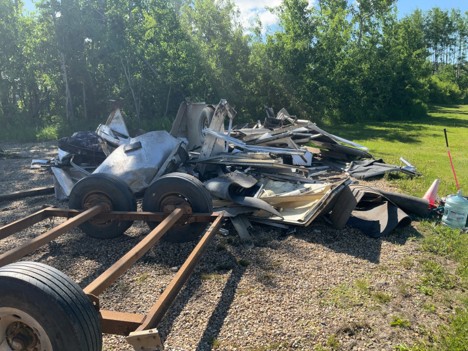
Photo showing damage to a horse trailer that was rolled a considerable distance with the Enilda EF1 tornado.
Video showing the Girouxville EF2 tornado (via Facebook):
https://www.facebook.com/valerie.sylvain.33/videos/1333314858192245/
Videos showing the Falher EF0 tornado (via Facebook):
https://www.facebook.com/reel/1293880852952487
https://www.facebook.com/reel/2493368527775303
Photo showing the McLennan EF0-Default tornado (via Facebook):
https://www.facebook.com/photo.php?fbid=10175046908490088&set=p.10175046908490088
Video showing the development of the Enilda EF1 tornado (via Facebook):
https://www.facebook.com/reel/1568255631322950
Thanks to Instant Weather for help with finding social media posts related to this event and ECCC's Prairie and Arctic Storm Prediction Centre for providing key evidence.