Tornado and downbursts in SW ON on June 12
The NTP has confirmed a tornado and two downbursts in southwestern Ontario on June 12. The damage with these events, all rated at EF0, occurred as a line of storms moved through the region during the early morning hours. The tornado occurred at Croton, while the downbursts occurred at Walpole Island and Blenheim.
Additional details are provided in the event summaries below, along with a regional map, survey summary maps, and survey photos. The event can also be plotted on a map using the NTP Dashboard here.
====
Event Name: Walpole Island, ON
Date: June 12, 2026
Start Time: 1:35 AM EDT (0535 UTC)
Final Classification: Downburst (microburst)
Final EF-Scale Rating: EF0
EF-Scale Damage Indicator / Degree of Damage: FR12/DOD-4
Location of worst damage: 42.5940N, 82.4679W
Description: Damage to a cell tower was reported in Walpole after a storm passed through the area. An NTP ground survey was completed on June 12, 2026, documenting the reported damage along with tree damage and minor roof damage in the area. Damage assessed as EF0 microburst, with an estimated max. wind speed of 130 km/h, with damage found over a limited area approximately 1.2 km long and up to 0.5 km wide. Start time is radar estimated. Satellite imagery review is pending.
Event Name: Blenheim, ON
Date: June 12, 2026
Start Time: 1:55 AM EDT (0555 UTC)
Final Classification: Downburst (microburst)
Final EF-Scale Rating: EF0
EF-Scale Damage Indicator / Degree of Damage: FR12/DOD-2
Location of worst damage: 42.3238N, 82.0051W
Description: Damage to trees and minor damage to homes and fences was reported in Blenheim after a storm passed through the area. A ground survey by a private citizen was completed on behalf of NTP on June 12, 2026. Damage assessed as EF0 microburst, with an estimated max. wind speed of 125 km/h, with damage found over a limited area approximately 2.2 km long and up to 0.9 km wide. Start time is radar estimated. Satellite imagery review is pending.
Event Name: Croton, ON
Date: June 12, 2026
Start Time: 2:00 AM EDT (0600 UTC)
Final Classification: Tornado (over land)
Final EF-Scale Rating: EF0
EF-Scale Damage Indicator / Degree of Damage: SBO/DOD-3
Start of damage track: 42.6032N, 82.0739W
End of damage track: 42.6278N, 82.0279W
Location of worst damage: 42.6080N, 82.0717W
Description: Damage to an outbuilding and crops was reported in the Croton area after a storm passed through. No injuries were reported. An NTP ground and drone survey was completed on June 12, 2026, documenting the reported damage and discovering additional damage to trees. Damage assessed as an EF0 tornado, with an estimated max. wind speed of 130 km/h, track length of 4.80 km and max. path width of 150 m. Tornado motion was from the SW (approx. 235 degrees). Start time is radar estimated. Satellite imagery review is pending.
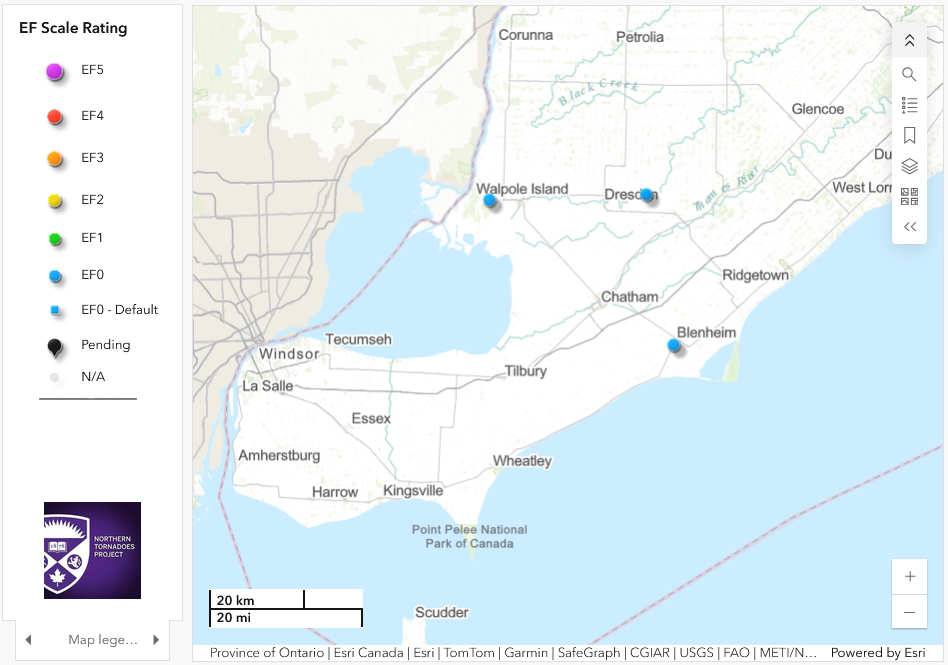
Regional map showing the locations of the tornado (near Dresden) and two downbursts.
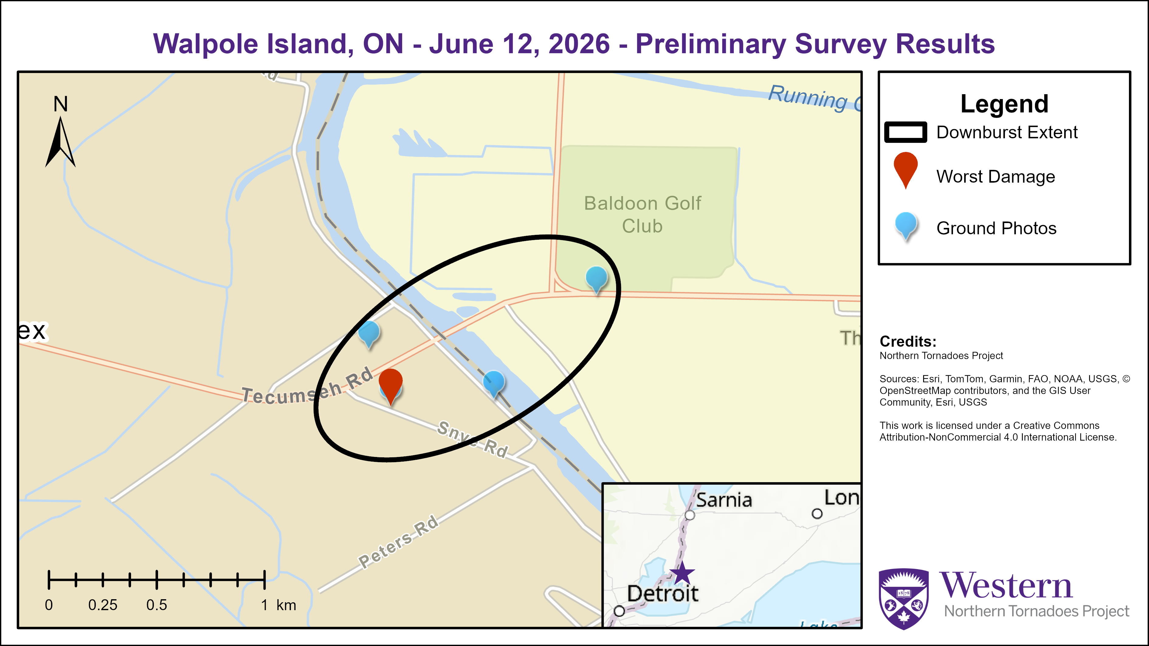
Survey summary map for Walpole Island, ON EF0 downburst.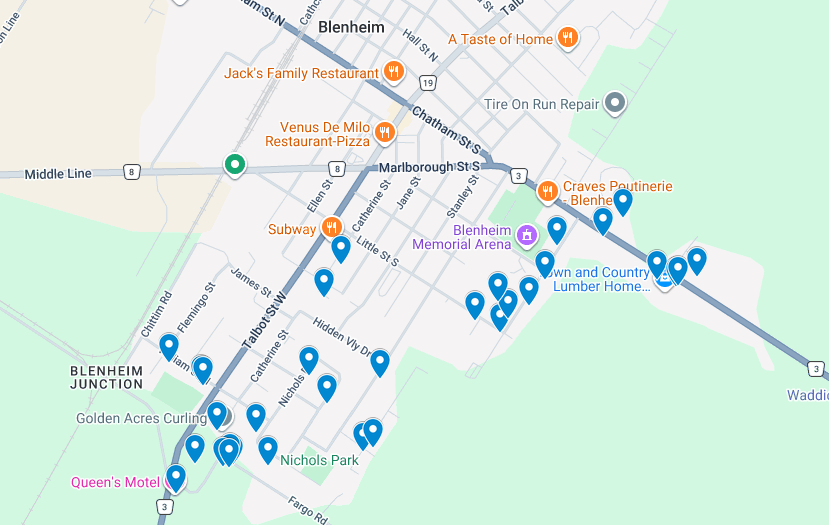
Map of damage points (blue pins) for the EF0 Blenheim, ON tornado submitted by Dalton Loveday (Instant Weather)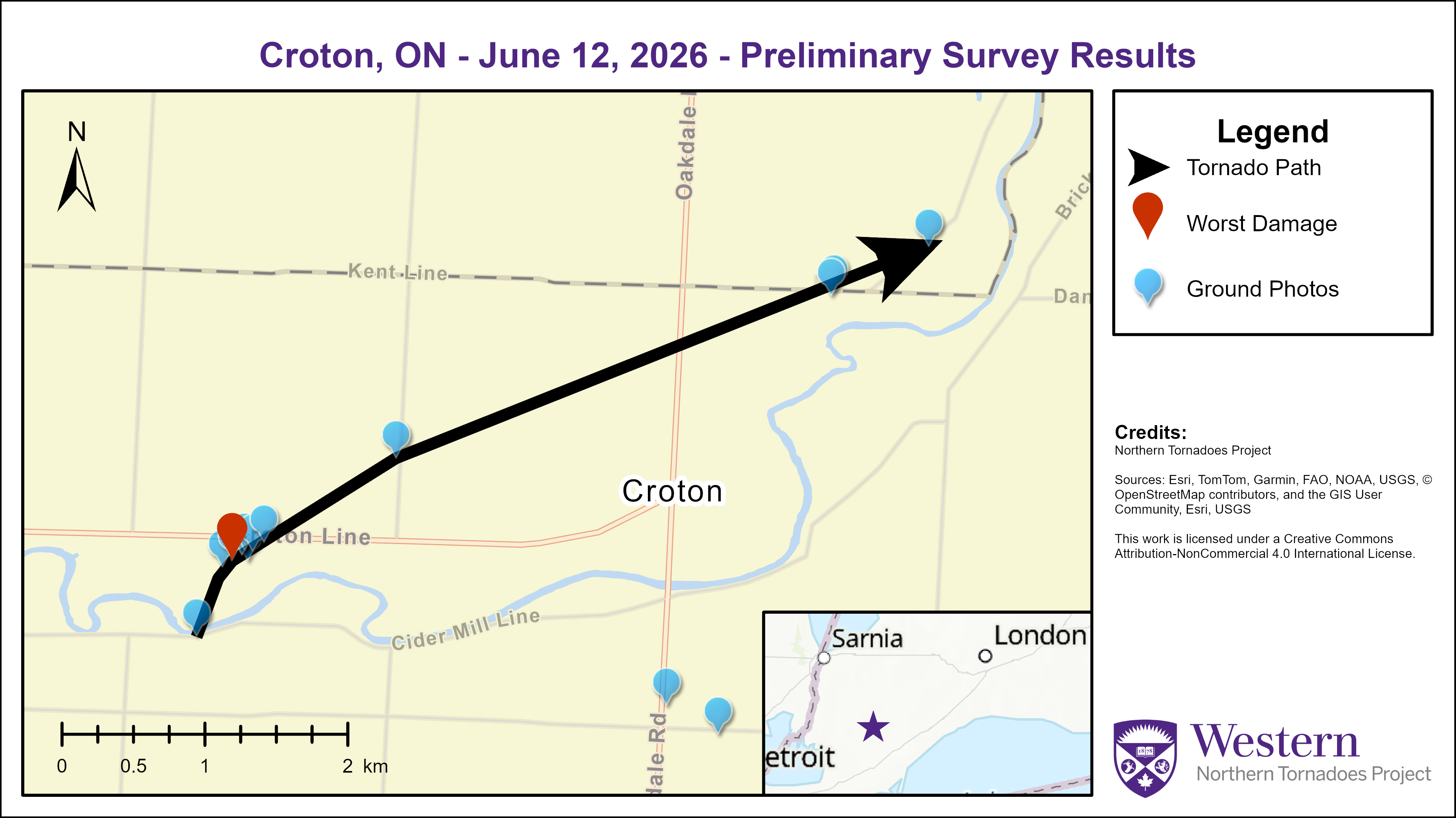
Survey summary map for the EF0 Croton, ON tornado.
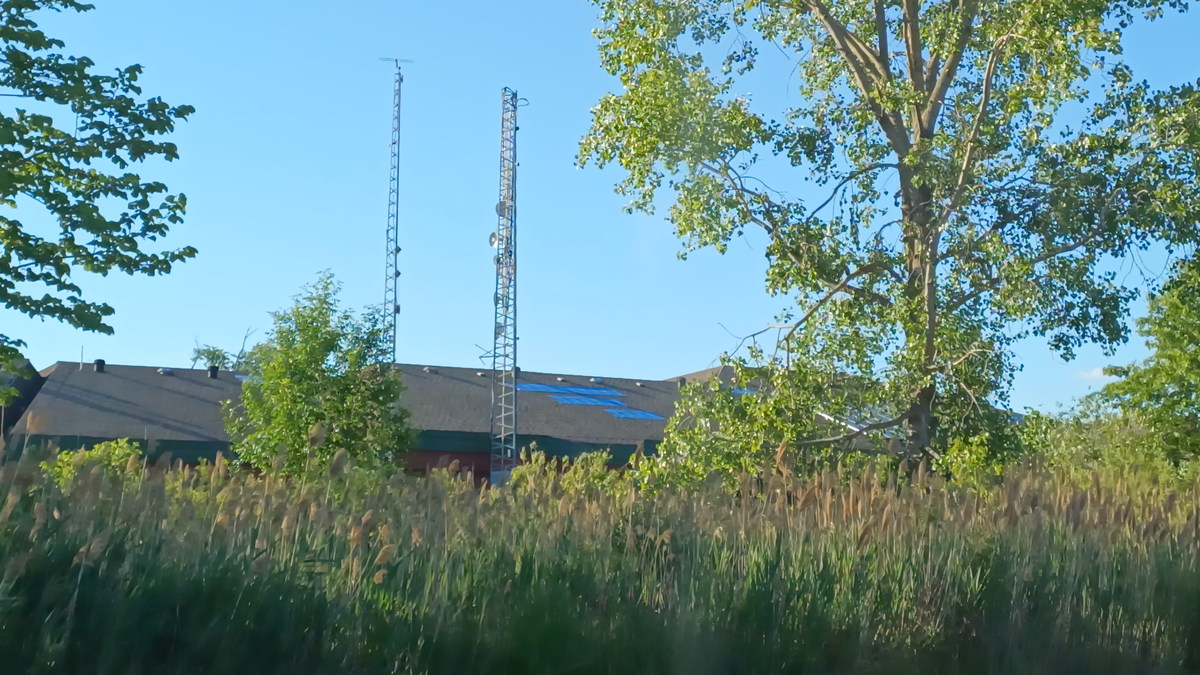
Photo of shingle damage and collapsed comms tower at Walpole Island.
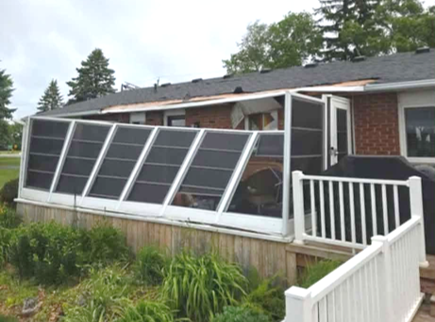
From the Walpole Island EF0 downburst, sunroom with roof blown over house onto front lawn, minor damage to roof structure (submitted photo).

Photo of minor shingle damage to roof due to Blenheim, ON EF0 downburst (Dalton Loveday / IW)
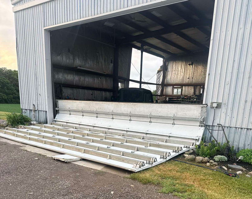
Photo of large metal door and blown-out wall on outbuilding due to the Croton, ON EF0 tornado.
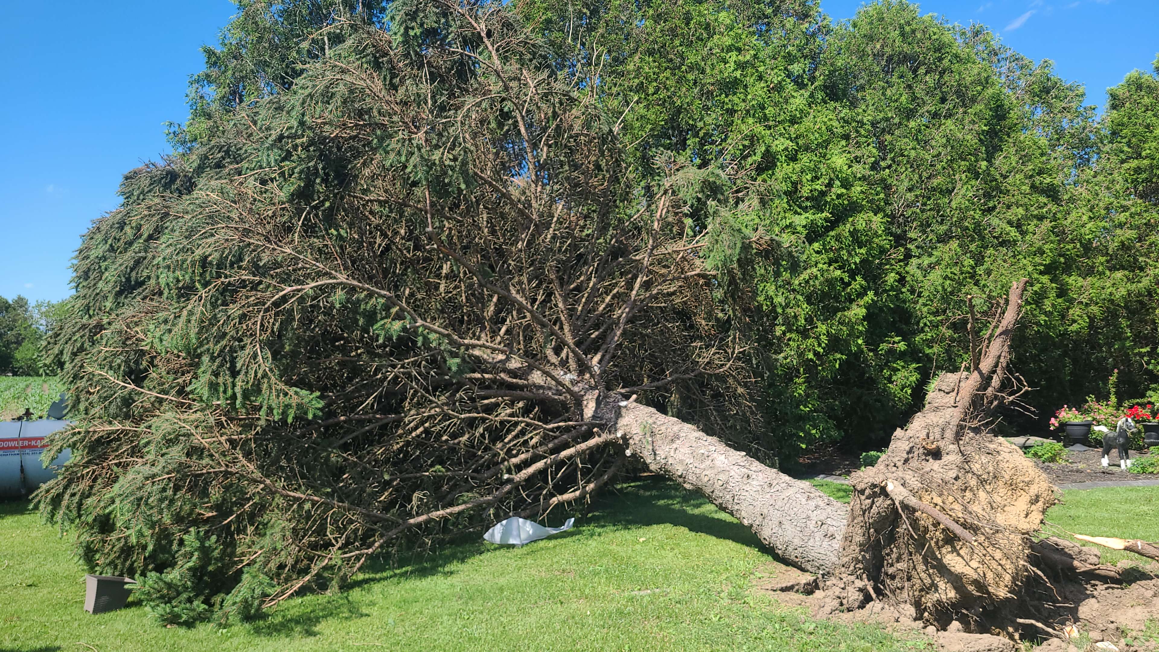
Large tree uprooted by the Croton, ON EF0 tornado.
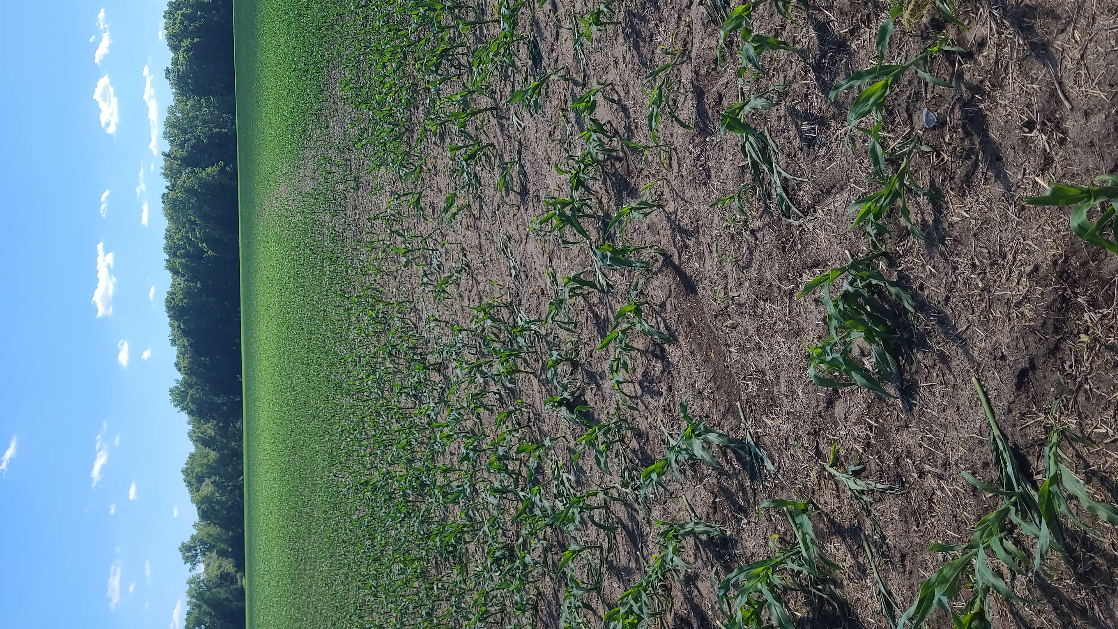
Path of EF0 tornado through young corn crop at Croton, ON.