Three tornadoes near the ON/QC border on Aug 29
The NTP has confirmed three tornadoes near the Ontario/Quebec border with storms on August 29. The two Ontario tornadoes in the Mattawa area caused EF2 tree damage while the Quebec tornado at Lac Kennedy resulted in EF1 damage to trees.Full details are available with the event summaries below, along with a regional map and radar images. The events can also be plotted on a map using the NTP Dashboard here.
===
Event Name: Kiosk, ON
Date: August 29, 2026
Start Time: 1:10 PM EDT (1710 UTC)
Final Classification: Tornado (over land)
Final EF-Scale Rating: EF2
EF-Scale Damage Indicator / Degree of Damage: C-T/DOD-6
Start of damage track: 46.1203N, 78.8170W
End of damage track: 46.1218N, 78.7479W
Location of worst damage: 46.1228N, 78.7906W
Description: Witnesses captured video of a vortex-funnel cloud aloft at Kiosk, though the view of the surface below was obscured by trees. Satellite imagery review revealed a tornado damage path through forested areas northeast of Kiosk. Damage assessed as EF2 tornado, with an estimated max. wind speed of 190 km/h, track length of 5.39 km and max. path width of 360 m. Tornado motion was from the W (approx. 270 degrees). Start time is radar estimated.
Event Name: Esker Lake, ON
Date: August 29, 2026
Start Time: 2:10 PM EDT (1810 UTC)
Final Classification: Tornado (over land)
Final EF-Scale Rating: EF2
EF-Scale Damage Indicator / Degree of Damage: C-T/DOD-6
Start of damage track: 46.0774N, 78.1296W
End of damage track: 46.0752N, 77.9779W
Location of worst damage: 46.0751N, 78.0188W
Description: Satellite imagery review of a storm track of interest revealed a tornado damage path through forested areas near Esker Lake (south of Bissett Creek). Damage assessed as EF2 tornado, with an estimated max. wind speed of 190 km/h, track length of 11.8 km and max. path width of 330 m. Tornado motion was from the W (approx. 270 degrees). Start time is radar estimated.
Event Name: Lac Kennedy, QC
Date: August 29, 2026
Start Time: 5:05 PM EDT (2105 UTC)
Final Classification: Tornado (over land)
Final EF-Scale Rating: EF1
EF-Scale Damage Indicator / Degree of Damage: C-T/DOD-5
Start of damage track: 46.2163N, 77.5227W
End of damage track: 46.1985N, 77.3832W
Location of worst damage: 46.2048N, 77.4236W
Description: Satellite imagery review of a storm track of interest revealed a tornado damage path through forested areas near Lac Kennedy (east of Rapides-des-Joachims). Damage assessed as EF1 tornado, with an estimated max. wind speed of 145 km/h, track length of 11.2 km and max. path width of 560 m. Tornado motion was from the W (approx. 280 degrees). Start time is radar estimated.
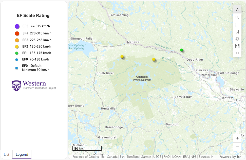
Regional map showing the start locations for the three tornadoes near the ON/QC border.
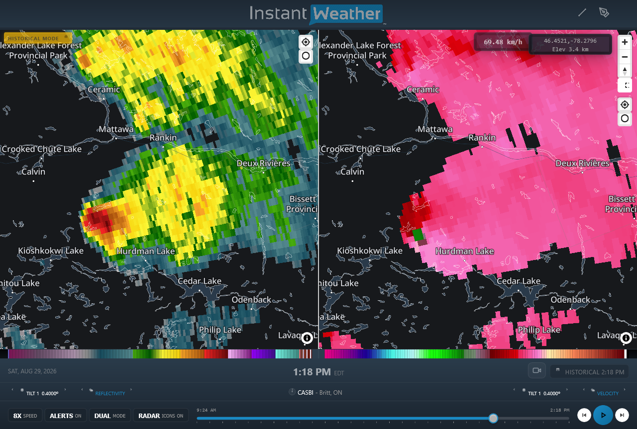
CASBI radar image showing reflectivity (left) and Doppler radial velocity (right) products at the time that the Kiosk, ON EF2 tornado was causing damage. Note the area of compact rotation at right with green indicating winds toward the radar and pink indicating winds away from the radar.
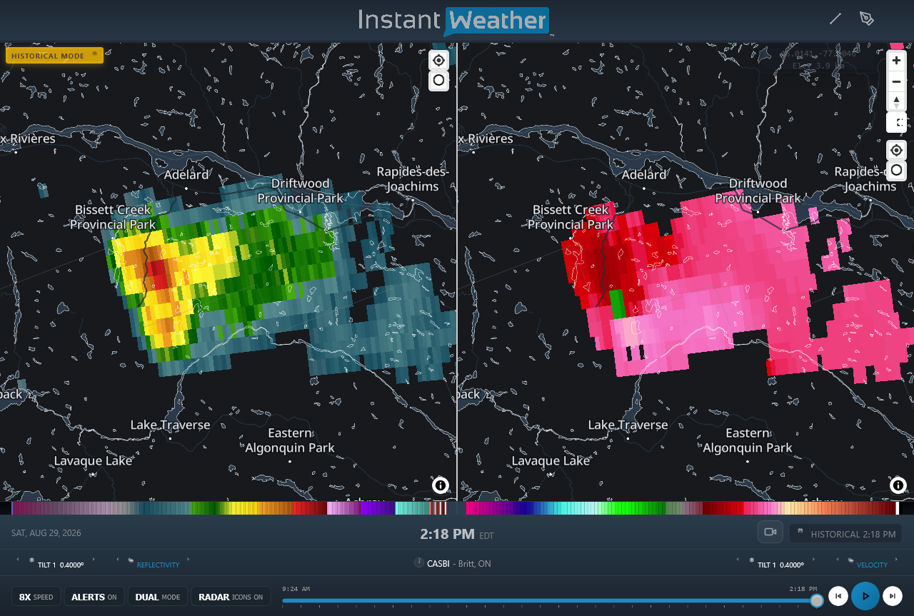
CASBI radar image showing reflectivity (left) and Doppler radial velocity (right) products at the time that the Esker Lake, ON EF2 tornado was causing damage. Note the area of compact rotation at right with green indicating winds toward the radar and pink indicating winds away from the radar.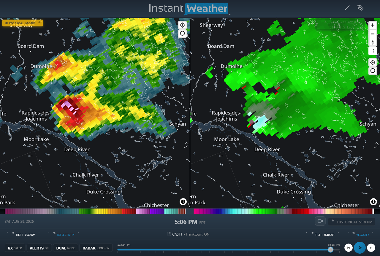
CASFT radar image showing reflectivity (left) and Doppler radial velocity (right) products at the time that the Lac Kennedy, QC EF1 tornado was causing damage. The area of rotation is indicated at right with light blue indicating winds toward the radar and grey pixels indicated winds away from the radar.
Video near the time of the Kiosk, ON EF2 tornado (Facebook): https://www.facebook.com/groups/ontariostormreports/permalink/1672107824428964/?rdid=ubdHBXcHdL3vBPVj&share_url=https%3A%2F%2Fwww.facebook.com%2Fshare%2Fp%2F194HD22Now%2F





