Three downbursts confirmed in northeastern Ontario on June 30
A line of severe storms that moved across northeastern Ontario produced downbursts over large areas on June 30. The NTP has confirmed three downbursts so far on this day, one with EF2-rated tree damage and the other two with EF1-rated tree damage.
Full details are provided in the summaries below, along with a regional map. The events can also be plotted on a map using the NTP Dashboard here.
====
Event Name: Lake Temagami (Southwest Arm), ON
Date: June 30, 2026
Start Time: 5:30 PM EDT (2130 UTC)
Final Classification: Downburst
Preliminary EF-Scale Rating: EF2
Location of worst damage: 46.8441N, 80.0995W
Description: Tree damage was reported in areas around the Southwest Arm of Lake Temagami after a storm passed through. Satellite imagery review revealed widespread downburst damage, with some notable downburst damage starting near Emerald Lake, and impacting forested areas around Turtleshell Lake and Gull Lake as well before tracking southeastward to south of Lake Temagami. No injuries have been reported. The visible swath of relatively stronger damage is 27 km long and up to 4 km wide. Preliminary assessment is EF2 downburst, with further investigation pending.
Event Name: Red Cedar Lake, ON
Date: June 30, 2026
Start Time: 6:05 PM EDT (2205 UTC)
Final Classification: Downburst
Preliminary EF-Scale Rating: EF1
Location of worst damage: 46.7392N, 79.9262W
Description: Tree damage was reported near Marten River after a storm passed through the area. Satellite imagery review revealed downburst damage in the area, including notable downburst damage at Red Cedar Lake (west of Marten River). No injuries have been reported. The visible swath of relatively stronger damage at Red Cedar Lake is 9 km long and up to 4 km wide. Preliminary assessment is EF1 downburst, with further investigation pending.
Event Name: Mattawa, ON
Date: June 30, 2026
Start Time: 7:00 PM EDT (2300 UTC)
Final Classification: Downburst
Preliminary EF-Scale Rating: EF1
Preliminary location of worst damage: 46.3240W, 78.7626N
Description: Tree damage was reported in the Mattawa area after a storm passed through. No injuries were reported. Preliminary satellite imagery review revealed a long swath of downburst damage, at least 25 km long, and up to 6 km wide in Mattawa. Preliminary assessment is EF1 downburst, with further investigation pending.
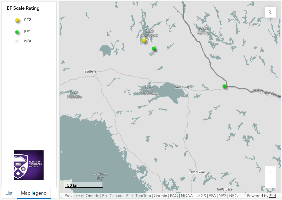
Regional map showing the worst damage locations for the three downbursts in northeastern Ontario.





