May 9 storm in Lucan, ON area produced EF0 microburst and tornado
The NTP has confirmed that a May 9 storm in the Lucan area produced an EF0 microburst and an EF0 tornado, both brief. The microburst removed the roof from a barn. The tornado toppled a vehicle and a solar panel on a pedestal, and removed some large tree branches.
Additional details are provided in the event summaries below, along with a regional map and satellite imagery. The tornadoes can also be plotted on a map using the NTP Dashboard here.
====
Event Name: Lucan, ON
Date: May 9, 2026
Start Time: 4:00 PM EDT (2000 UTC)
Final Classification: Downburst (microburst)
Final EF-Scale Rating: EF0
EF-Scale Damage Indicator / Degree of Damage: SBO/DOD-6
Location of worst damage: 43.1492N, 81.3737W
Description: Damage to a farm building south of Lucan was reported after a storm passed through the area. No injuries were reported. An NTP ground and drone survey was completed on May 10, 2026, documenting the reported damage. Damage in the Lucan area is assessed as EF0 microburst, with an estimated max. wind speed of 130 km/h. Start time is radar estimated. Satellite imagery review is pending. The storm also produced a weak tornado south of Granton, causing EF0 damage.
Event Name: Granton, ON
Date: May 9, 2026
Start Time: 4:05 PM EDT (2005 UTC)
Final Classification: Tornado
Final EF-Scale Rating: EF0
EF-Scale Damage Indicator / Degree of Damage: C-T/DOD-2
Tornado location: 43.1871N, 81.2824W
Damage to a solar panel was reported south of Granton after a storm passed through the area. A truck pulling a trailer along the road nearby was reportedly toppled. No injuries were reported. An NTP ground and drone survey was completed on May 10, 2026, documenting the reported damage and additional weak tree damage over a limited area. Damage in the Granton area is assessed as EF0 tornado, with an estimated max. wind speed of 110 km/h. Due to limited damage indicators in the area, the information available is insufficient to accurately estimate track details, through the tornado path was likely at least 1 km long and tornado motion was from the W (as storm motion was approx. 265 degrees). Start time is radar estimated. Satellite imagery review is pending. The storm also produced a weak microburst south of Lucan, causing EF0 damage.
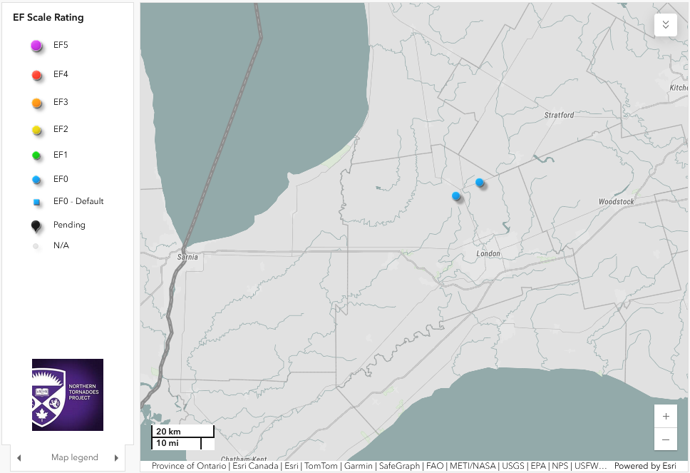
Regional map showing the locations of the EF0 downburst (left) and the EF0 tornado (right).
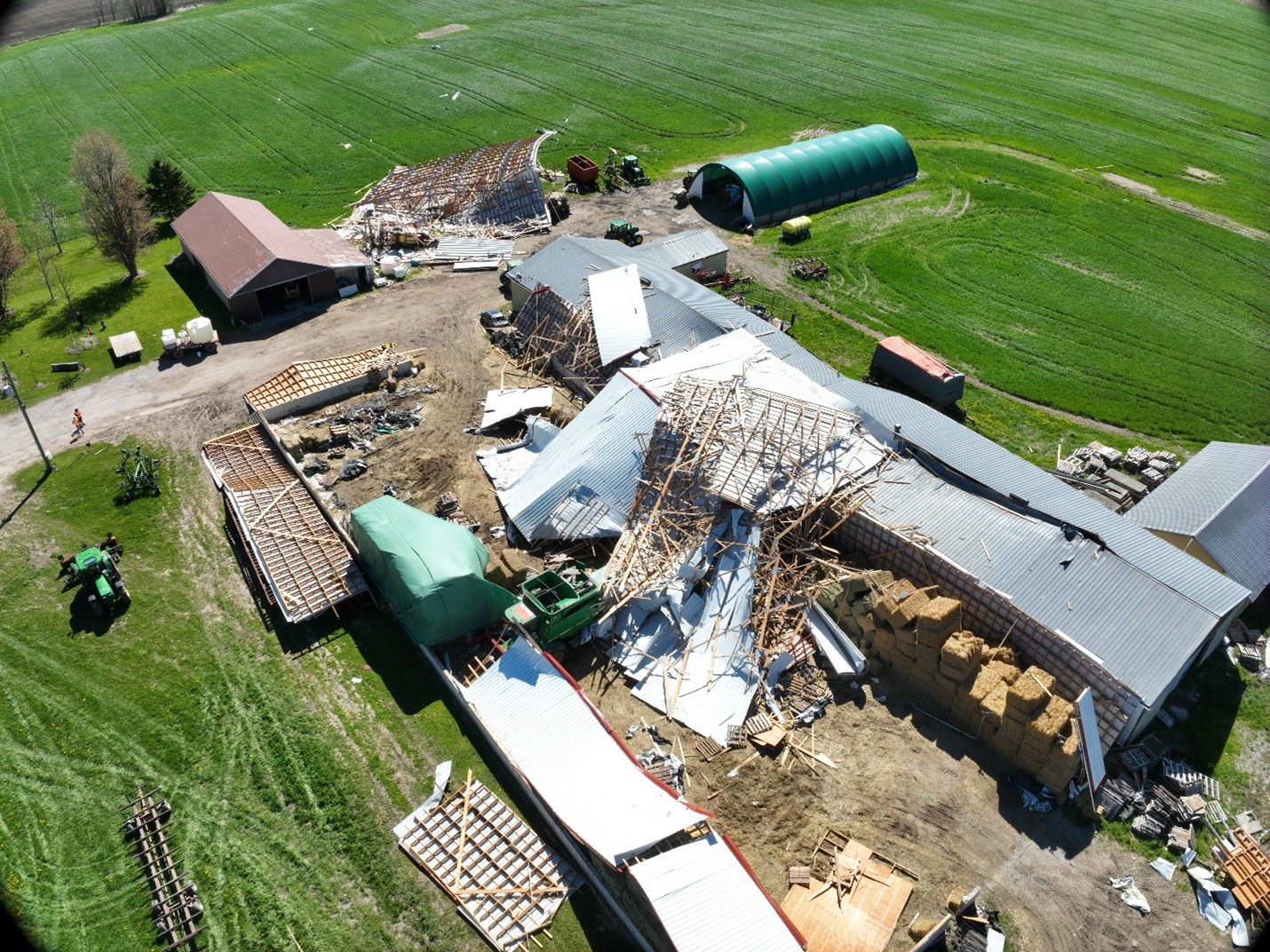
Oblique drone image showing the removed roof and fallen walls of a large barn impacted by the EF0 microburst. The barn had large openings on each end.
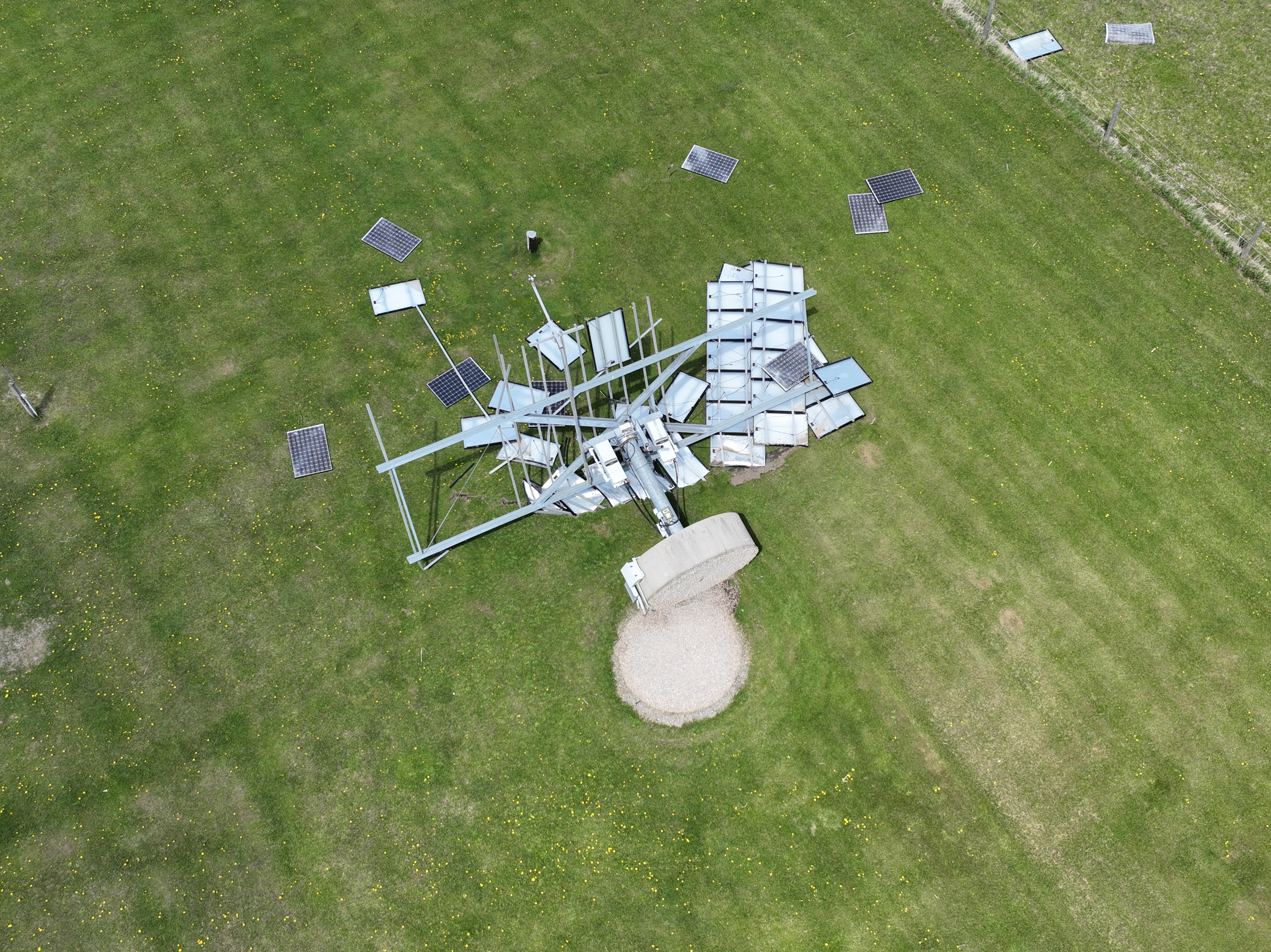
Drone image showing the solar panels and pedestal that were toppled by the EF0 tornado.