Five more tornadoes in southern SK
The NTP has confirmed an additional five weak tornadoes in southern SK over the period from June 29 to July 3.
No damage was reported for four of these, and therefore a rating of EF0-Default has been assigned for those.
The tornado at Denzil, SK caused damage to grain bins, trees, a barn and farm equipment. An NTP damage survey assessed the damage at EF1.
Full details are provided in the event summaries below, along with a regional map. For the Denzil tornado, a survey summary map and survey photos are also provided. The events can also be plotted on a map using the NTP Dashboard here.
====
Event Name: Elrose, SK
Date: June 29, 2026
Start Time: 6:00 PM CST (0000 UTC)
Final Classification: Tornado (Over Land)
Preliminary EF-Scale Rating: EF0-Default
Estimated Tornado Location: 51.13N, 107.91W
Description: Witnesses captured video of a tornado southeast of Elrose. No damage and no injuries have been reported. The preliminary EF-Scale assessment is EF0-Default. Start time is based on witness report. Satellite imagery review is pending.
Event Name: Kindersley, SK
Date: July 2, 2026
Start Time: 3:25 PM CST (2125 UTC)
Final Classification: Tornado (Over Land)
Preliminary EF-Scale Rating: EF0-Default
Estimated Tornado Location: 51.63N, 109.06W
Description: Witnesses captured video and photos of a tornado northeast of Kindersley. No damage and no injuries have been reported. The preliminary EF-Scale assessment is EF0-Default. Start time is based on witness report. Satellite imagery review is pending.
Event Name: Denzil, SK
Date: July 2, 2026
Start Time: 6:25 PM CST (0025 UTC)
Final Classification: Tornado (over land)
Final EF-Scale Rating: EF1
EF-Scale Damage Indicator / Degree of Damage: C-FSGB/DOD-2
Start of damage track: 52.1925N, 109.6045W
End of damage track: 52.1956N, 109.5979W
Location of worst damage: 52.1930N, 109.6010W
Description: Witnesses captured video and photos of a tornado southeast of Denzil, that caused damage to grain bins, trees, a barn and farm equipment at a property in the path. No injuries were reported. An NTP ground and drone survey was completed on July 3, 2026, documenting the reported damage. Damage assessed as an EF1 tornado, with an estimated max. wind speed of 150 km/h, track length of 0.56 km and max. path width of 50 m. Tornado motion was from the SW (approx. 235 degrees). Start time is based on witness report. Further investigation is pending into reports of additional brief tornadoes in the area. Satellite imagery review is pending.
Event Name: Springwater, SK
Date: July 3, 2026
Start Time: 2:15 PM CST (2015 UTC)
Final Classification: Tornado (Over Land)
Preliminary EF-Scale Rating: EF0-Default
Estimated Tornado Location: 51.97N, 108.27W
Description: Witnesses captured photos of a tornado near Springwater. No damage and no injuries have been reported. The preliminary EF-Scale assessment is EF0-Default. Start time is based on witness report. Satellite imagery review is pending.
Event Name: Edam, SK
Date: July 3, 2026
Start Time: 4:00 PM CST (2200 UTC)
Final Classification: Tornado (Over Land)
Preliminary EF-Scale Rating: EF0-Default
Estimated Tornado Location: 53.166N, 108.738W
Description: Witnesses captured video and photos of a tornado southeast of Edam. No damage and no injuries have been reported. The preliminary EF-Scale assessment is EF0-Default. Start time is based on witness report. Satellite imagery review is pending.
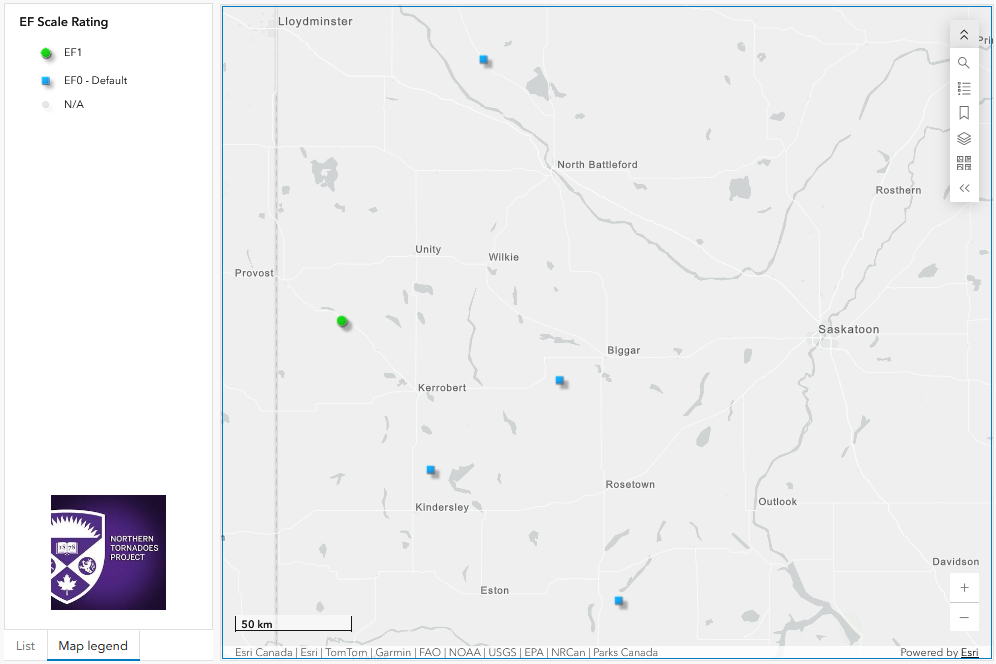
Regional map showing the locations of the five new SK tornadoes.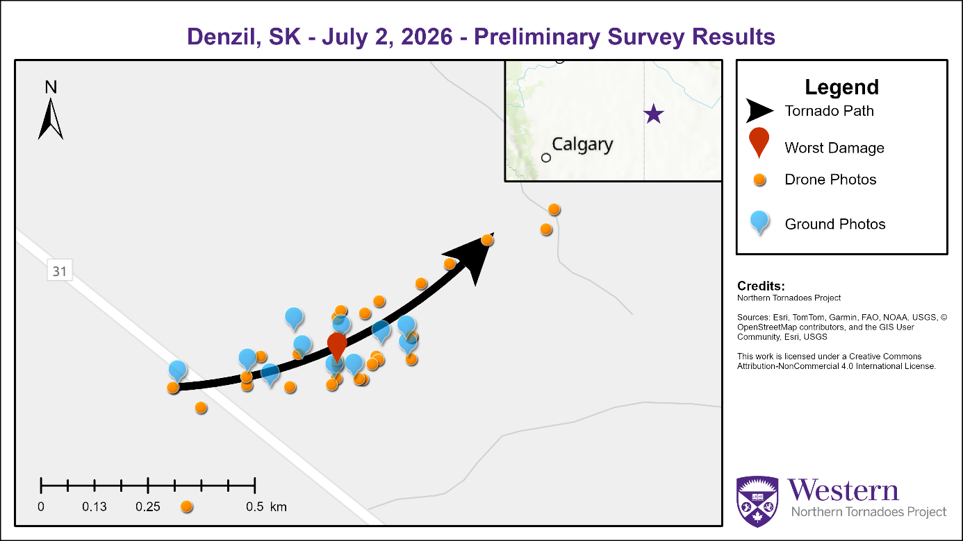
Survey summary map for the Denzil, SK EF1 tornado.
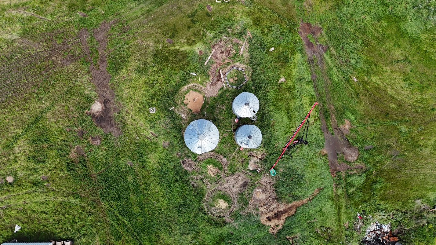
Drone photo showing the location of worst damage where seven anchored, empty grain bins were toppled and lofted / rolled away.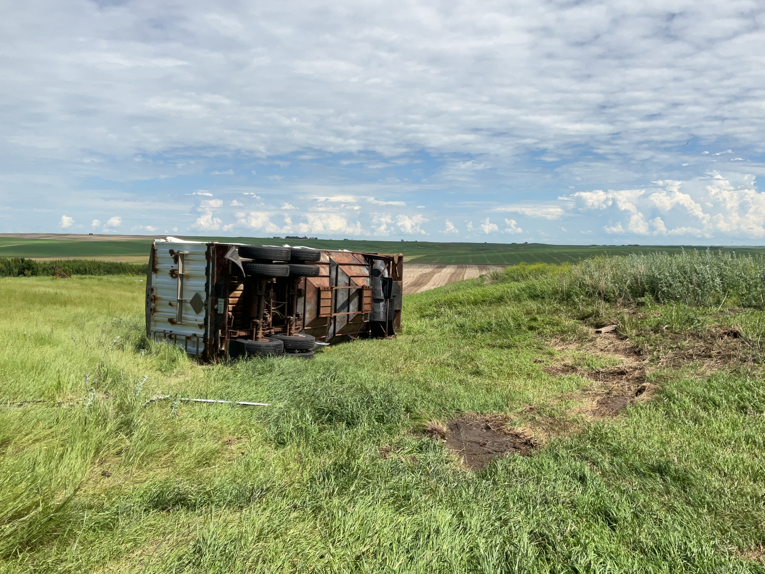
Ground photo showing a large trailer that was dragged / rolled about 30 m.