First results from Jun 6-9 in SK and MB
We can share some of the first results from NTP investigations for the June 6-9 severe weather outbreak in southern SK and MB. The storms produced large damaging hail, flooding rain, and wind-related damage, including that caused by tornadoes.
The first tornado damage surveyed was at Hirsch, SK, and was rated at EF1. The details for this tornado are provided in the event summary below, along with regional and survey maps and selected photos. The tornado can also be plotted on a map using the NTP Dashboard here.
A second, more intense tornado near Oxbow, SK, has been given a preliminary rating of EF3. This tornado appears to have a long track and is still being investigated. Note that the last F/EF3 tornado recorded in SK dates back to July 2010 with the Semans tornado. And SK tornado damage has not been rated higher than F/EF3 in over a century.
Two tornadoes on June 9 with confirmation based on analysis of visual evidence including occurred near Ste Anne and near Dufrost, MB. Surveys are pending and no ratings have been assigned.
There are numerous other reports of both tornadoes and wind damage that will be investigated in the coming days.
====
Event Name: Hirsch, SK
Date: June 7, 2026
Start Time: 8:15 PM CST (0215 UTC)
Final Classification: Tornado (over land)
Final EF-Scale Rating: EF1
EF-Scale Damage Indicator / Degree of Damage: C-FSGB/DOD-2
Start of damage track: 49.1471N, 102.6132W
End of damage track: 49.2639N, 102.4514W
Location of worst damage: 49.1738N, 102.5901W
Description: An NTP survey team visiting the Hirsch area discovered a path of damage from a storm on June 7, 2026, including several damaged grain bins, snapped power poles and tree damage. Minor damage to a home, shed and two outbuildings was also documented. No injuries were reported. The ground and drone survey was completed on June 9, 2026. Damage assessed as an EF1 tornado, with an estimated max. wind speed of 150 km/h, track length of 17.7 km and max. path width of 810 m. Tornado motion was from the SW (approx. 225 degrees). Start time is radar estimated. Satellite imagery review is pending.
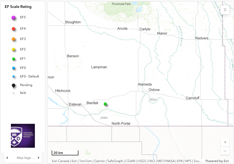
Regional map showing the location of the Hirsch, SK EF1 tornado.
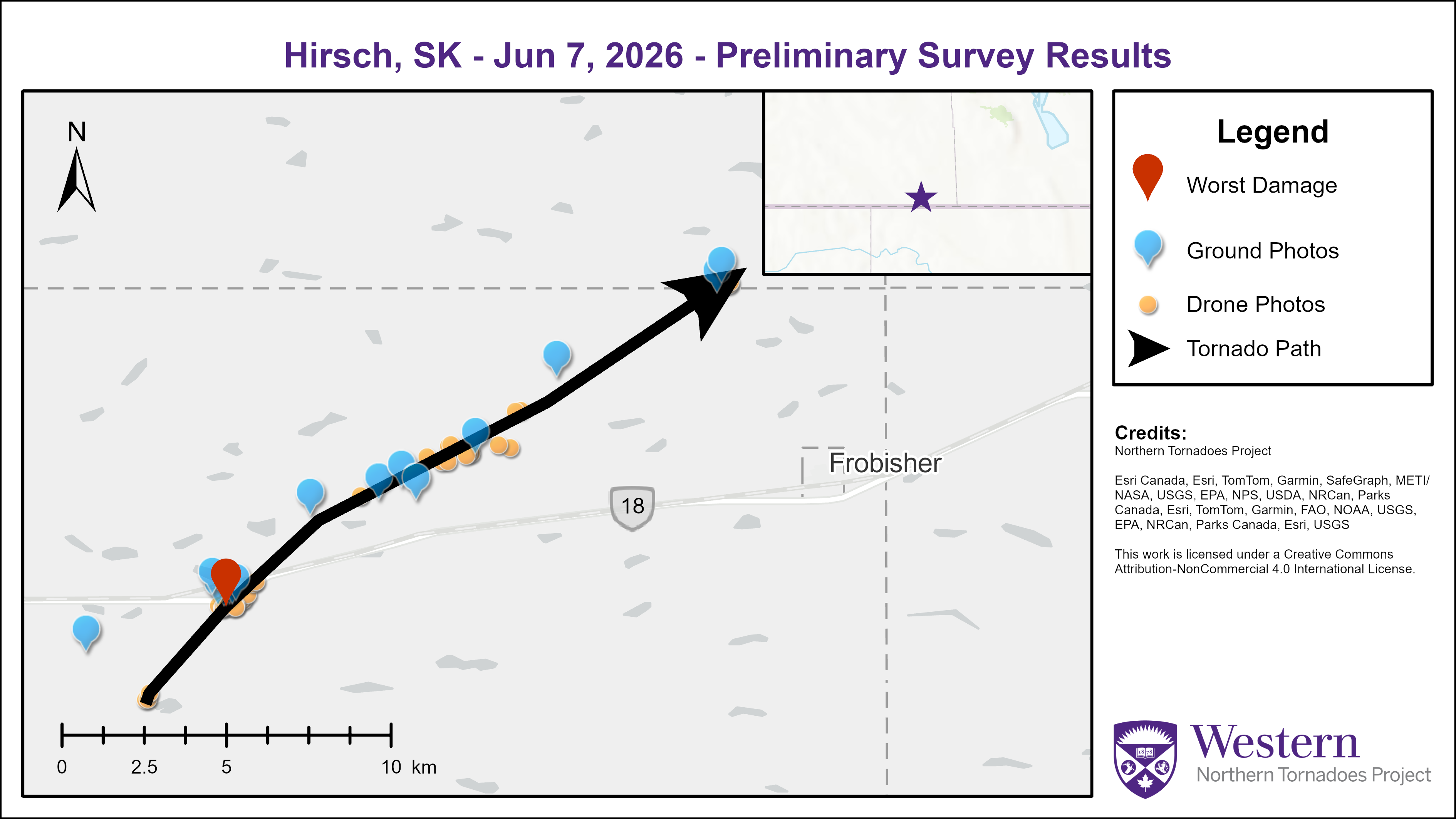
Survey map showing the track of the Hirsch, SK EF1 tornado.
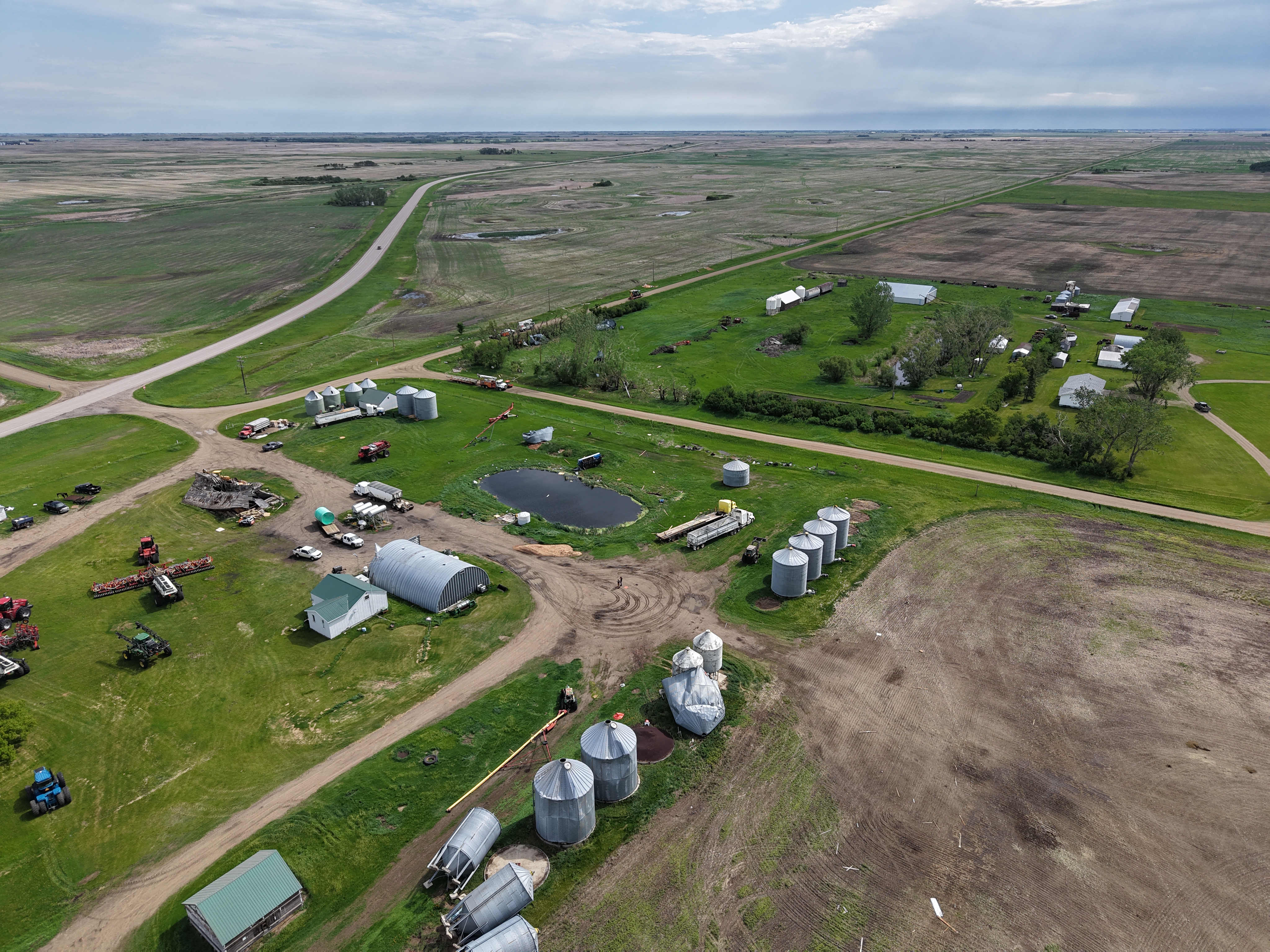
Drone photo showing damage to grain bins and trees.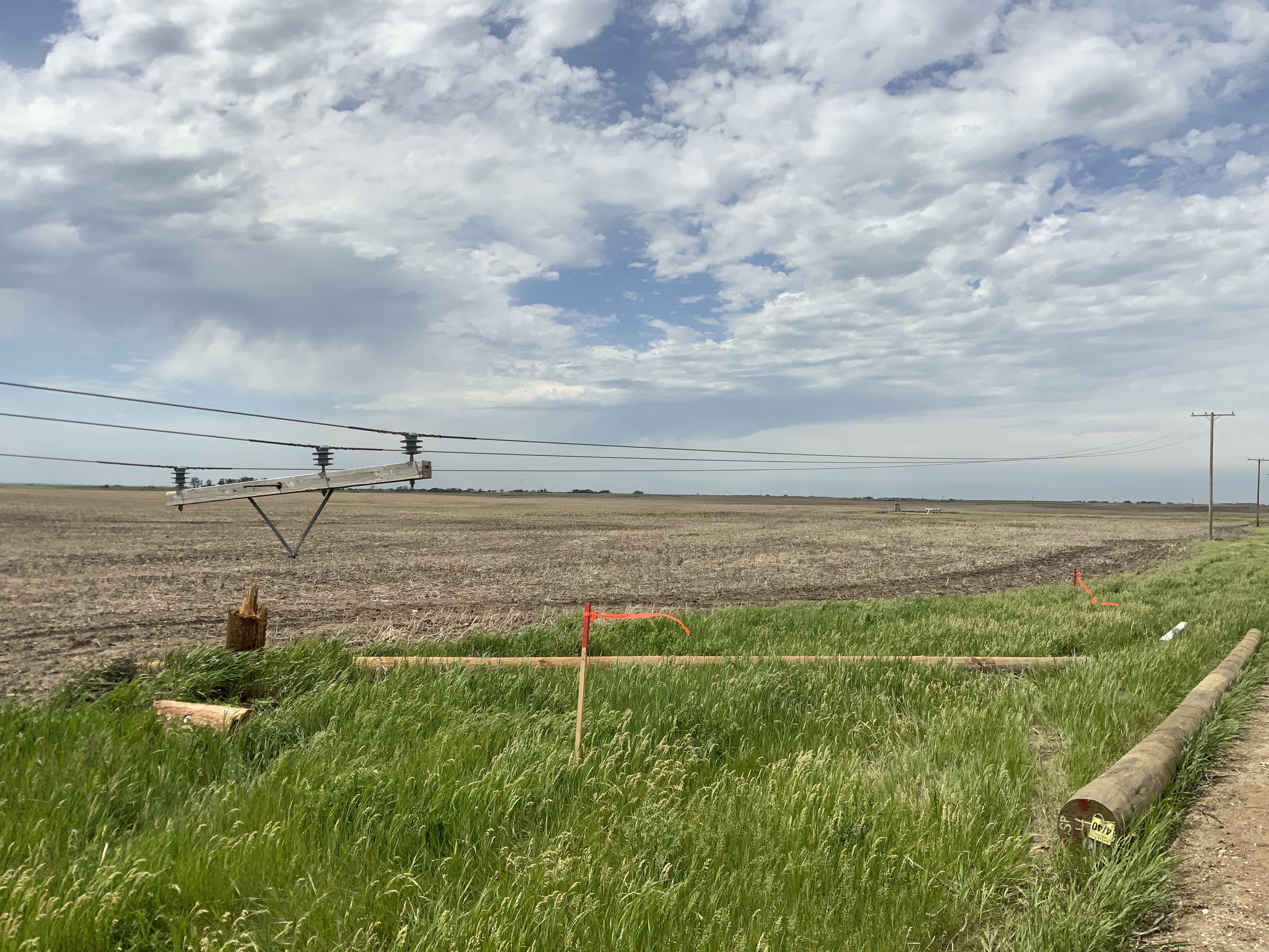
Damage photo showing location where power poles were snapped.