EF3 tornado in eastern AB on July 11
The NTP has confirmed an EF3 tornado in eastern AB at Tulliby Lake on July 11. An NTP damage survey team documented significant damage along the path of the tornado, including a destroyed house, a thrown trailer, and areas with every tree snapped or uprooted.Regarding the destroyed house, due to the home's construction and the level of surrounding damage and other damage along the path, and considering precedent events/ratings at locations such as Dunrobin, ON in 2018, the decision was made to assign an EF3 rating rather than EF4. Nevertheless, it's the third EF3 tornado on the Prairies this season - all from different events in different provinces - which is noteworthy.
Full details are available with the event summary below, along with a regional map, survey summary map, survey photos and radar imagery. The event can also be plotted on a map using the NTP Dashboard here.
====
Event Name: Tulliby Lake, AB
Date: July 11, 2026
Start Time: 5:32 PM MDT (2332 UTC)
Final Classification: Tornado (over land)
Preliminary EF-Scale Rating: EF3
EF-Scale Damage Indicator / Degree of Damage: FR12/DOD-9
Start of damage track: 53.7083N, 110.2496W
End of damage track: 53.7781N, 110.0144W
Location of worst damage: 53.7649N, 110.0770W
Description: Witnesses captured video and photos of a tornado near Tulliby Lake, where significant damage at a residential property was later reported. Tree damage and damage to several other properties was also reported. No injuries were reported. An NTP ground and drone survey was completed on July 13-14, 2026, documenting the reported damage. Damage assessed as EF3 tornado, with an estimated max. wind speed of 230 km/h, track length of 17.5 km and max. path width of 450 m. Tornado motion was from the WSW (approx. 245 degrees). Start time is based on witness report. Satellite imagery review is pending.
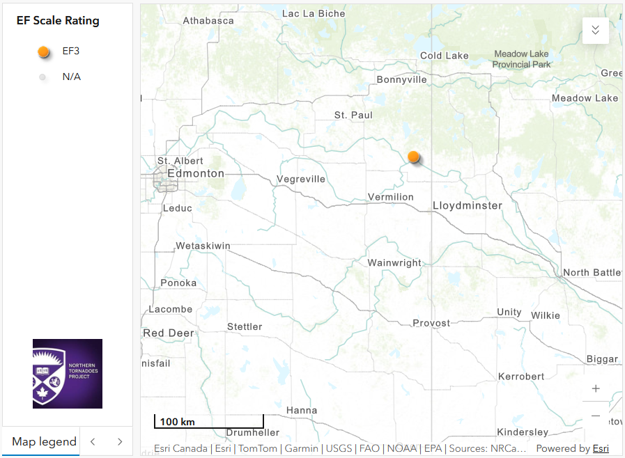
Regional map showing the start location for the Tulliby Lake, AB EF3 tornado.
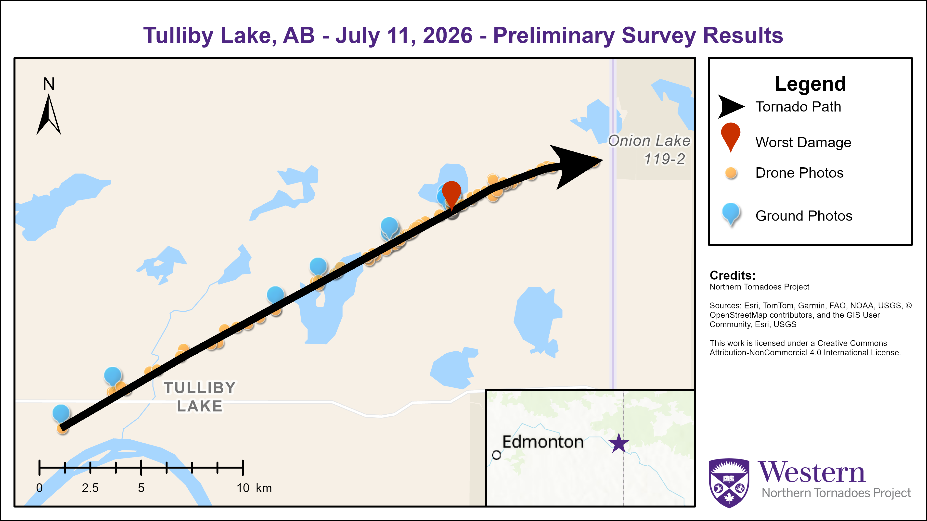
Survey summary map showing the track of the Tulliby Lake, AB EF tornado.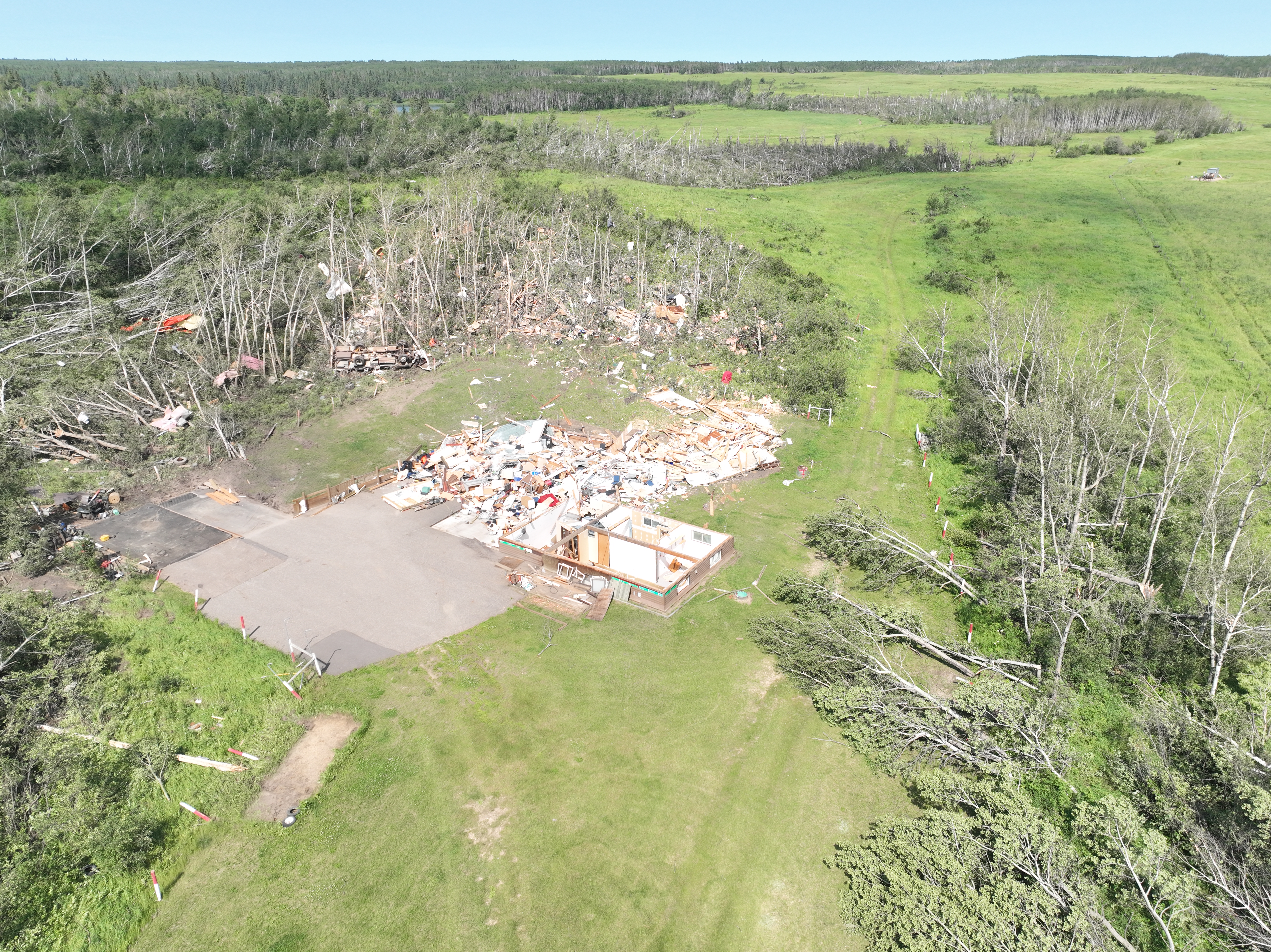
Drone photo showing extensive damage to a wood-frame house and surrounding tree damage. All walls and floors were removed from the foundation, and debris was strewn to the northeast of the house.
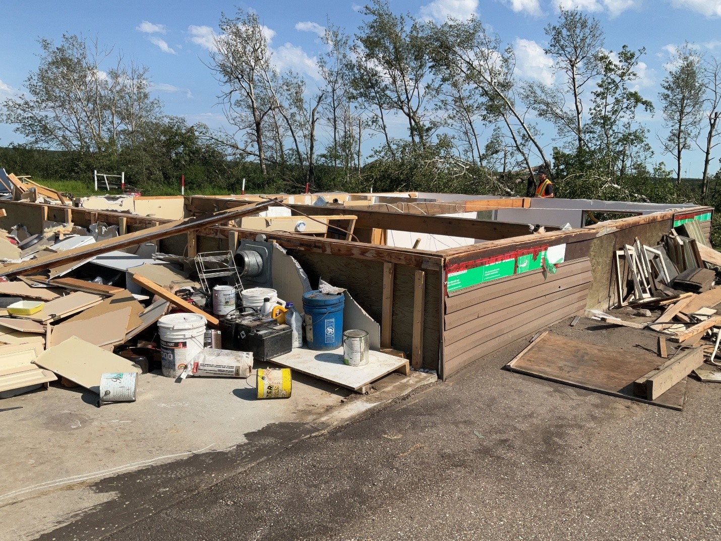
Ground photo of the house showing only the wooden foundation remaining.
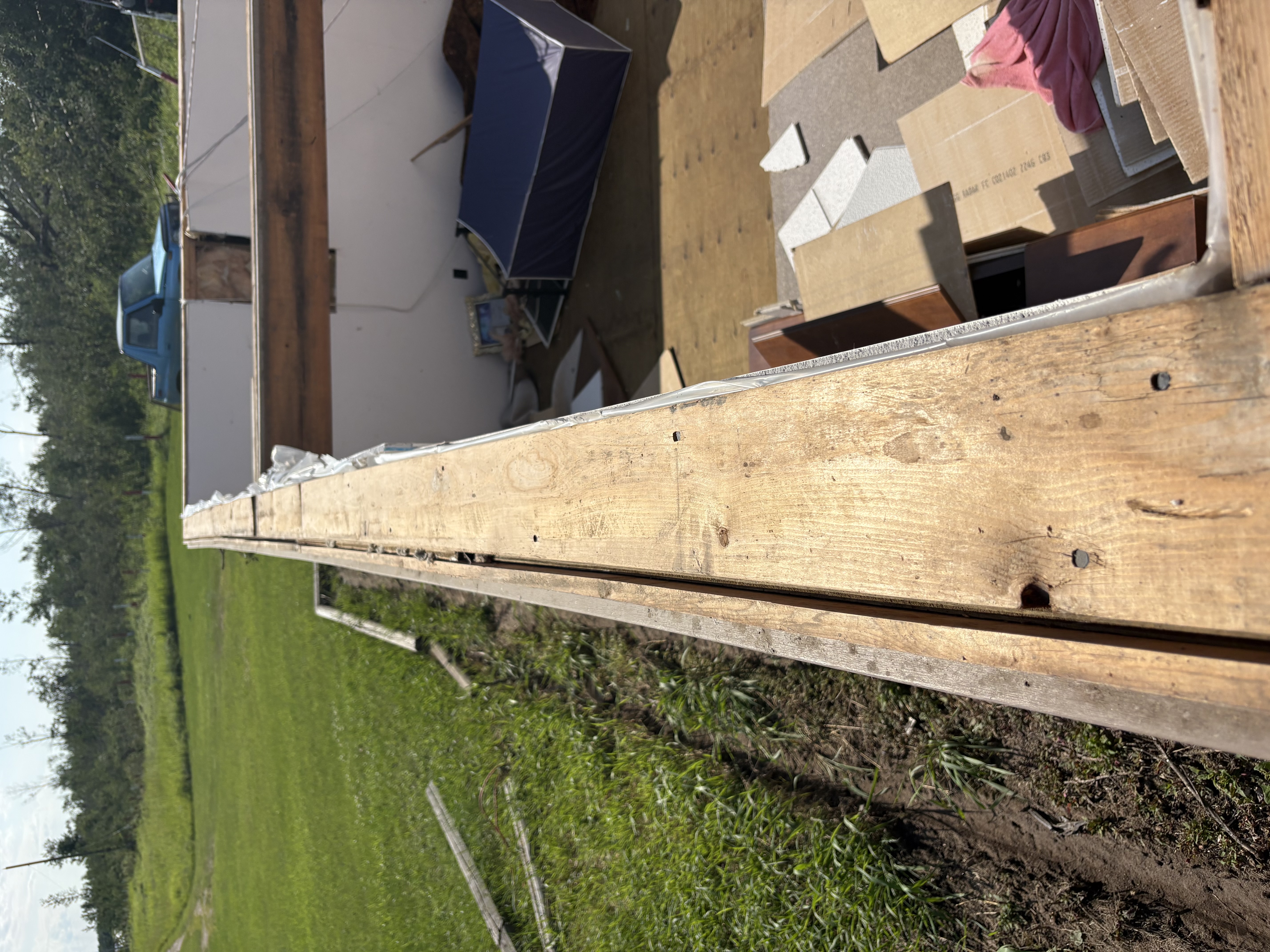
Foundation sill plate showing connections to floor joists / rim joists were limited or absent.
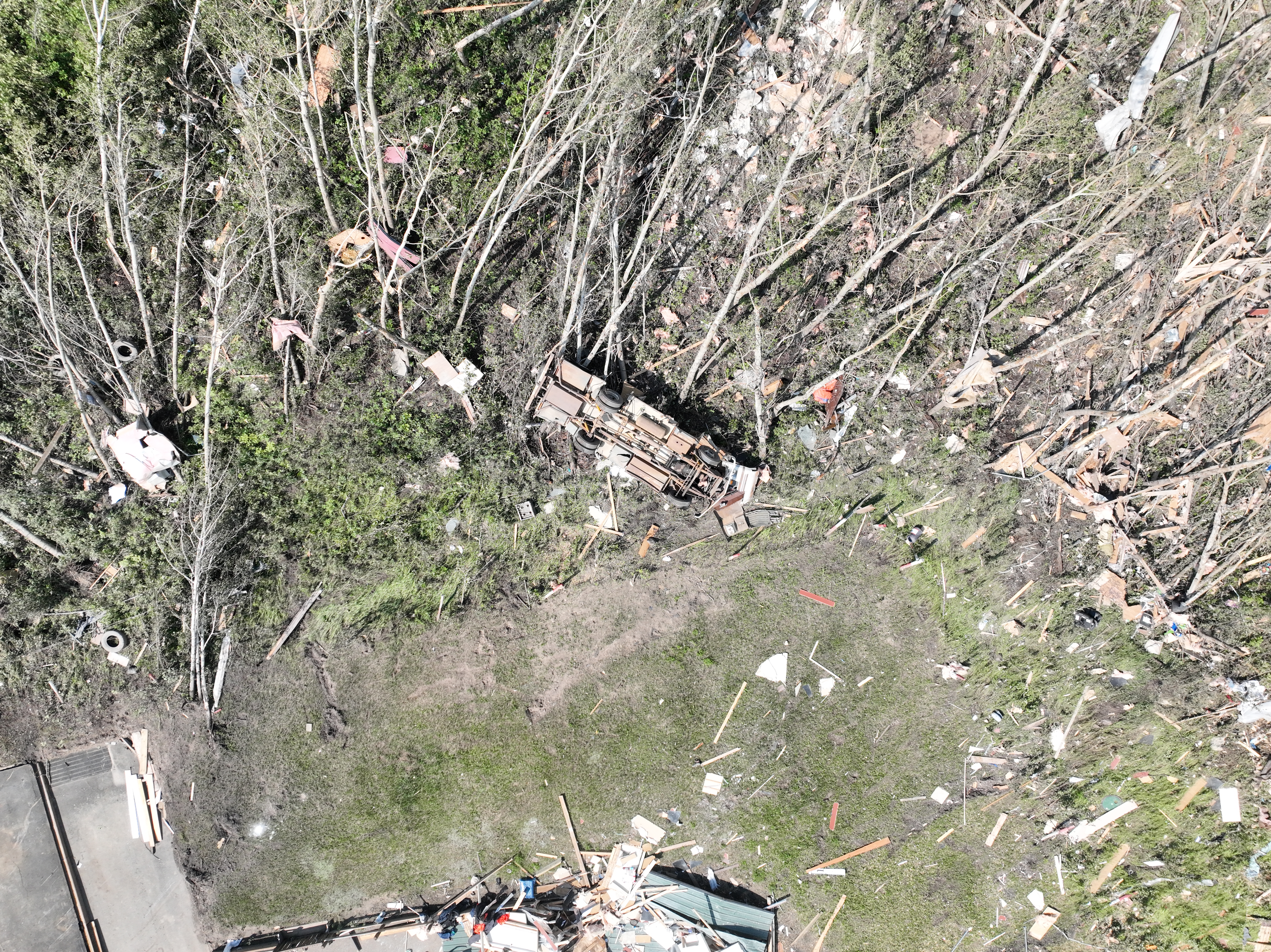
Drone photo of a large recreational vehicle that was lofted a short distance then rolled uphill into the nearby trees.
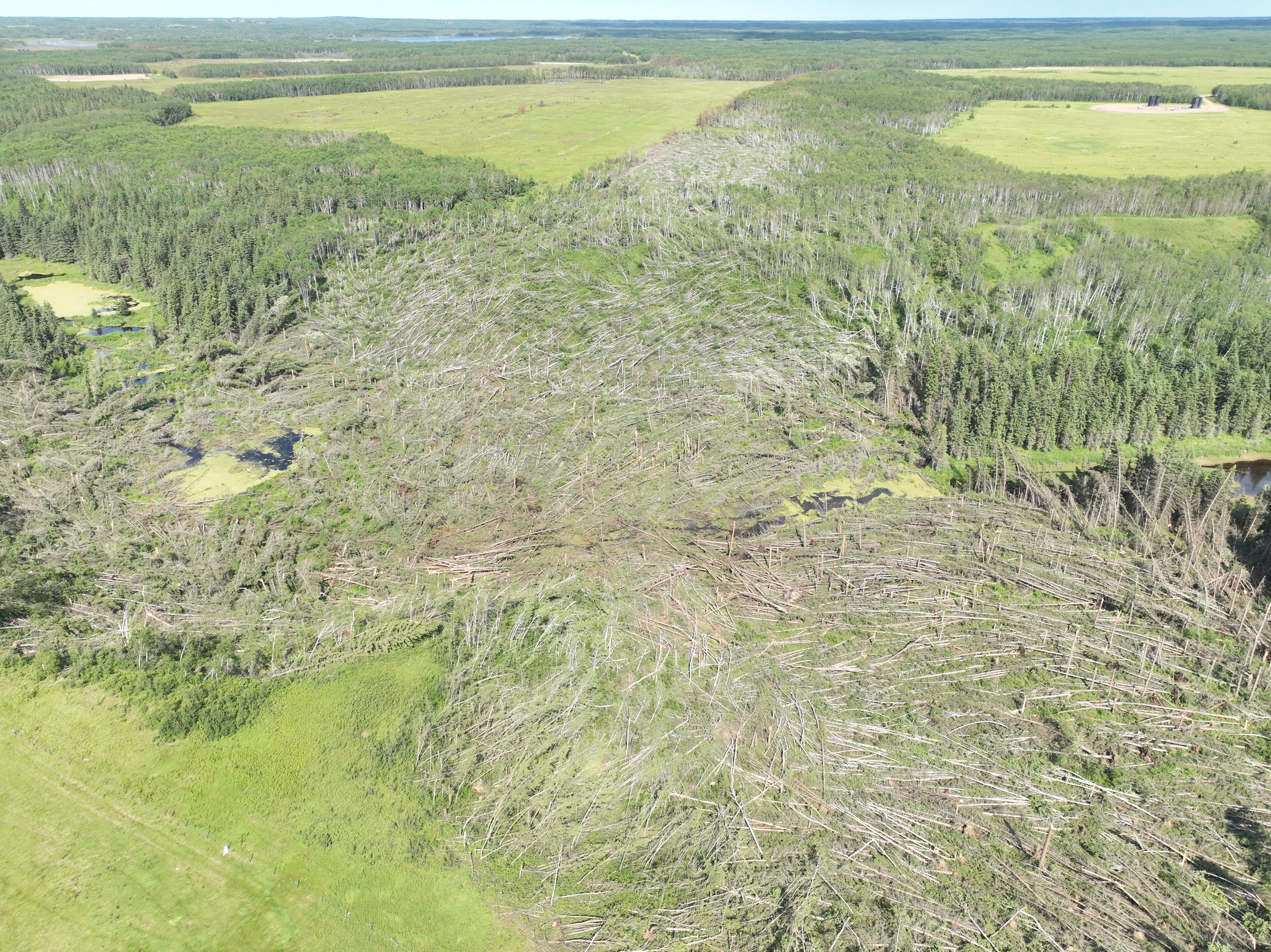
Oblique drone photo showing a clear path of downed trees about 1 km ENE of the house extending into the distance.
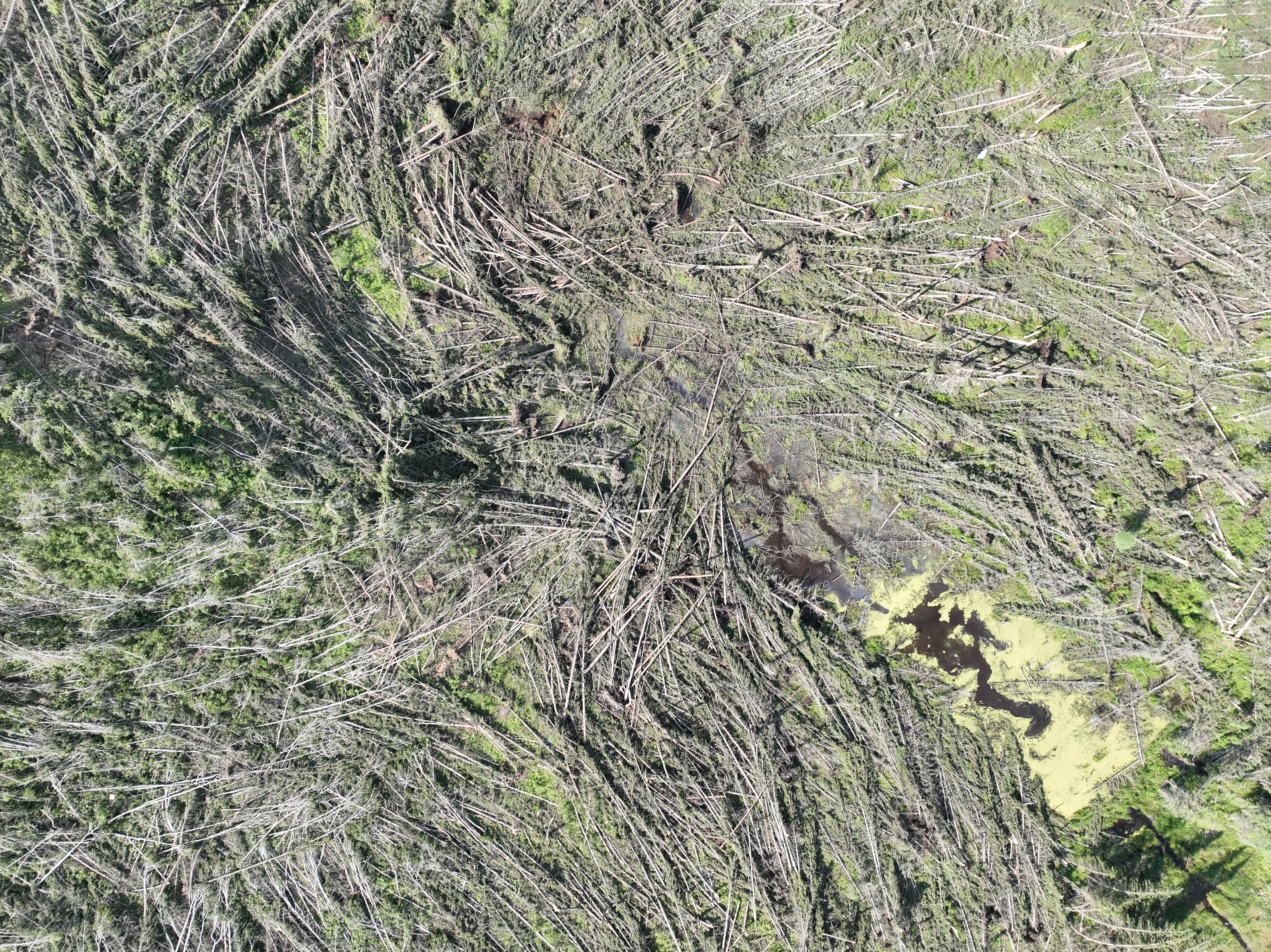
Nadir drone image of intense and clearly convergent tree damage at the same location.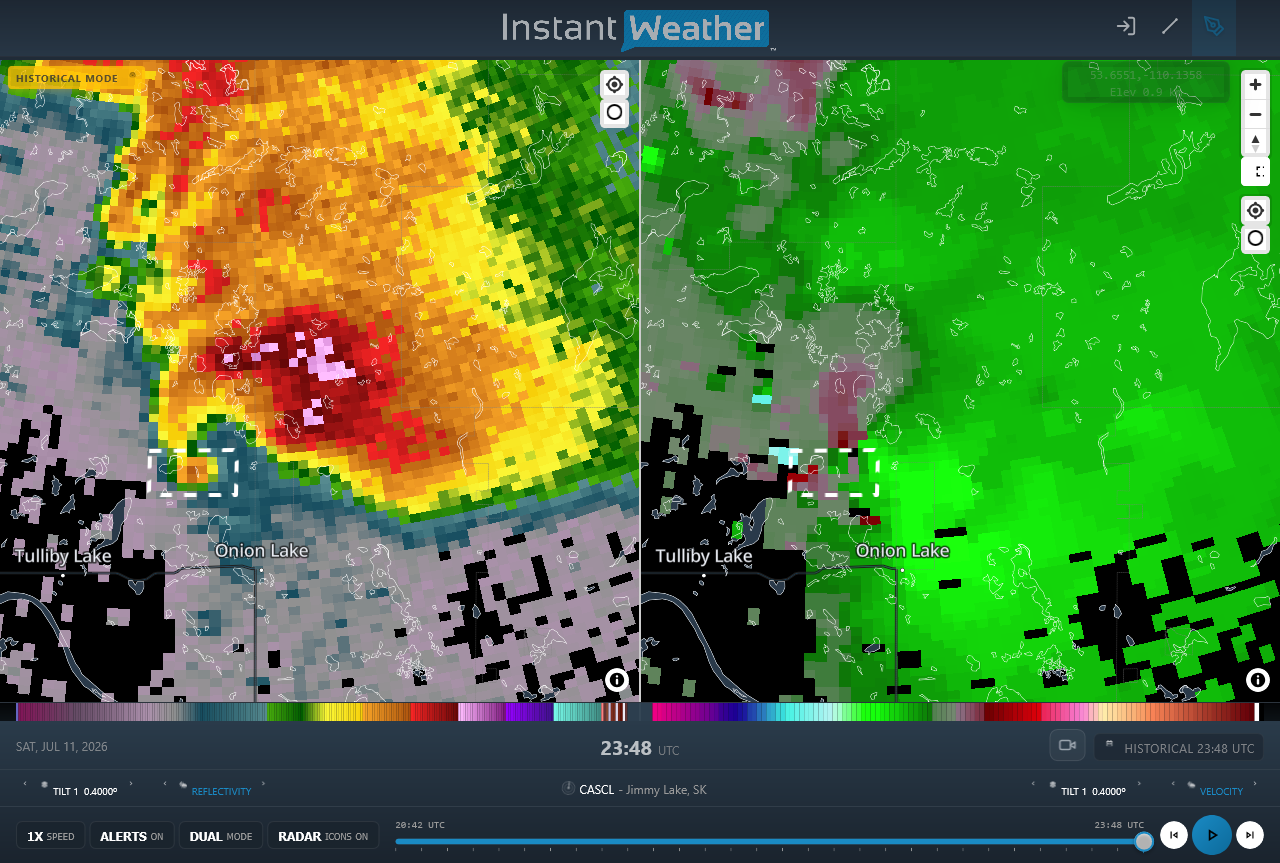
Radar image at lowest tilt nearest the time when the tornado hit the house showing a classic supercell thunderstorm presentation including a hook echo. The white dashed box indicates the location of enhanced reflectivity (at left) related to a 'debris ball'. The corresponding velocity image at shows relatively weak mesocyclonic rotation, with some noise and drop-outs in the vicinity.





