EF2 tornado in southern AB on July 17
The NTP has confirmed an EF2 tornado at Coal Valley in southern AB on July 17. Witnesses captured visual evidence of a tornado south of Robb, near Coal Valley. A track of tree damage was identified and assessed at EF2. The intensity of tree damage may be revisited later using the NTP's treefall analysis tools.
Full details are available with the event summary below, along with a regional map and damage photos. The event can also be plotted on a map using the NTP Dashboard here.
Special thanks to Colin Waddell for providing the initial report of tree damage.
===
Event Name: Coal Valley, AB
Date: July 17, 2026
Start Time: 4:58 PM MDT (2258 UTC)
Final Classification: Tornado (over land)
Final EF-Scale Rating: EF2
EF-Scale Damage Indicator / Degree of Damage: C-T/DOD-6
Start of damage track: 53.0368N, 116.9942W
End of damage track: 52.9787N, 116.8864W
Location of worst damage: 53.0189N, 116.9354W
Description: Witnesses captured video and photos of a tornado south of Robb, near Coal Valley. Tree damage was later reported and a track of damage was seen during satellite imagery review. Damage assessed as EF2 tornado, with an estimated max. wind speed of 190 km/h, track length of 10.3 km and max. path width of 940 m. Tornado motion was from the NW (approx. 310 degrees). Start time is based on witness report.
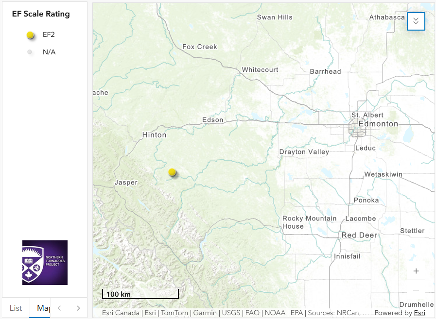
Regional map showing the start location of the Coal Valley, AB EF2 tornado.
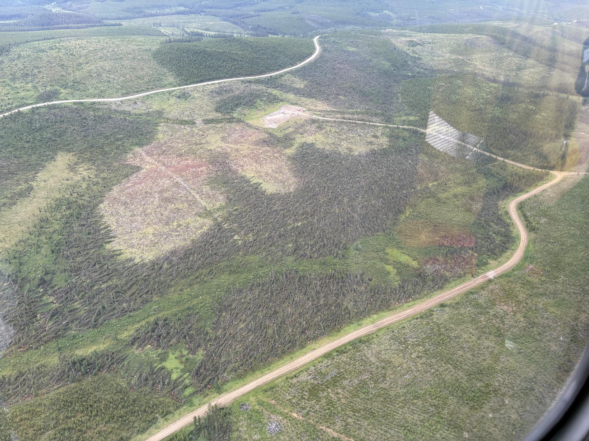
Aircraft aerial image of extensive tree damage along the track of the Coal Valley EF2 tornado. Submitted to the NTP by Colin Waddell.
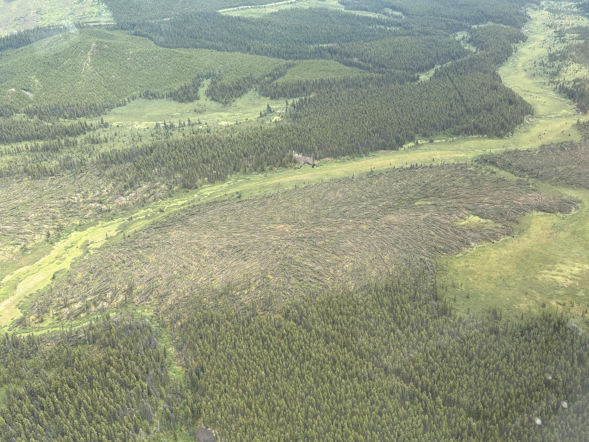
Aircraft aerial image of extensive tree damage along the track of the tornado. Submitted to the NTP by Colin Waddell.





