EF1 tornado in Winnipeg on June 29
The NTP has confirmed an EF1 tornado that affected Winnipeg on June 29. Damage to houses, commercial buildings and trees was found during a damage survey led by NTP partner Prof. John Hanesiak at the University of Manitoba.
Full details are provided in the event summary below, along with a regional map, a survey summary map, and survey photos. The event can also be plotted on a map using the NTP Dashboard here.
====
Event Name: Winnipeg, MB
Date: June 29, 2026
Start Time: 9:51 PM CDT (0251 UTC)
Final Classification: Tornado (over land)
Final EF-Scale Rating: EF1
EF-Scale Damage Indicator / Degree of Damage: FR12/DOD-4
Start of damage track: 49.8090N, 97.2195W
End of damage track: 49.8431N, 97.1483W
Location of worst damage: 49.8178N, 97.2012W
Description: Witness captured video of tornado in southwestern Winnipeg and damage to homes, businesses and trees was reported in the areas of Whyte Ridge, Linden Ridge, Chevrier and Crescent Park. No injuries were reported. An NTP ground and drone survey was completed over several days (June 30, July 1 and 4, 2026), documenting the reported damage and additional damage along the path. Damage assessed as an EF1 tornado, with an estimated max. wind speed of 155 km/h, track length of 6.45 km and max. path width of 200 m. Tornado motion was from the SW (approx. 235 degrees). Start time is based on security camera footage near the start of the damage track. Satellite imagery review pending.
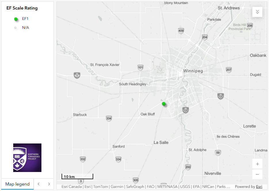
Regional map showing the start location of the EF1 tornado on the southwest side of Winnipeg, MB.
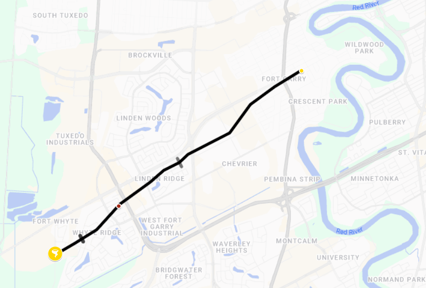
Survey map showing the track of the EF1 tornado through southwestern Winnipeg. The tornado symbol indicates the start of the 6.45 km track.
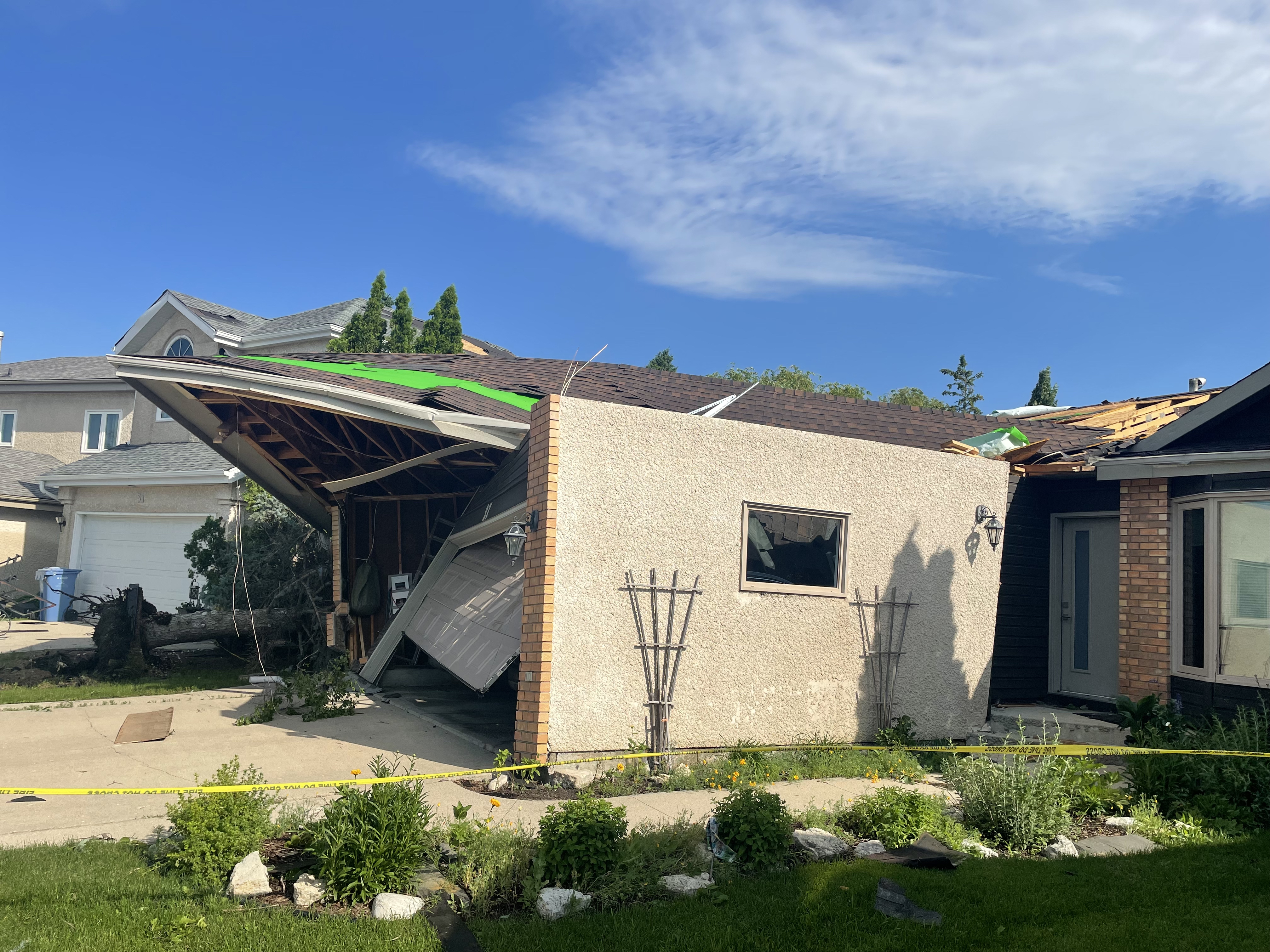
Ground photo of worst damage, with roof of garage pulled partly off exposing garage walls and house roof structure. Assessed as FR12 DOD4 EXP giving 155 km/h maximum gust speed and an EF1 rating.
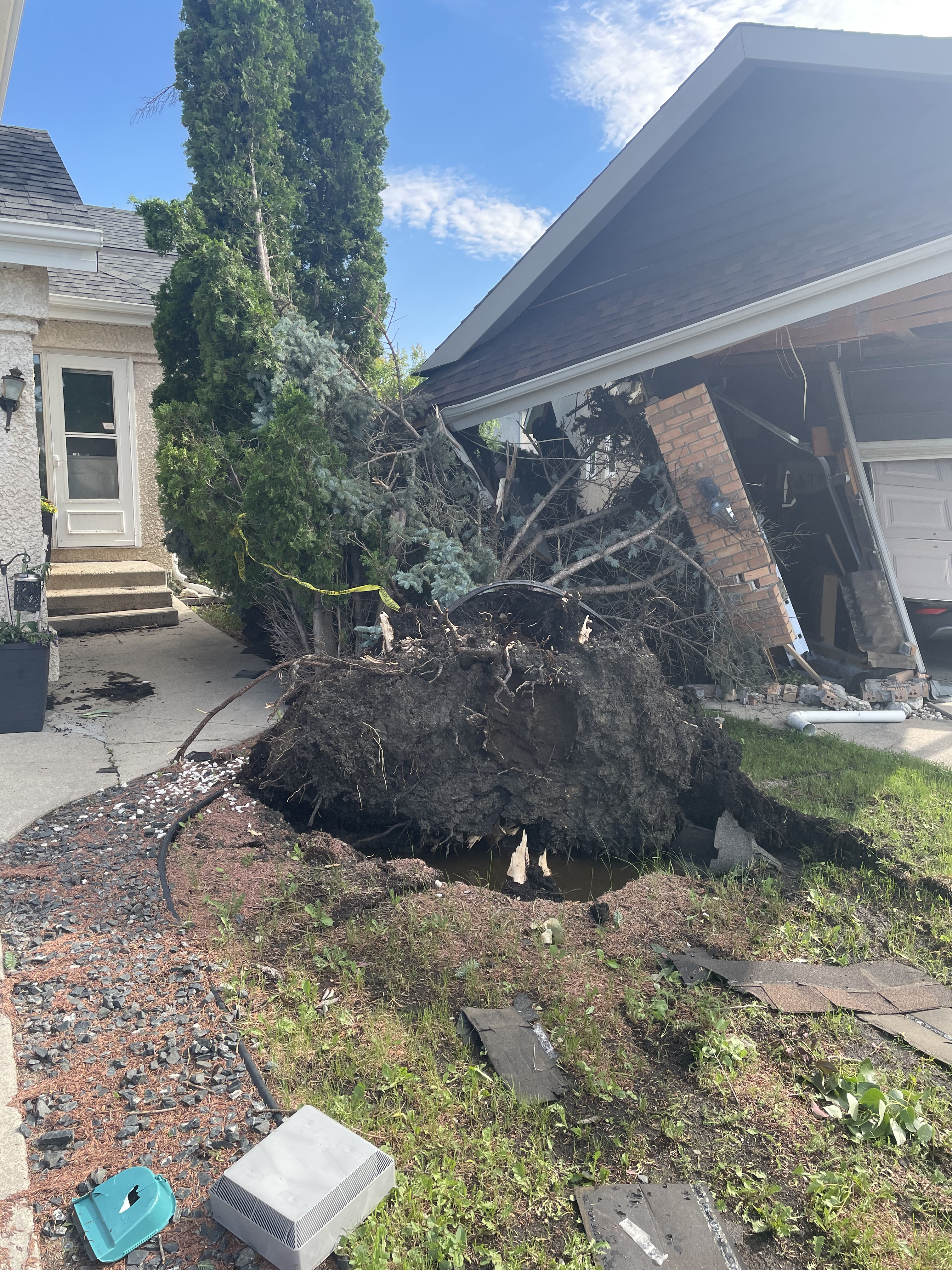
Large spruce tree uprooted next to the house with the garage roof damage. The tree was uprooted before the garage roof slid over top of it.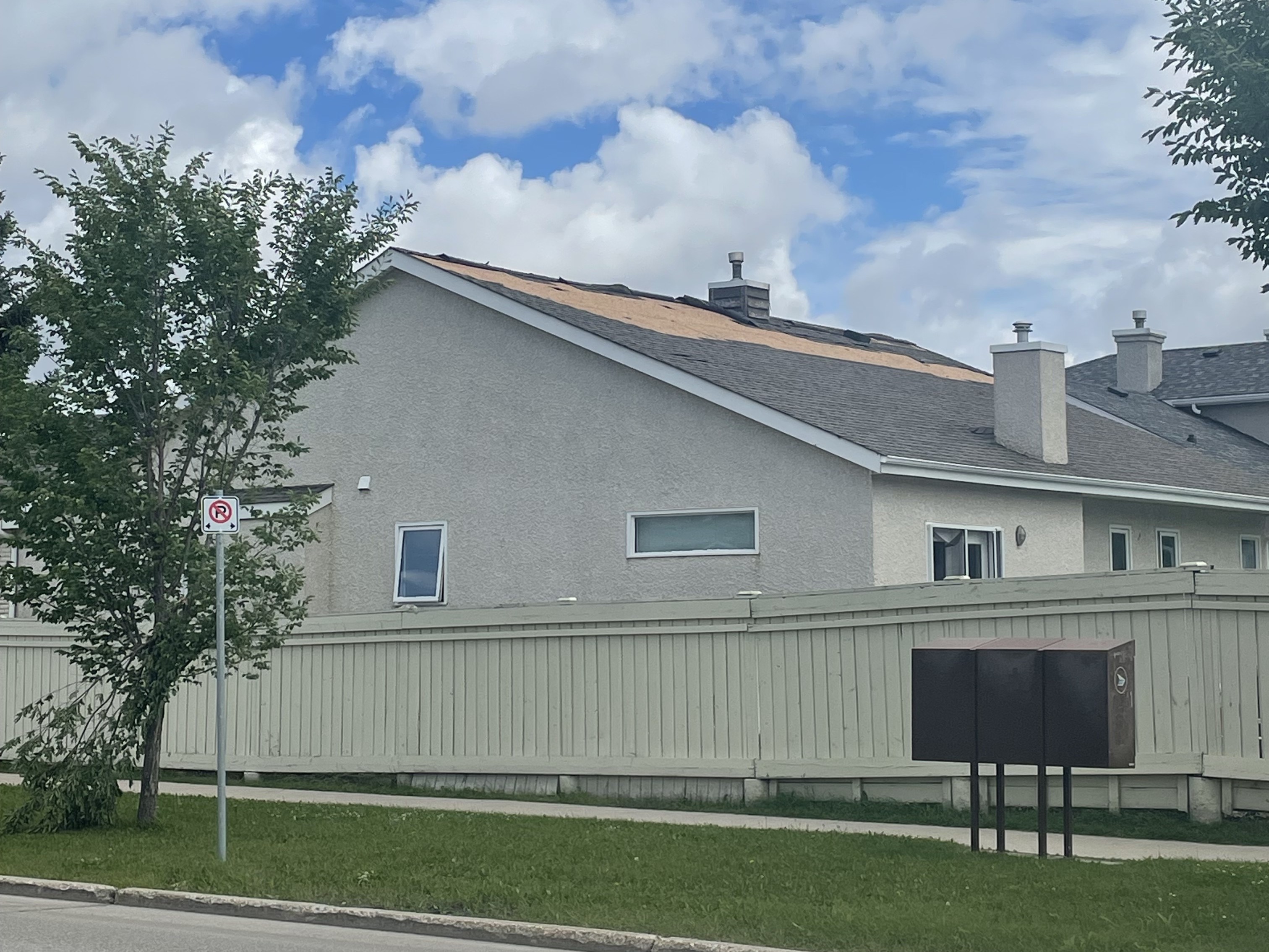
Ground photo of a house with shingles removed and tree with broken branch.
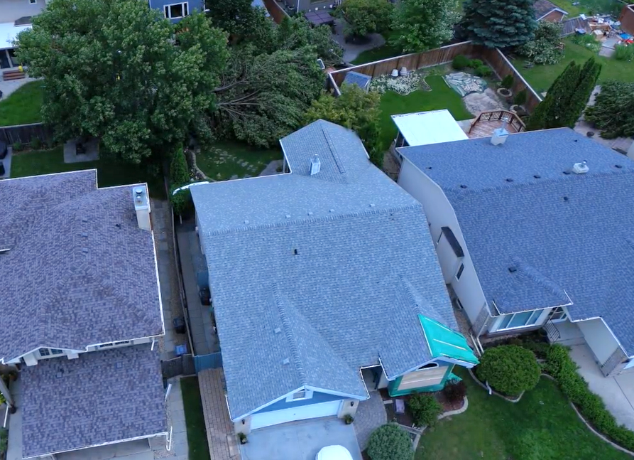
Drone photo showing damage to house in foreground (window, roof) and tree damage in the background.
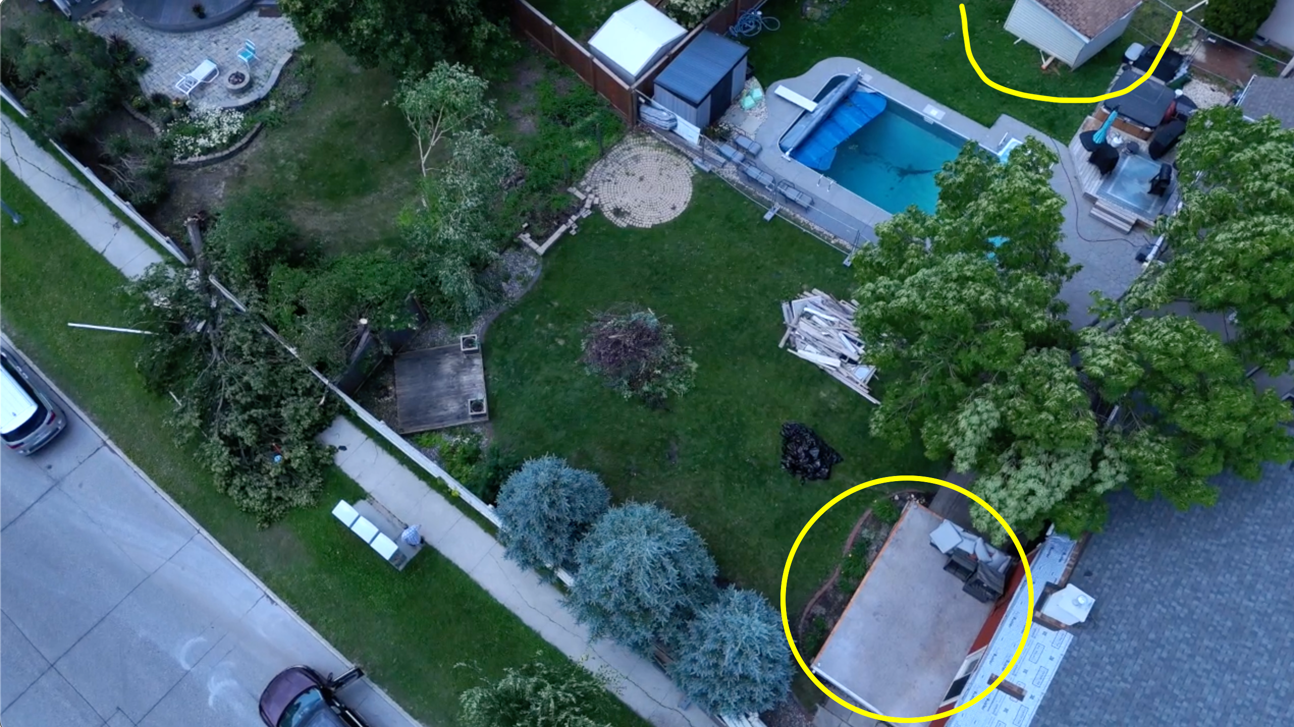
Drone photo showing a shed that was lofted more than 5 m (circled top), a sunroom that was destroyed (circled, bottom, only remaining floor shown) and tree damage (left).
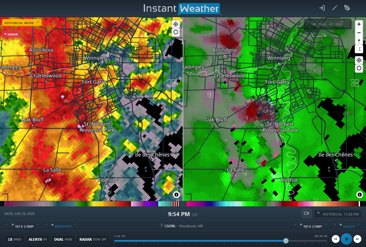
CASWL radar image showing line of storms in reflectivity (left) and rotation in radial velocity (right) along the leading edge of the line of storms near the start of the EF1 tornado track.





