EF0-rated tornado and downburst in southern ON from Aug 8
The NTP has confirmed an EF0 downburst at Whitestone and an EF0 tornado at Lindsay in southern ON from Aug 8.
For Whitestone, a damage survey team documented tree damage consistent with a weak downburst.
For Lindsay, witnesses captured video and photos of the tornado, but a damage survey team - working around drone flight restrictions - could find only damage to tree branches along a short, narrow path. Thanks to Instant Weather for helping to compile reports from this event!
Full details are available with the event summaries below, along with a regional map, a survey summary map (for Whitestone only) and survey photos. The events can also be plotted on a map using the NTP Dashboard here.
====
Event Name: Whitestone Lake, ON
Date: August 8, 2026
Start Time: 8:55 AM EDT (1255 UTC)
Final Classification: Downburst
Final EF-Scale Rating: EF0
EF-Scale Damage Indicator / Degree of Damage: C-T/DOD-3
Location of worst damage: 45.6203N, 79.8554W
Description: Tree damage was reported in the Whitestone Lake area after a storm passed through. No injuries were reported. An NTP ground and drone survey was completed on August 10, 2026, documenting the reported damage and additional tree damage. Satellite imagery review revealed some visible tree damage. Damage assessed as EF0 downburst, with an estimated max. wind speed of 115 km/h, with damage found over an area approximately 5.1 km long and up to 2.2 km wide. Start time is radar estimated.
Event Name: Lindsay, ON
Date: August 8, 2026
Start Time: 1:05 PM EDT (1705 UTC)
Final Classification: Tornado (over land)
Final EF-Scale Rating: EF0
EF-Scale Damage Indicator / Degree of Damage: C-T/DOD-2
Start of damage track: 44.3771N, 78.7718W
End of damage track: 44.3805N, 78.7299W
Location of worst damage: 44.3780N, 78.7502W
Description: Witnesses captured video and photos of a tornado in the Lindsay area. Damage to trees and tossed loose debris was reported. No injuries were reported. An NTP ground survey was completed on August 11, 2026, documenting some tree damage. Satellite imagery review revealed some crop damage and some tree damage in the area. Damage assessed as EF0 tornado, with an estimated max. wind speed of 90 km/h, track length of 3.38 km and max. path width of 40 m. Tornado motion was from the W (approx. 265 degrees). Start time is based on witness report.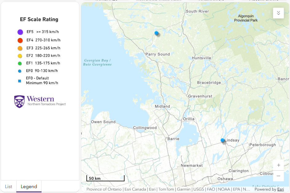
Regional map showing the locations of the EF0 downburst at Whitestone (top) and the EF0 tornado at Lindsay (bottom).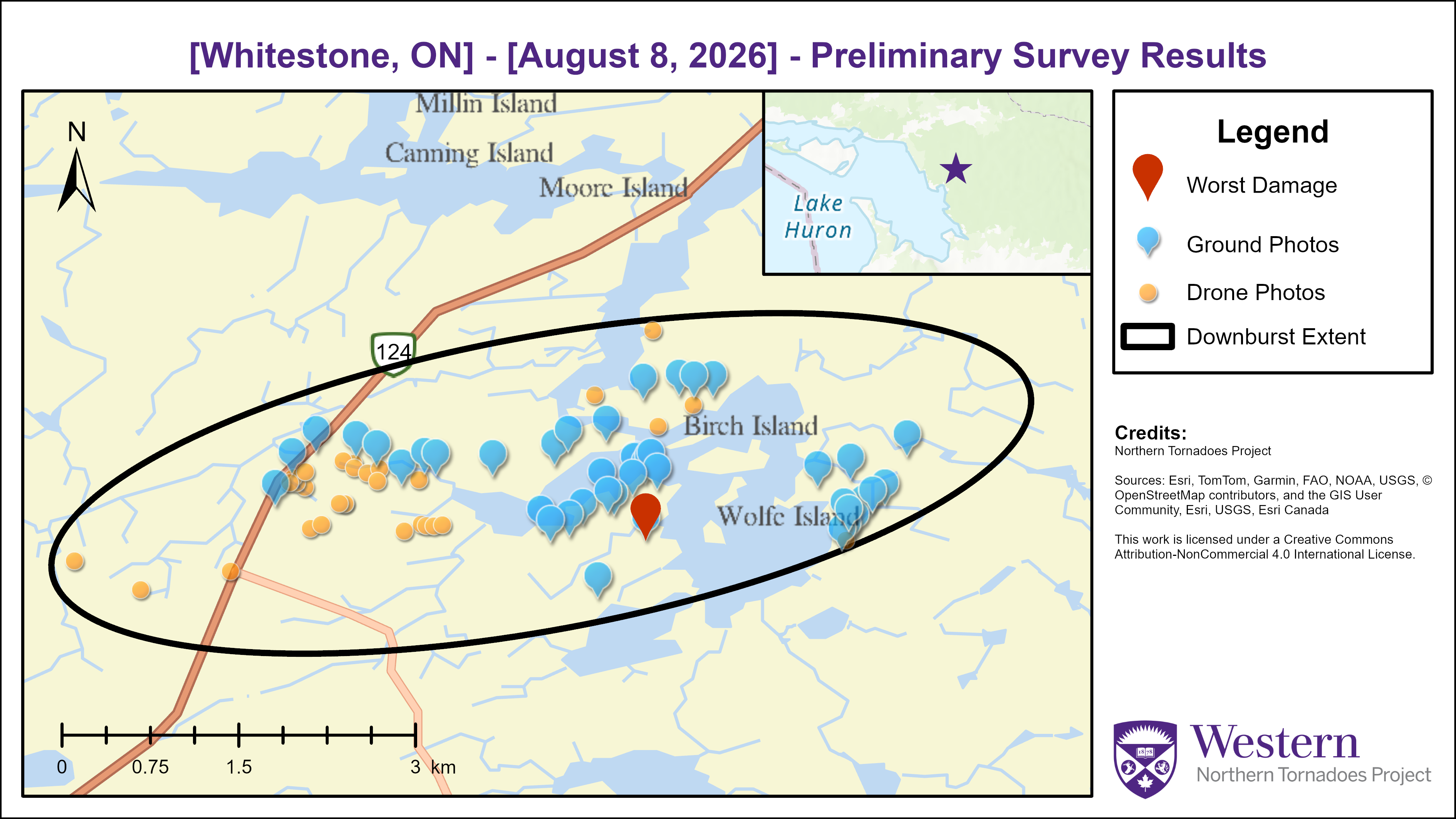
Survey summary map for the Whitestone EF0 downburst.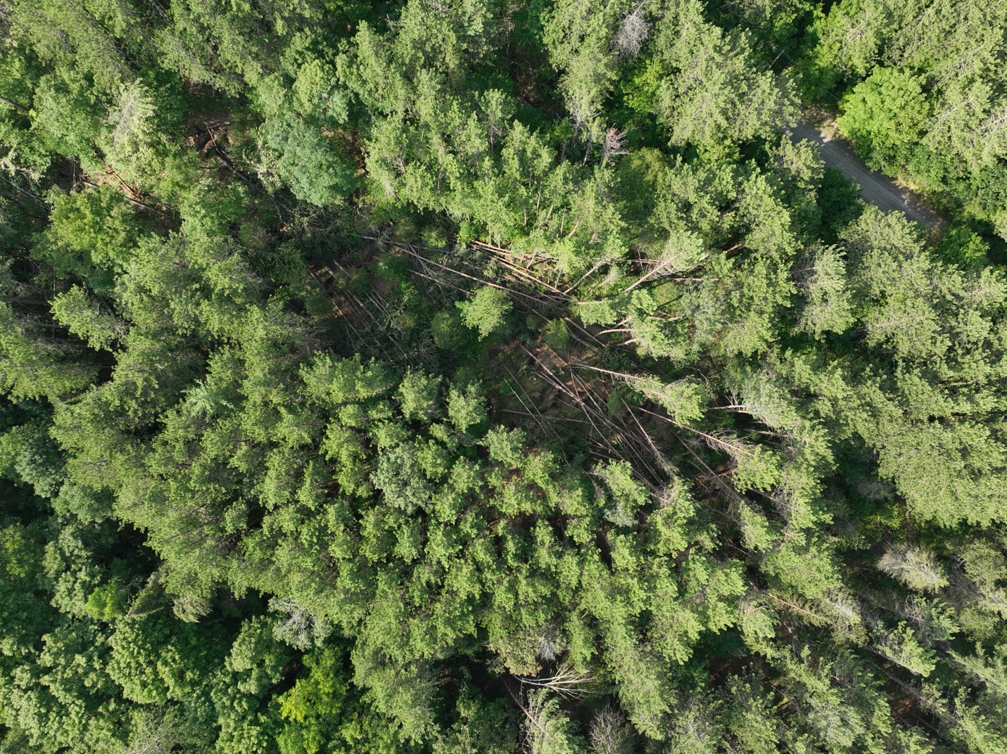
Nadir drone image showing one area of treefall associated with the Whitestone EF0 downburst.
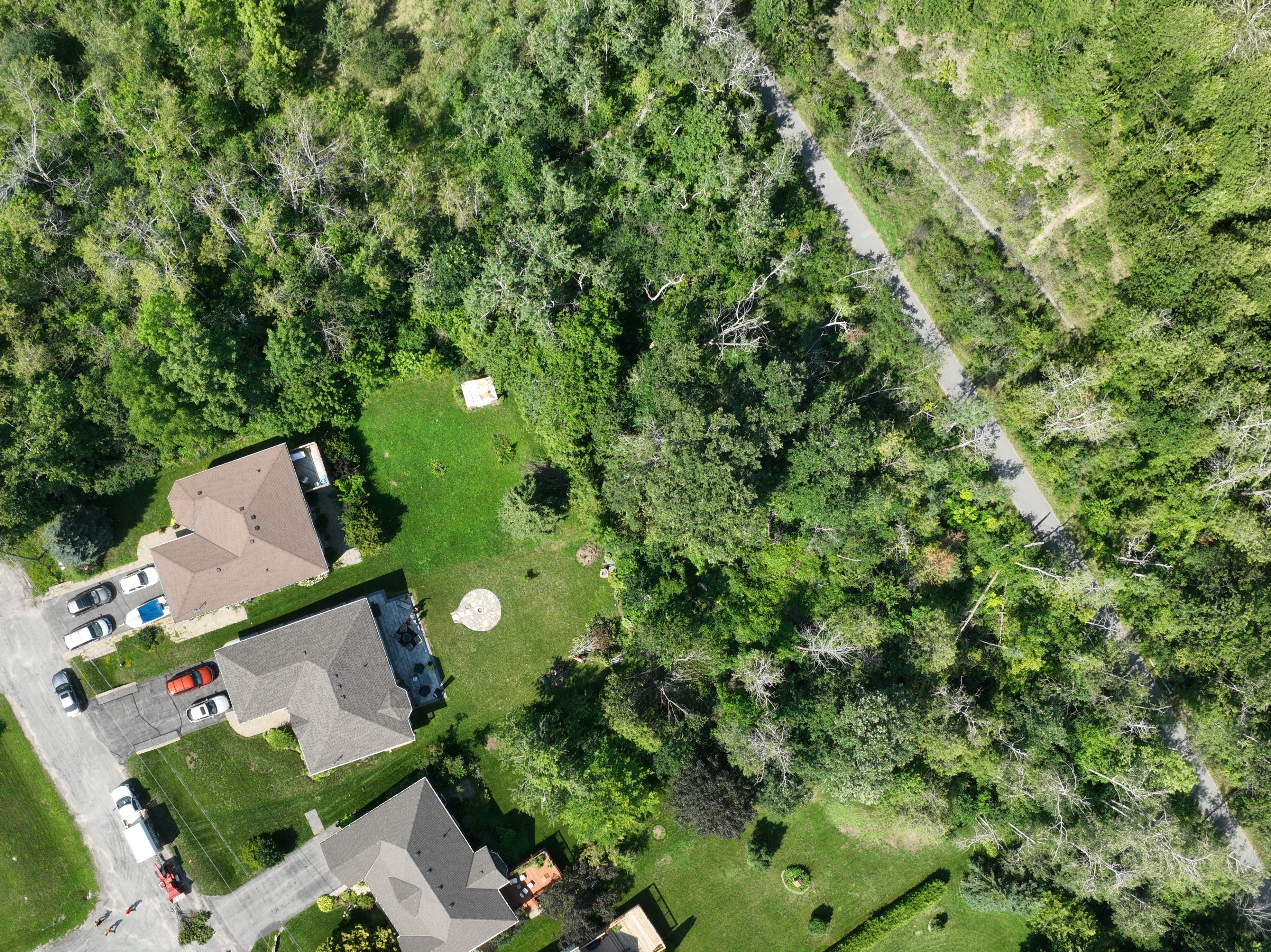
Nadir drone image showing area with sporadic tree damage along the tornado track in Lindsay, ON. Some branches were being cleaned up as this photo was taken (wood chipper at bottom left).
Impressive video of Lindsay tornado:
https://www.facebook.com/christinecjstewart/videos/1056873247275386/?rdid=Bovk5R7OeIdhfOtN





