EF0 tornado in southwestern ON on Aug 8
The NTP has confirmed an EF0 tornado that occurred at Woodstock in southwestern Ontario on August 8. The tornado developed just outside the city and travelled 3 km into the city's west side before dissipating. Sporadic damage to trees on the northeast side of Woodstock (many compromised by conditions such as rot or root girdling) was due to straight-line winds and was not related to the tornado.
Full details are available with the event summary below, along with a regional map, survey photos and radar imagery. The event can also be plotted on a map using the NTP Dashboard here.
====
Event Name: Woodstock, ON
Date: August 8, 2026
Start Time: 3:20 PM EDT (1920 UTC)
Final Classification: Tornado (over land)
Final EF-Scale Rating: EF0
EF-Scale Damage Indicator / Degree of Damage: C-SFOF/DOD-1
Start of damage track: 43.1212N, 80.8032W
End of damage track: 43.1285N, 80.7689W
Location of worst damage: 43.1288N, 80.7734W
Description: Witnesses captured video and photos of a tornado in the Woodstock area. Damage to trees and fences was reported in the area. No injuries were reported. An NTP ground survey was completed on August 8, 2026, documenting some damage in western Woodstock and additional unrelated weak tree damage in community. Satellite imagery review revealed a track of crop damage in the vicinity of the witness reports. Damage assessed as EF0 tornado, with an estimated max. wind speed of 90 km/h, track length of 2.97 km and max. path width of 50 m. Tornado motion was from the WSW (approx. 255 degrees). Start time is radar estimated.
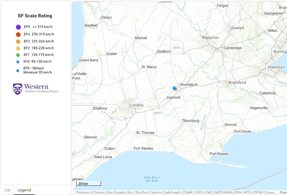
Regional map showing the start location of the EF0 tornado at Woodstock, ON.
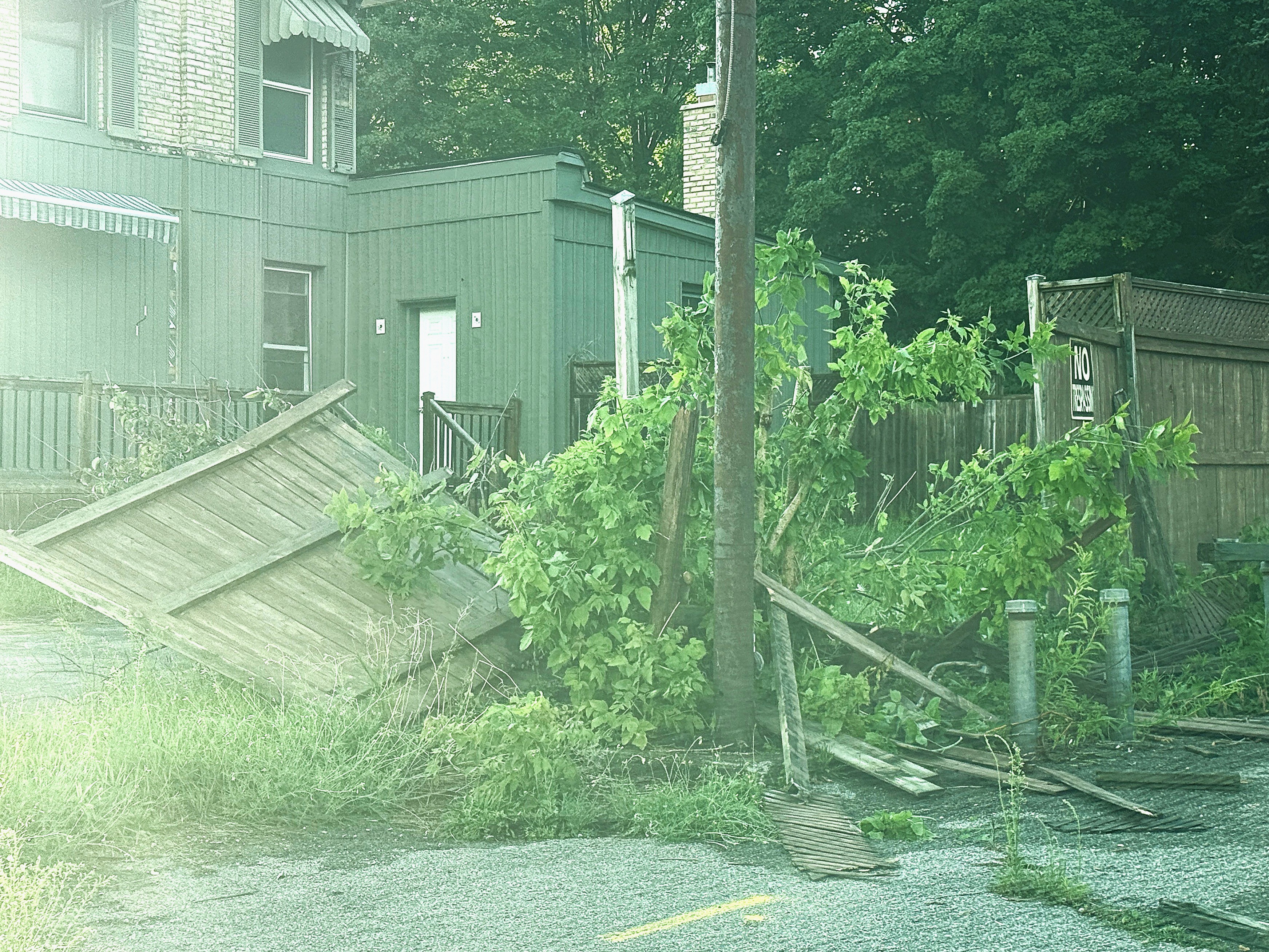
Photo of fence blown over by tornado at west end of Woodstock (C-SFOF DOD1 EXP 90 km/h).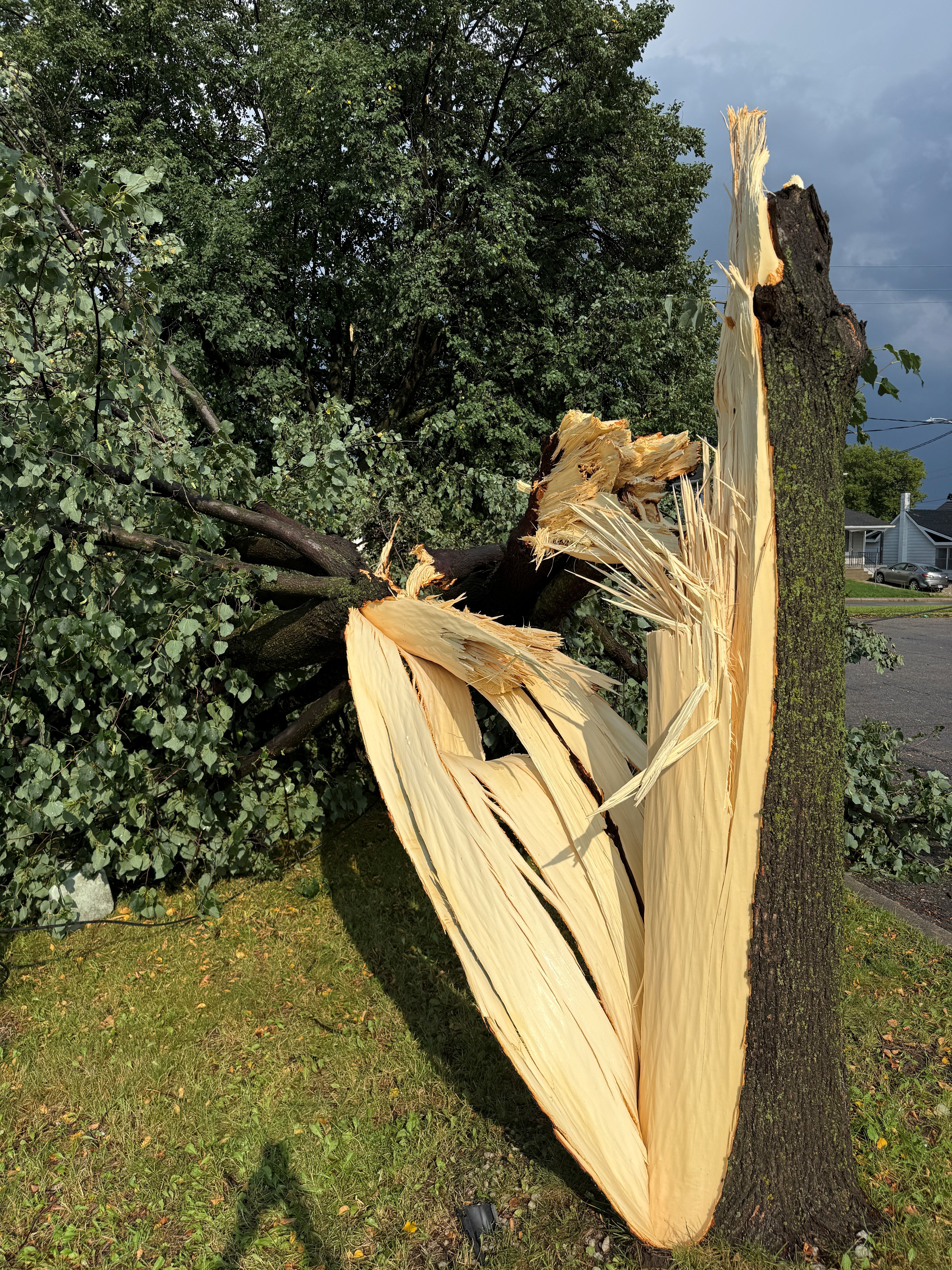
Tree felled by the tornado at the west end of Woodstock. Note however that the tree stem broke at an area of rot, meaning that the tree health was compromised and a 'lower bound' wind speed of 80 km/h needs to be assigned. This is often the case with sporadic urban treefall.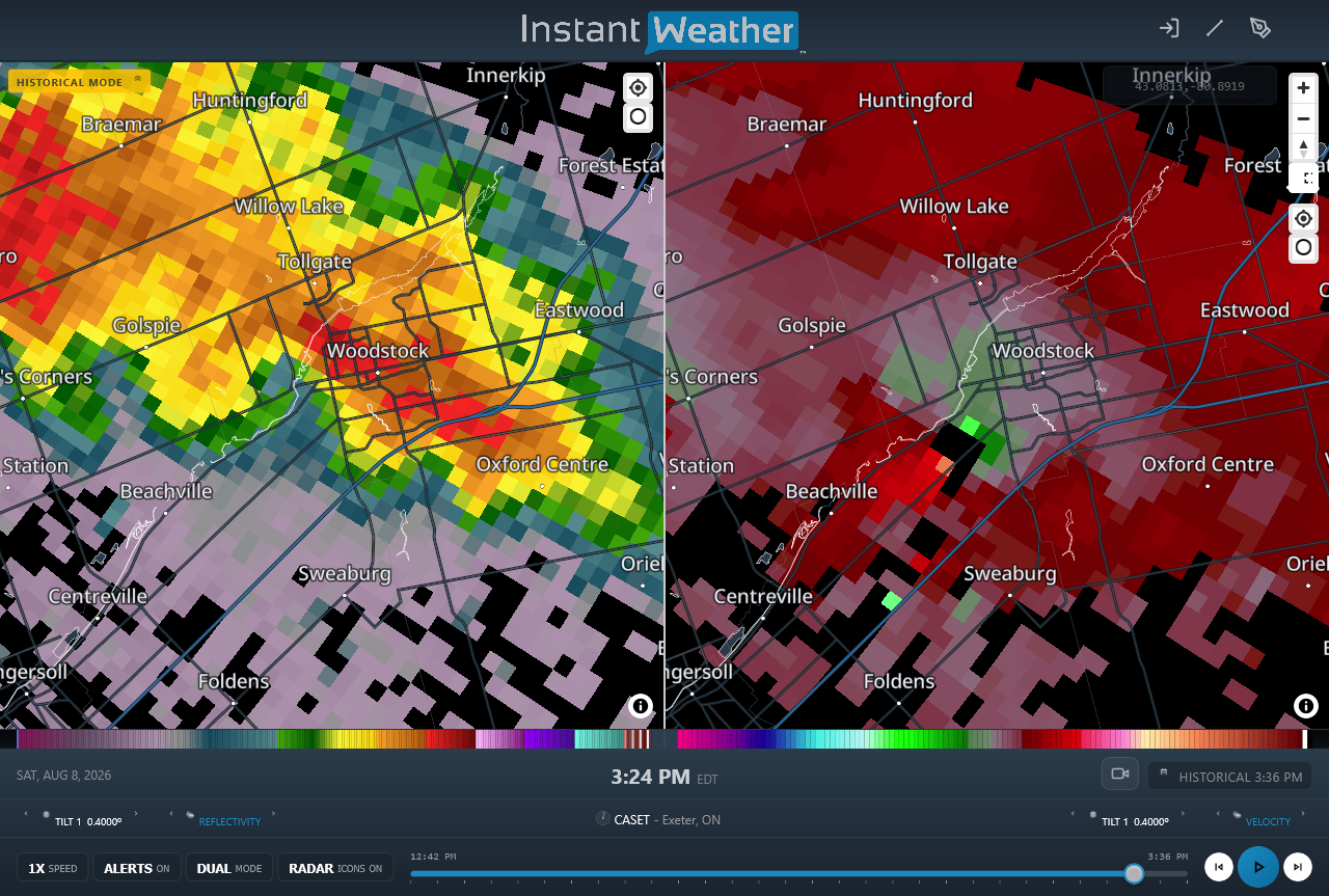
CASET radar image near the start time of the EF0 tornado showing a hook echo in reflectivity at left and an azimuthal shear couplet in radial velocity at right.
Link to video of the tornado as it caused damage at the west end of Woodstock, after which it quickly dissipated:
https://www.facebook.com/share/v/1CvD5KBtZL/.





