EF0 tornado in eastern ON on Aug 2
The NTP has confirmed an EF0 tornado near Kemptville in eastern Ontario on August 2. A damage survey found tree damage indicating a maximum wind speed of 115 km/h over a short, narrow path.
Full details are available with the event summary below, along with a regional map, survey summary map, survey photos and radar imagery. The event can also be plotted on a map using the NTP Dashboard here.
Special thanks for Connor Mockett and Tom Smetana for providing the results of their preliminary damage survey.
====
Event Name: Kemptville, ON
Date: August 2, 2026
Start Time: 3:45 PM EDT (1945 UTC)
Final Classification: Tornado (over land)
Final EF-Scale Rating: EF0
EF-Scale Damage Indicator / Degree of Damage: C-T/DOD-3
Start of damage track: 45.0438N, 75.6597W
End of damage track: 45.0533N, 75.6533W
Location of worst damage: 45.0500N, 75.6559W
Description: Damage to trees and fields was reported north of Kemptville after a storm passed through the area. No injuries were reported. An NTP ground and drone survey was completed on August 6, 2026, documenting the reported damage and some additional tree damage. Damage assessed as EF0 tornado, with an estimated max. wind speed of 115 km/h, track length of 1.18 km and max. path width of 80 m. Tornado motion was from the SSW (approx. 205 degrees). Start time is radar estimated. Satellite imagery review is pending.
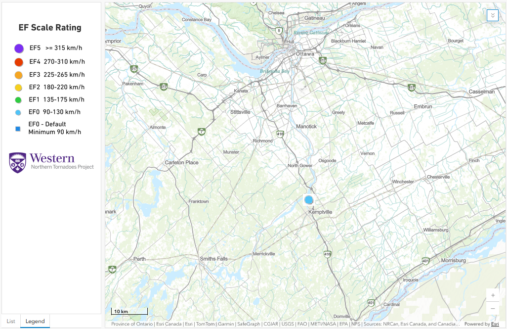
Regional map showing the location of the EF0 tornado near Kemptville, ON.
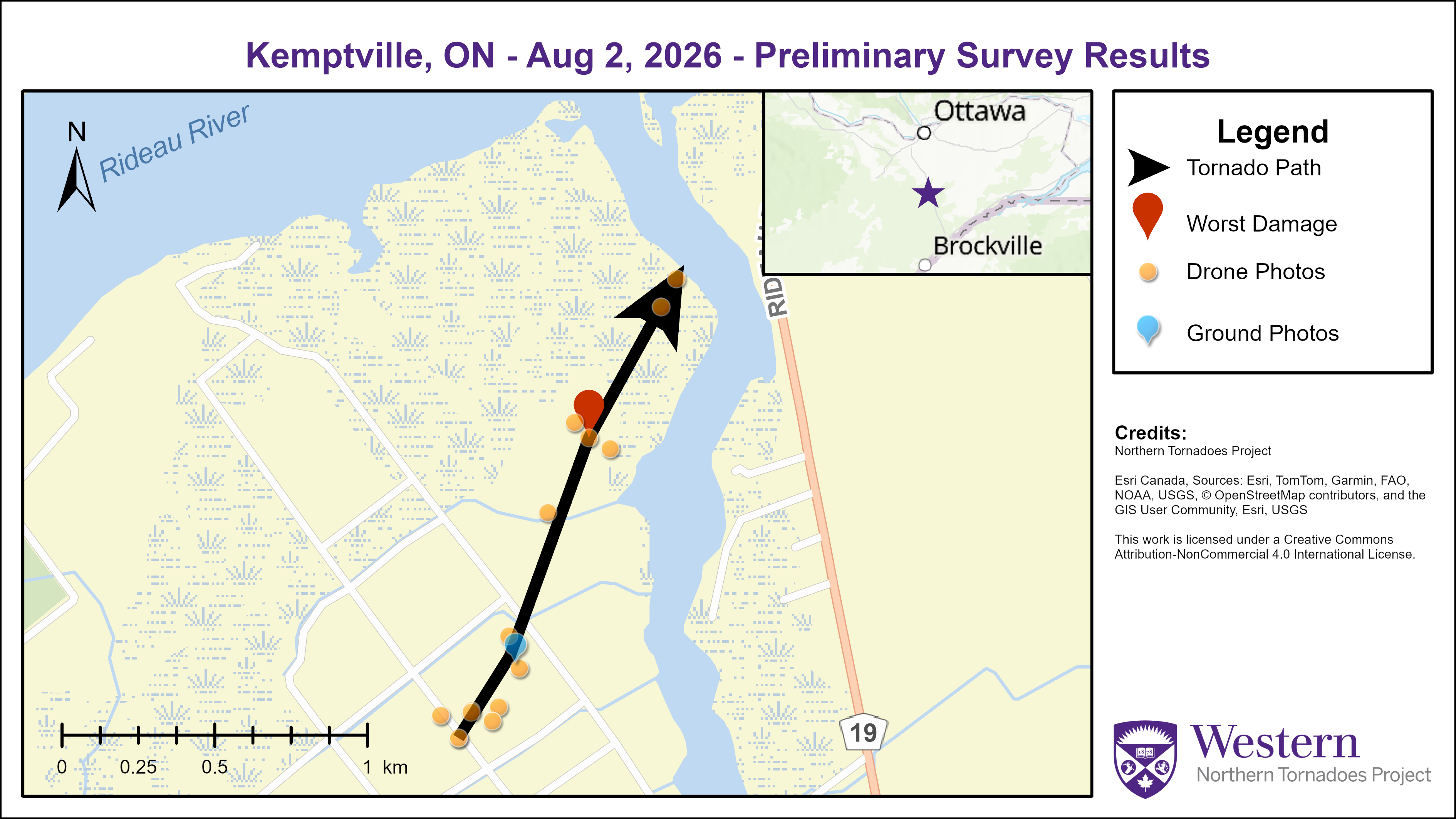
Survey map showing the track of the EF0 tornado near Kemptville, ON.
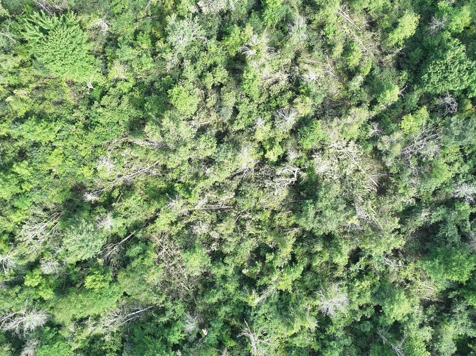
Nadir drone photo of the worst tree damage. Several trees are down within a relatively small area and with various treefall directions.
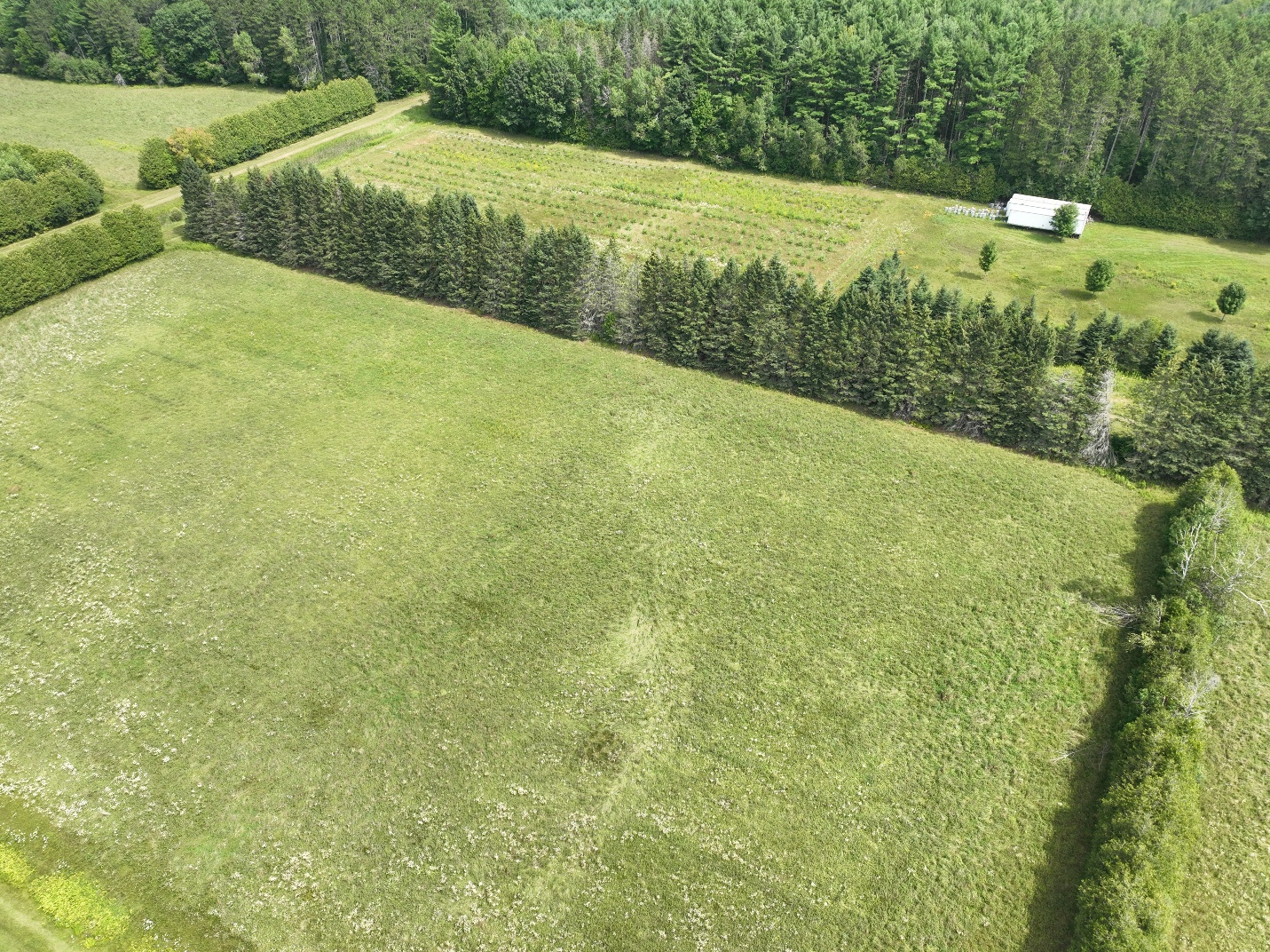
Oblique drone photo showing faint markings in the grass from the tornado before it entered a wooded area where several trees were downed.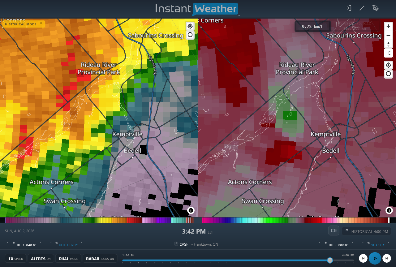
Radar image just prior to the tornado occurring, showing a small hook in the reflectivity at left and a weak rotation couplet in radial velocity at right.





