EF0 downburst in southwestern ON on July 18
The NTP has confirmed an EF0 downburst at Mapleton in southwestern ON on July 18. An affected area near 7 km long and 3 km wide was identified following analysis of damage survey results, radar imagery and submitted evidence. Farm buildings and trees were the main damage indicators.
Full details are available with the event summary below, along with a regional map, survey summary map and damage survey photos. The event can also be plotted on a map using the NTP Dashboard here.
====
Event Name: Mapleton, ON
Date: July 18, 2026
Start Time: 1:50 PM EDT (1750 UTC)
Final Classification: Downburst
Final EF-Scale Rating: EF0
EF-Scale Damage Indicator / Degree of Damage: SBO/DOD-6
Location of worst damage: 42.8229N, 81.0284W
Description: Damage to barns and trees was reported east of Mapleton (northwest of Aylmer) after a storm passed through the area. No injuries were reported. An NTP ground and drone survey was completed on July 20, 2026, documenting the reported damage and additional tree and crop damage. Damage assessed as EF0 downburst, with an estimated max. wind speed of 130 km/h, with intermittent damage found over an area approximately 7.1 km long and up to 3.2 km wide. Start time is radar estimated. Satellite imagery review is pending.
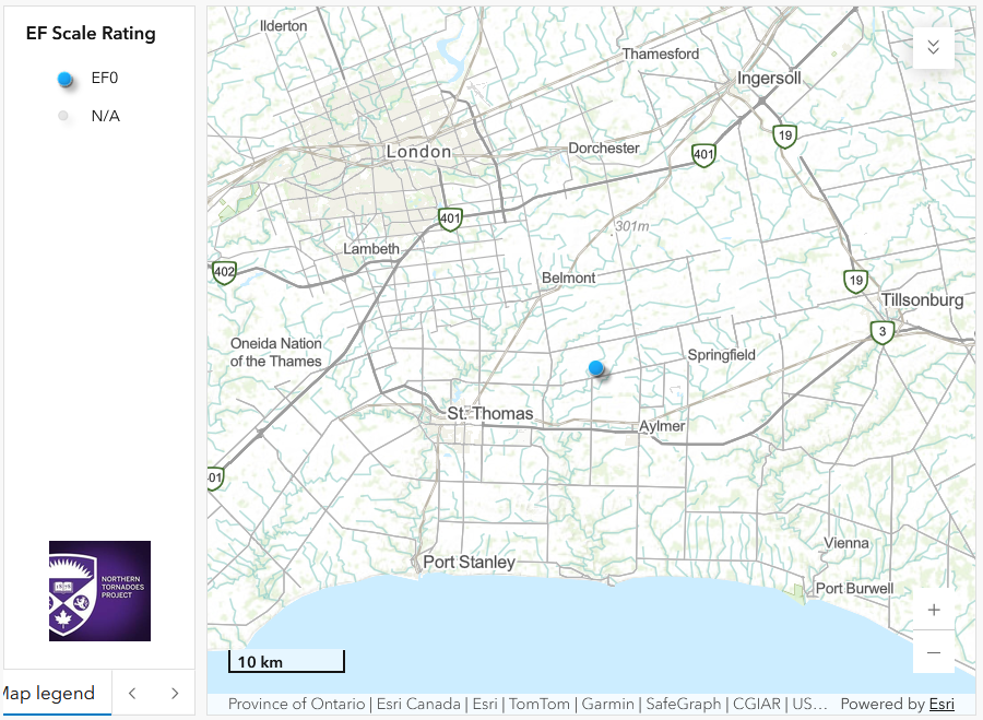
Regional map showing the location of the EF0 downburst at Mapleton, ON.
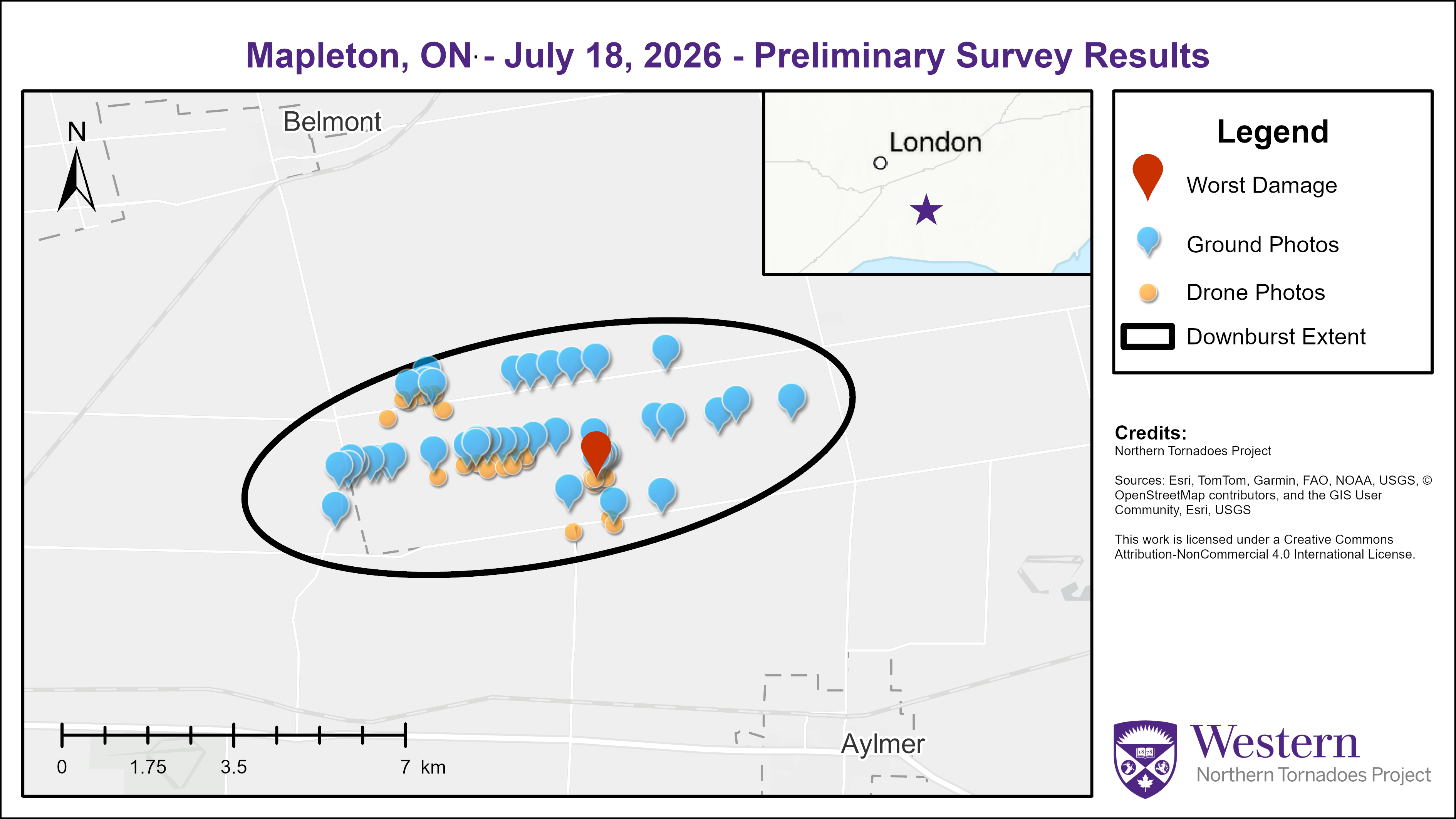
Survey summary map for the Mapleton EF0 downburst.

Ground photo showing the point of worst damage - extensive damage to a barn (SBO DOD6 LB 130km/h EF0).
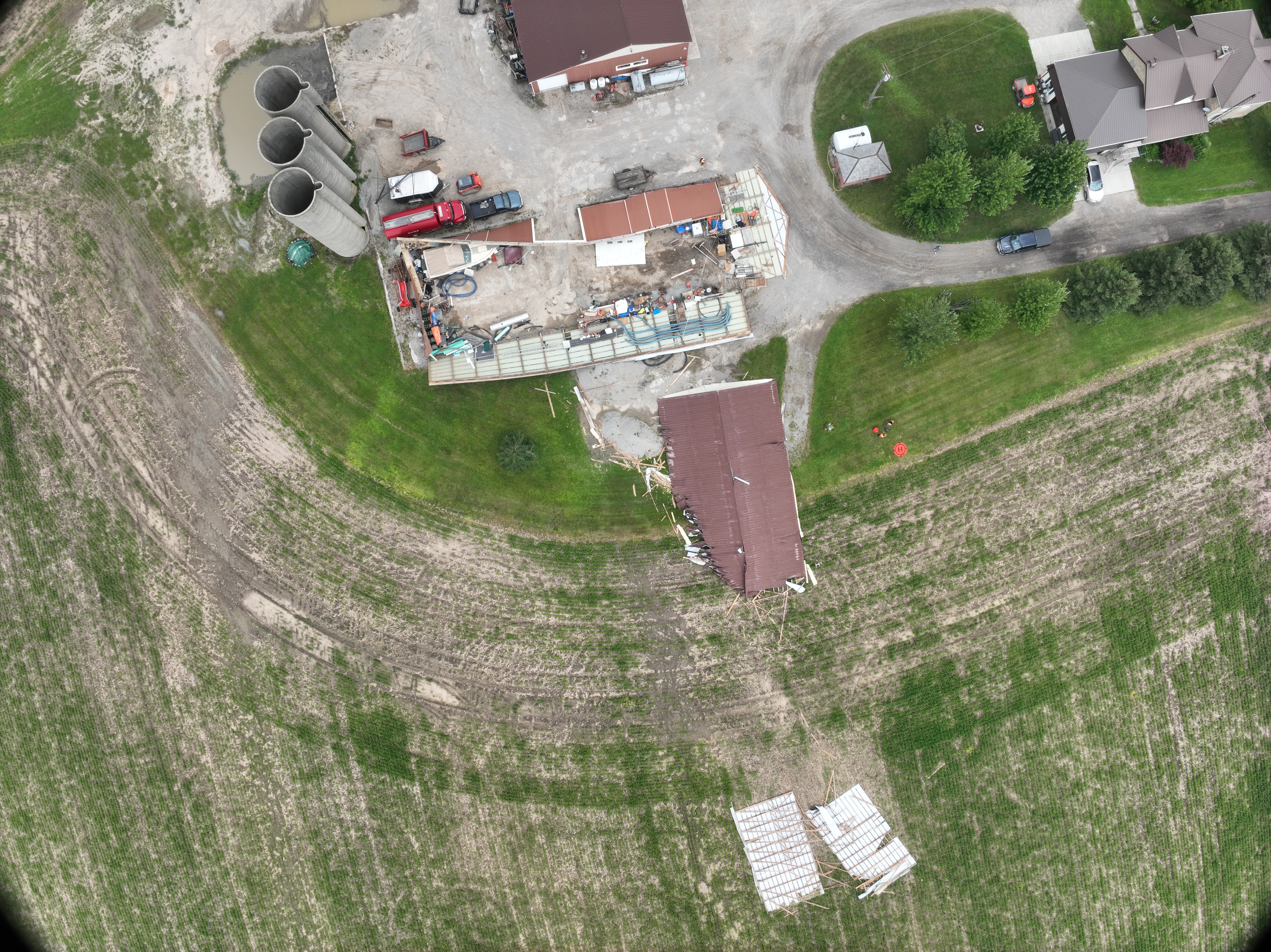
Nadir drone image showing the damage to the same barn.
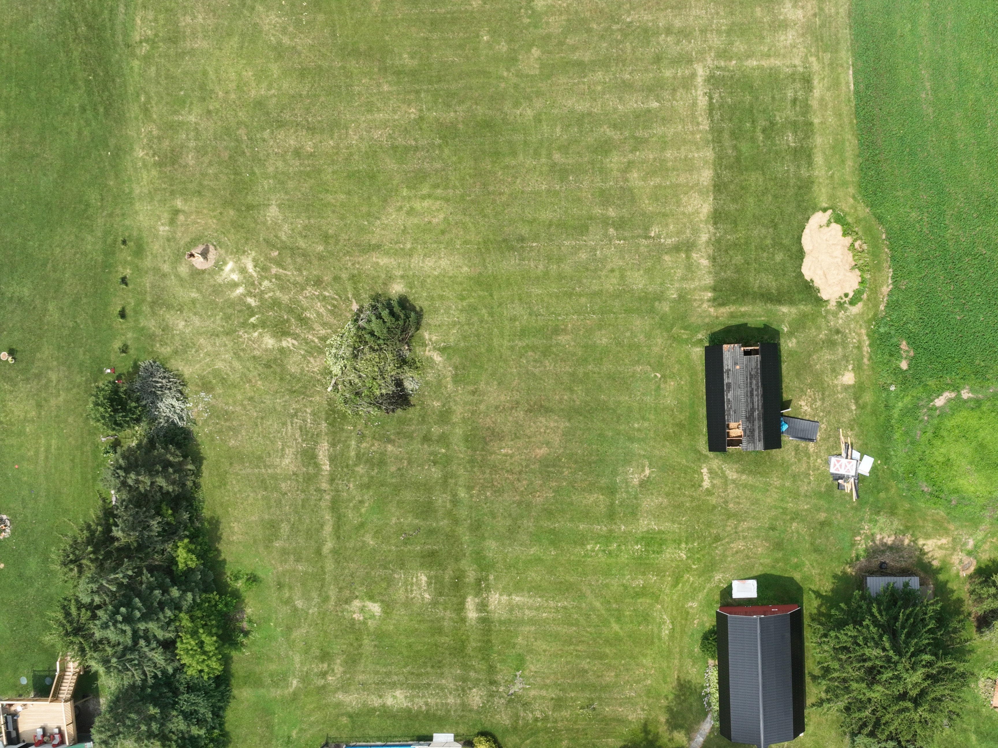
Nadir drone photo showing roof damage to a barn and tree damage.





