Details on the three MB tornadoes from June 2
After thorough investigation, the NTP confirmed three tornadoes in southern Manitoba from the storms there on June 2. NTP damage surveys were conducted for two of these, documenting EF0 damage. The third was confirmed based on photographic evidence and had no related damage. It was therefore assigned an EF0-Default rating.
The event summaries, a regional map, survey summary maps and related survey photos are shown below. The event can also be plotted on a map using the NTP Dashboard here.
====
Event Name: Douglas, MB
Date: June 2, 2026
Start Time: Likely 3:40 PM CDT (2040 UTC)
Final Classification: Tornado (over land)
Final EF-Scale Rating: EF0
EF-Scale Damage Indicator / Degree of Damage: C-T/DOD-3
Start of damage track: 49.9126N, 99.6204W
End of damage track: 49.9917N, 99.5792W
Location of worst damage: 49.9162N, 99.6172W
Description: Witness captured video of a funnel cloud northeast of Douglas and reported minor tree damage in the vicinity. No injuries were reported. An NTP ground and drone survey was completed on June 3, 2026, documenting the reported damage and discovering minor roof damage to a garage, fence damage and additional tree damage. Damage assessed as an EF0 tornado, with an estimated max. wind speed of 115 km/h, track length of 9.68 km and max. path width of 410 m. Tornado motion was from the SSW (approx. 200 degrees). Start time is radar estimated. Satellite imagery review is pending.
Event Name: Manitou, MB
Date: June 2, 2026
Start Time: 4:24 PM CDT (2124 UTC)
Final Classification: Tornado (over land)
Final EF-Scale Rating: EF0
EF-Scale Damage Indicator / Degree of Damage: C-T/DOD-3
Start of damage track: 49.2149N, 98.4664W
End of damage track: 49.2079N, 98.4394W
Location of worst damage: 49.2080N, 98.4402W
Description: Witness captured video of a tornado southeast of Manitou. No damage and no injuries were reported. An NTP ground and drone survey was completed on June 4, 2026, discovering damage to trees and some ground scouring. Damage assessed as an EF0 tornado, with an estimated max. wind speed of 115 km/h, track length of 2.21 km and max. path width of 120 m. Tornado motion was from the WNW (approx. 290 degrees). Start time is based on witness report. Satellite imagery review is pending.
Event Name: Sperling, MB
Date: June 2, 2026
Start Time: 5:50 PM CDT (2250 UTC)
Final Classification: Tornado (over land)
Preliminary EF-Scale Rating: EF0-default
Estimated tornado location: 49.49N, 97.61W
Description: Witnesses captured photos of a tornado southeast of Sperling. No damage and no injuries were reported. An NTP survey team explored the area on June 4, 2026, but discovered no damage. The preliminary EF-scale assessment is default EF0. Start time is based on witness report. Satellite imagery review is pending.
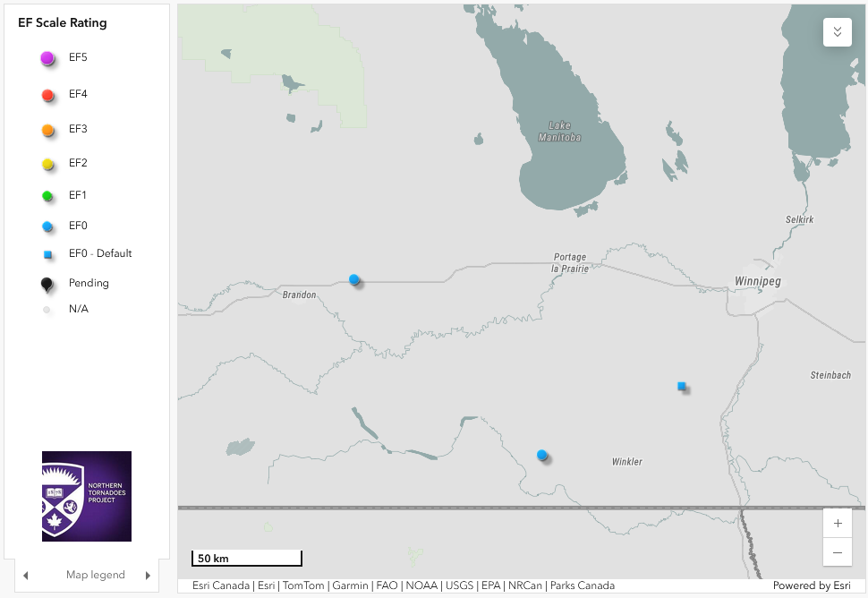
Regional map showing the locations of the three tornadoes from June 2 - Douglas at left, Manitou at centre and Sperling at right.
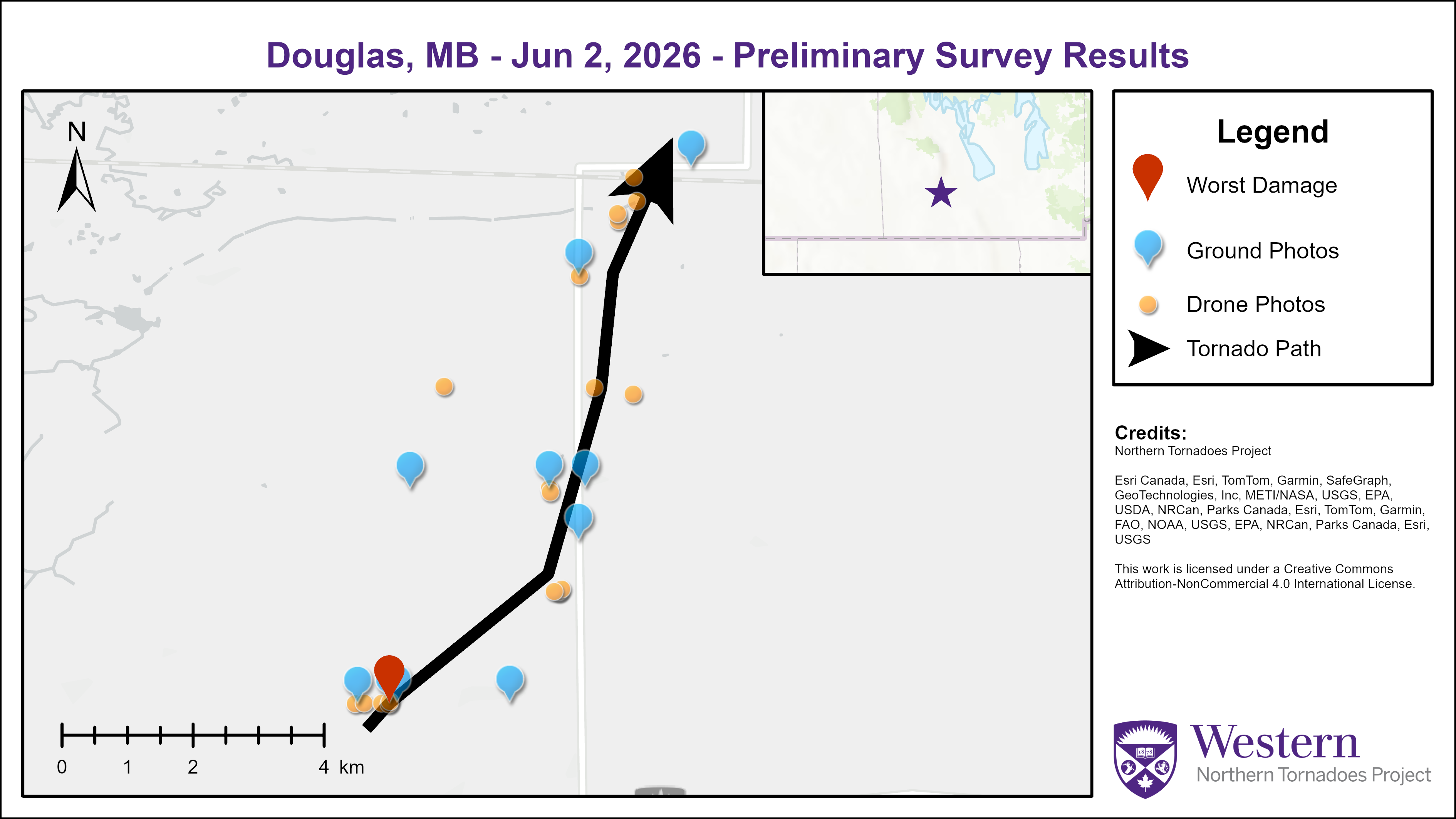
Survey summary map for the Douglas, MB EF0 tornado.
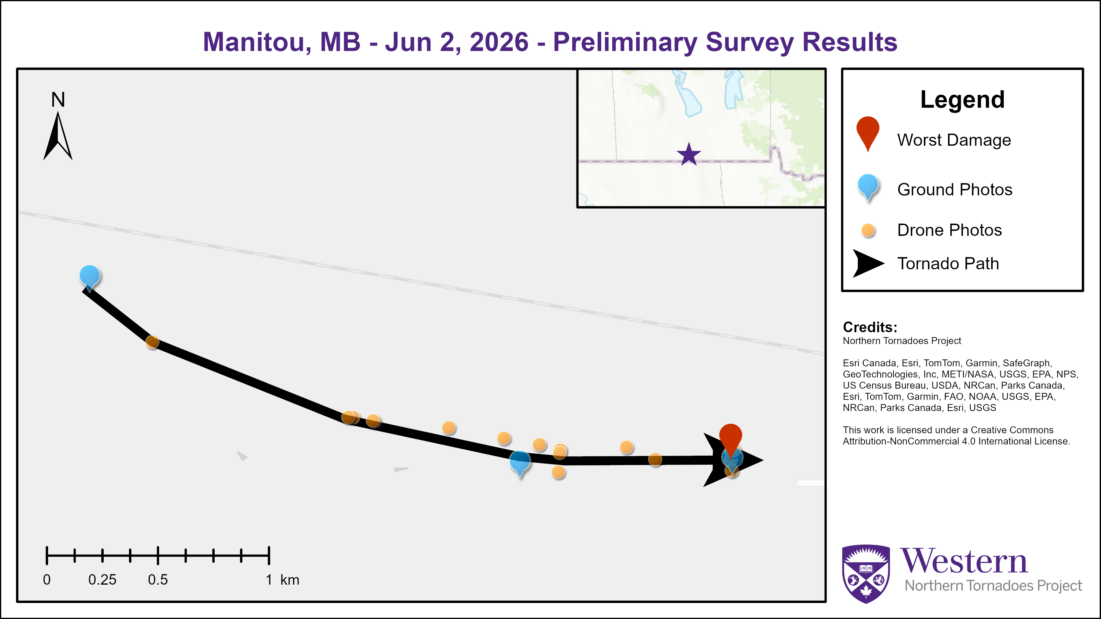
Survey summary map for the Manitou, MB EF0 tornado.
Worst damage point near the start of the Douglas track. This location had some trees snapped facing north and some south. There were a mix of dead trees and trees that were alive and freshly snapped, with varying north and south directions.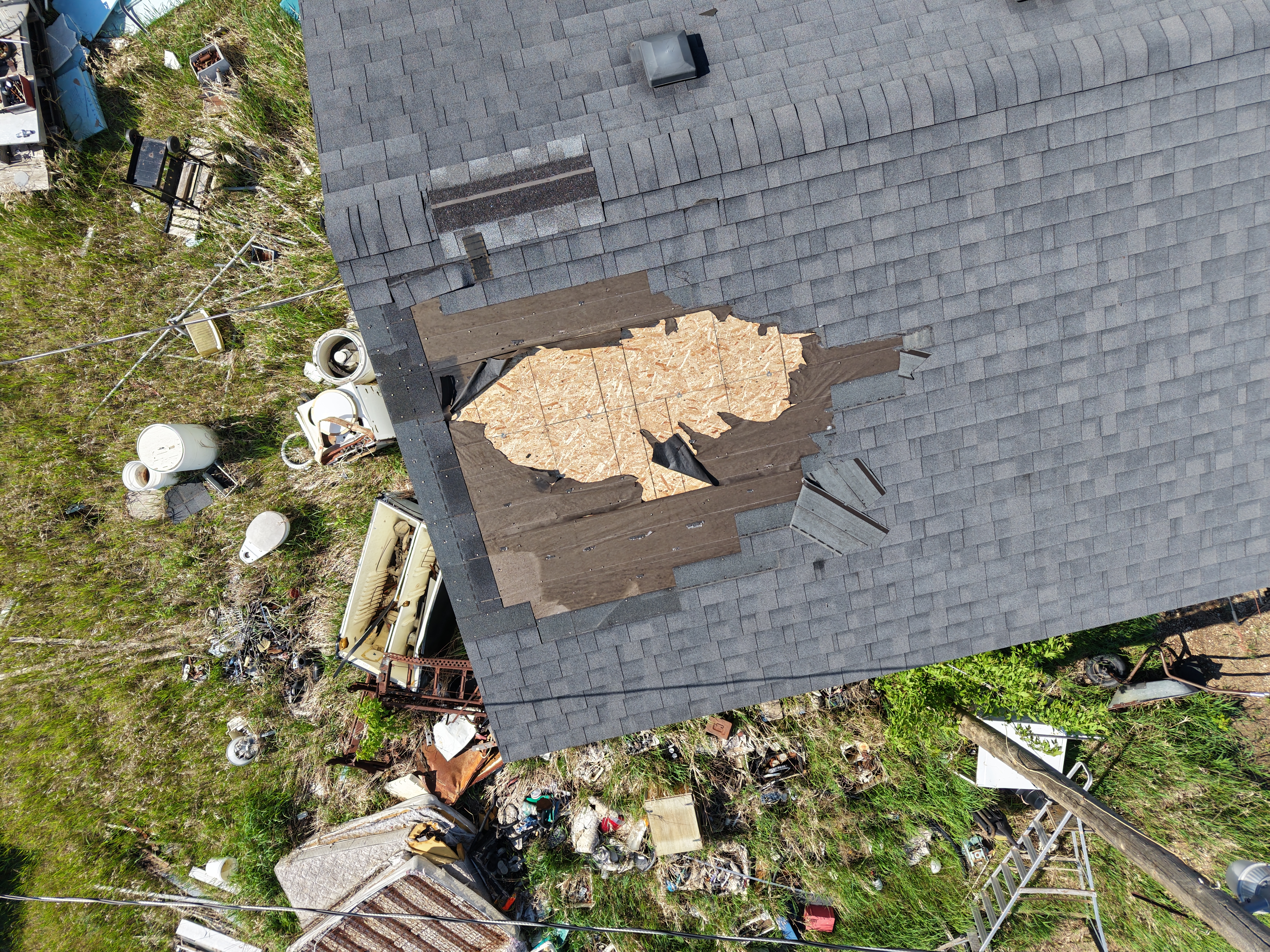
Shingle damage to a garage along the track of the Douglas tornado.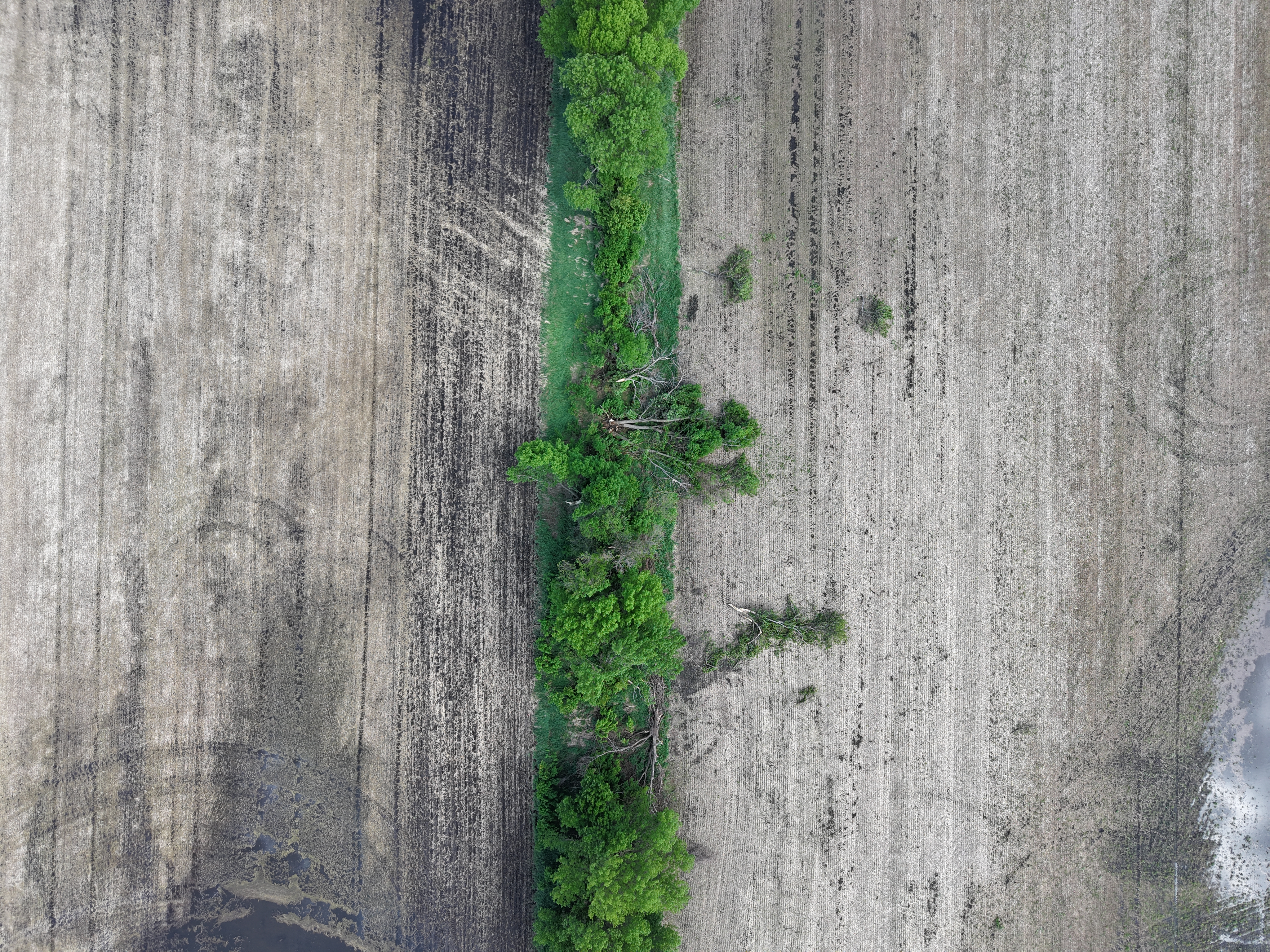
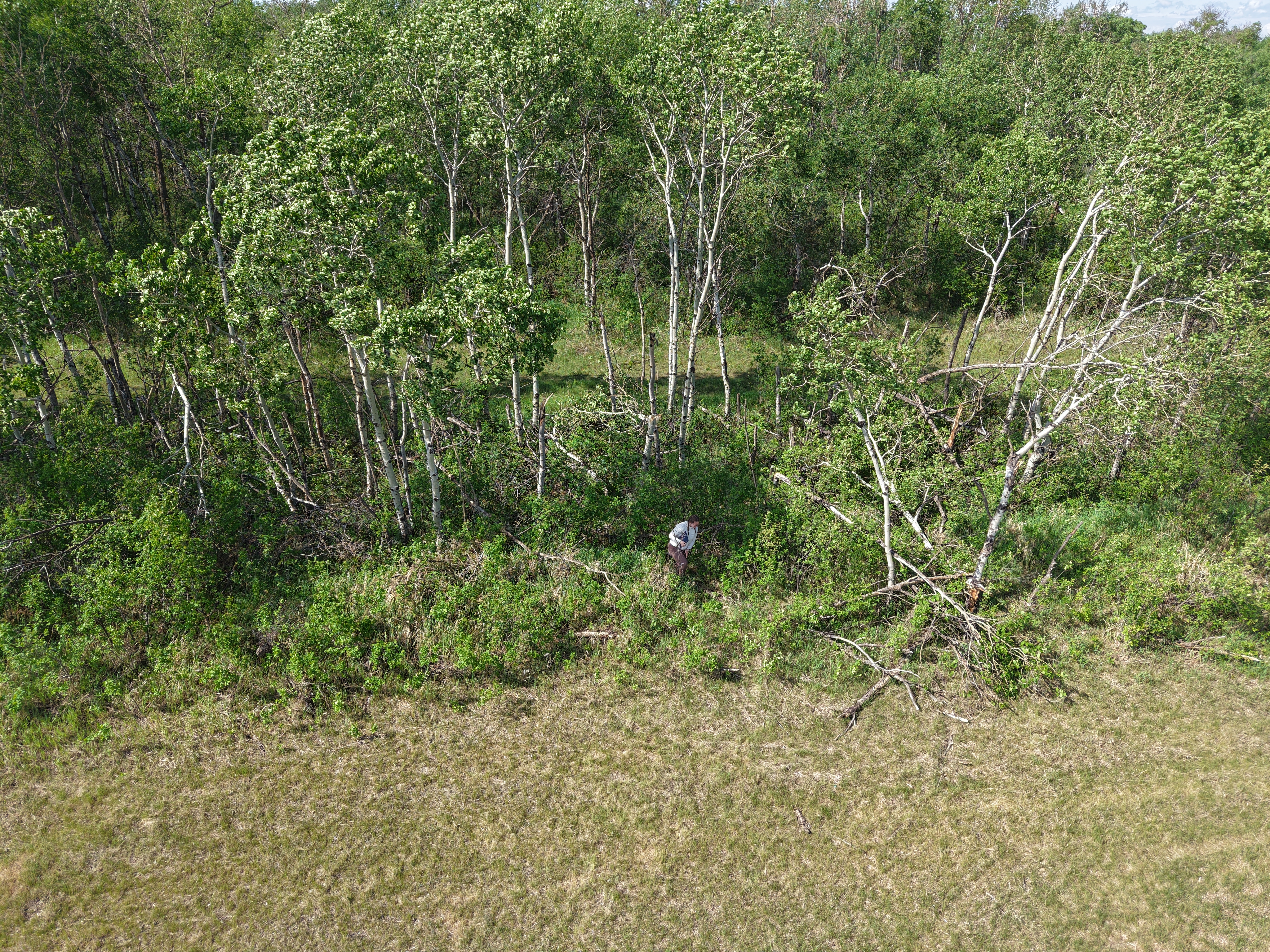
Tree damage with fresh ground scouring leading up to the trees, along the track of the Manitou tornado.