Another tornado in SW ON on Sep 2
The NTP has confirmed another tornado in southwestern ON with the storms on September 2, this time just north of Wellesley. The tornado has been rated EF1 based on the results of a damage survey that included parts of a barn roof being removed and thrown. A brief tornado debris signature was also detected on radar.
Tree damage in Wellesley was found to be due to straight-line winds, part of a larger swath of wind damage stretching from the Lake Huron shore south of Goderich to the Brantford area.
Full details are available with the event summary below, along with a regional map, survey map, survey photos and radar imagery. The event can also be plotted on a map using the NTP Dashboard here.
====
Event Name: Wellesley, ON
Date: September 2, 2026
Start Time: 5:25 PM EDT (2125 UTC)
Final Classification: Tornado (over land)
Final EF-Scale Rating: EF1
EF-Scale Damage Indicator / Degree of Damage: SBO/DOD-4
Start of damage track: 43.4910N, 80.8012W
End of damage track: 43.4966N, 80.7272W
Location of worst damage: 43.4965N, 80.7586W
Description: Damage to power poles, trees and a fabric-covered structure was reported in the Wellesley area after a storm passed through. No injuries were reported. An NTP ground and drone survey was completed on September 6, 2026, documenting the reported damage along with roof damage to a barn and a home, crop damage and a converted refrigerated trailer moved from its original location. Damage assessed as EF1 tornado, with an estimated max. wind speed of 145 km/h, track length of 6.11 km and max. path width of 490 m. Tornado motion was from the W (approx. 265 degrees). Start time is radar estimated. Satellite imagery review is pending.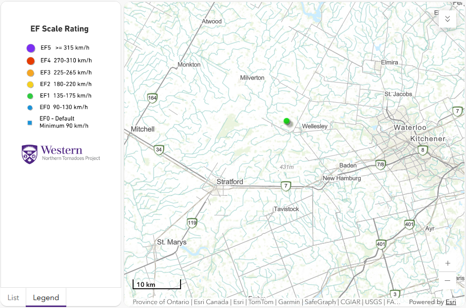
Regional map showing the start location of the Wellesley, ON EF1 tornado.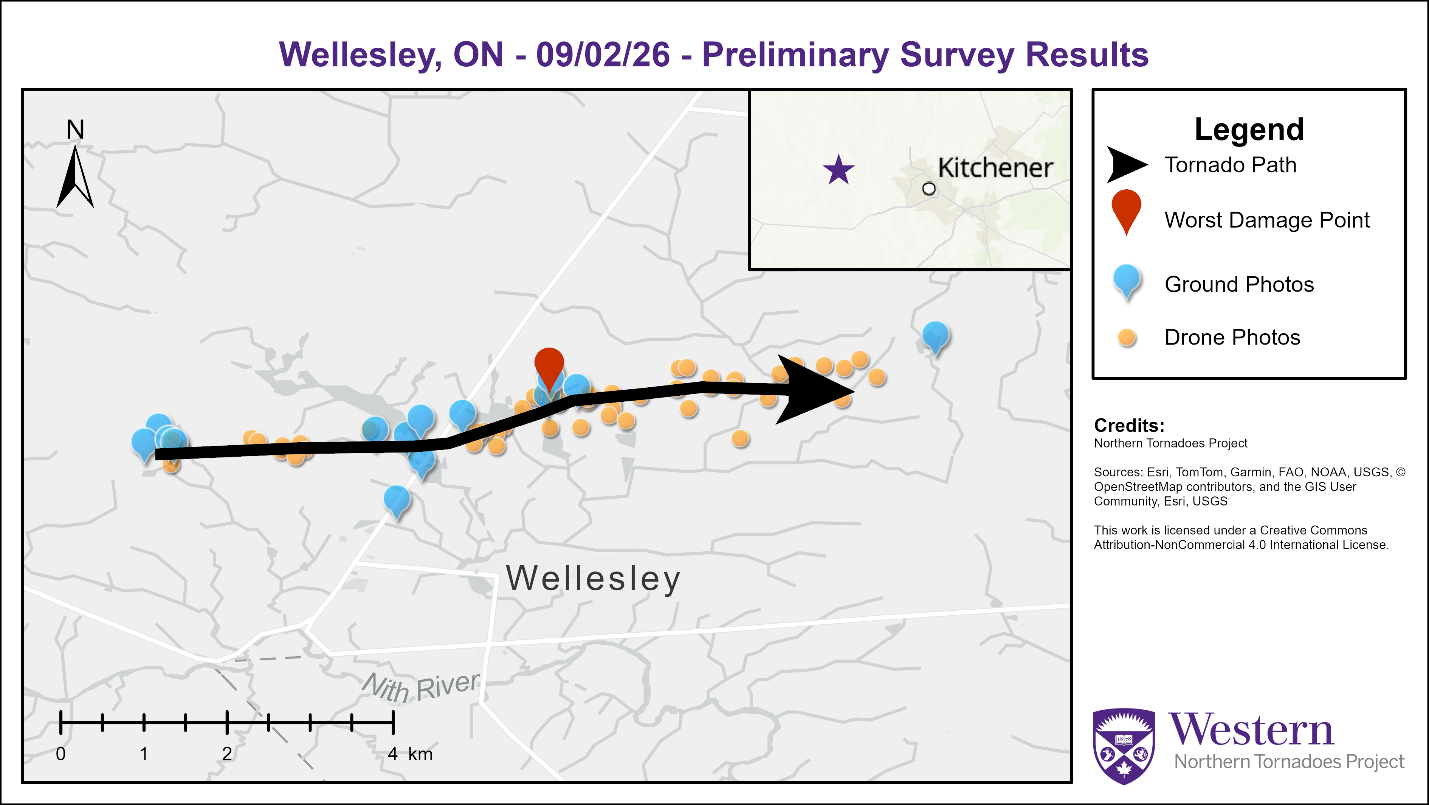
Survey map showing the track of the Wellesley EF1 tornado.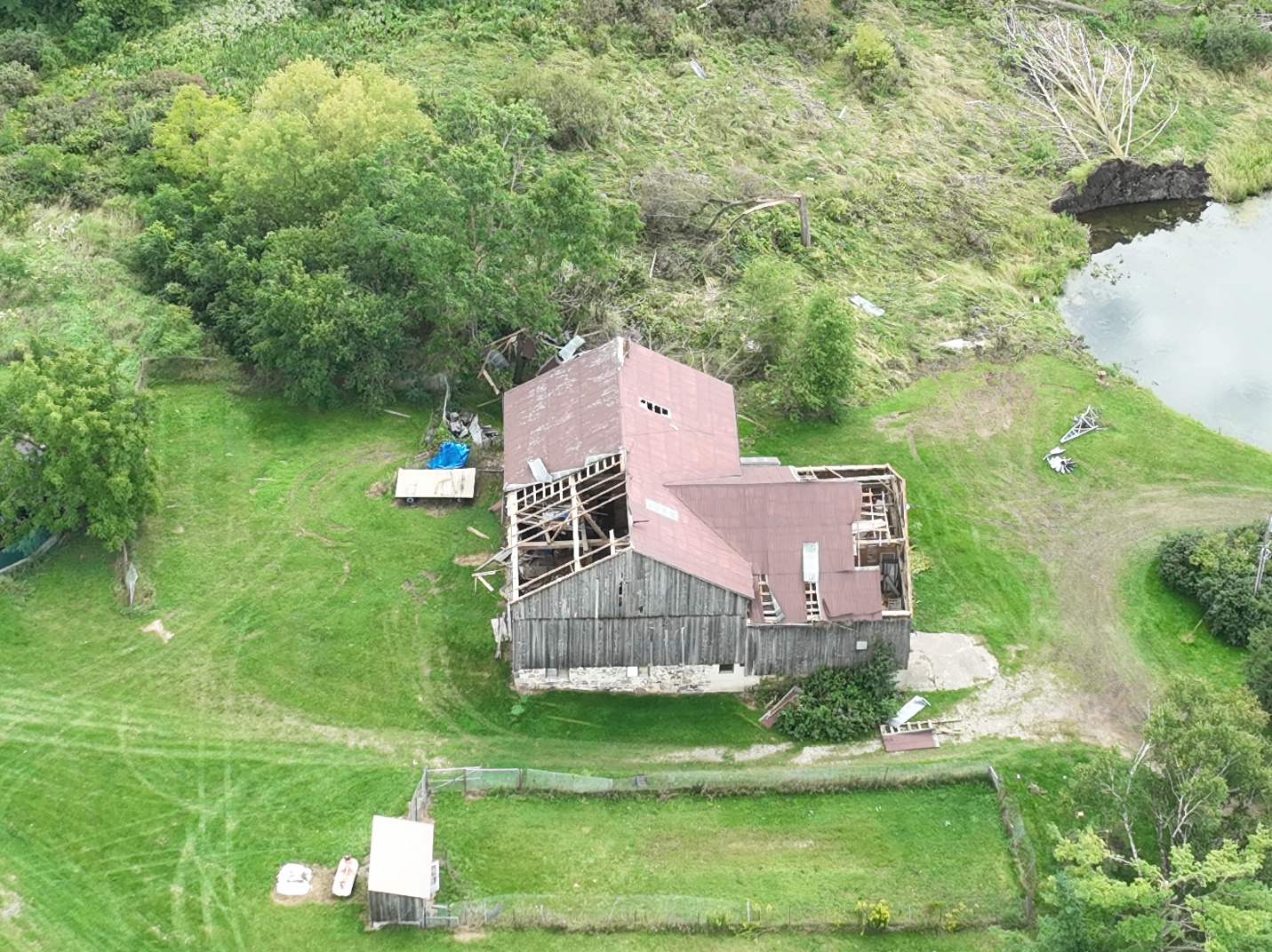
Drone photo of a barn missing parts of its roof and some tree damage on Weimar Line, the location of worst damage. 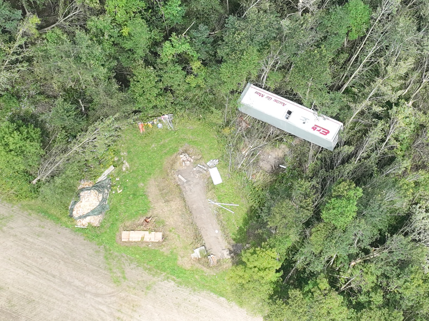
Drone photo of a converted refrigeration trailer moved off its foundation.
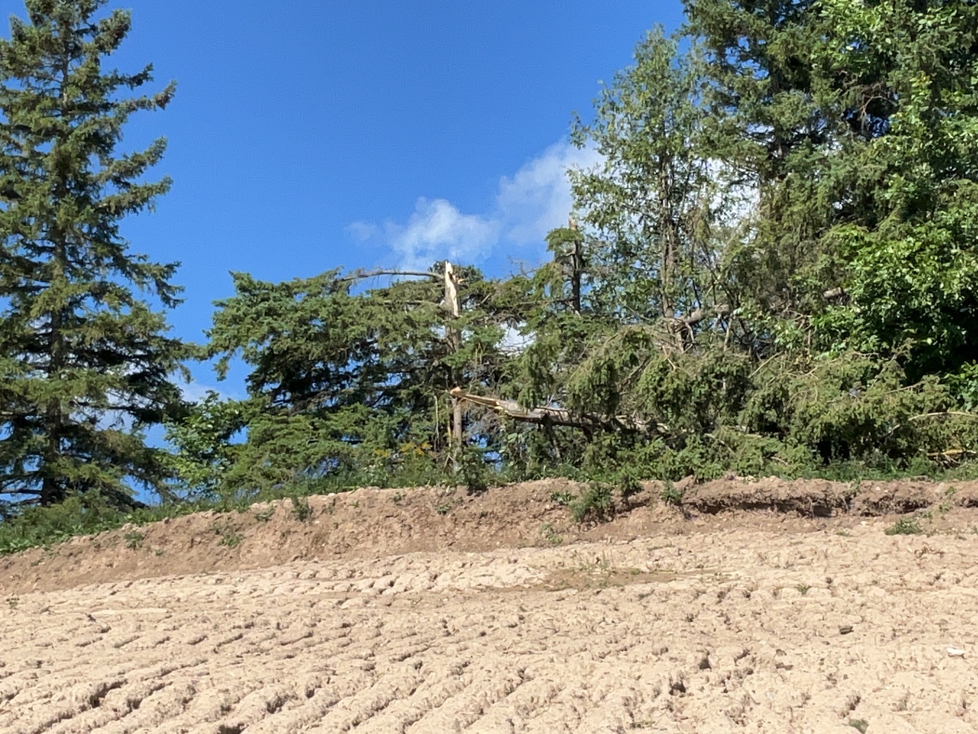
Ground photo of two trees snapped at a property on Manser Road near start location.
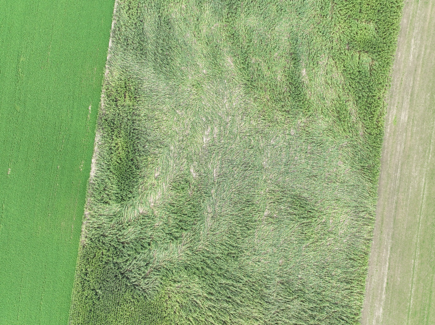
Drone photo of crop damage near Weimar Line and Greenwood Hill Road.
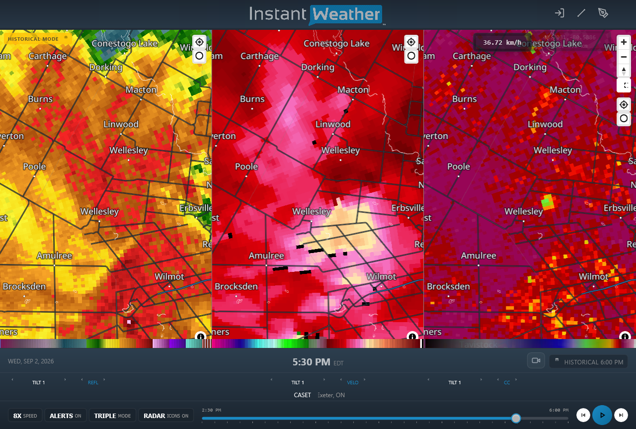
CASET radar image showing reflectivity (left), radial velocity (centre) and correlation coefficient (right) products. A brief tornado debris signature can be seen with the tornado just northeast of Wellesley (blue-green pixels).





