Additional tornado in SW ON on Sep 3
The NTP has confirmed an additional tornado in southwestern Ontario with the storms on September 3, this time at River Canard, south of Windsor. Damage to roof shingles, trees and power poles was rated at EF0.
Full details are available with the event summary below, along with a regional map, a survey map, survey photos and radar imagery. The event can also be plotted on a map using the NTP Dashboard here.
Special thanks to Mary Ann McManemy of Windsor Essex Storm and Environment Enthusiasts (WE-SEE) for providing preliminary information about the damage along the tornado's path.
====
Event Name: River Canard, ON
Date: September 3, 2026
Start Time: 4:19 PM EDT (2019 UTC)
Final Classification: Tornado (over land)
Final EF-Scale Rating: EF0
EF-Scale Damage Indicator / Degree of Damage: FR12/DOD-2
Start of damage track: 42.1808N, 83.0906W
End of damage track: 42.1425N, 83.0564W
Location of worst damage: 42.1621N, 83.0690W
Description: Tree damage was reported near River Canard after a storm passed through the area. No injuries were reported. Additional damage along a narrow path was documented by a private citizen on behalf of NTP, including minor roof damage to several homes, a leaning power pole and tree and ground cover damage. An NTP ground survey was completed on September 20, 2026, documenting the reported damage and additional power pole damage. Satellite imagery review revealed some damage to grasses along the path. Damage assessed as EF0 tornado, with an estimated max. wind speed of 125 km/h, track length of 5.10 km and max. path width of 200 m. Tornado motion was from the NW (approx. 325 degrees). Start time is radar estimated.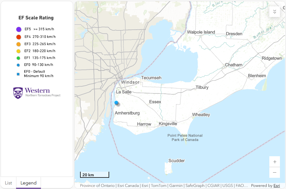
Regional map showing the start location of the River Canard, ON EF0 tornado.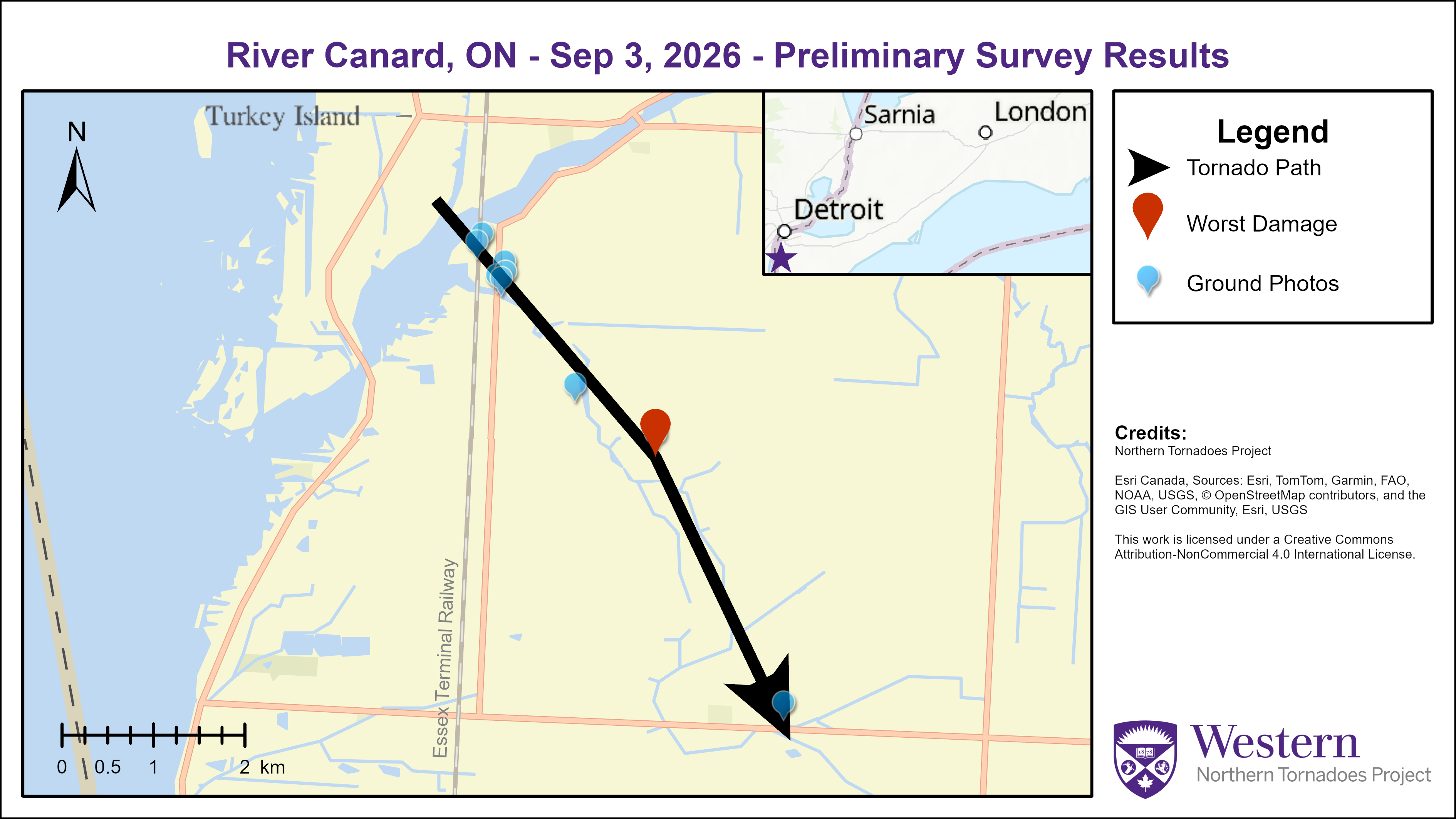
Survey map showing the path of the EF0 tornado at River Canard, ON on Sep 3.
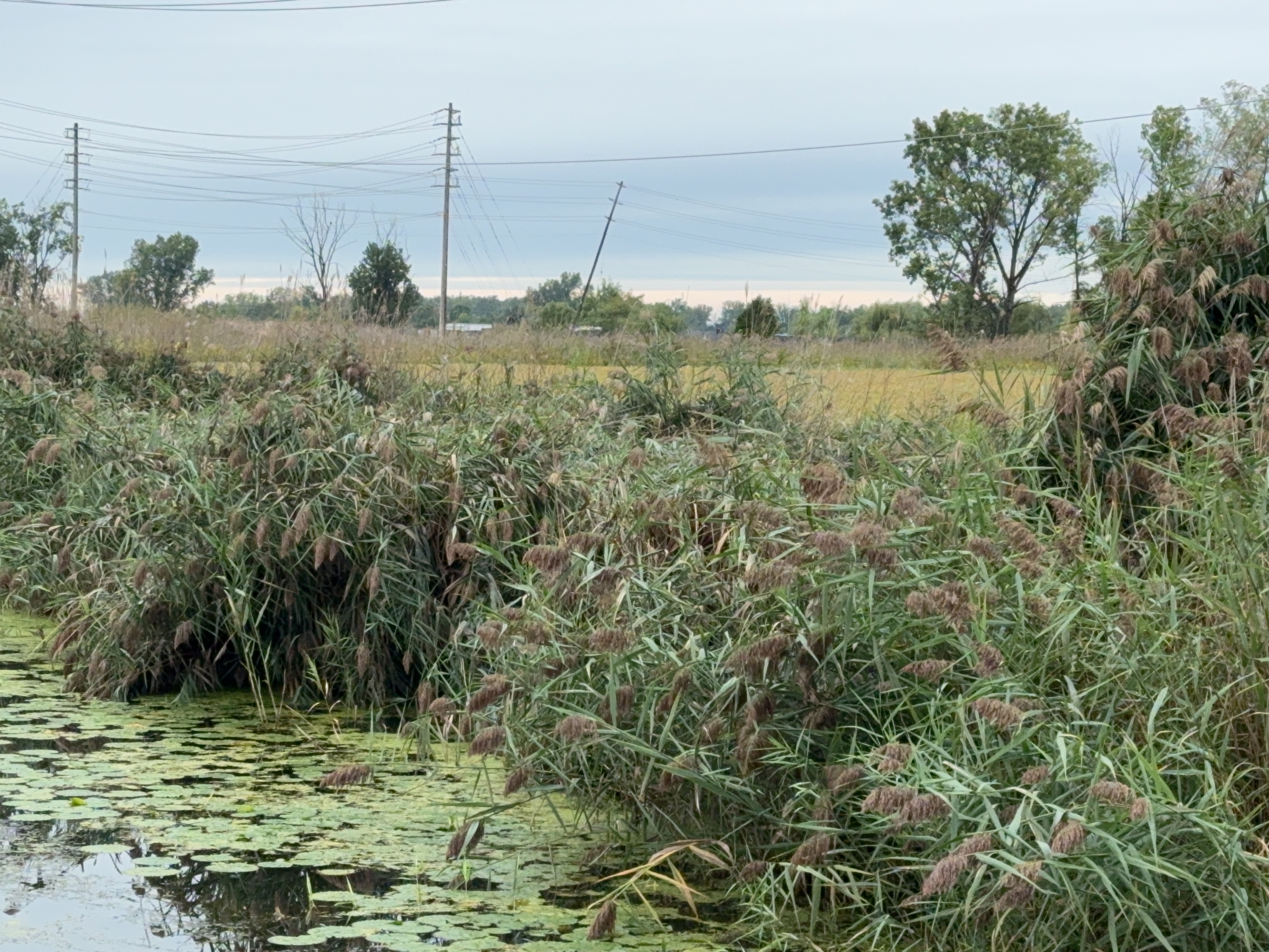
Photo of part of large area of phragmites blown over and leaning power pole near the start of the tornado track.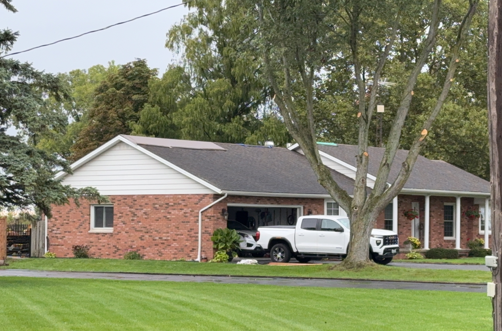
Worst damage point with shingle damage (tarped) and tree damage (cleaned up).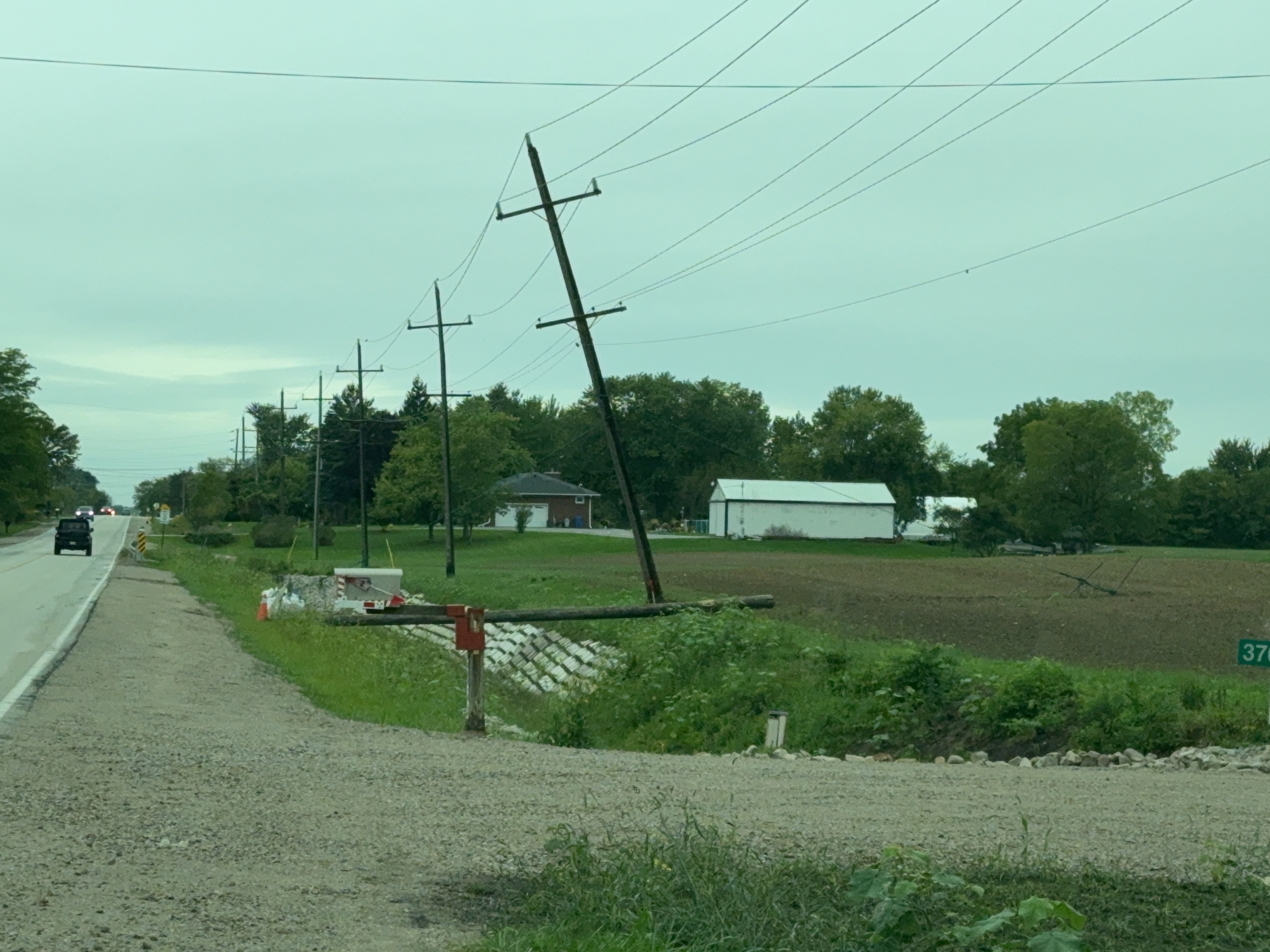
Photo of leaning power pole near the end of the tornado track, held up by guy wires and about to be replaced.
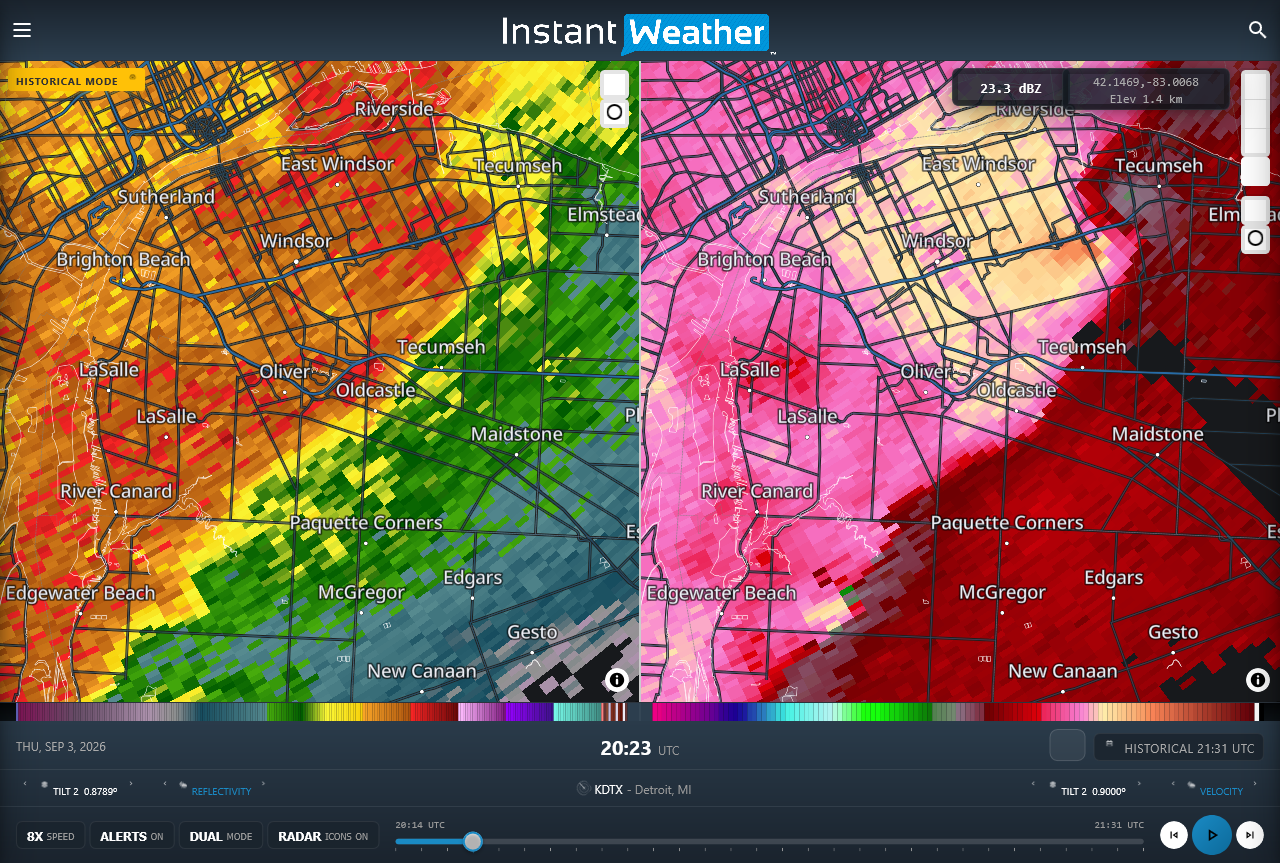
DTX radar image showing reflectivity (left) and Doppler radial velocity (right) products at the time of the River Canard EF0 tornado. Note the area of compact rotation at lower left just to the southeast of River Canard with green indicating winds toward the radar and yellow indicating winds away from the radar. Note that the Windsor EF1 tornado was still ongoing at this time, and a more broad area of rotation is shown at top right southwest of Tecumseh.





