Additional SK tornadoes from July 10
The NTP has confirmed an additional six tornadoes from July 10 in southern Saskatchewan. Three of these were confirmed soley on the basis of submitted photos and video plus radar analysis. Another three were investigated by an NTP damage survey team. All were rated EF0-Default or EF0.
Full details are available with the event summaries below, along with a regional map, survey summary maps, and survey photos. The events can also be plotted on a map using the NTP Dashboard here.
Special thanks to Travis Farncombe for assistance with the Dundurn and Herzel tornadoes, and to NTP Super-Contributor Francis Lavigne-Theriault for assistance with the Cupar tornadoes.
====
Event Name: Dundurn, SK
Date: July 10, 2026
Start Time: 3:58 PM CST (2158 UTC)
Final Classification: Tornado (Over Land)
Final EF-Scale Rating: EF0-Default
Estimated Tornado Location: 51.78N, 106.53W
Description: Witnesses captured video and photos of a tornado south of Dundurn. With no damage reported or visible during satellite imagery review, event assessed as default EF0. Information available insufficient to accurately estimate track length, max. path width and tornado motion. Start time is based on witness report.
Event Name: Cupar (1), SK
Date: July 10, 2026
Start Time: 8:35 PM CST (0235 UTC)
Final Classification: Tornado (over land)
Final EF-Scale Rating: EF0
EF-Scale Damage Indicator / Degree of Damage: C-T/DOD-3
Start of damage track: 51.0433N, 104.1485W
End of damage track: 51.0492N, 104.1102W
Location of worst damage: 51.0502N, 104.1236W
Description: Witness captured video of a tornado northeast of Cupar. A second tornado developed shortly after to the northwest. Damage to trees and a horse corral was reported in the area of the first tornado. No injuries were reported. An NTP ground and drone survey was completed on July 16, 2026, documenting the reported damage and additional tree damage from the first tornado. Satellite imagery review did not reveal any visible damage. Damage assessed as EF0 tornado, with an estimated max. wind speed of 115 km/h, track length of 2.92 km and max. path width of 90 m. Tornado motion was from the WSW (approx. 255 degrees). Start time is based on witness report. No damage was reported or discovered in the area of the second tornado (Cupar (2)).
Event Name: Cupar (2), SK
Date: July 10, 2026
Start Time: 8:36 PM CST (0236 UTC)
Final Classification: Tornado (Over Land)
Final EF-Scale Rating: EF0-Default
Estimated Tornado Location: 51.06N, 104.21W
Description: Witnesses captured video of two tornadoes north of Cupar. Damage was reported in the area of the first tornado, however no damage was reported in the area of the second tornado. An NTP ground and drone survey in the area on July 16, 2026, did not discover any damage in the area of the second tornado. Satellite imagery review did not reveal any visible damage. Tornado is assessed as default EF0, and information available insufficient to accurately estimate track length, max. path width and tornado motion. Start time is based on witness report. The first tornado (Cupar (1)) caused EF0 damage.
Event Name: Leross (1), SK
Date: July 10, 2026
Start Time: 8:38 PM CST (0238 UTC)
Final Classification: Tornado (over land)
Final EF-Scale Rating: EF0
EF-Scale Damage Indicator / Degree of Damage: C-T/DOD-3
Estimated start of tornado: 51.244N, 103.863W
End of damage track: 51.2469N, 103.8219W
Location of worst damage: 51.2470N, 103.8227W
Description: Witnesses captured video of a tornado south of Leross. A second tornado developed a short time later northeast of Leross. No damage and no injuries were reported in either area. An NTP ground and drone survey was completed on July 16, 2026, discovering some weak tree and crop damage in the area of the first tornado. Satellite imagery review did not reveal any visible damage. Damage assessed as EF0 tornado, with an estimated max. wind speed of 115 km/h, track length of 2.91 km and max. path width of 70 m. Tornado motion was from the W (approx. 265 degrees). Start time is based on witness report.
Event Name: Leross (2), SK
Date: July 10, 2026
Start Time: 8:45 PM CST (0245 UTC)
Final Classification: Tornado (over land)
Final EF-Scale Rating: EF0
EF-Scale Damage Indicator / Degree of Damage: C-T/DOD-3
Estimated start of tornado: 51.330N, 103.847W
End of damage track: 51.3368N, 103.8337W
Location of worst damage: 51.3356N, 103.8358W
Description: Witness captured video of a tornado northeast of Leross. An earlier tornado developed south of Leross. No damage and no injuries were reported in either area. An NTP ground and drone survey was completed on July 16, 2026, discovering some weak tree and crop damage in the area of the second tornado. Satellite imagery review revealed some visible crop damage. Damage assessed as EF0 tornado, with an estimated max. wind speed of 115 km/h, track length of 1.21 km and max. path width of 40 m. Tornado motion was from the SW (approx. 230 degrees). Start time is based on witness report.
Event Name: Herzel, SK
Date: July 10, 2026
Start Time: 9:28 PM CST (0328 UTC)
Final Classification: Tornado (Over Land)
Final EF-Scale Rating: EF0-Default
Estimated Tornado Location: 51.04N, 103.74W
Description: Witnesses captured video and photos of a tornado northwest of Herzel. With no damage reported or visible during satellite imagery review, event assessed as default EF0. Information available insufficient to accurately estimate track length, max. path width and tornado motion. Start time is based on witness report.
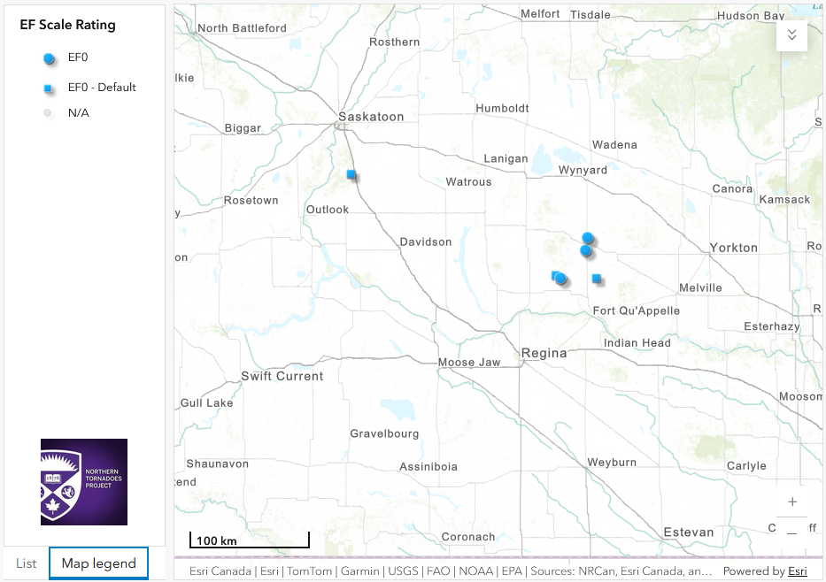
Regional map showing the start locations of the six additional tornadoes in southern SK.
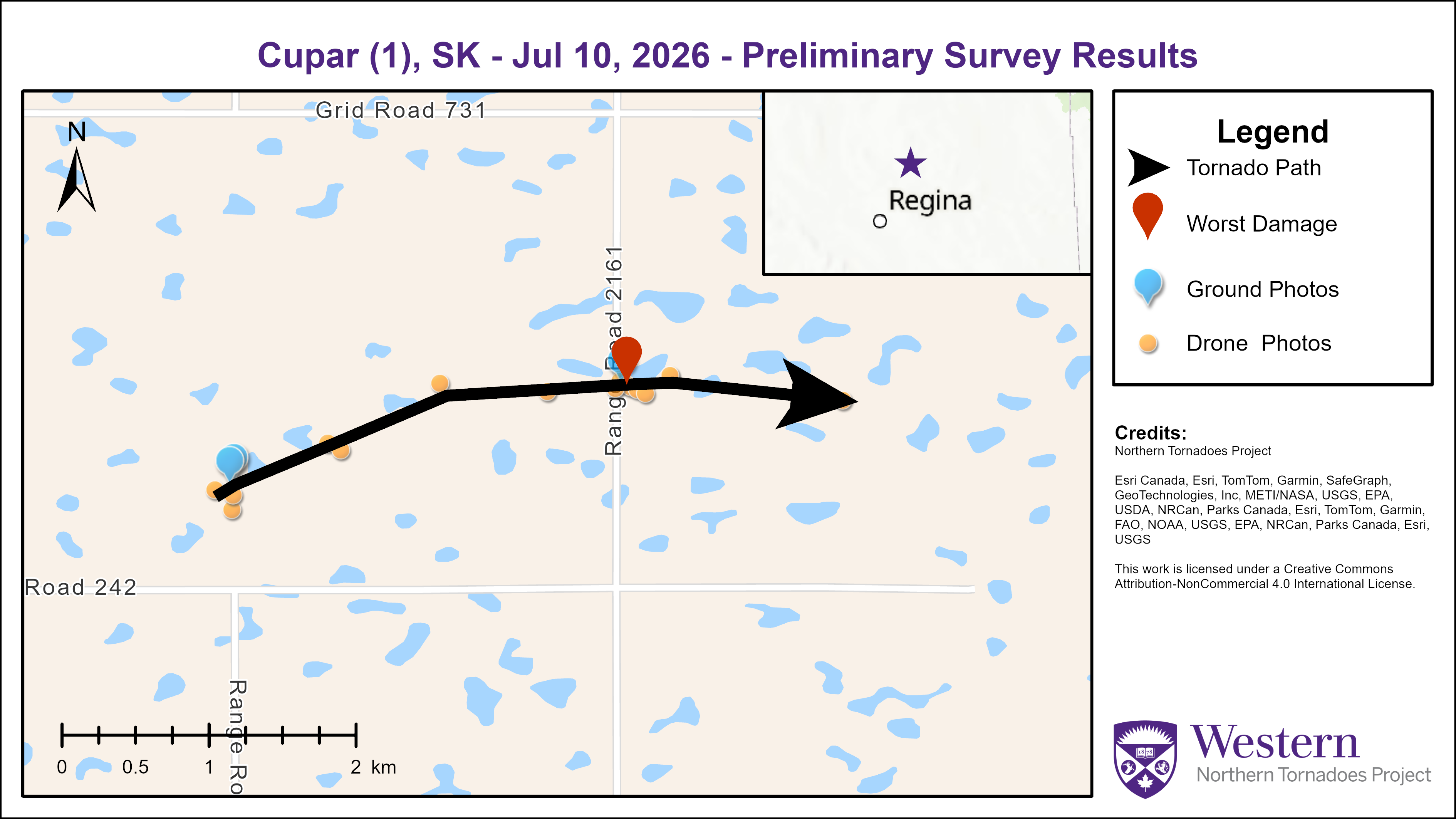
Survey summary map for the Cupar(1) EF0 tornado.
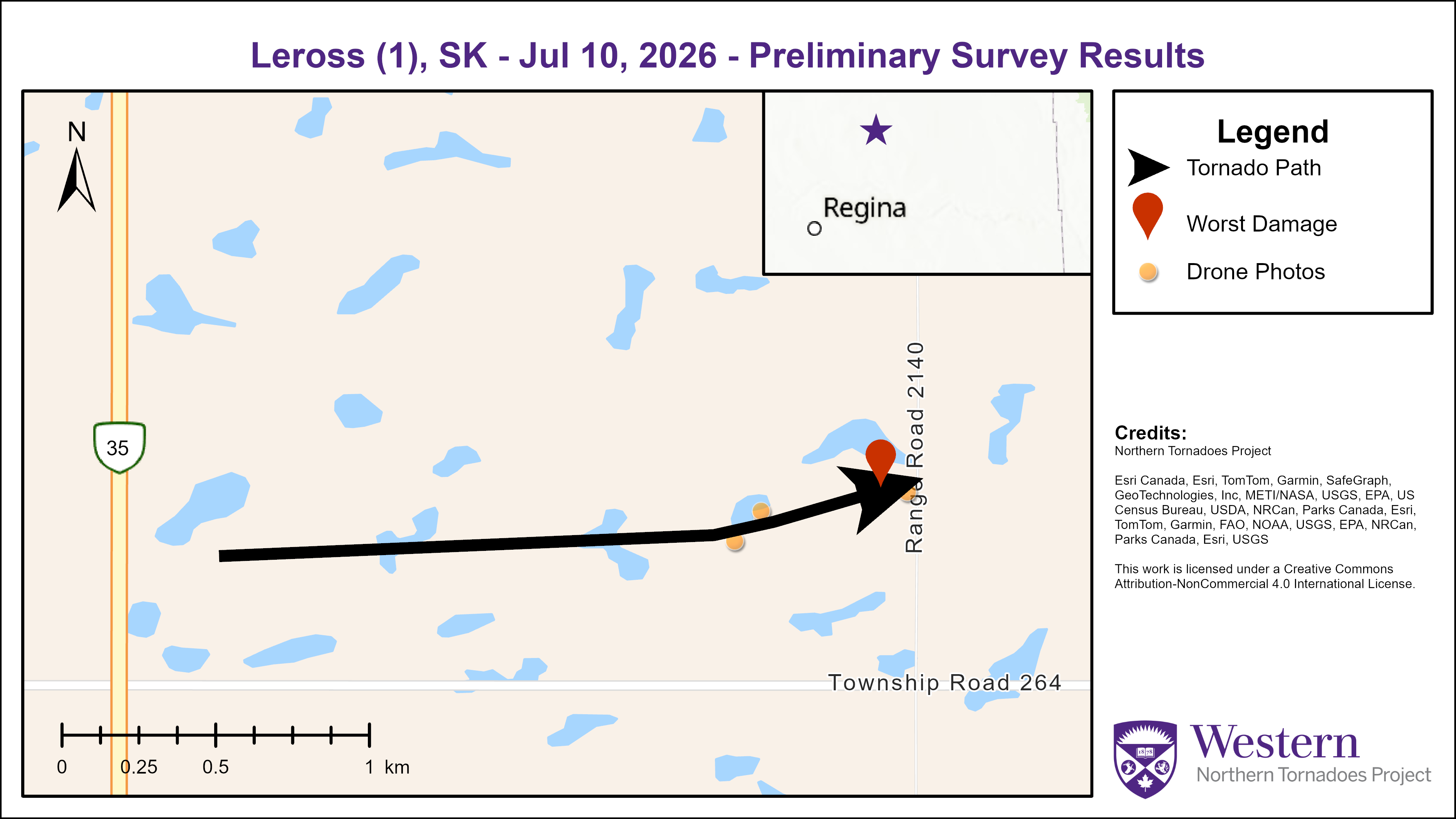
Survey summary map for the Leross(1) EF0 tornado.
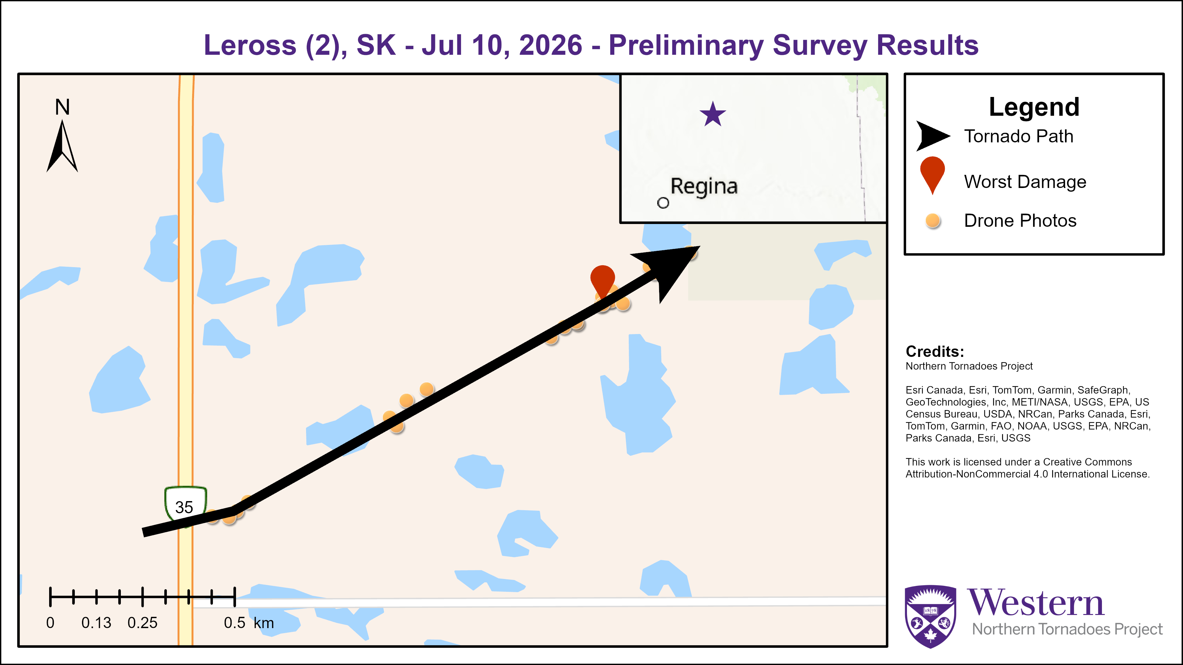
Survey summary map for the Leross(2) EF0 tornado.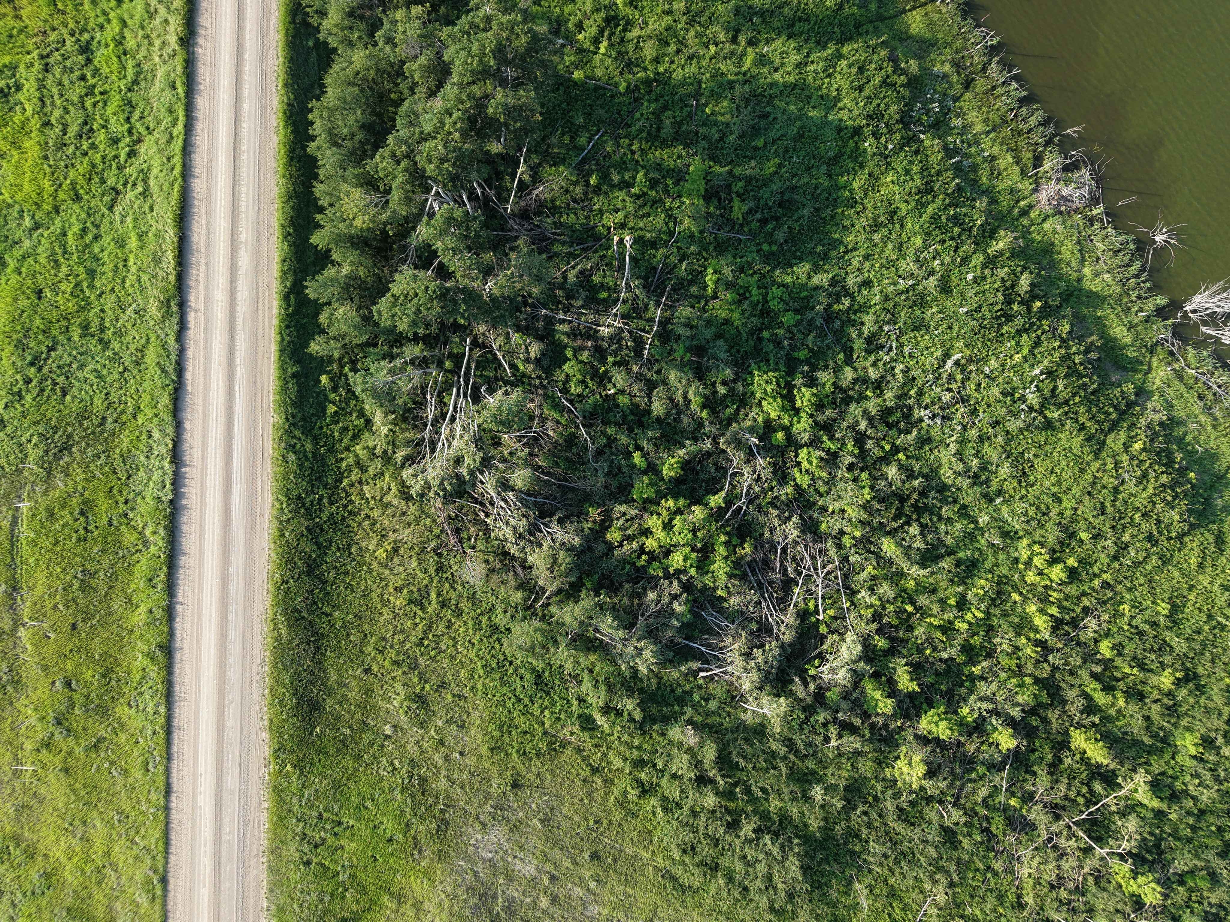
Drone photo of tree damage caused by the EF0 tornado at Cupar(1).
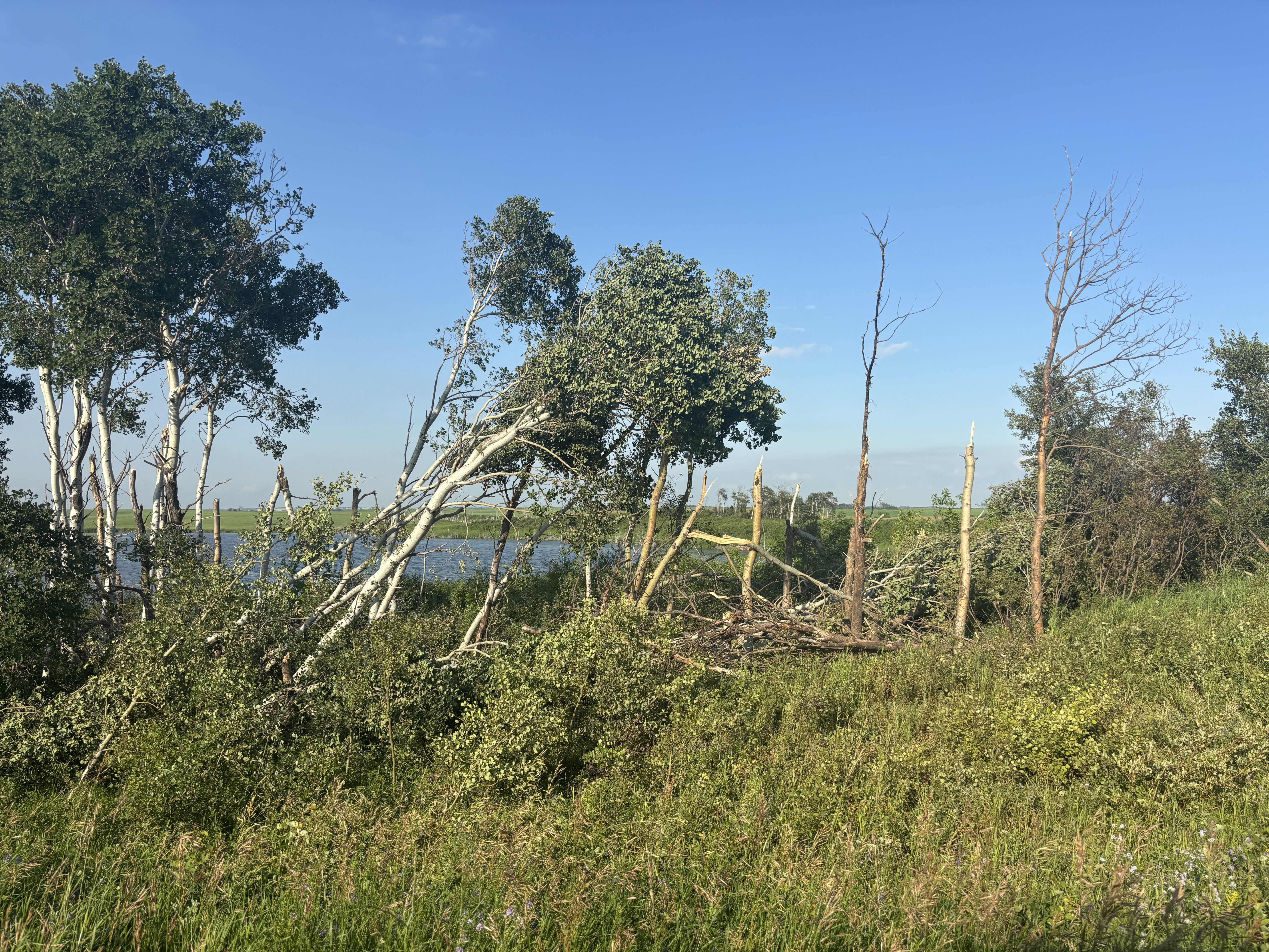
Ground photo of tree damage caused by the Cupar(1) EF0 tornado.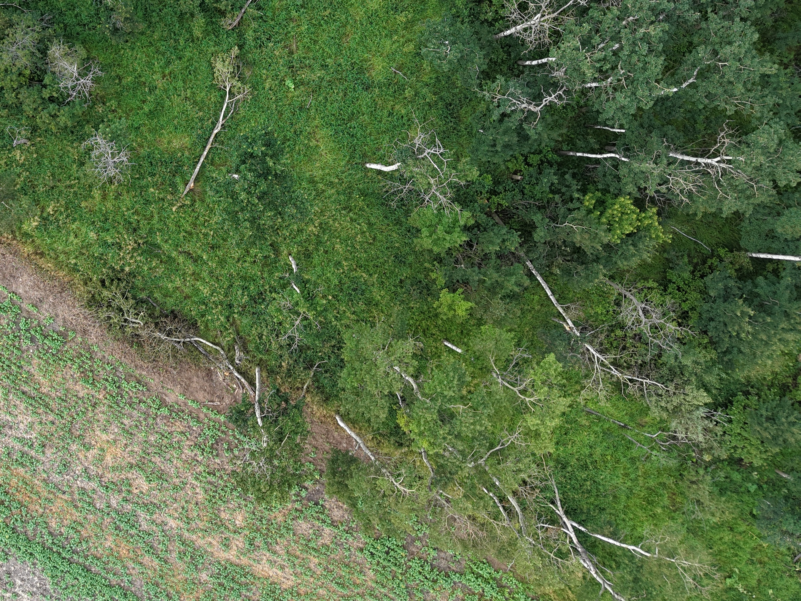
Drone photo of tree damage caused by the Leross(1) EF0 tornado.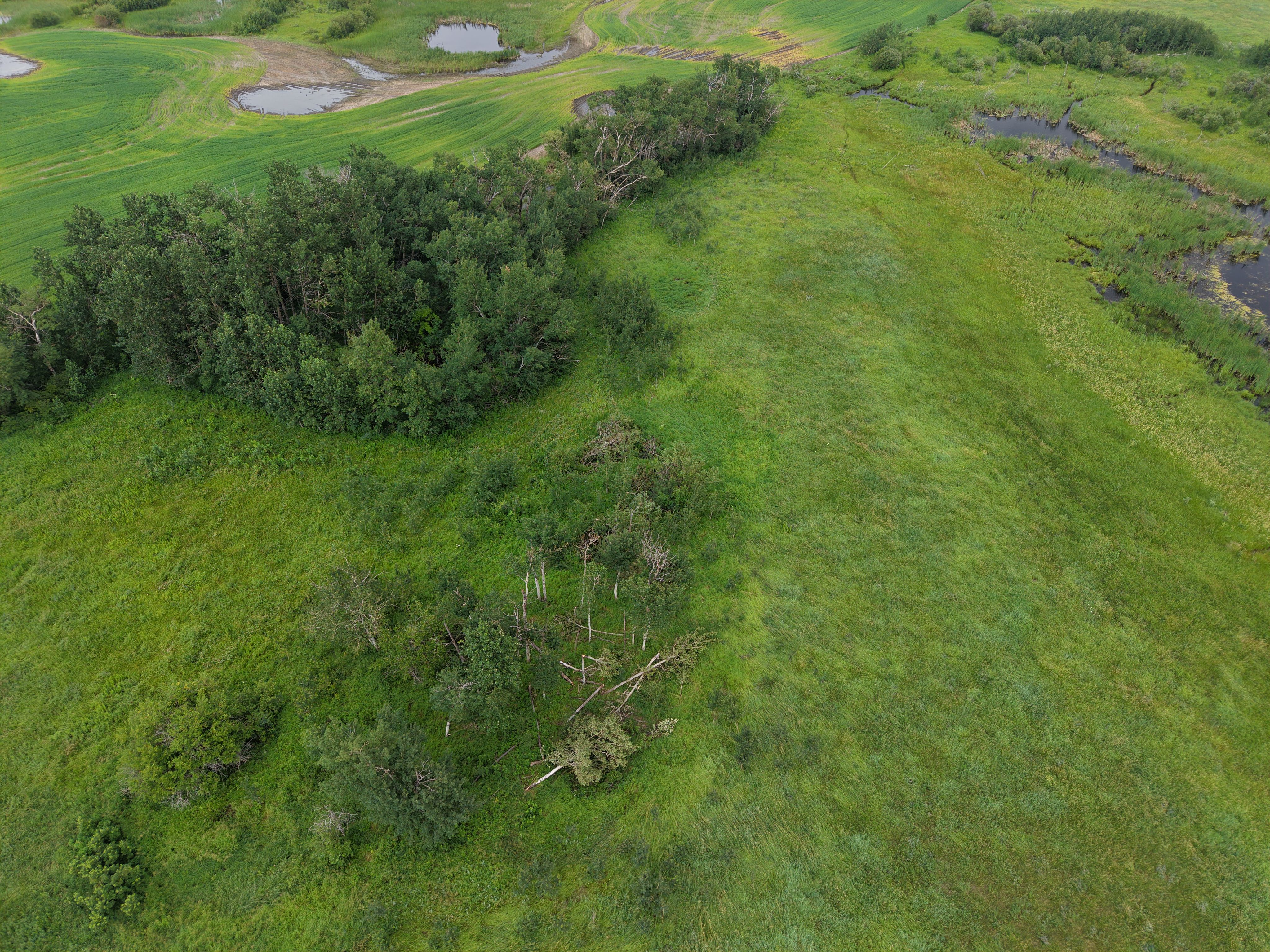
Drone photo of tree damage caused by the Leross(2) EF0 tornado.





