Additional SK tornadoes from July 11
The NTP has confirmed an additional seven tornadoes from July 11 in southern Saskatchewan.
Two of these were confirmed soley based on submitted photos and video plus radar analysis and were assigned an EF0-Default rating after no damage was reported or found via surveys. The other five were investigated by an NTP damage survey team, and assigned damage ratings of EF0 or EF1.
Full details are available with the event summaries below, along with a regional map, survey summary maps, and survey photos. The events can also be plotted on a map using the NTP Dashboard here.
====
Event Name: Glaslyn (1), SK
Date: July, 11, 2026
Start Time: 7:20 PM CST (0120 UTC)
Final Classification: Tornado (Over Land)
Final EF-Scale Rating: EF0-Default
Estimated Tornado Location: 53.32N, 108.40W
Description: Witnesses captured video and photos of two tornadoes southeast of Glaslyn. No damage was reported. An NTP ground and drone survey team searched for damage in the area but found none. With no damage discovered or visible during satellite imagery review, event assessed as default EF0. Information available insufficient to accurately estimate track length, max. path width and tornado motion. Start time is estimated based on witness report.
Event Name: Glaslyn (2), SK
Date: July 11, 2026
Start Time: 7:22 PM CST (0122 UTC)
Final Classification: Tornado (Over Land)
Final EF-Scale Rating: EF0-Default
Estimated Tornado Location: 53.31N, 108.38W
Description: Witnesses captured video and photos of two tornadoes southeast of Glaslyn. No damage was reported. An NTP ground and drone survey team searched for damage in the area but found none. With no damage discovered or visible during satellite imagery review, event assessed as default EF0. Information available insufficient to accurately estimate track length, max. path width and tornado motion. Start time is based on witness report.
Event Name: Klein Lake, SK
Date: July 11, 2026
Start Time: 7:50 PM CST (0150 UTC)
Final Classification: Tornado (over land)
Final EF-Scale Rating: EF0
EF-Scale Damage Indicator / Degree of Damage: SBO/DOD-3
Start of damage track: 53.3946N, 108.0206W
End of damage track: 53.3720N, 107.9343W
Location of worst damage: 53.3749N, 107.9443W
Description: Witness reported a tornado and captured video of the associated vortex-funnel cloud aloft west of Belbutte. Damage to a large shop, trees and a fence at a farm property was later reported. No injuries were reported. An NTP ground and drone survey was completed on July 15, 2026, documenting the reported damage along with additional tree damage starting near Klein Lake. Satellite imagery review revealed some isolated areas of tree damage. Damage assessed as EF0 tornado, with an estimated max. wind speed of 130 km/h, track length of 6.31 km and max. path width of 230 m. Tornado motion was from the WNW (approx. 295 degrees). Start time is based on witness report.
Event Name: Spiritwood, SK
Date: July 11, 2026
Start Time: 8:15 PM CST (0215 UTC)
Final Classification: Tornado (over land)
Final EF-Scale Rating: EF0
EF-Scale Damage Indicator / Degree of Damage: C-T/DOD-3
Start of damage track: 53.3649N, 107.5657W
End of damage track: 53.3656N, 107.5486W
Location of worst damage: 53.3655N, 107.5492W
Description: Witnesses captured video and photos of a tornado west of Spiritwood. No damage was reported. An NTP ground and drone survey team visited the area on July 15, 2026, discovering a path of tree damage. Satellite imagery review did not reveal any visible damage. Damage assessed as EF0 tornado, with an estimated max. wind speed of 115 km/h, track length of 1.18 km and max. path width of 70 m. Tornado motion was from the W (approx. 265 degrees). Start time is based on witness report.
Event Name: Hatherleigh, SK
Date: July 11, 2026
Start Time: 8:30 PM CST (0230 UTC)
Final Classification: Tornado (over land)
Preliminary EF-Scale Rating: EF1
EF-Scale Damage Indicator / Degree of Damage: C-T/DOD-5
Start of damage track: 53.0220N, 108.1064W
End of damage track: 52.9947N, 108.0277W
Location of worst damage: 53.0131N, 108.0655W
Description: Witnesses reported a tornado and captured video of the associated vortex-funnel cloud aloft near Hatherleigh, where tree damage was later reported. No injuries were reported. An NTP ground and drone survey was completed on July 15, 2026, documenting a path of tree damage, along with roof damage to a home. Satellite imagery review revealed visible tree damage along the path. Damage assessed as EF1 tornado, with an estimated max. wind speed of 145 km/h, track length of 6.07 km and max. path width of 350 m. Tornado motion was from the WNW (approx. 300 degrees). Start time is radar estimated.
Event Name: Mildred (1), SK
Date: July 11, 2026
Start Time: 8:30 PM CST (0230 UTC)
Final Classification: Tornado (over land)
Final EF-Scale Rating: EF0
EF-Scale Damage Indicator / Degree of Damage: C-T/DOD-3
Start of damage track: 53.3438N, 107.4268W
End of damage track: 53.3563N, 107.4073W
Location of worst damage: 53.3533N, 107.4176W
Description: Tree damage was reported in the Mildred area after a storm passed through. An NTP ground and drone survey team visited the area on July 15, 2026, discovering a path of tree damage west of Mildred (a second path of damage northeast of Mildred from a later tornado was also discovered). Satellite imagery review revealed isolated areas of tree damage. Damage west of Mildred assessed as EF0 tornado, with an estimated max. wind speed of 115 km/h, track length of 2.02 km and max. path width of 160 m. Tornado motion was from the SW (approx. 225 degrees). Start time is radar estimated.
Event Name: Mildred (2), SK
Date: July 11, 2026
Start Time: 8:40 PM CST (0240 UTC)
Final Classification: Tornado (over land)
Final EF-Scale Rating: EF0
EF-Scale Damage Indicator / Degree of Damage: C-T/DOD-3
Start of damage track: 53.3615N, 107.3212W
End of damage track: 53.3685N, 107.2952W
Location of worst damage: 53.3629N, 107.3185W
Description: Tree damage was reported in the Mildred area after a storm passed through. An NTP ground and drone survey team visited the area on July 15, 2026, discovering a path of damage northeast of Mildred (an earlier tornado caused tree damage west of Mildred as well). Damage to trees and a grain bin was documented. Satellite imagery review did not reveal any visible damage. Damage northeast of Mildred assessed as EF0 tornado, with an estimated max. wind speed of 115 km/h, track length of 1.90 km and max. path width of 150 m. Tornado motion was from the WSW (approx. 245 degrees). Start time is radar estimated.
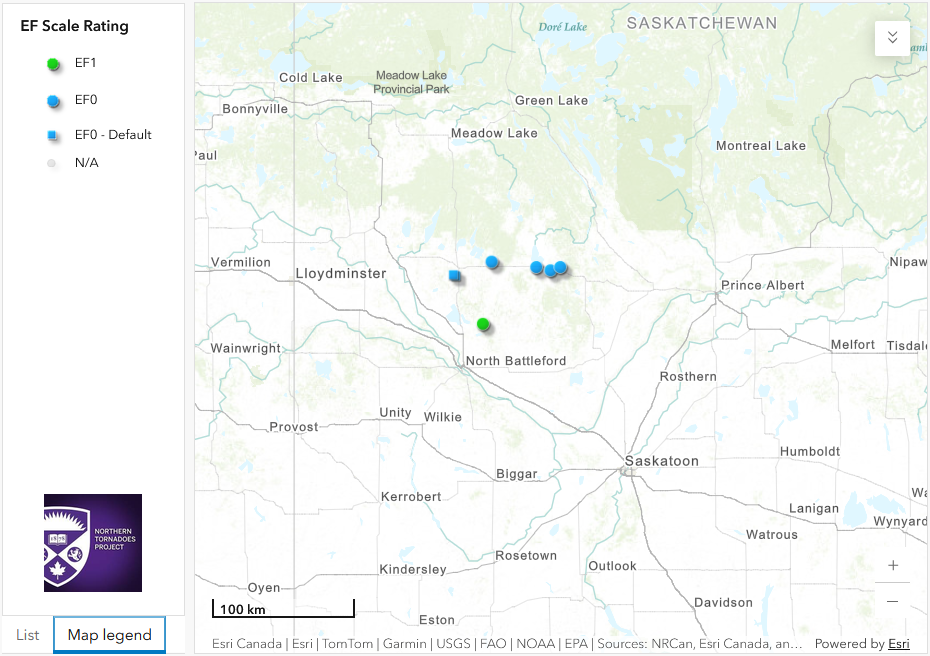
Regional map showing the start locations of the seven additional tornadoes for July 11 in southern SK.
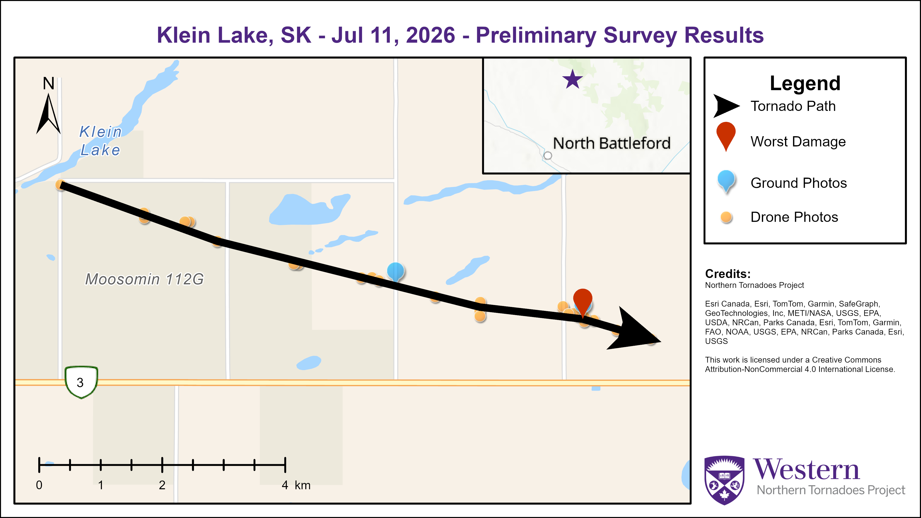
Survey summary map for the Klein Lake EF0 tornado.
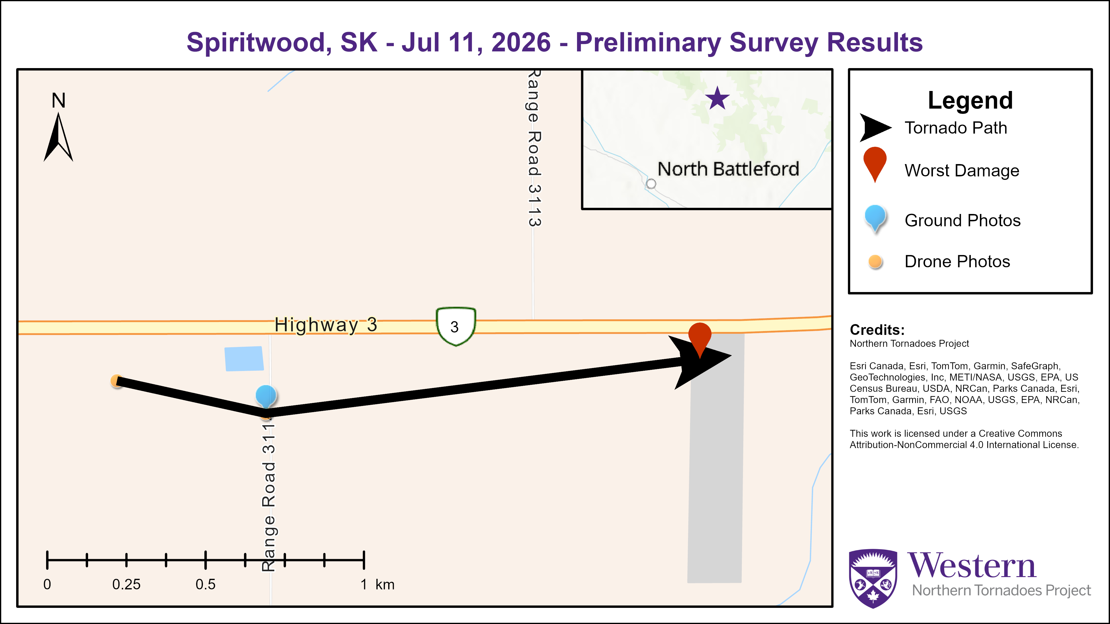
Survey summary map for the Spiritwood EF0 tornado.
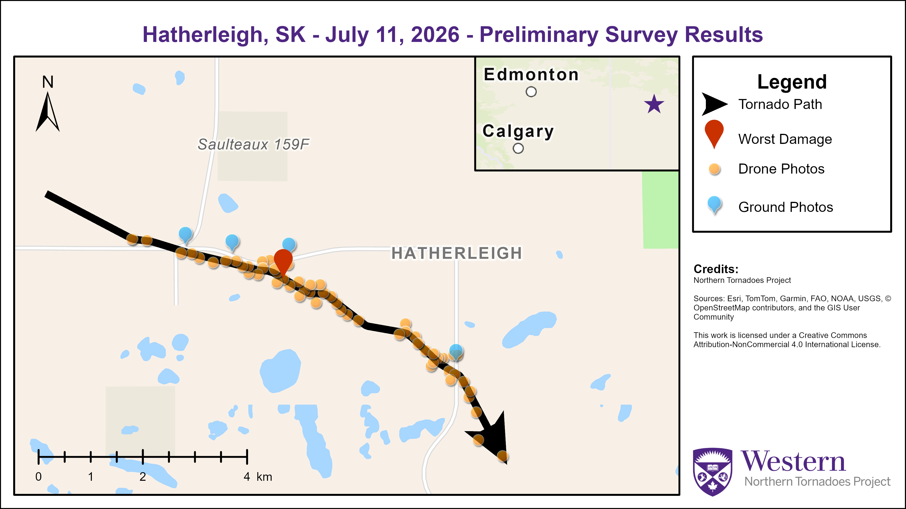
Survey summary map for the Hatherleigh EF1 tornado.
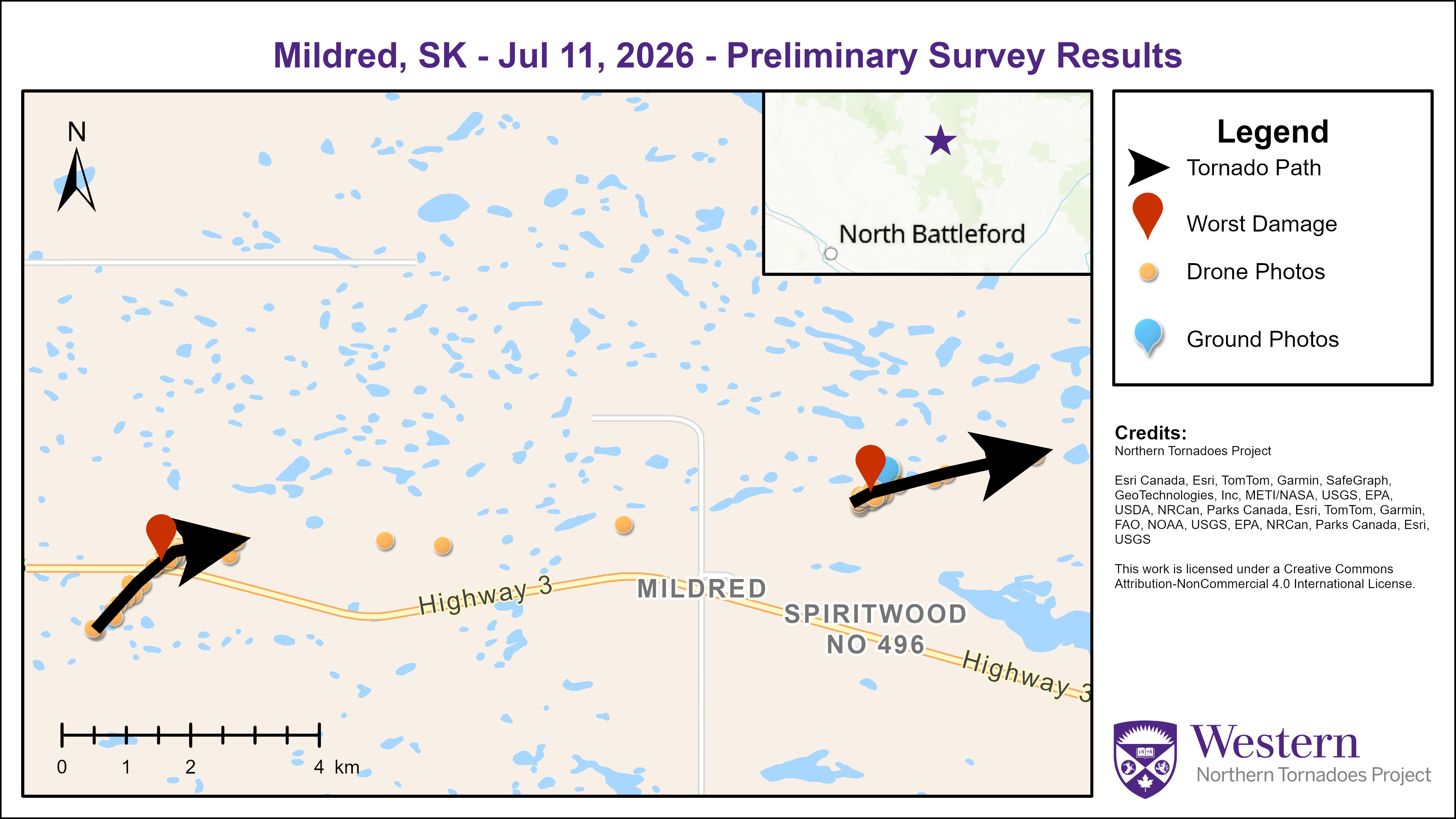
Survey summary map showing the tracks of the two Mildred-area EF0 tornadoes.

Ground photo of damage to an outbuilding caused by the Klein EF0 tornado.
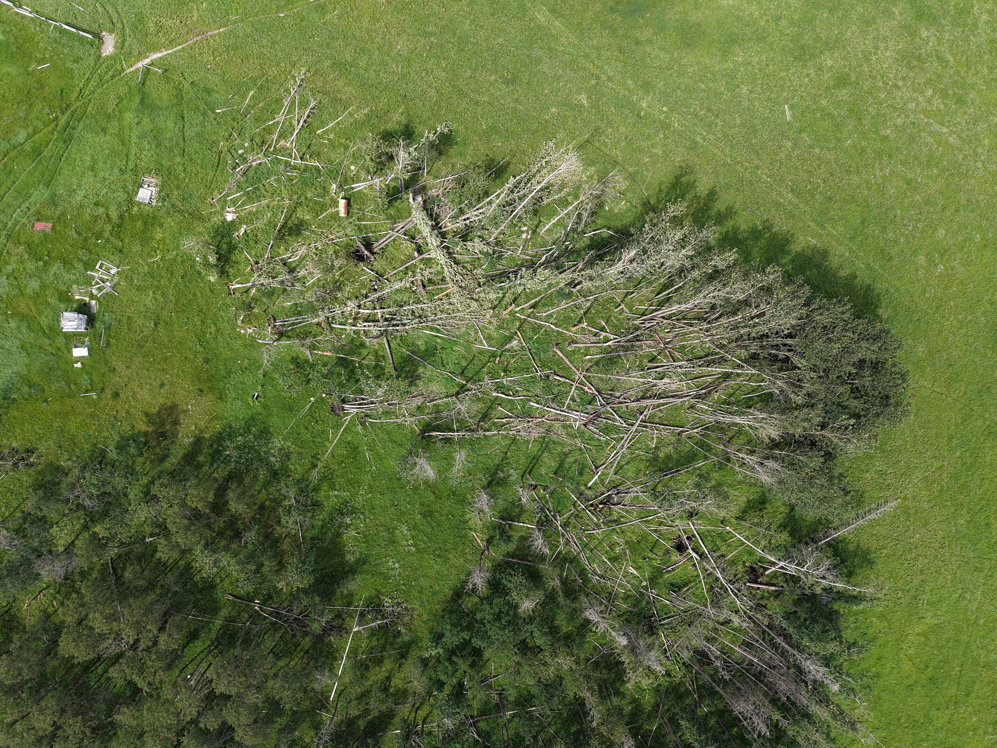
Nadir drone photo of tree damage caused by the Klein EF0 tornado.
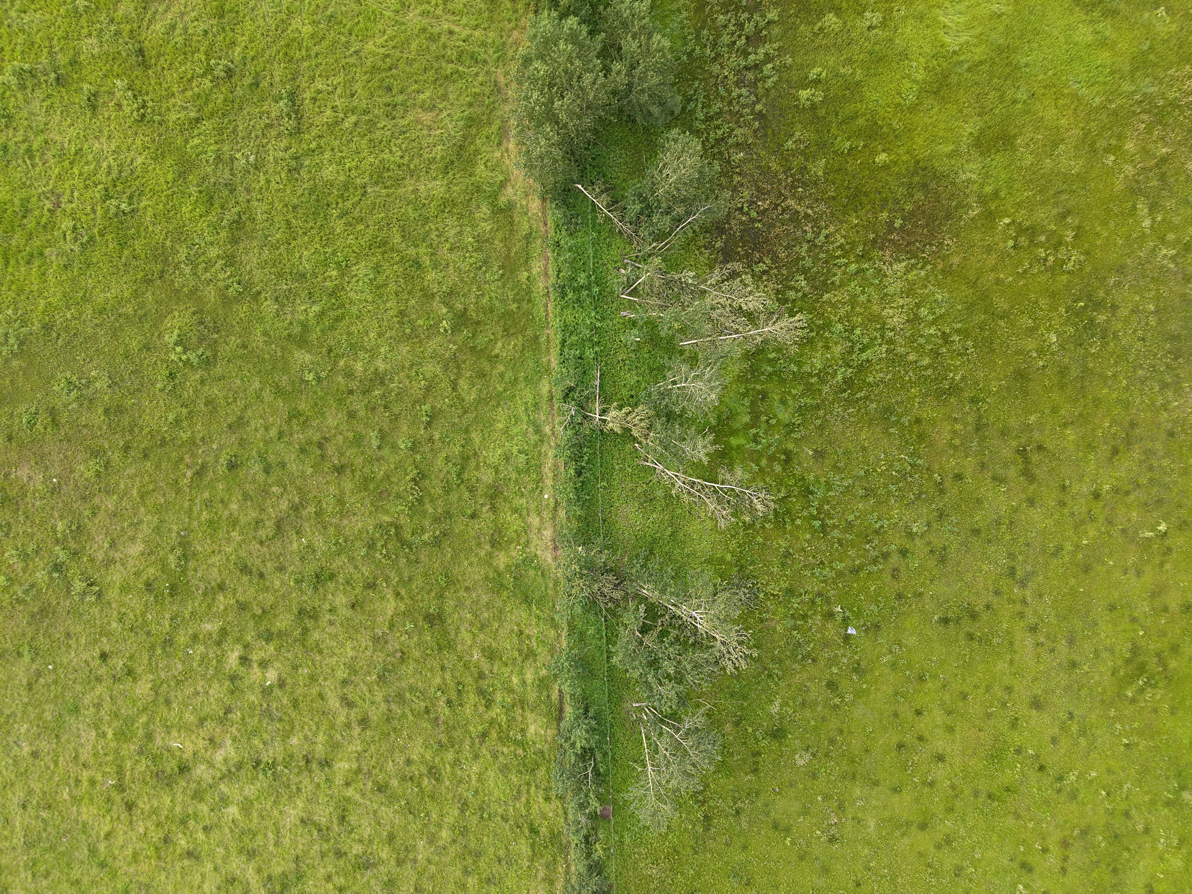
Nadir drone photo of tree damage caused by the Spiritwood EF0 tornado.
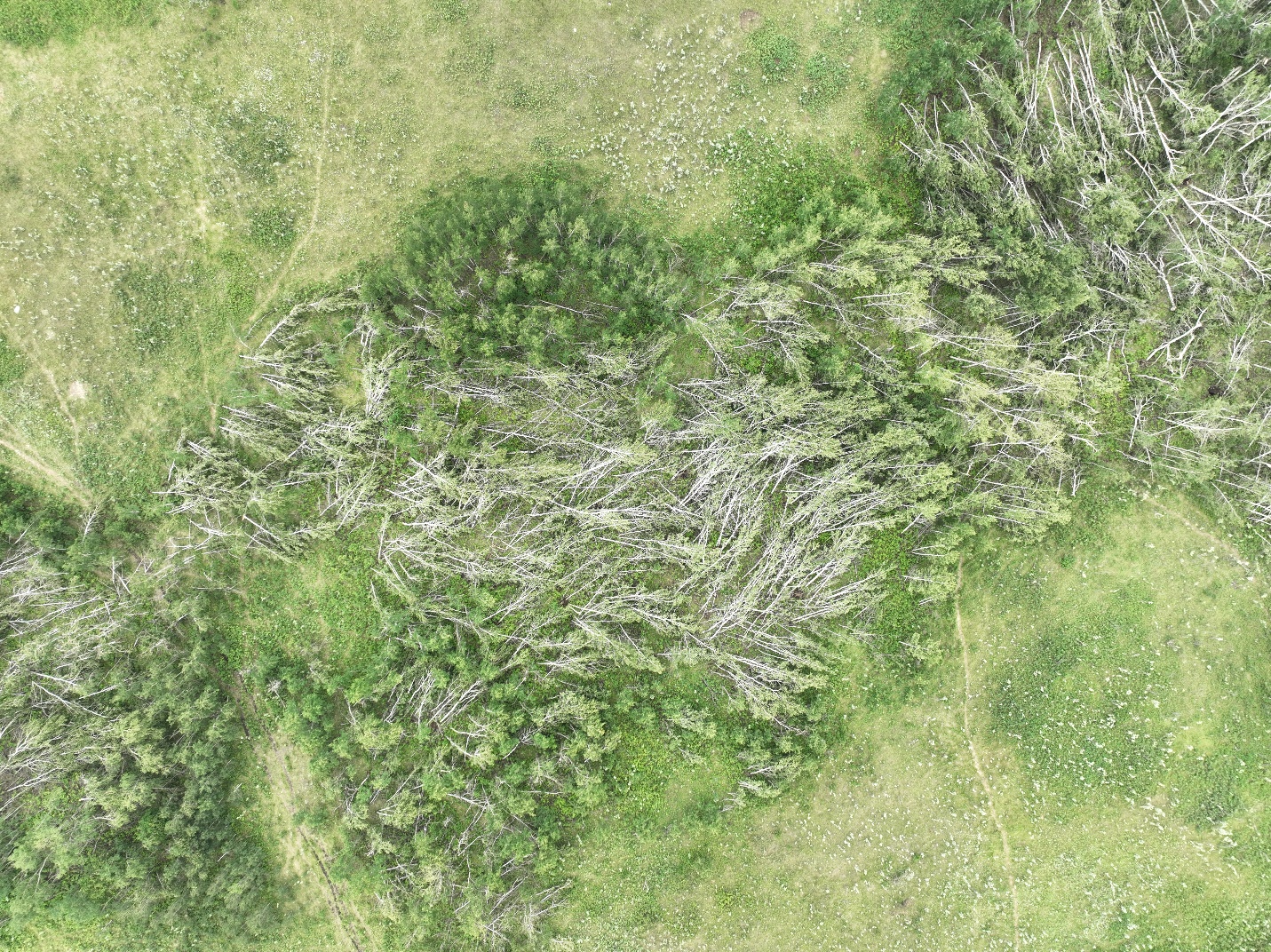
Nadir drone photo of the worst tree damage for the Hatherleigh EF1 tornado, showing an area of forest that was mostly uprooted/snapped by the tornado.
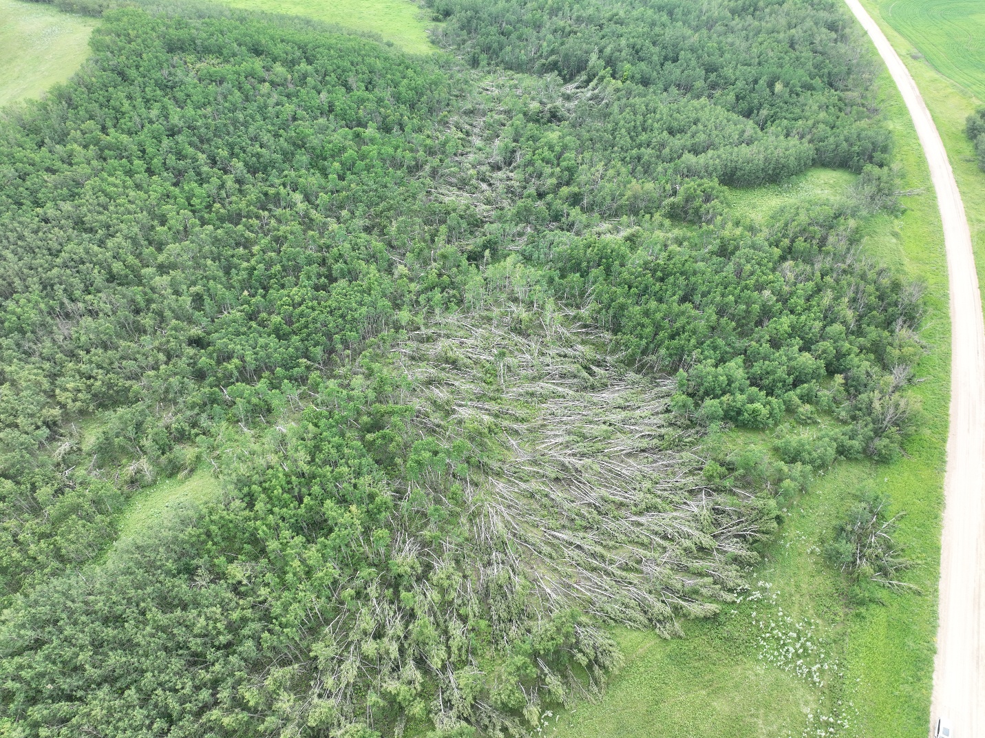
Oblique drone photo showing a swath of significant tree damage extending into the distance.
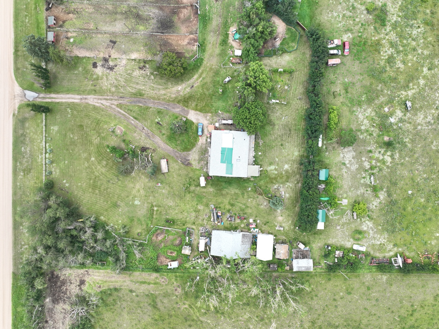
Drone photo of roof damage to a house that has been covered by a tarp.

Drone photo of tree damage with the Mildred(1) EF0 tornado.
Drone photo of grain bin and tree damage with the Mildred(1) EF0 tornado.
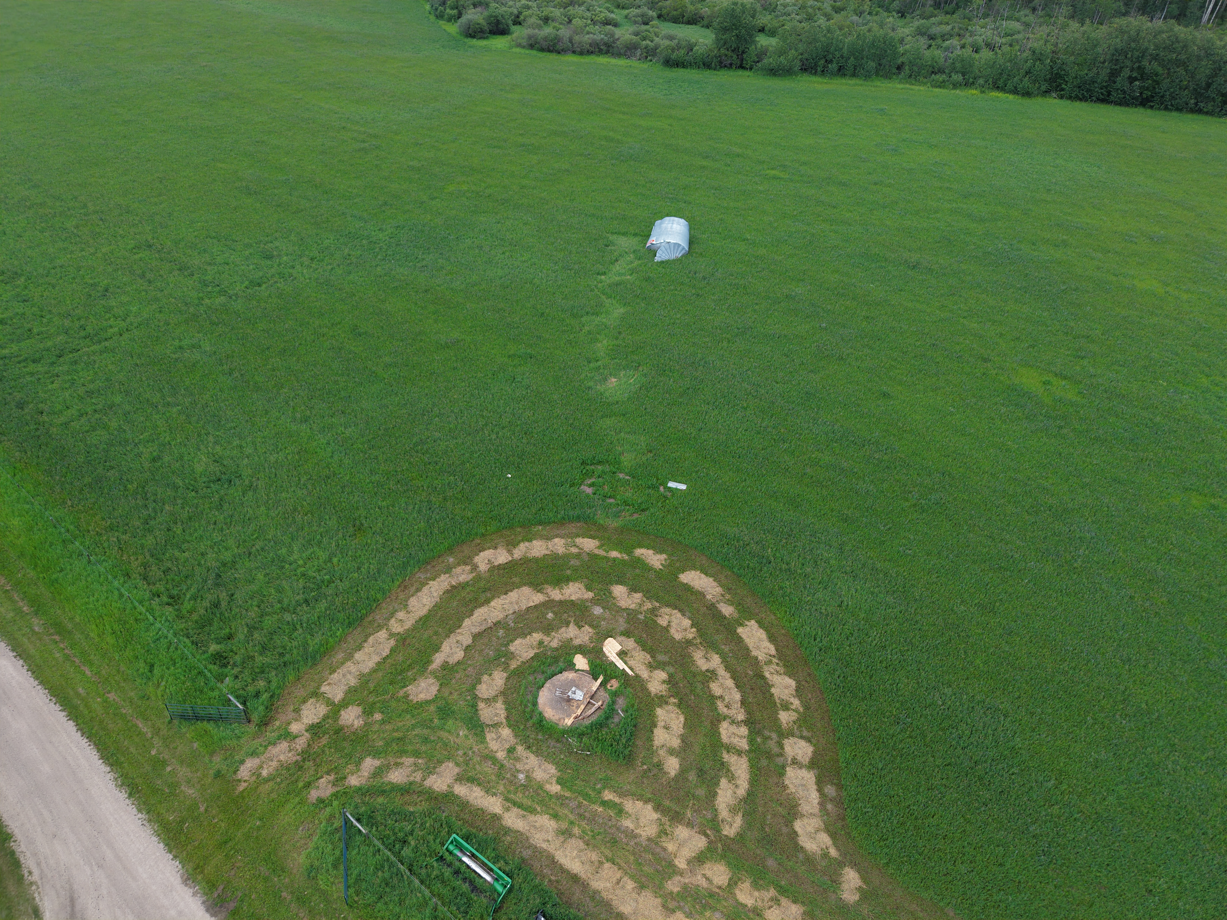
Oblique drone photo of a grain bin that was rolled through a field by the Mildred(2) EF0 tornado. The marks in the field are from the grain bin rolling, and the original location of the grain bin is at bottom centre of the photo.
Nadir drone photo showing convergent tree damage near a house caused by the Mildred(2) EF0 tornado.





