Two weak tornadoes in QC on June 19
The NTP, after a thorough ground and drone survey, is confirming that two weak tornadoes occurred in the Eastern Townships region of Quebec on June 19. Based on the damage with these events, the first tornado at Lefebvre has been assigned an EF0 rating and the second tornado at Danville has been assigned an EF1 rating.
Details are provided in the summaries below, along with regional and survey maps and images from the survey. The tornadoes can be plotted on a map using the NTP Dashboard here.
====
Event Name: Lefebvre, QC
Date: June 19, 2025
Start Time: 3:20 PM EDT (1920 UTC)
Final Classification: Tornado (Over Land)
Final EF-Scale Rating: EF0
EF-Scale Damage Indicator / Degree of Damage: C-T/DOD-3
Start of damage track: 45.7309N, 72.4440W
End of damage track: 45.7224N, 72.3706W
Location of worst damage: 45.7253N, 72.4048W
Description: Witness captured video of a tornado north of Lefebvre, where tree damage was later reported. No injuries were reported. An NTP ground and drone survey was completed on June 21, 2025, documenting a track of weak tree damage. Damage assessed as EF0 tornado, with an estimated max. wind speed of 115 km/h, track length of 5.84 km and max. path width of 230 m. Tornado motion was from the W (approx. 280 degrees). Start time is radar estimated.
Event Name: Danville, QC
Date: June 19, 2025
Start Time: 3:45 PM EDT (1945 UTC)
Final Classification: Tornado (Over Land)
Final EF-Scale Rating: EF1
EF-Scale Damage Indicator / Degree of Damage: FR12/DOD-4
Start of damage track: 45.7574N, 72.1751W
End of damage track: 45.7800N, 72.0002W
Location of worst damage: 45.7807N, 72.0202W
Description: Witnesses captured video of a funnel cloud near Danville (partially obscured by topography), where damage to a barn, homes, trees and trailers was also reported. No injuries were reported. An NTP ground and drone survey was completed on June 21, 2025, documenting the track and additional tree damage. Damage assessed as EF1 tornado, with an estimated max. wind speed of 155 km/h, track length of 14.0 km and max. path width of 400 m. Tornado motion was from the W (approx. 260 degrees). Start time is radar estimated.
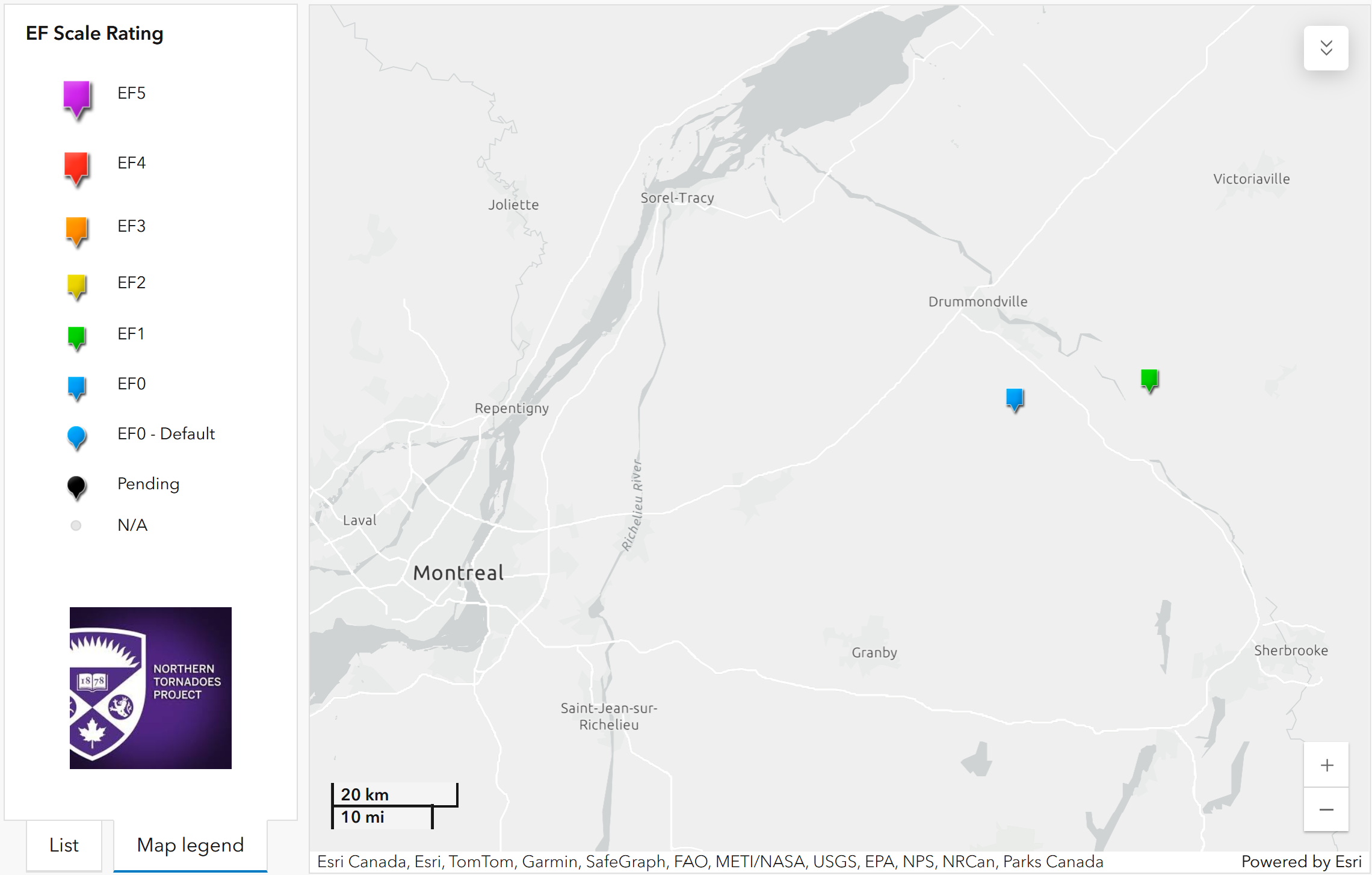
Regional map showing the start locations for the two QC tornadoes - Lefebvre EF0 (left) and Danville EF1 (right)
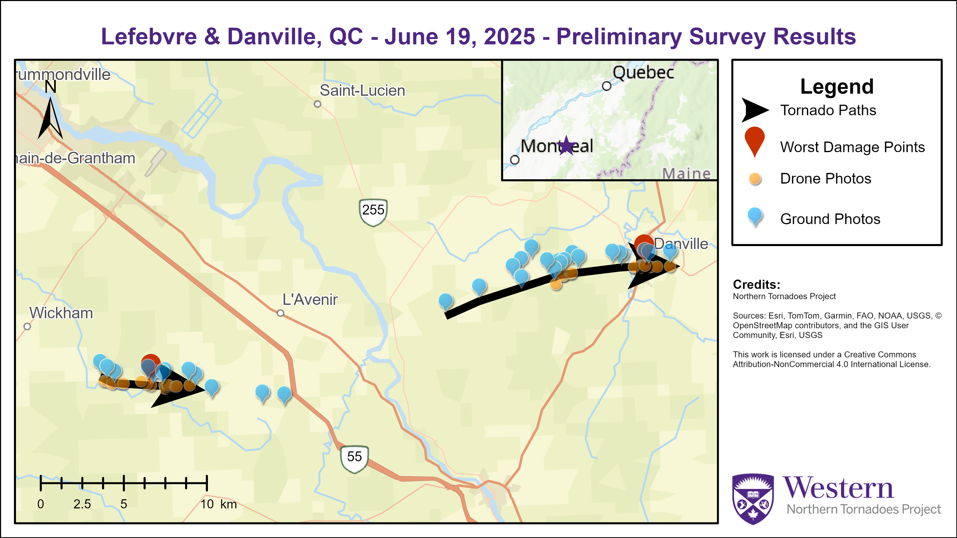
Map of the damage paths and collected data for the Lefebvre (left) and Danville (right) tornadoes.
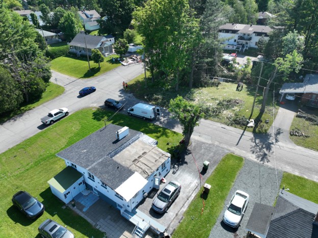
Drone photo of the worst rated damage in the Danville tornado, a house with a collapsed carport and related partial roof loss. (45.7807, -72.0202)
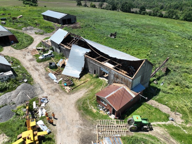
Drone photo of a barn with partial roof loss on the west wide of Danville. (45.7775304°N, 72.0850163°W)
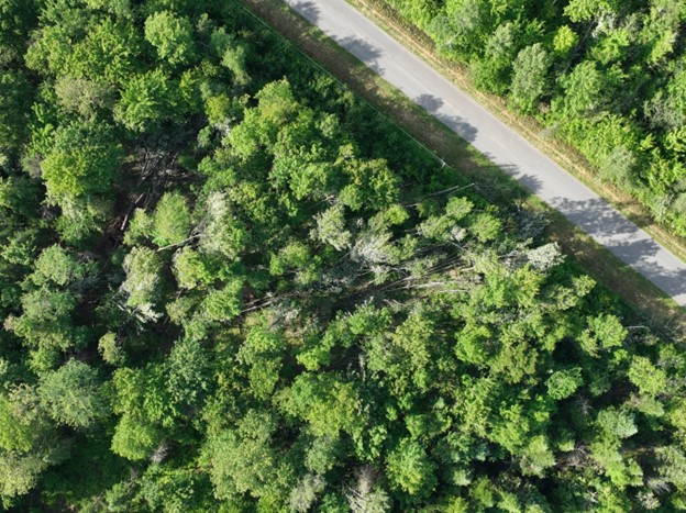
Drone photo of worst damage along the tornado path just north of Lefebvre. (45.7253, -72.4048)