Two EF1 tornadoes NE of Edmonton, AB
The NTP has confirmed two EF1 tornadoes that occurred on May 26 near Lac la Biche, AB, northeast of Edmonton. An NTP ground/drone survey identified two long, narrow paths of damage. Damage included partial roof removal from a home and many snapped and uprooted trees.
Details are provided in the event summaries below, along with regional and survey maps, and photos from the surveys. You can plot the tornadoes on a map via the NTP Dashboard here.
====
Event Name: Atmore, AB
Date: May 26, 2025
Start Time: 7:00 PM MDT (0100 UTC)
Final Classification: Tornado (Over Land)
Final EF-Scale Rating: EF1
EF-Scale Damage Indicator / Degree of Damage: FR12/DOD-4
Start of damage track: 54.8007N, 112.5610W
End of damage track: 54.9447N, 112.3456W
Location of worst damage: 54.9359N, 112.3581W
Description: Damage to homes near Atmore and Rossian (north of Plamondon) along with tree damage was reported after a storm passed through the area. No injuries were reported. An NTP ground and drone survey was completed on May 28, 2025, documenting the reported damage and additional weak damage in the area. Satellite imagery review revealed visible tree damage along a narrow path. Damage assessed as EF1 tornado, with an estimated max. wind speed of 175 km/h, track length of 21.2 km and max. path width of 300 m. Tornado motion was from the SW (approx. 220 degrees). Start time is radar estimated.
Event Name: Avenir, AB
Date: May 26, 2025
Start Time: 7:25 PM MDT (0125 UTC)
Final Classification: Tornado (Over Land)
Final EF-Scale Rating: EF1
EF-Scale Damage Indicator / Degree of Damage: C-T/DOD-4
Start of damage track: 54.9945N, 112.2772W
End of damage track: 55.0471N, 112.2371W
Location of worst damage: 55.0029N, 112.2728W
Description: Satellite imagery review revealed a narrow path of tree damage near Avenir. An NTP ground and drone survey was completed on May 28, 2025, documenting the track and additional weak damage in the area. Damage assessed as EF1 tornado, with an estimated max. wind speed of 150 km/h, track length of 6.43 km and max. path width of 370 m. Tornado motion was from the SSW (approx. 205 degrees). Start time is radar estimated.
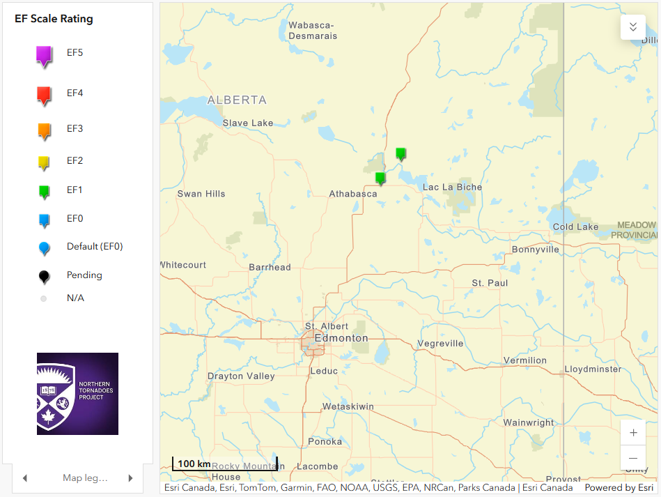
Regional map showing the locations of the Atmore and Avenir EF1 tornadoes.
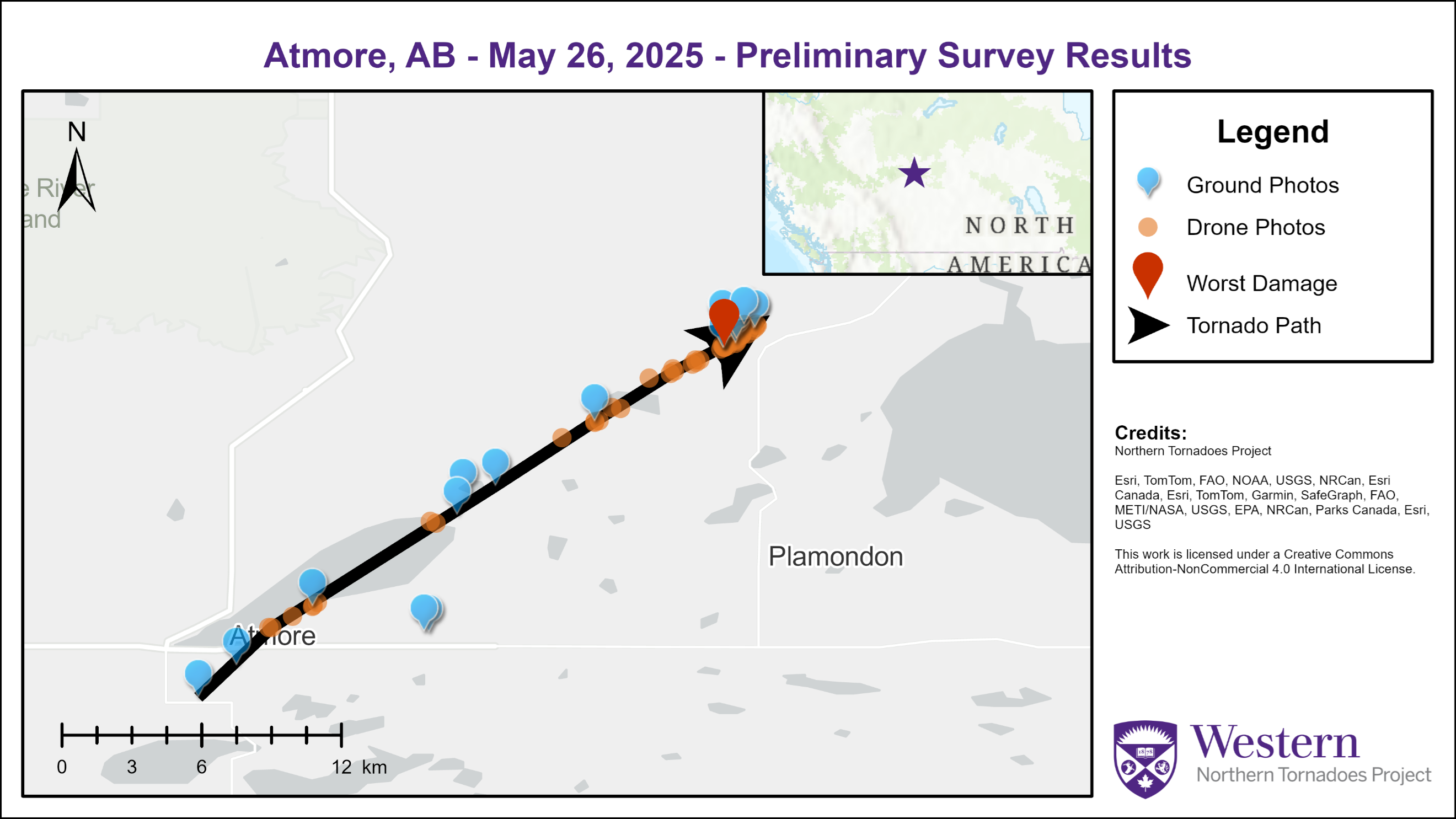
Survey map for the Atmore, AB EF1 tornado.
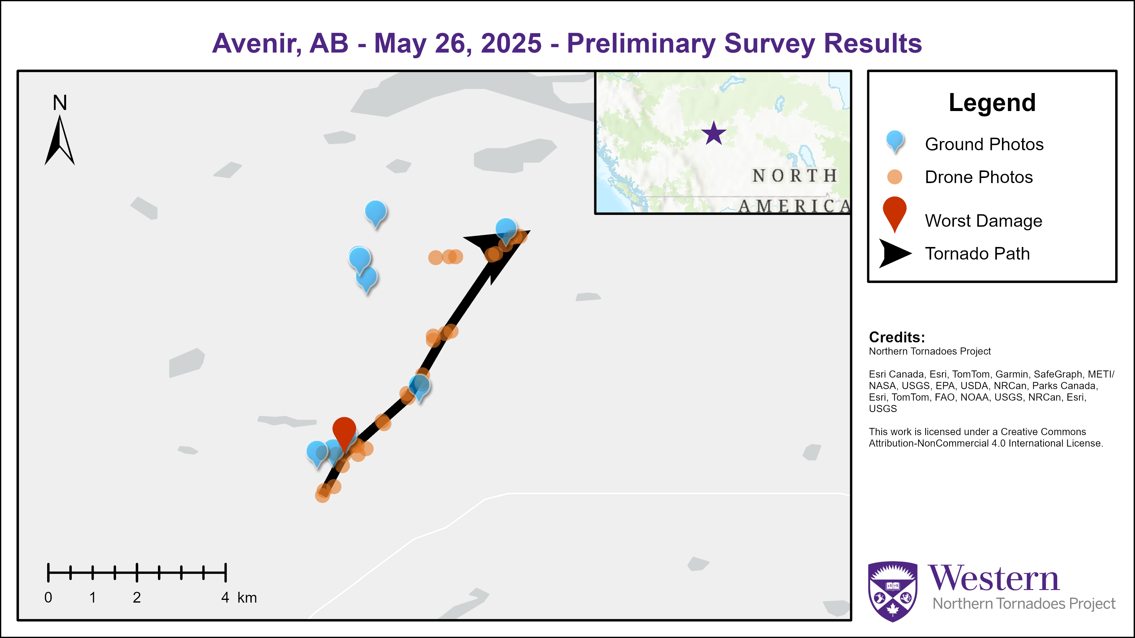
Survey map for the Avenir, AB EF1 tornado.
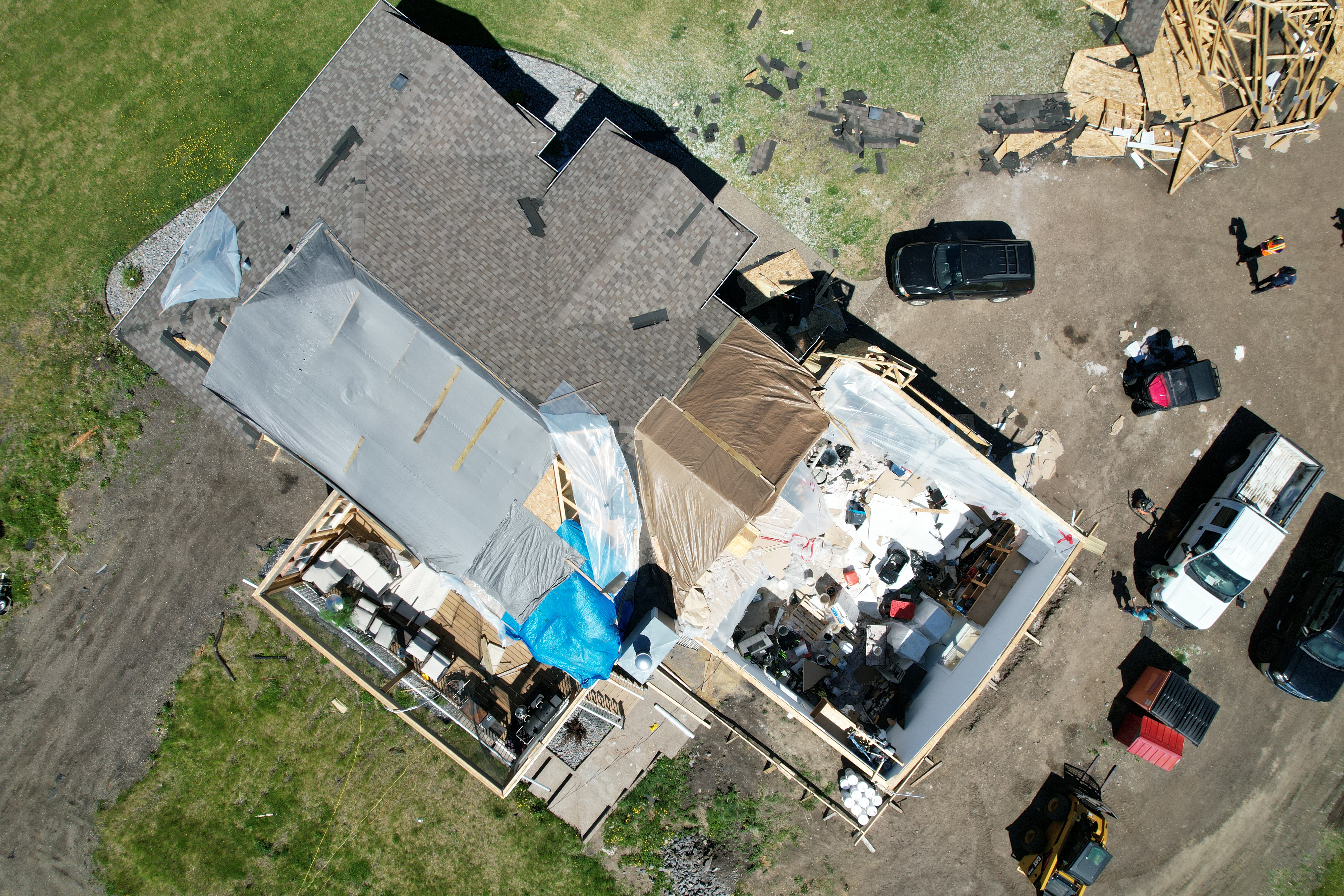
Drone image showing partial roof removal from a home near Atmore, AB.
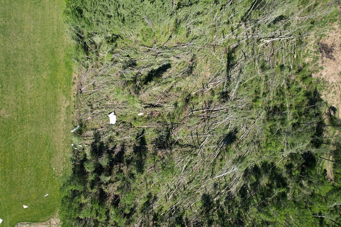
Drone image showing snapped and uprooted trees in a narrow convergence pattern near Atmore, AB.
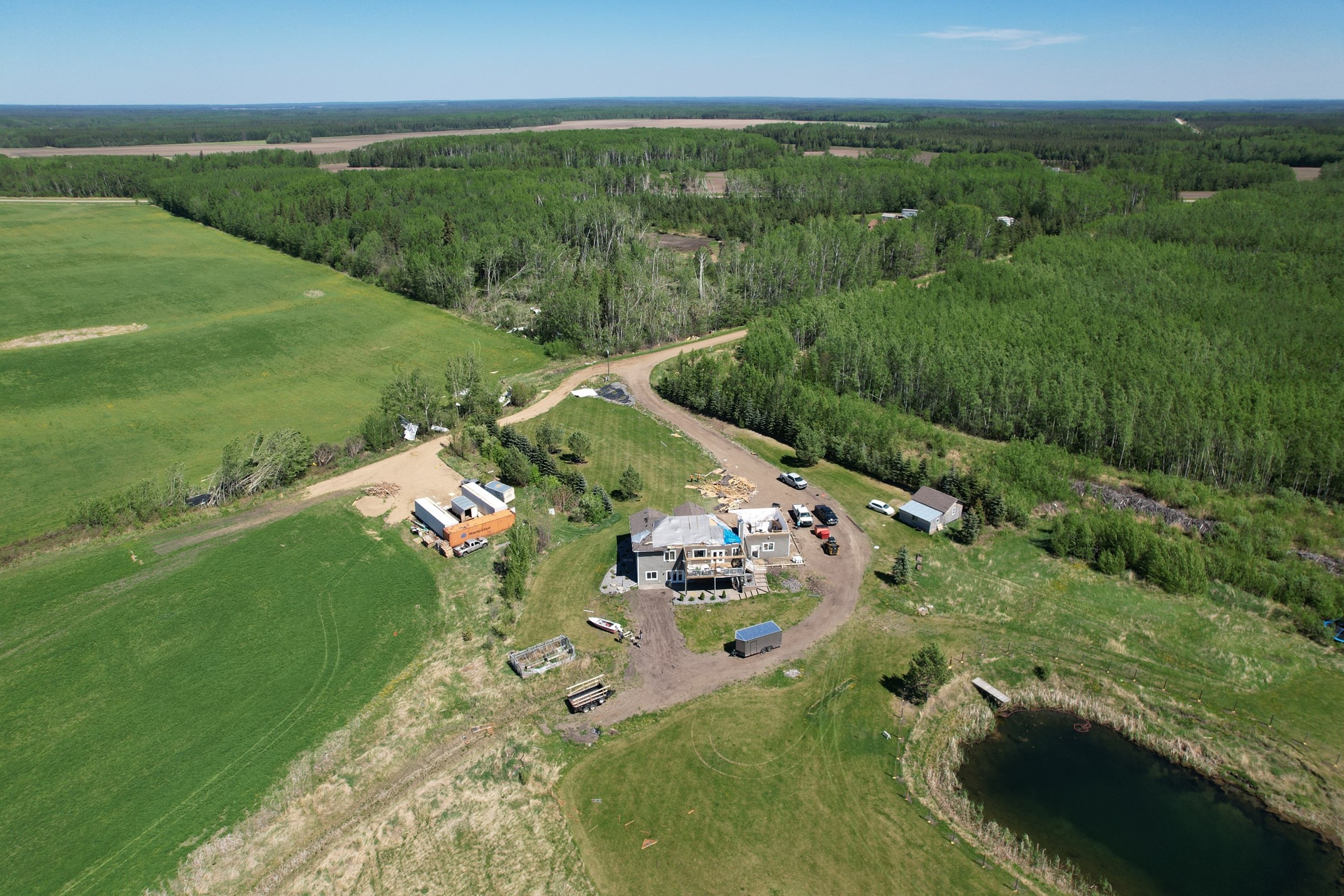
Oblique drone photo showing the path of the tornado through the area with the worst damage near Atmore, AB, including the damage from the previous two images.
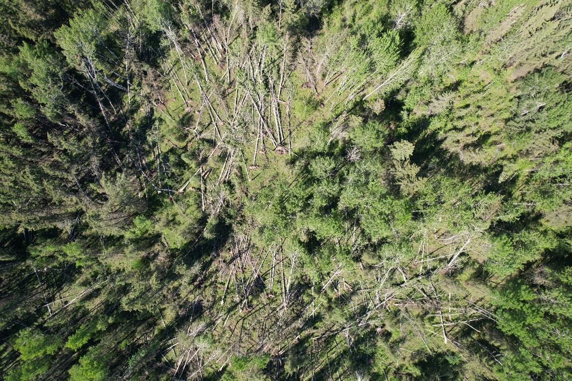
Drone image showing convergent tree damage near Avenir, AB.
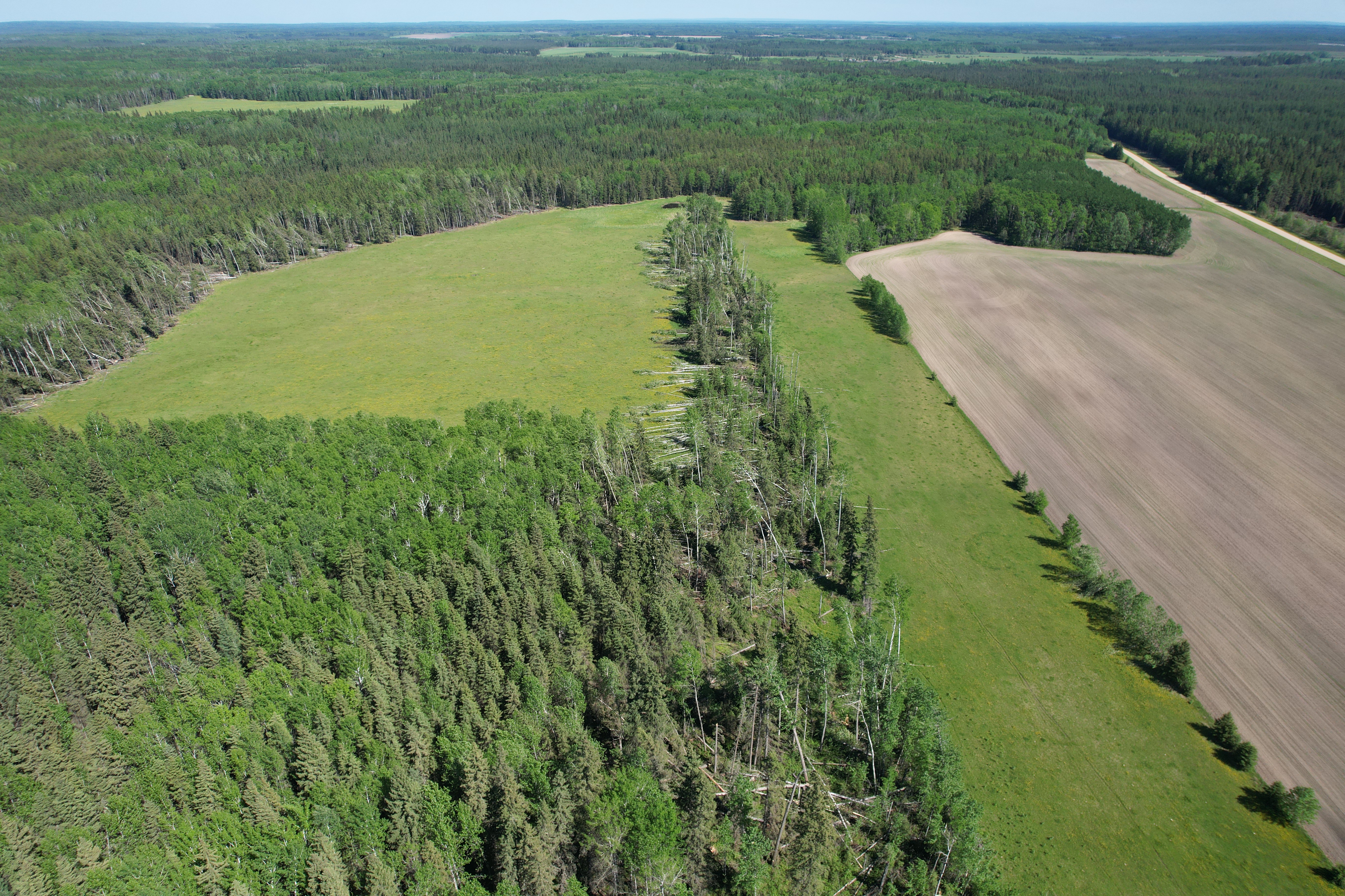
Oblique drone photo showing tree damage in a narrow path from right to left near Avenir, AB.