Three tornadoes near Goderich, ON on July 26
The NTP has confirmed three tornadoes that occurred in the Goderich, ON area on July 26. The first occurred with a long-lived supercell thunderstorm over Lake Huron, based on numerous photos and video. Given there was no damage, this tornado has been assigned an Default-EF0 rating.
The supercell weakened as it approach shore but re-intensified over land and produced a weak tornado at Potter's Hill. A ground/drone survey found damage consistent with winds of 125 km/h, resulting in an EF0 rating.
The same supercell thunderstorm spawned a new area of rotation and later a new tornado near Harlock, resulting in winds estimated at 90 km/h, giving a rating of EF0.
The details for the three tornadoes are provided in the event summaries below, along with regional and survey maps, survey photos, and links to relevent videos and photos.
The tornadoes can also be plotted on a map using the NTP Dashboard here. Note also that the full set of drone and ground photos will be available at a later time via our open data portal.
Thanks to the Instant Weather team with their help with this event!
====
Event Name: Lake Huron (Goderich), ON
Date: July 26, 2025
Start Time: 6:30 PM EDT (2230 UTC)
Final Classification: Tornado (Over Water)
Final EF-Scale Rating: EF0-Default
Estimated Tornado Start Location: 43.63N, 81.85W
Description: Witnesses captured video and photos of a waterspout over Lake Huron (southwest of Goderich). No damage was reported, nor was any found along the shoreline by an NTP survey team on July 27, 2025. Satellite imagery review of the shoreline is pending. Start time is estimated based on witness reports.
Event Name: Porter's Hill, ON
Date: July 26, 2025
Start Time: 6:55 PM EDT (2255 UTC)
Final Classification: Tornado (Over Land)
Final EF-Scale Rating: EF0
EF-Scale Damage Indicator / Degree of Damage: SBO/DOD-5
Start of damage track: 43.6727N, 81.6544W
End of damage track: 43.7094N, 81.5966W
Location of worst damage: 43.7022N, 81.6036W
Description: Witnesses captured video and photos of a tornado north of Porter's Hill (south of Goderich). Damage to a barn, a coverall building and trees was reported. No injuries were reported. An NTP ground and drone survey was completed on July 27, 2025, documenting the reported damage. Damage assessed as EF0 tornado, with an estimated max. wind speed of 125 km/h, track length of 6.24 km and max. path width of 190 m. Tornado motion was from the SW (approx. 230 degrees). Start time is estimated based on witness reports. Satellite imagery review is pending. The same parent storm produced a tornado over Lake Huron (southwest of Goderich).
Event Name: Harlock, ON
Date: July 26, 2025
Start Time: 7:30 PM EDT (2330 UTC)
Final Classification: Tornado (Over Land)
Final EF-Scale Rating: EF0
EF-Scale Damage Indicator / Degree of Damage: C-T/DOD-2
Start of damage track: 43.6704N, 81.4352W
End of damage track: 43.6762N, 81.3783W
Location of worst damage: 43.6697N, 81.4141W
Description: Witnesses captured video and photos of a tornado that developed near Harlock, where tree damage was later reported. No injuries were reported. An NTP ground and drone survey was completed on July 27, 2025, documenting tree and crop damage. Damage assessed as EF0 tornado, with an estimated max. wind speed of 90 km/h, track length of 4.68 km and max. path width of 330 m. Tornado motion was from the W (approx. 260 degrees). Start time is estimated based on witness report. Satellite imagery review is pending.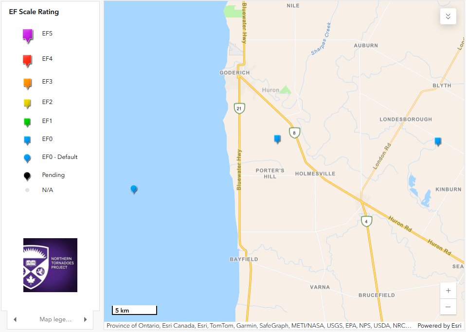
Regional map showing the start locations of the three tornadoes (one over Lake Huron and two inland).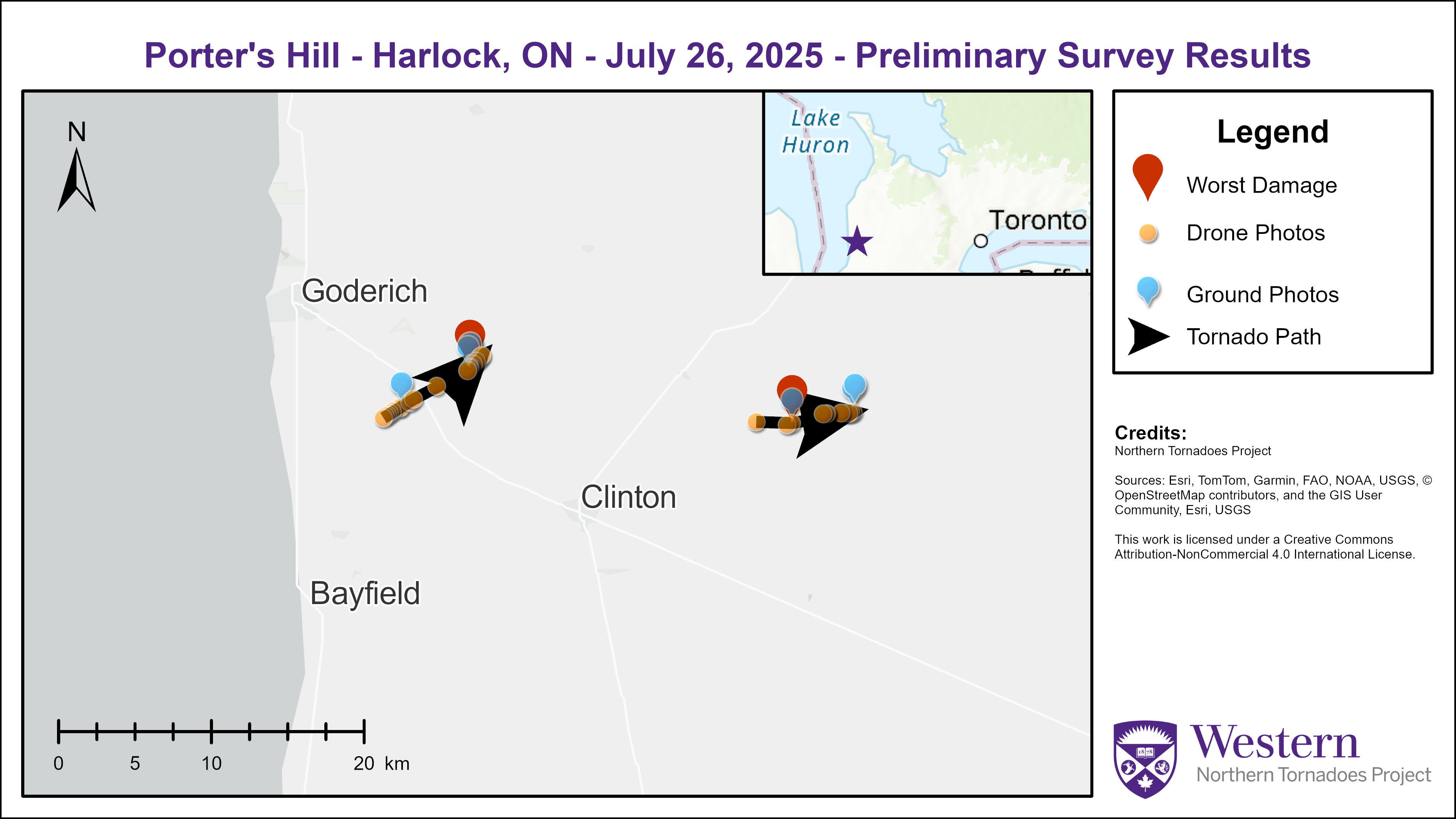
Survey map showing the damage paths for the two EF0 tornadoes over land.
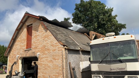
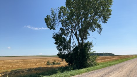
Ground photo of worst damage point (SBO/DOD5 LB 125km/hr EF0) for Porter's Hill EF0 tornado.
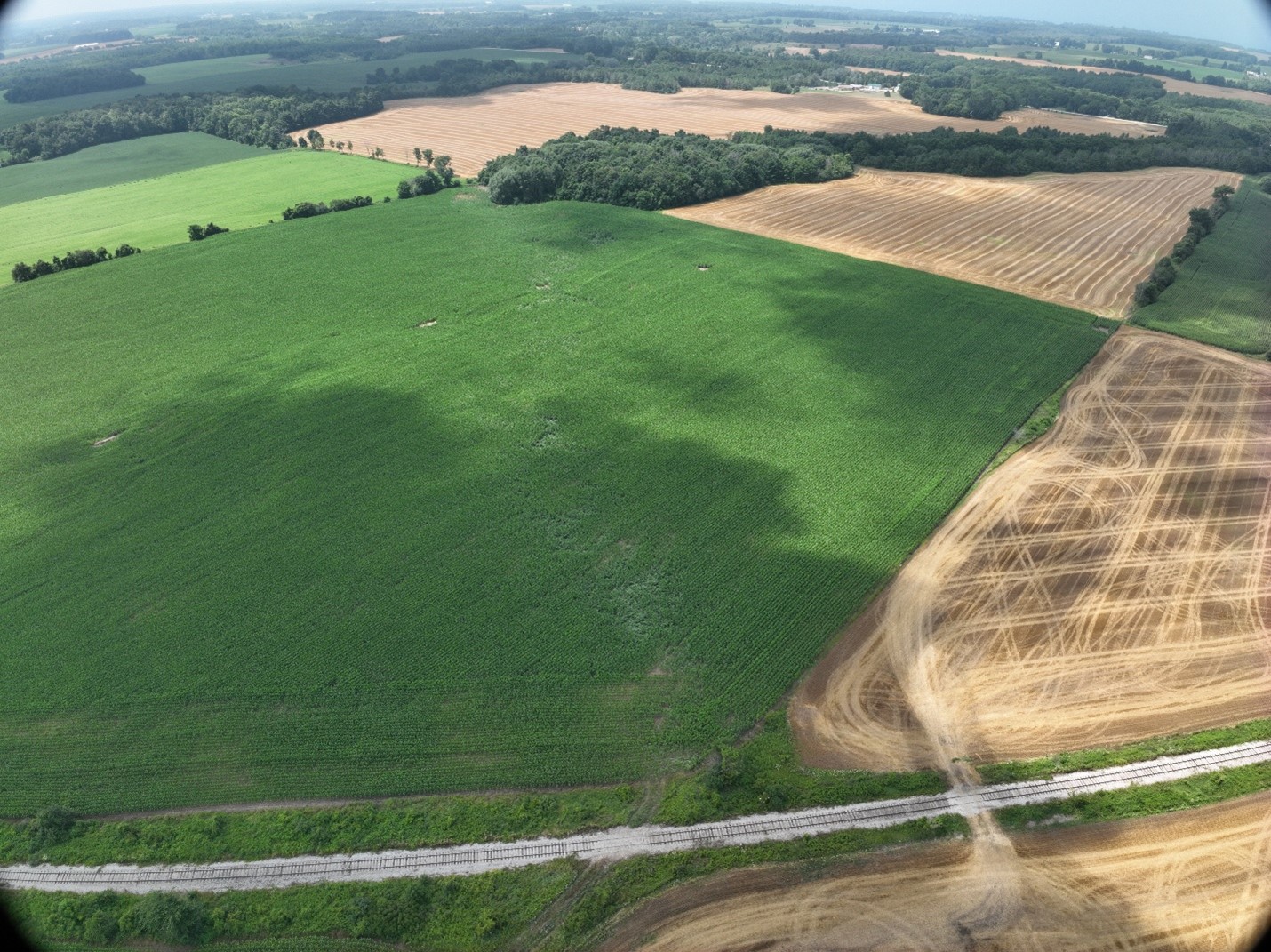
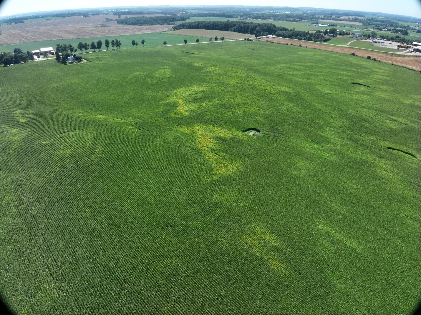
Oblique drone photo of vortex marks through crops for Porter's Hill EF0 tornado.
Large branch broken was worst damage found for the Harlock EF0 tornado.
Oblique drone photo of vortex marks through crops for Harlock EF0 tornado.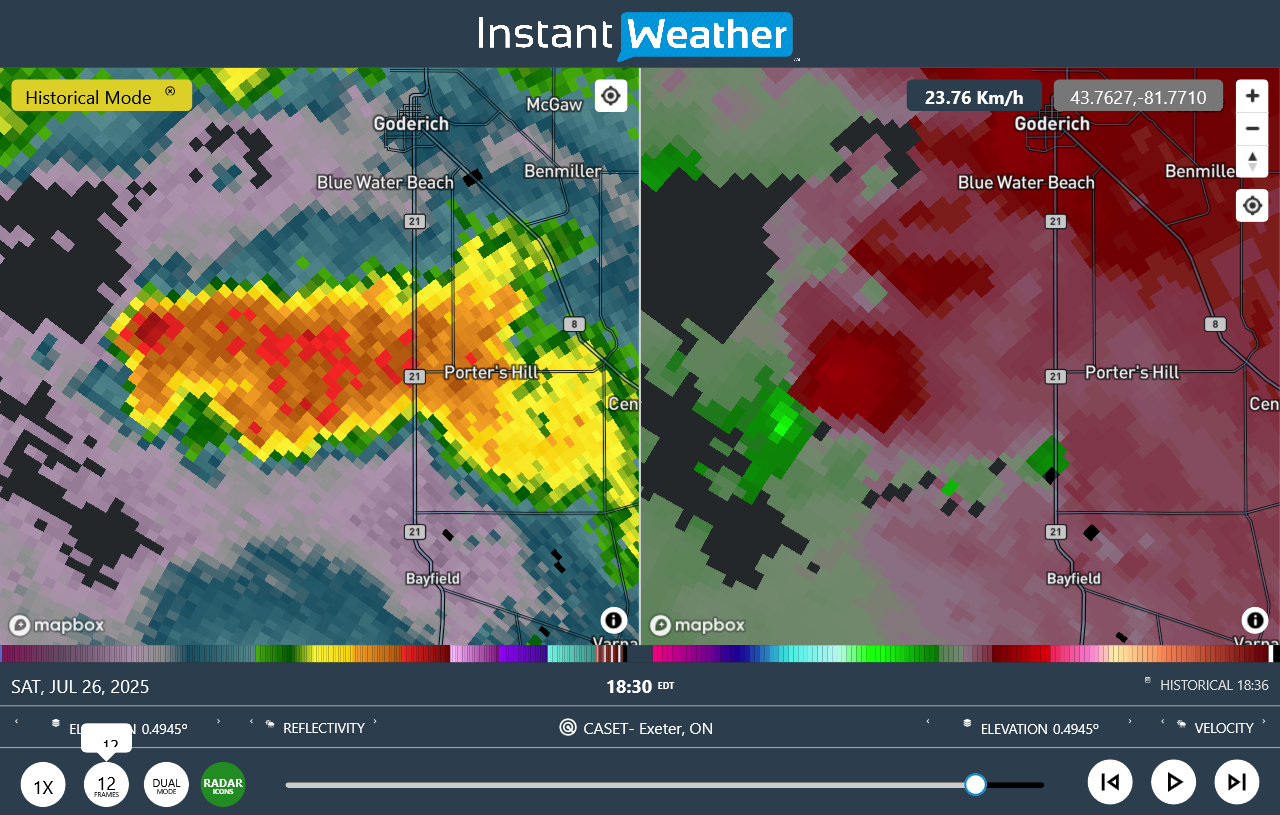
CASET radar image (reflectivity, velocity) at the time of the tornado over Lake Huron.
CASET radar image (reflectivity, radial velocity) at the time of the Porter's Hill tornado.
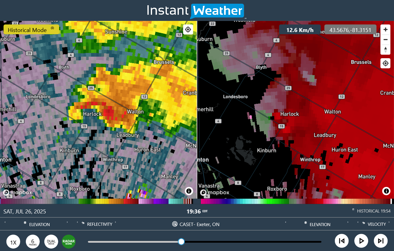
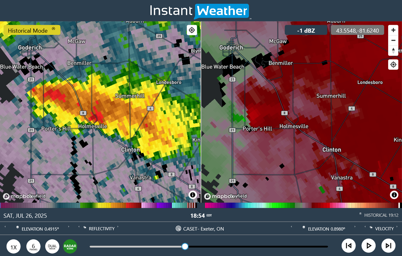
CASET radar image (reflectivity, radial velocity) at the time of the Harlock tornado.
Links to tornado videos:
https://www.facebook.com/blake.fuller.96780/videos/1137113634909029/?rdid=8TS795X3IyTVvMsy
https://www.facebook.com/reel/1660589657935260