Three EF2 tornadoes in NE ON on Jul 12
The NTP has confirmed three EF2 tornadoes in the Englehart area of northeastern Ontario on July 12. Details are provided in the event summaries below, along with a regional map and selected satellite imagery. The tornadoes can be plotted on a map using the NTP Dashboard here.
Thanks to Sarah Clarke for alerting to us to the damage near Tarzwell and submitting photos.
====
Event Name: Trethewey Lake, ON
Date: July 12, 2025
Start Time: 5:50 PM EDT (2150 UTC)
Final Classification: Tornado (Over Land)
Final EF-Scale Rating: EF2
EF-Scale Damage Indicator / Degree of Damage: C-T/DOD-6
Start of damage track: 47.4455N, 80.5097W
End of damage track: 47.5342N, 80.4343W
Location of worst damage: 47.5085N, 80.4554W
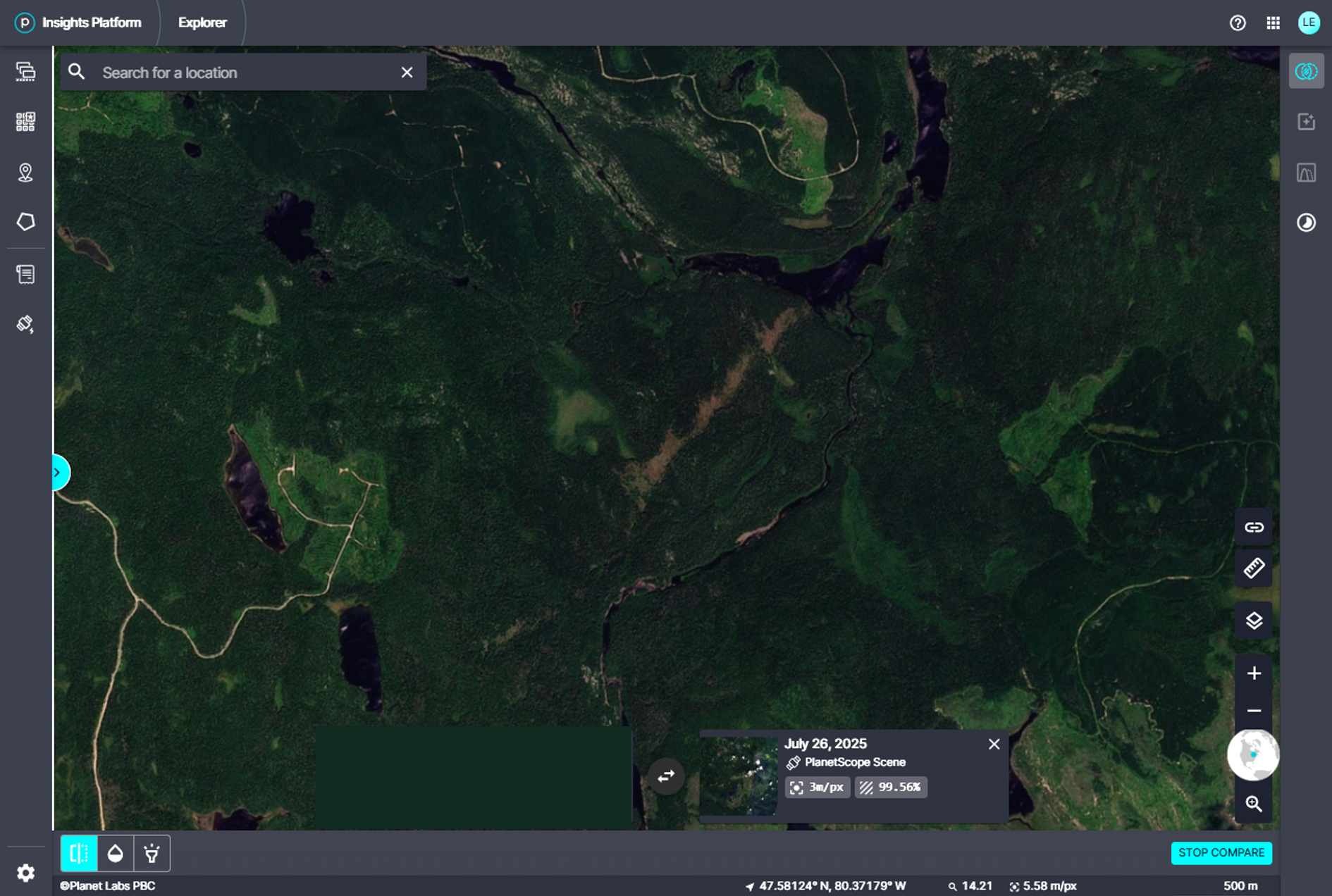
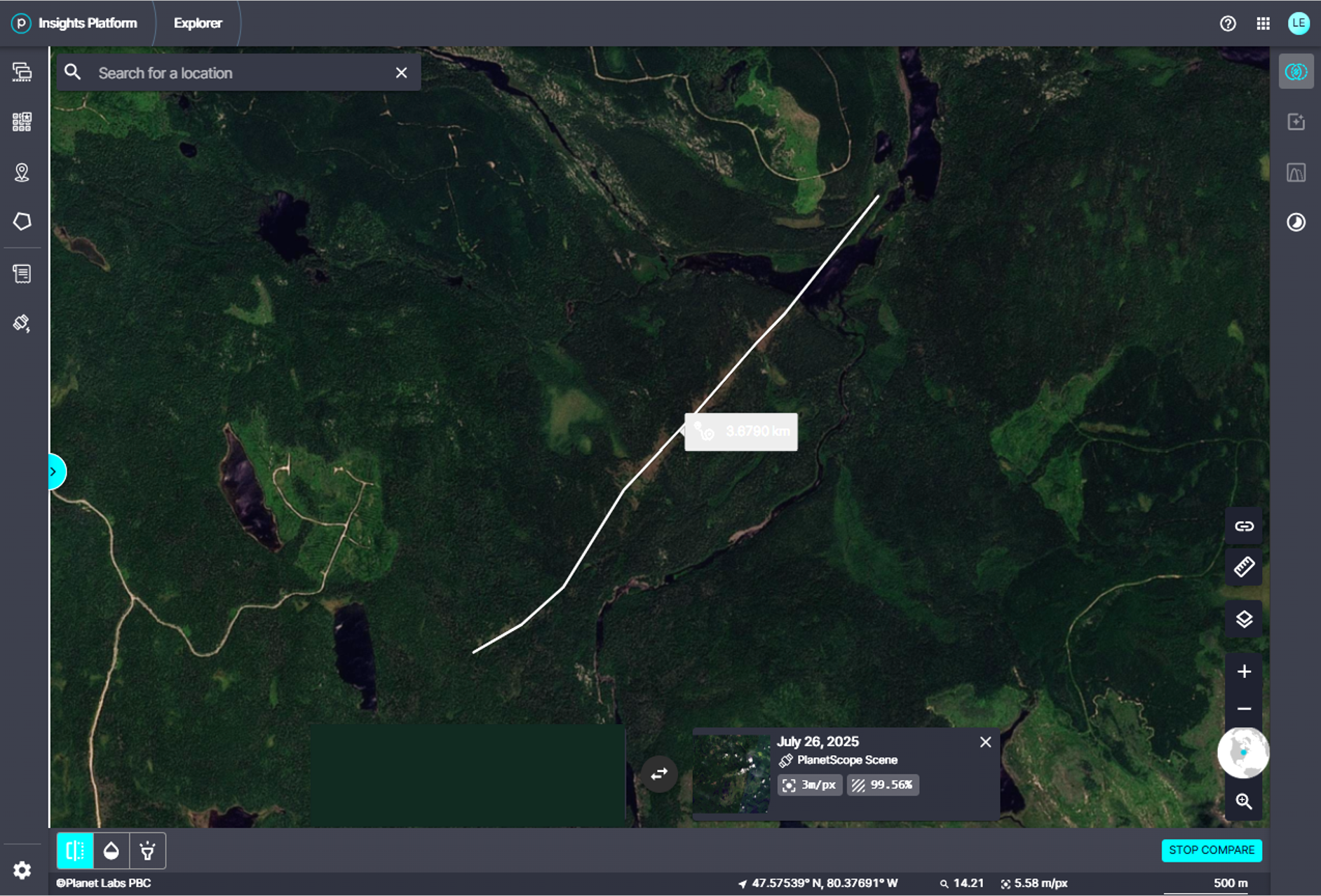
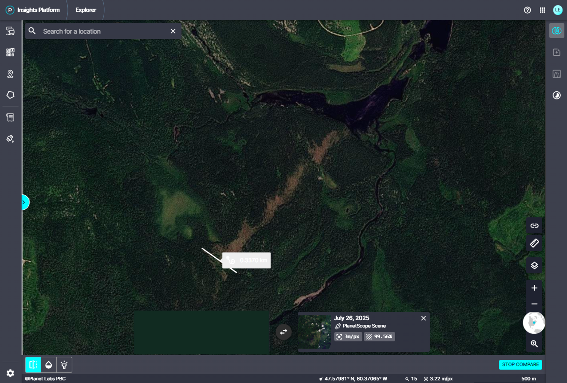
Description: Satellite imagery review of a storm track of interest revealed significant tornado damage in forested areas near Trethewey Lake (southeast of Gowganda). Tornado damage assessed as EF2, with an estimated max. wind speed of 215 km/h, track length of 11.5 km and max. path width of 1.08 km. Tornado motion was from the SSW (approx. 210 degrees). Start time is radar estimated. The same parent storm later produced the EF2 Crane Creek tornado.
Event Name: Crane Creek, ON
Date: July 12, 2025
Start Time: 6:05 PM EDT (2205 UTC)
Final Classification: Tornado (Over Land)
Final EF-Scale Rating: EF2
EF-Scale Damage Indicator / Degree of Damage: C-T/DOD-6
Start of damage track: 47.5660N, 80.4122W
End of damage track: 47.5905N, 80.3800W
Location of worst damage: 47.5757N, 80.3986W
Description: Satellite imagery review of a storm track of interest revealed tornado damage in forested areas near Crane Creek (south of Elk Lake). Tornado damage assessed as EF2, with an estimated max. wind speed of 190 km/h, track length of 3.68 km and max. path width of 340 m. Tornado motion was from the SW (approx. 220 degrees). Start time is radar estimated. The same parent storm earlier produced the EF2 Trethewey Lake tornado.
Event Name: Tarzwell, ON
Date: July 12, 2025
Start Time: 7:00 PM EDT (2300 UTC)
Final Classification: Tornado (Over Land)
Final EF-Scale Rating: EF2
EF-Scale Damage Indicator / Degree of Damage: C-T/DOD-6
Start of damage track: 48.0210N, 79.9979W
End of damage track: 48.0988N, 79.9568W
Location of worst damage: 48.0396N, 79.9934W
Description: Tree damage was reported north of Englehart after a storm passed through the area. Satellite imagery review revealed a tornado damage in forested areas near Tarzwell (south of Kirkland Lake). Tornado damage assessed as EF2, with an estimated max. wind speed of 190 km/h, track length of 9.27 km and max. path width of 600 m. Tornado motion was from the SSW (approx. 200 degrees). Start time is radar estimated.
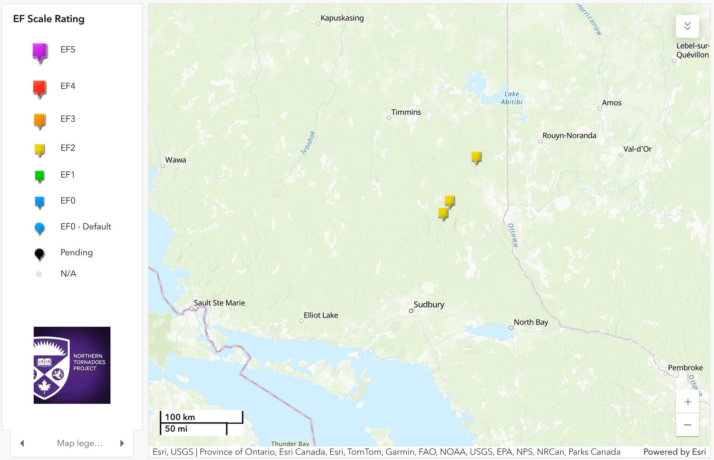
Regional map showing the locations of the three EF2 tornadoes in NE ON on July 12.
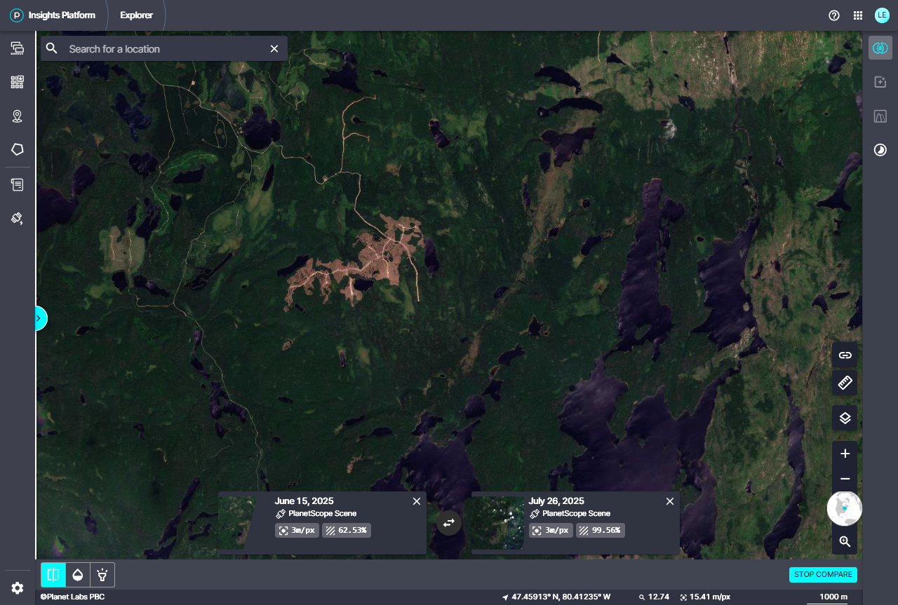
Planet.com satellite image showing the track of damage for the Trethewey EF2 tornado.
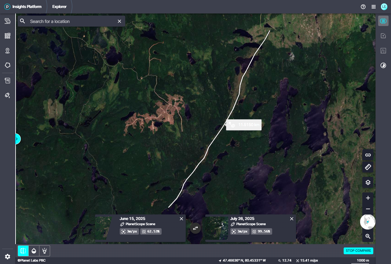
Full track and length measurement for the Trethewey EF2 tornado.
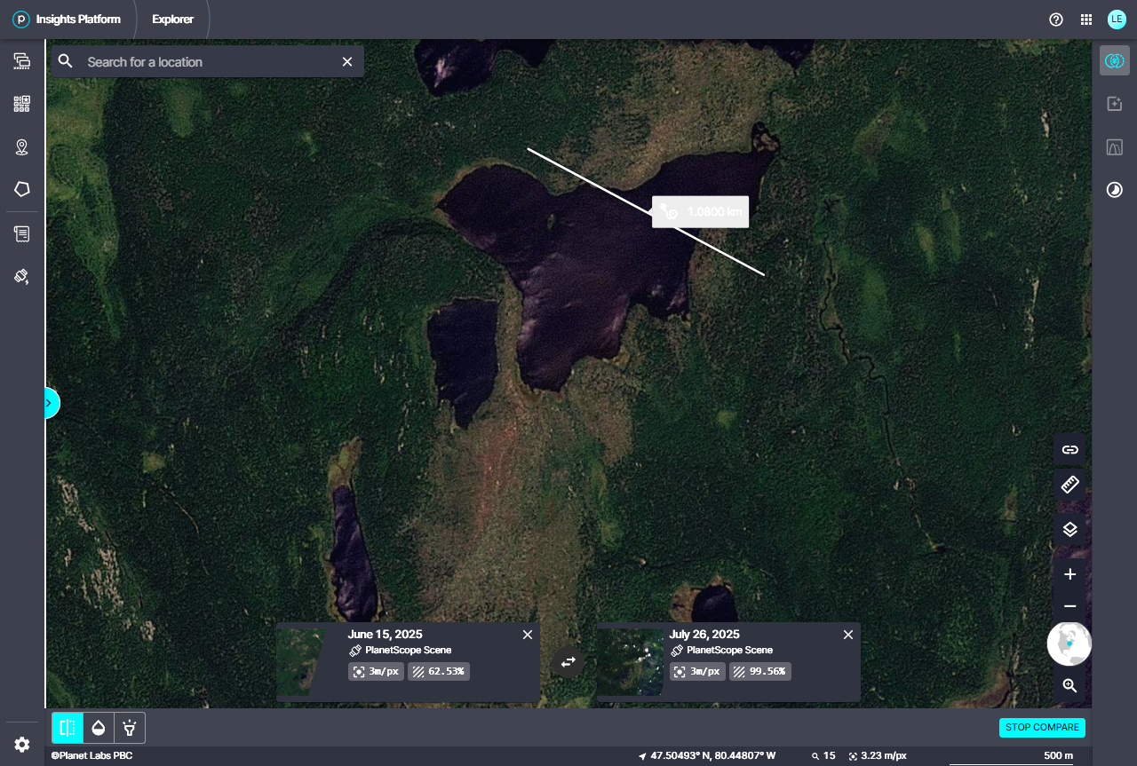
Zoom and max width measurement for Tretheway EF2 tornado.
Planet.com satellite image showing the track of damage for the Crane Lake EF2 tornado.
Full track and length measurement for the Crane Lake EF2 tornado.
Zoom and max width measurement for Crane Lake EF2 tornado.
Planet.com satellite image showing the track of damage for the Tarzwell EF2 tornado.
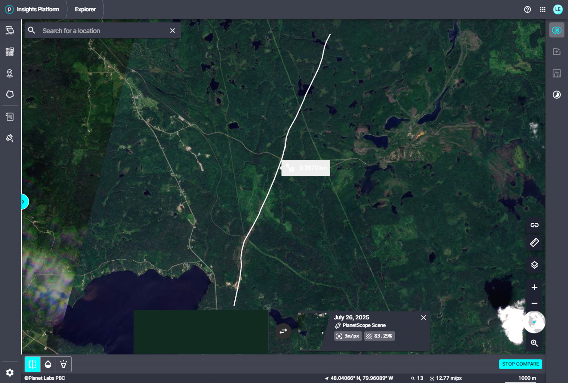
Full track and length measurement for the Tarzwell EF2 tornado.
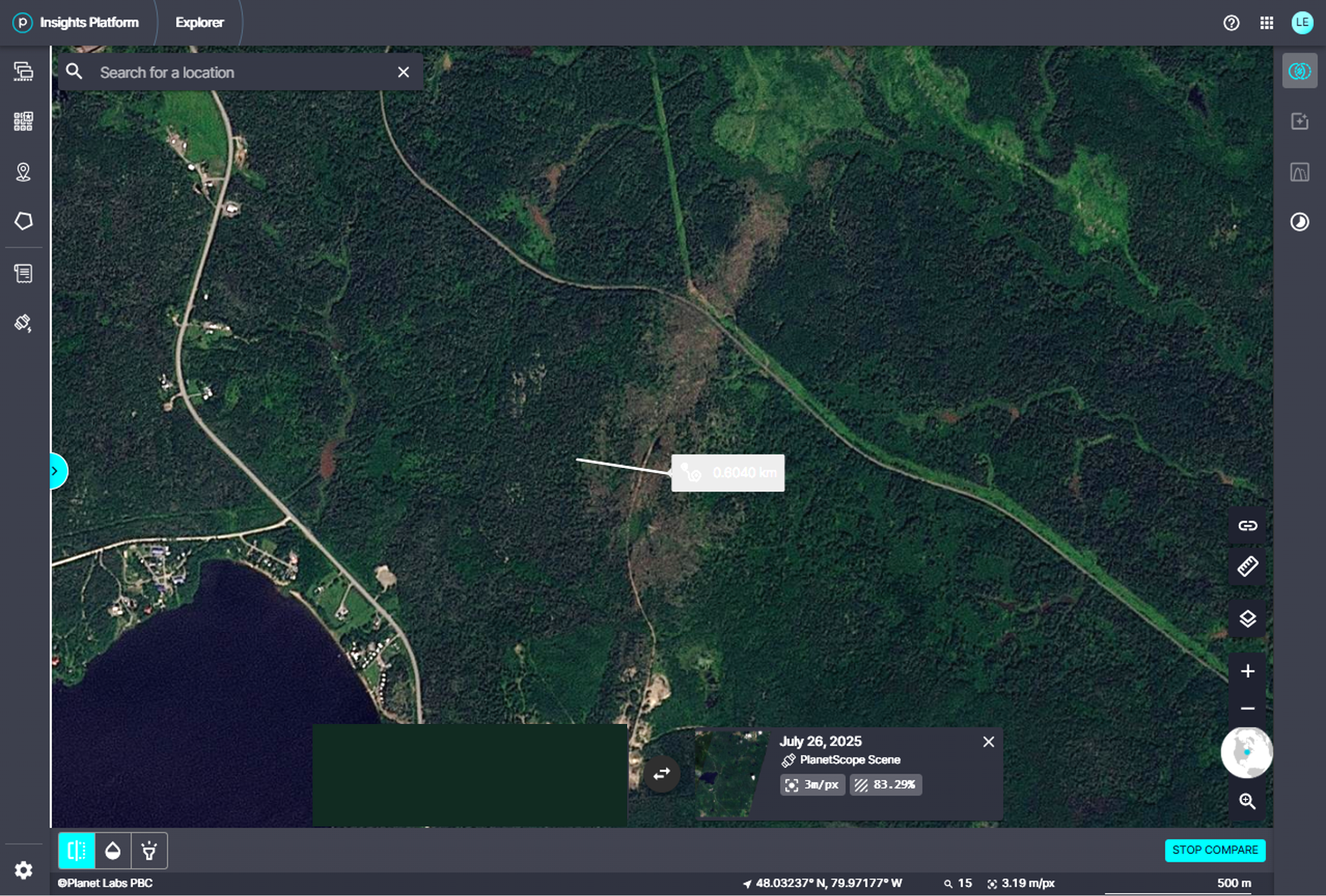
Zoom and max width measurement for Tarzwell EF2 tornado.
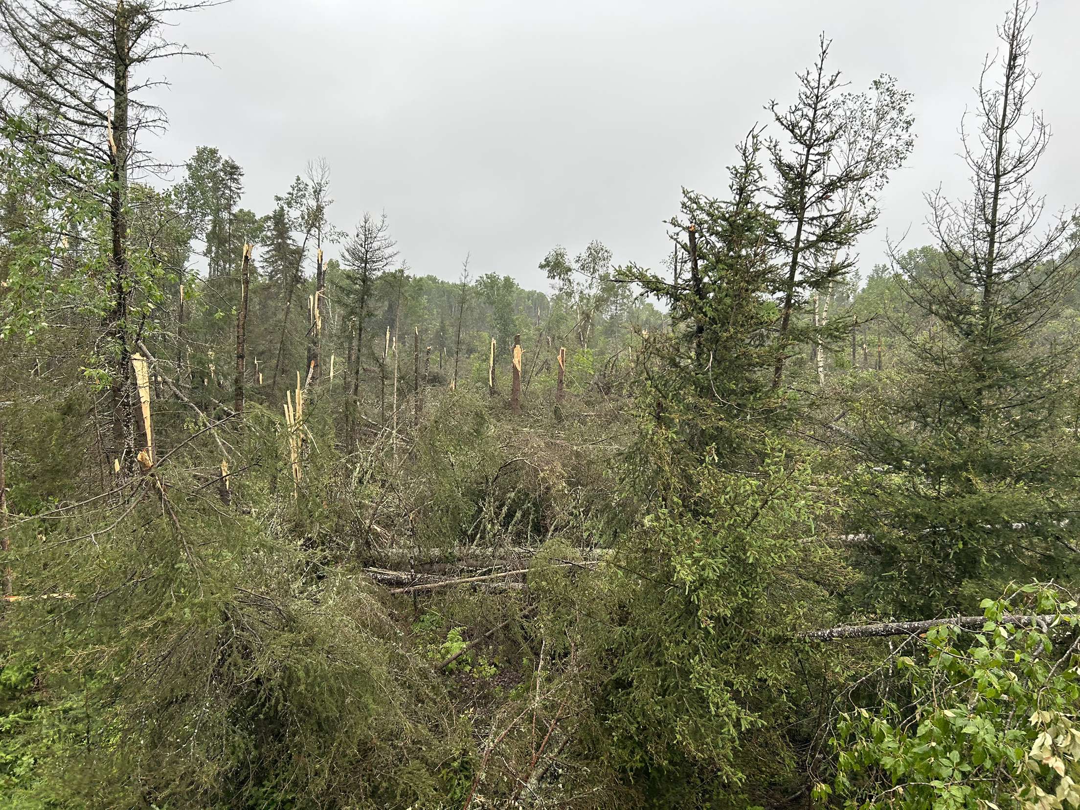
Photo submitted by Sarah Clarke of the Tarzwell EF2 tornado damage path from the ground. Used with permission.