Ontario's first tornado of the season an EF0 near Woodstock
Following a ground/drone survey, the NTP has confirmed Ontario's first recorded tornado of the season - an EF0 near Lakeside, northwest of Woodstock, that developed along the leading edge of a line of storms during the early morning hours of May 16. Only trees and a power pole were damaged along the tornado's narrow path. Radar at the time shows a compact area of low-level rotation.
Details are provided in the event summary below, along with a regional map, a survey map, survey photos and a radar image. The tornado can also be plotted using the NTP Dashboard here. Thanks to Daria Koscinski and Rowan Yates for reporting the damage, and even mapping it out!
====
Event Name: Lakeside, ON
Date: May 16, 2025
Start Time: 3:00 AM EDT (0700 UTC)
Final Classification: Tornado (Over Land)
Final EF-Scale Rating: EF0
EF-Scale Damage Indicator / Degree of Damage: C-T/DOD-3
Start of damage track: 43.1618N, 81.0049W
End of damage track: 43.1710N, 80.9627W
Location of worst damage: 43.1684N, 80.9795W
Description: Damage to trees and a power pole was reported south of Lakeside after a storm passed through the area. No injuries were reported. An NTP ground and drone survey was completed on May 20, 2025, documenting the tree damage. Damage assessed as EF0 tornado, with an estimated max. wind speed of 115 km/h, track length of 3.60 km and max. path width of 160 m. Tornado motion was from the WSW (approx. 255 degrees). Start time is based on radar imagery. Satellite imagery review is pending.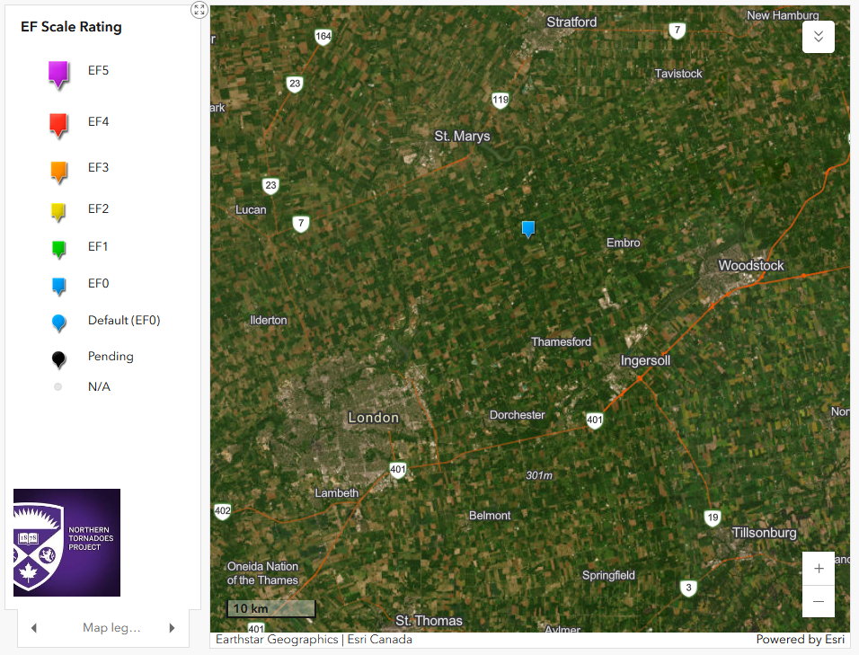
Regional map showing the location of the EF0 tornado near Lakeside, ON.
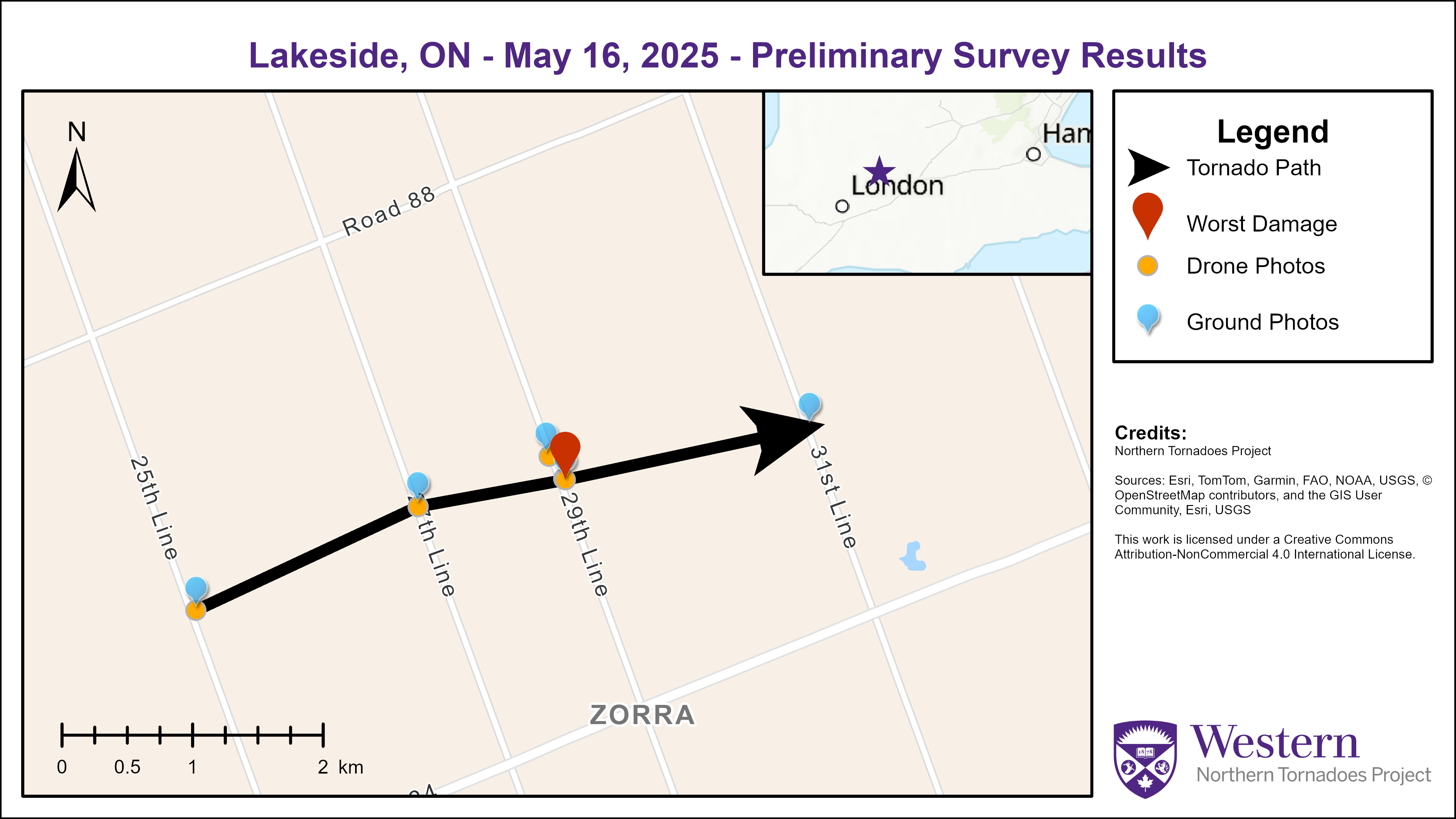
Survey map for the Lakeside EF0 tornado.
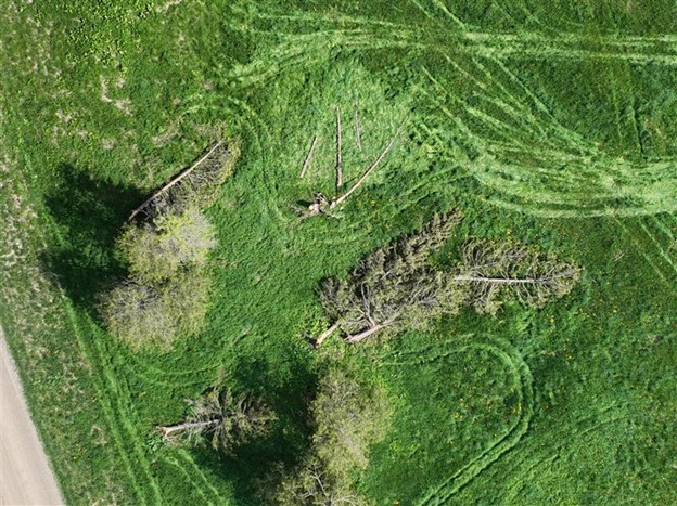
Drone photo of worst damage point featuring multiple snapped conifers (43.1684° N, -80.9795° W).
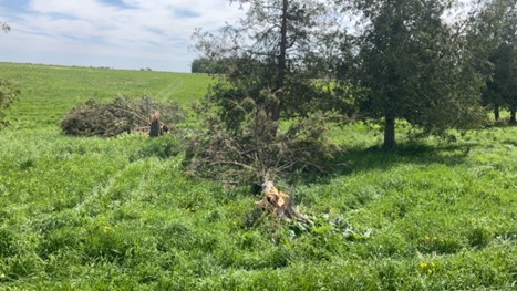
Ground photo up close to tree snaps at worst damage point (43.1684° N, -80.9795° W).
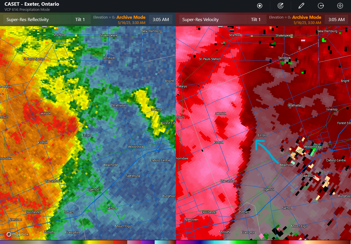
CASET radar image showing reflectivity (left) and radial velocity (right) near the time of the tornado. The location of a compact area of rotation along the leading edge of the storm is indicated by the blue arrow.