Ontario's first EF2 tornado recorded in NW ON on Jul 27
The NTP has confirmed Ontario's first EF2 tornado of the year in NW ON on July 27. Both Planet and Sentinel satellite images were used to identify and assess the damage path through the forest.
Details in the event summary below, along with a regional map and satellite images. The tornado can be plotted on a map using the NTP Dashboard here.
====
Event Name: Law Lake (Mine Centre), ON
Date: July 27, 2025
Start Time: 6:10 PM CDT (2310 UTC)
Final Classification: Tornado (Over Land)
Final EF-Scale Rating: EF2
EF-Scale Damage Indicator / Degree of Damage: C-T/DOD-6
Start of damage track: 48.7882N, 92.5134W
End of damage track: 48.8025N, 92.4407W
Location of worst damage: 48.7961N, 92.4736W
Description: Satellite imagery review of a storm track of interest revealed tornado damage in forested areas near Law Lake (northeast of Mine Centre). Tornado is assessed as EF2, with an estimated max. wind speed of 190 km/h, track length of 5.58 km and max. path width of 260 m. Tornado motion was from the WSW (approx. 255 degrees). Start time is radar estimated.
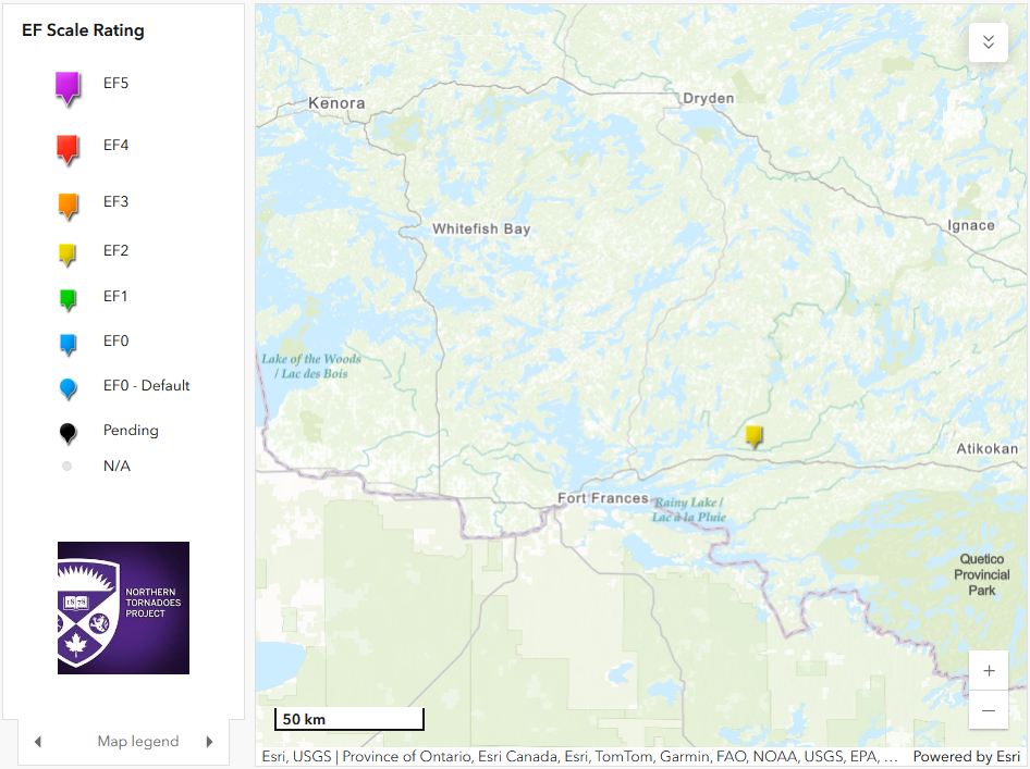
Regional map showing the location of the EF2 tornado on July 27.
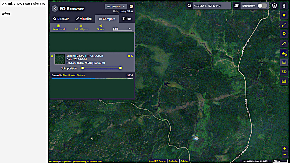
Sentinel II satellite image showing the tornado damage path through the forest from WSW to ENE (light brown).
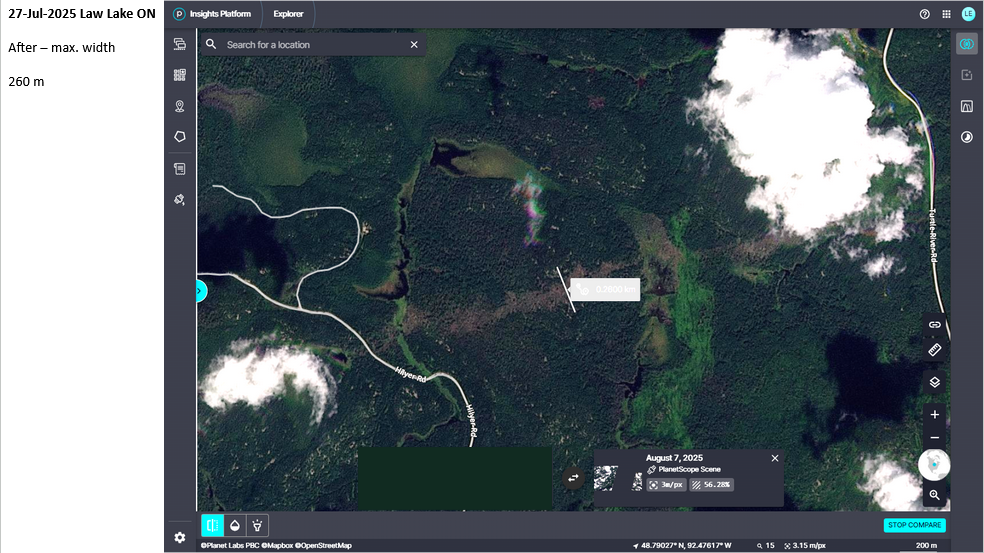
Planet satellite image zoomed in to worst damage area with maximum path width of 260 m measured.