EF1 downbust near Brooks AB with long-lived storm on Aug 20
Based on witness reports, NTP and NHP damage surveys, and analysis of radar and satellite imagery, the NTP is confirming an EF1 downburst in the Brooks, AB area that occurred with a long-lived wind/hail storm through southern Alberta and parts of Saskatchewan on August 20.
A supercell thunderstorm originated in the foothills south of Calgary near 3 pm MDT and rapidly transformed into a well-organized and damaging wind/hail storm, more like a bow-echo type storm (so called for its bow-like shape). It caused its worst damage in the Brooks, AB area but continued into southern Saskatchewan. The hail damage from this storm is visible as a 'scar' on satellite imagery stretching from west of Brant, AB to Beechy Provincial Pasture, SK, with a total length of over 400 km.
There was extensive damage in a roughly west-southwest to east-northeast corridor northwest and north of Brooks, measuring over 22 km in length and up to 6 km in width. High volumes of hail, with maximum estimated diameters of 40-50 mm, were driven by winds exceeding 120 km/h over a period of 20 minutes or more.
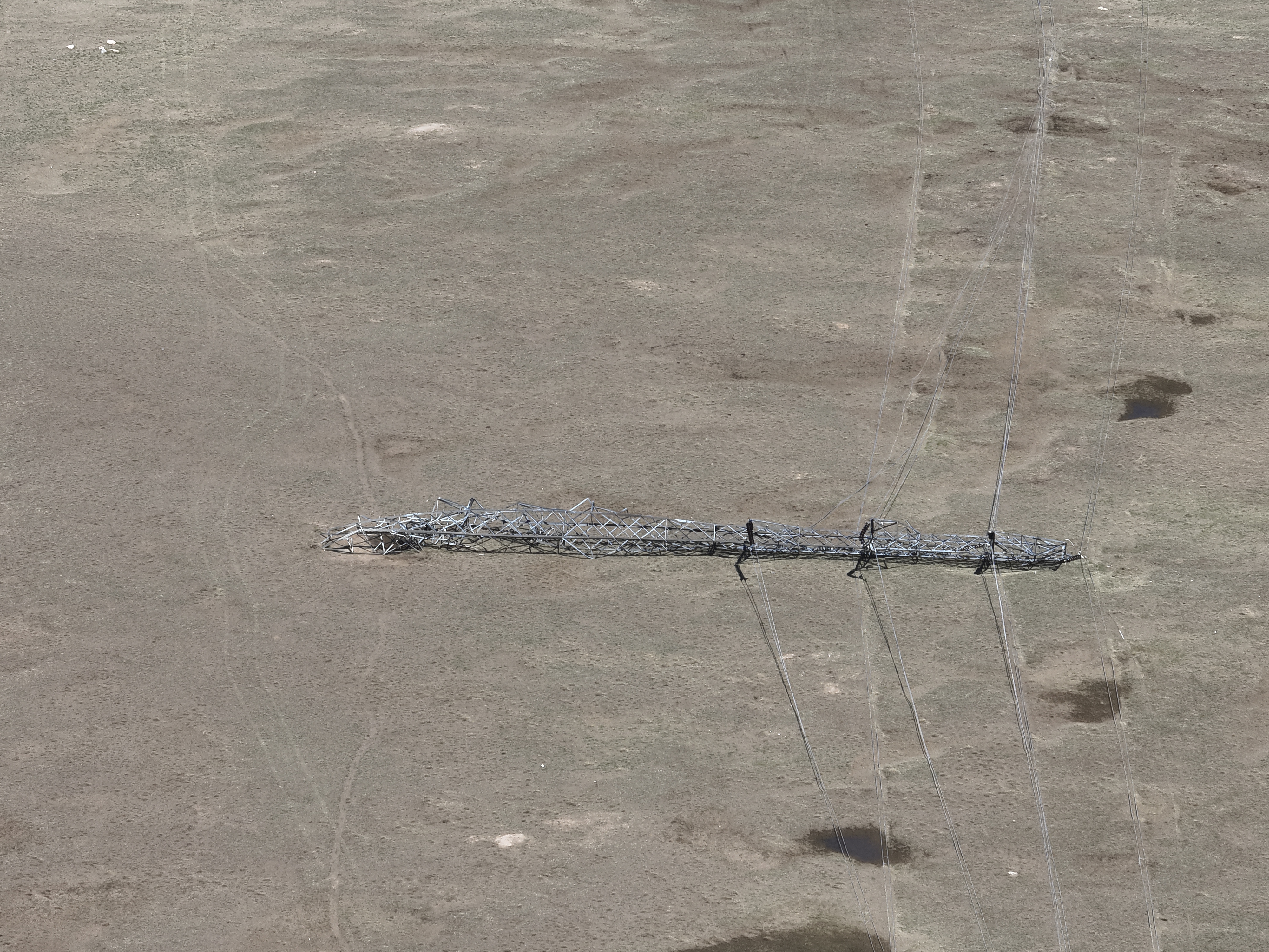
The NTP survey identified a downburst with maximum winds up to 165 km/h in this area. The failure of metal truss electical transmission towers typically requires a higher wind speed, but the combination of wind and copious amounts of large hail in this case may have contributed to the failure. This will be studied further, and the rating for this downburst may be upgraded based on the results.
The event summary for the downburst is provided below, along with regional and survey maps and images from the survey. The downburst event can also be plotted on a map using the NTP Dashboard here.
Note that there may be additional wind events added later as the analysis of this extensive track of wind and hail damage continues.
====
Event Name: Brooks, AB
Date: August 20, 2025
Start Time: 5:15 PM MDT (2315 UTC)
Final Classification: Downburst
Final EF-Scale Rating: EF1
EF-Scale Damage Indicator / Degree of Damage: C-ETL/DOD-6
Location of worst damage: 50.6342N, 111.9900W
Description: Damage to several large transmission towers, light poles, structures (farm buildings, homes and a warehouse) and trees was reported in the Brooks area (near Cassils) and south of Duchess and Millicent after a storm passed through the area. Significant hail damage was also reported. No injuries were reported, though several farm animals were reportedly killed. An NTP ground and drone survey was completed August 22-23, 2025, documenting intermittent damage over an area approximately 22 km long and up to 6 km wide. Satellite imagery review did not reveal any additional visible wind damage. Damage assessed as EF1 downburst, with an estimated max. wind speed of 165 km/h. Start time is radar estimated.
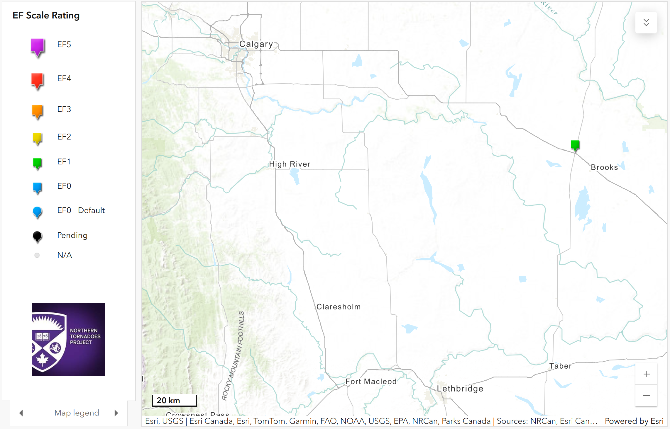
Regional map showing the location of the Brooks, AB EF1 downburst.
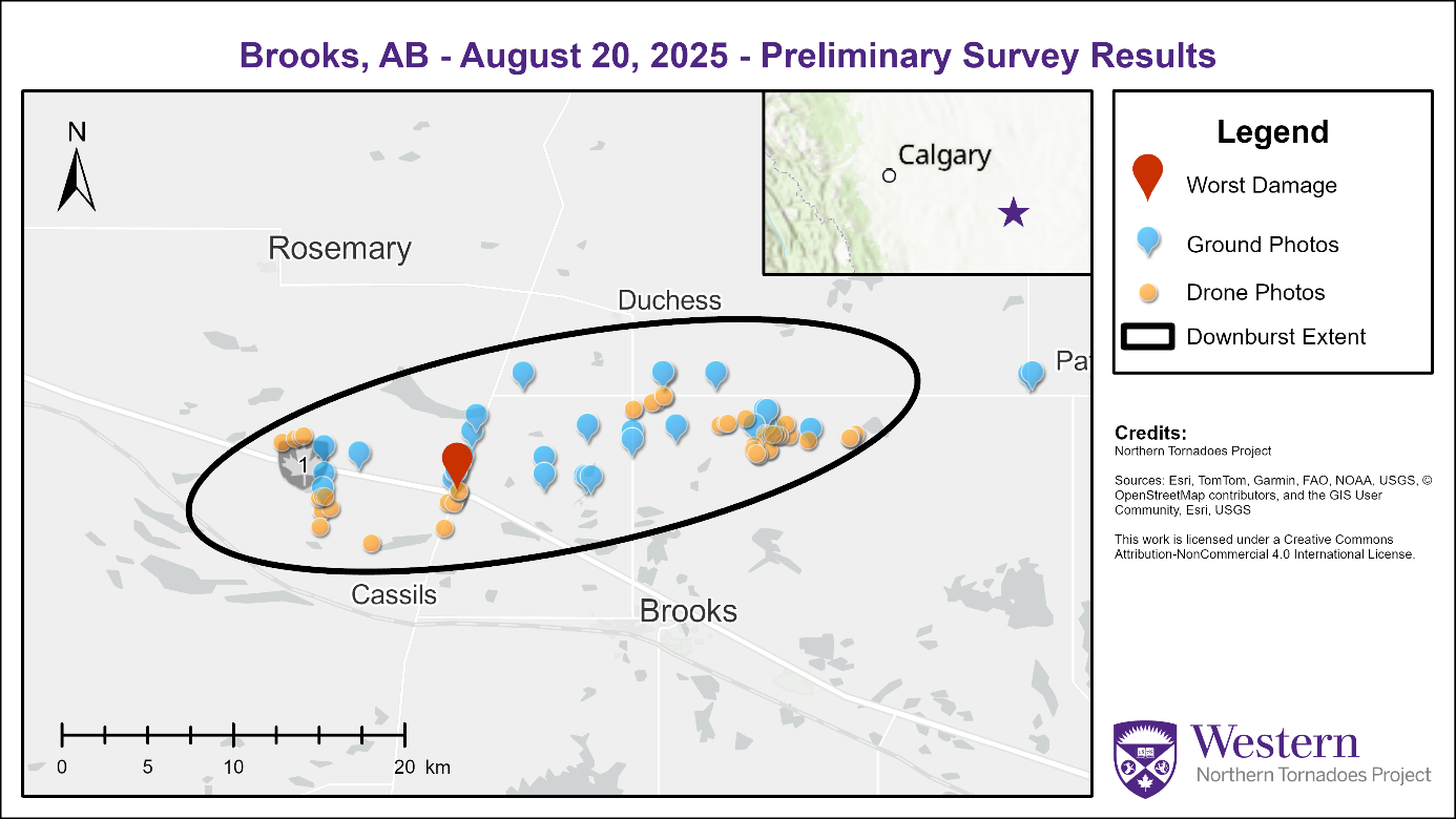
Survey map for the Brooks, AB EF1 downburst.
Metal-truss electrical transmission tower flattened by the EF1 downburst. Concurrent large hail may have been a contributing factor.
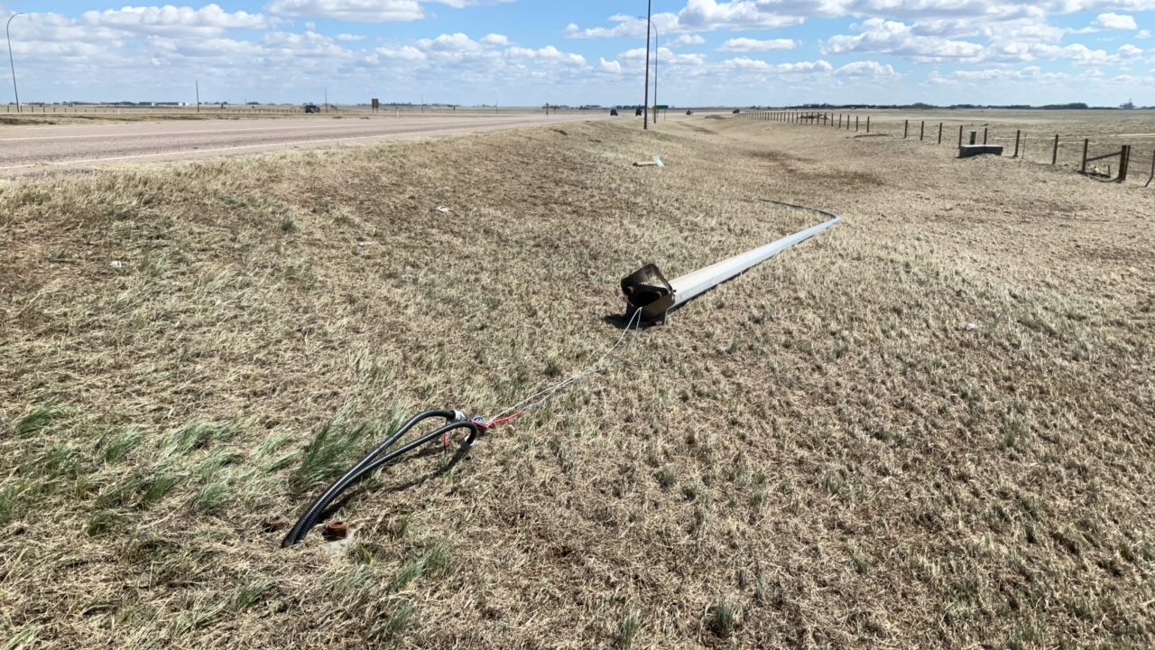
Luminary towers toppled by the downburst winds.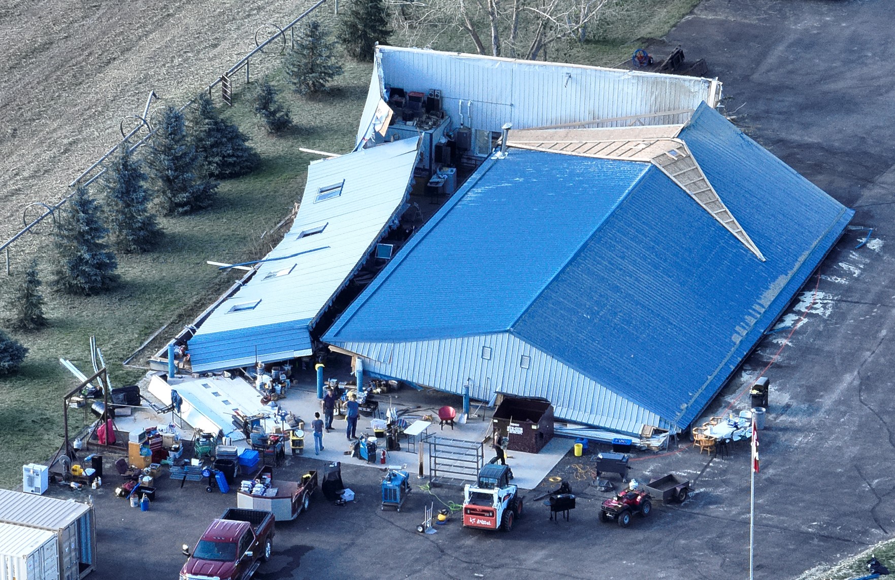
Outbuilding collapsed due to the EF1 downburst winds.
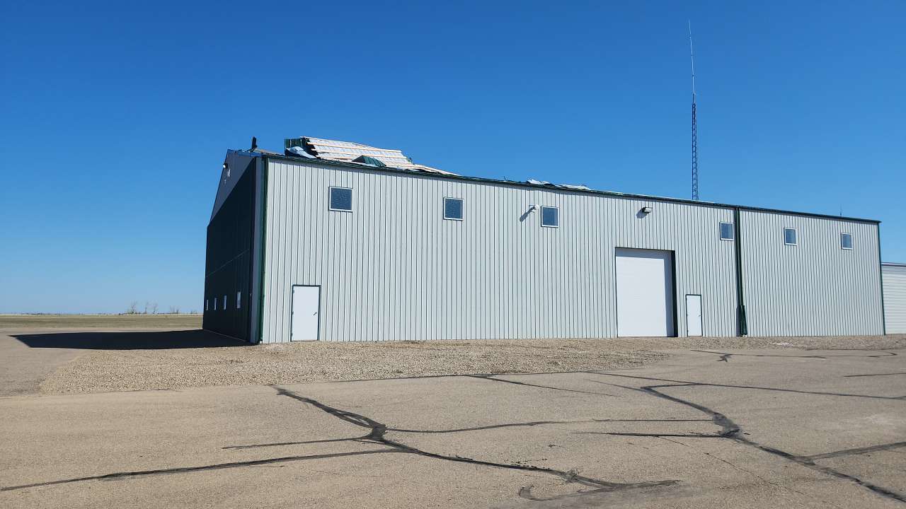
Structure with roof damage due to the downburst winds.
