EF1 downburst at Mitchell, ON on Jul 24
The NTP has confirmed - following a ground/drone investigation - that a downburst caused damage rated up to EF1 at Mitchell, ON on July 24. The worst damage was to a drive shed with maximum winds estimated at 150 km/h.
Full details are provided in the event summary below, along with regional and survey maps and damage images. The tornado can also be plotted on a map using the NTP Dashboard here.
====
Event Name: Mitchell, ON
Date: July 24, 2025
Start Time: 7:00 PM EDT (2300 UTC)
Final Classification: Downburst
Final EF-Scale Rating: EF1
EF-Scale Damage Indicator / Degree of Damage: SBO/DOD-5
Location of worst damage: 43.4561N, 81.2220W
Description: Damage to several barns, power poles, trees and crops was reported in the Mitchell area after a storm passed through. No injuries were reported. A limited NTP ground survey was completed on July 24, 2025, and a full ground and drone survey was completed on July 25-26. Damage assessed as EF1 downburst, with an estimated max. wind speed of 150 km/h, with intermittent damage found over an area approximately 13.4 km long and up to 8.6 km wide. Start time is based on witness reports. Satellite imagery review is pending.
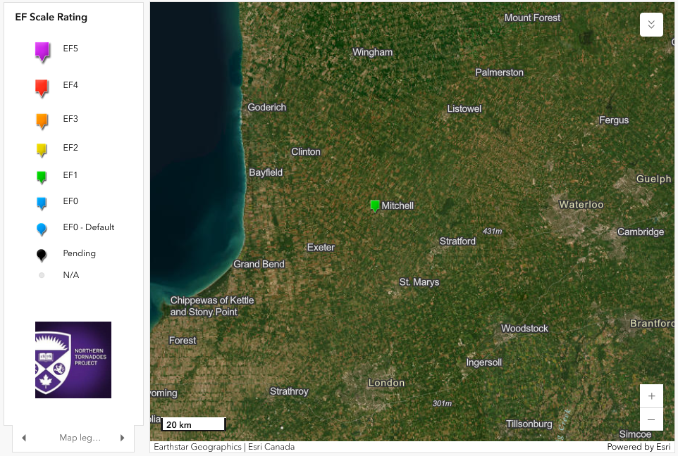
Regional map showing the location of the Mitchell, ON EF1 downburst.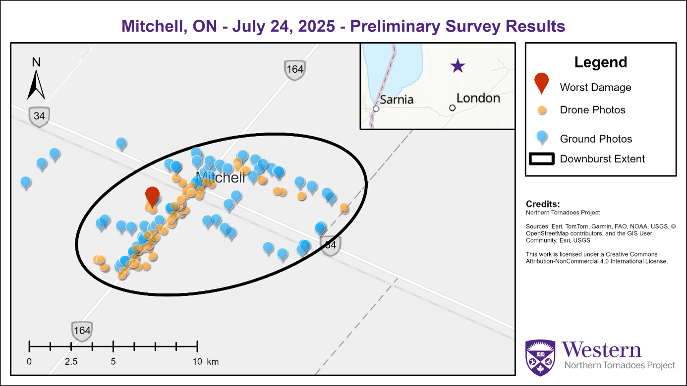
Survey map showing the locations of ground points/photos and drone images as well as the spatial extent of the EF1 downburst at Mitchell, ON.
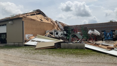
Ground photo of the worst damage point with the roof removed from a drive shed - assessed at SBO/DOD5 (EXP), 150 km/hr, EF1.
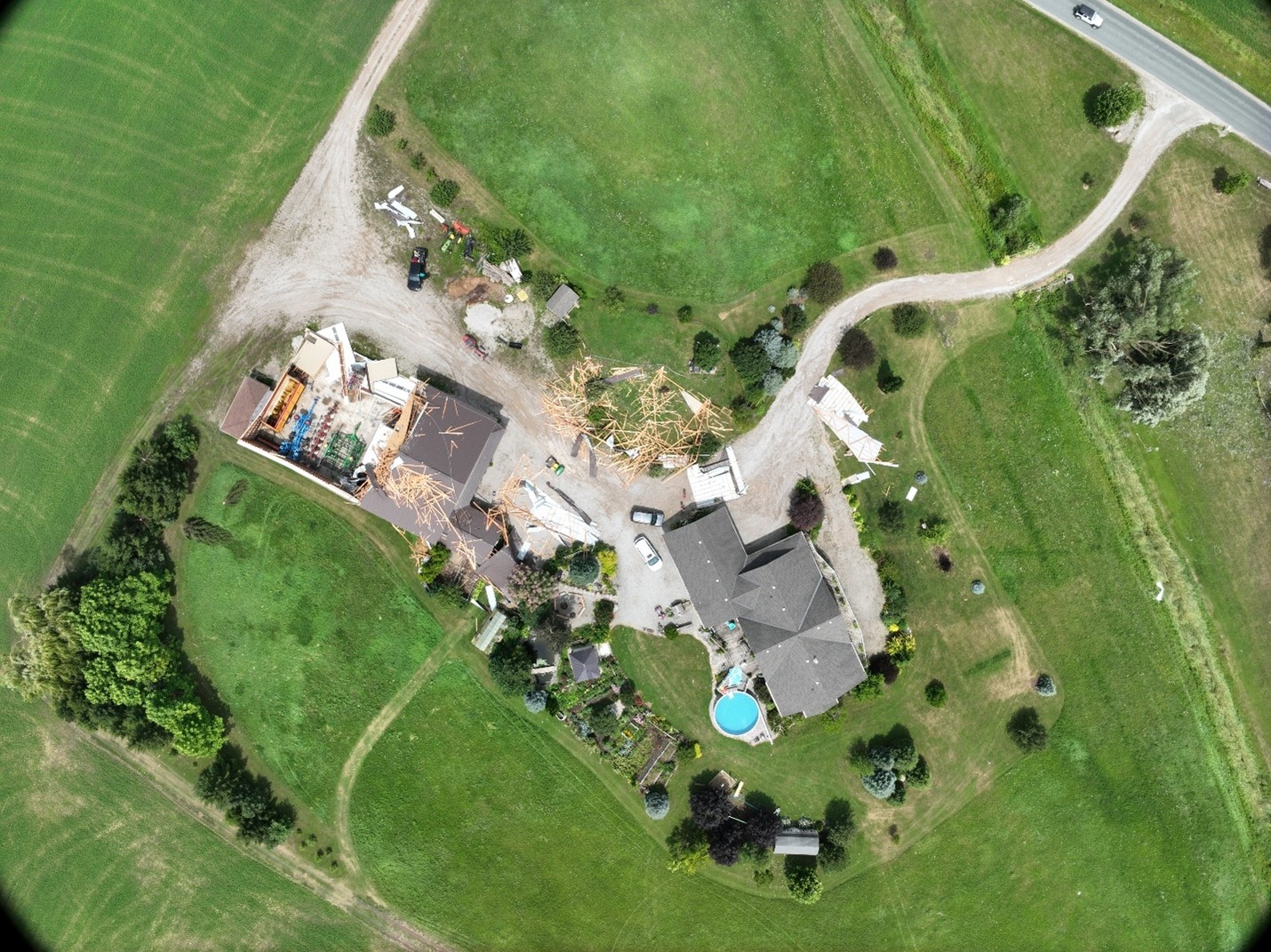
Nadir drone image at the worst damage point showing the roof of the drive shed removed and thrown to the east, plus scattered tree damage.