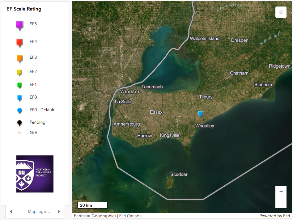
EF0 Microburst in SW ON on Aug 17
Following a field investigation by an NTP survey team, the NTP has confirmed that an EF0 microburst caused structural damage to a large drive shed in southwestern Ontario near Coatsworth on August 17. The damage was rated at the upper end of EF0. Details are provided in the event summary below, along with a regional map, survey map and drone survey photo. The microburst can be plotted on a map using the NTP Dashboard here.
====
Event Name: Coatsworth, ON
Date: August 17, 2025
Start Time: 4:00 AM EDT (0800 UTC)
Final Classification: Downburst (microburst)
Final EF-Scale Rating: EF0
EF-Scale Damage Indicator / Degree of Damage: SBO/DOD-6
Location of worst damage: 42.1512N, 82.4202W
Description: Barn damage was reported southwest of Coatsworth (northeast of Wheatley) after a storm passed through the area. No injuries were reported. An NTP ground and drone survey was completed on August 18, 2025, documenting the reported damage along with damage to crops and items blown downwind (including a trampoline). Damage assessed as EF0 downburst (microburst), with an estimated max. wind speed of 130 km/h, with damage found over an area approximately 500 m long and up to 300 m wide. Start time is radar estimated. Satellite imagery review is pending.
Regional map showing the location of the EF0 microburst at Coatsworth, ON.
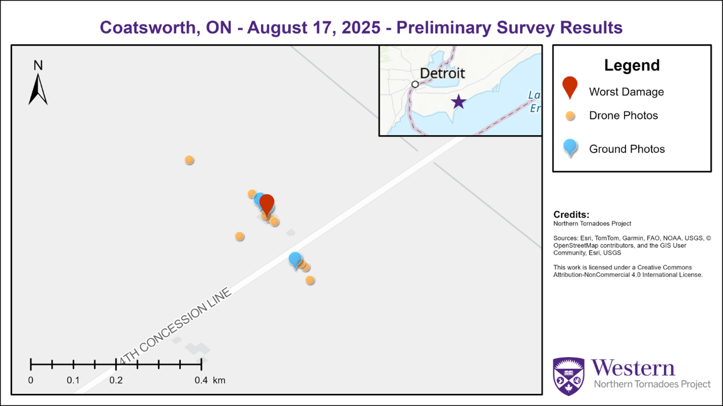
Preliminary survey map for the Coatsworth, ON microburst including the worst damage location alongside ground and drone photo locations.
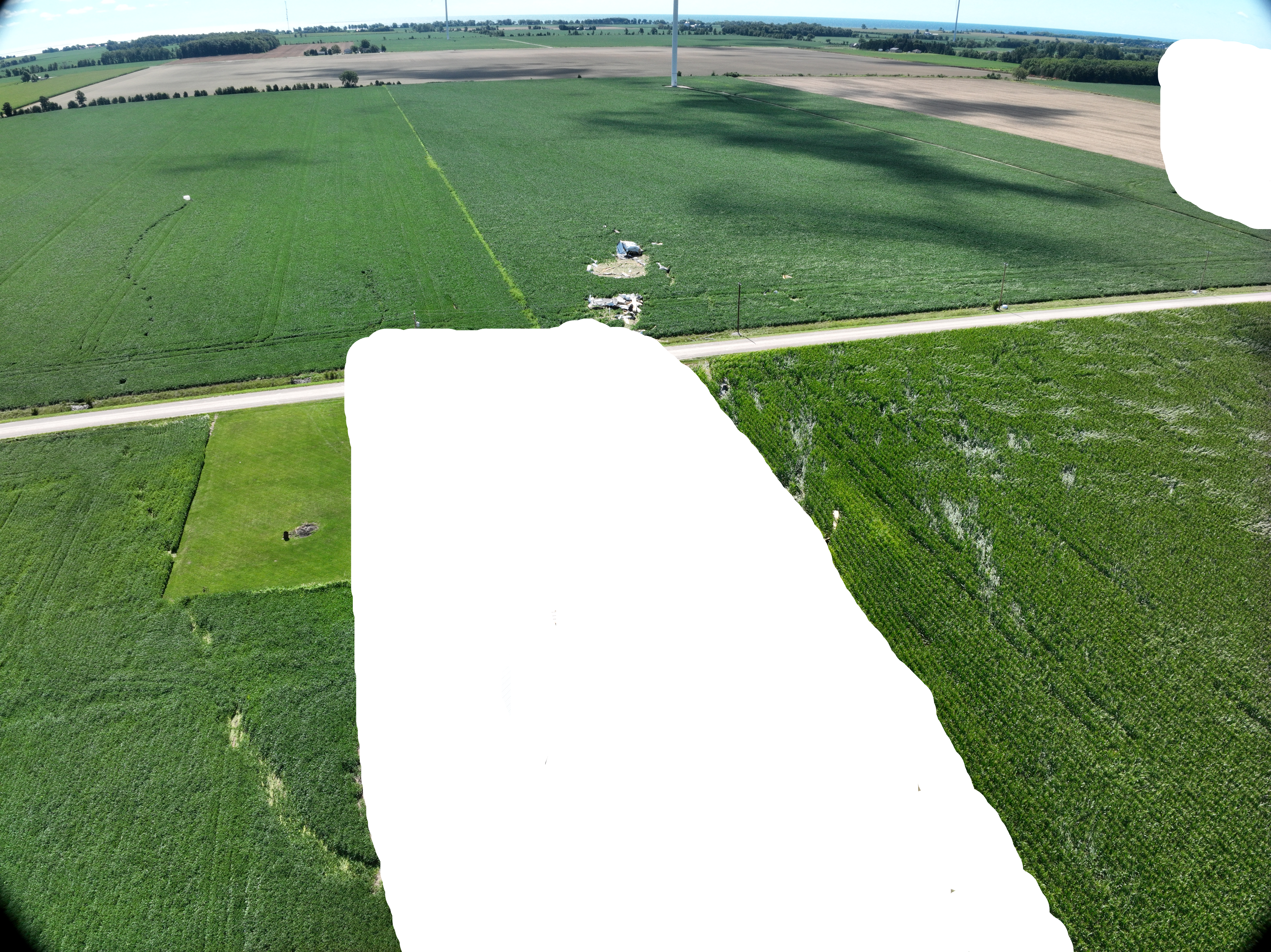
Drone photo of the area with the worst damage - note that identifying objects (including the machine shed with its roof off and some walls down) were removed at the request of the property owner. Parts of the building's roof were thrown well downwind (centre), a heavy object was rolled a long distance across the road and into a field (left), and there were numerous narrow patches in the corn field where the corn stalks were laying flat (right).
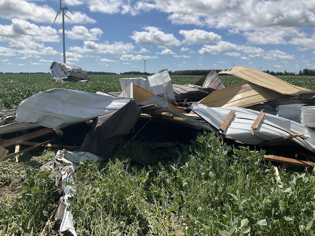
Ground photo of debris from farm roof lofted up to 150 m SE from the point of worst damage.