Canada's first EF2 tornado of 2025 at Lodgepole AB
The NTP has confirmed Canada's first recorded EF2 tornado of 2025 at Lodgepole AB on July 2. The tornado moved slowly in a crescent-shaped path, giving it a damage path length of not even 4 km. Details are provided in the event summary below, along with regional and survey maps and images from the investigation. The tornado can be plotted on a map using the NTP Dashboard here.====
Event Name: Lodgepole, AB
Date: July 2, 2025
Start Time: 5:10 PM MDT (2310 UTC)
Final Classification: Tornado (Over Land)
Preliminary EF-Scale Rating: EF2
EF-Scale Damage Indicator / Degree of Damage: C-T/DOD-5
Start of damage track: 53.1488N, 115.3281W
End of damage track: 53.1365N, 115.3159W
Location of worst damage: 53.1443N, 115.3389W
Description: Witnesses captured video and photos of a tornado north of Lodgepole (southwest of Drayton Valley), where tree damage was later reported. No injuries were reported. An NTP ground and drone survey was completed on July 3, 2025, documenting a curved track of damage in the treed area. Damage assessed as preliminary EF2 tornado, with an estimated max. wind speed of 190 km/h, track length of 3.36 km and max. path width of 600 m. The tree damage pattern suggests the tornado traveled roughly westward before curving back to the southeast (further analysis is pending). Start time is based on witness report. Satellite imagery review is pending.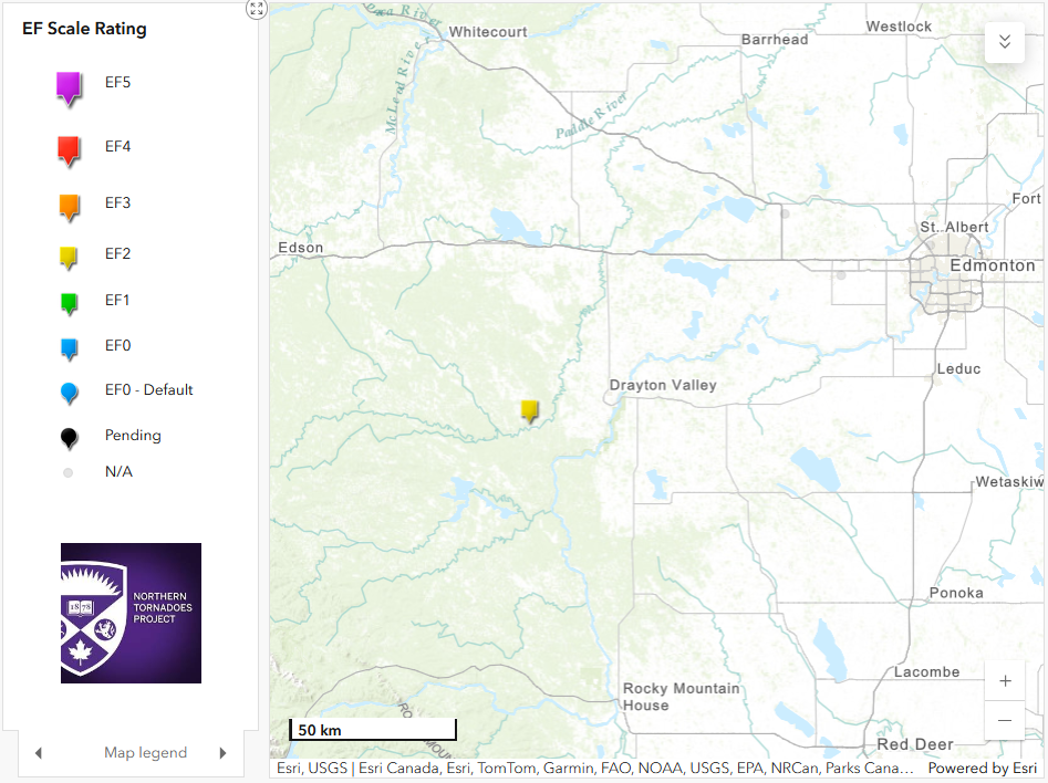
Regional map showing the location of the Lodgepole, AB EF2 tornado
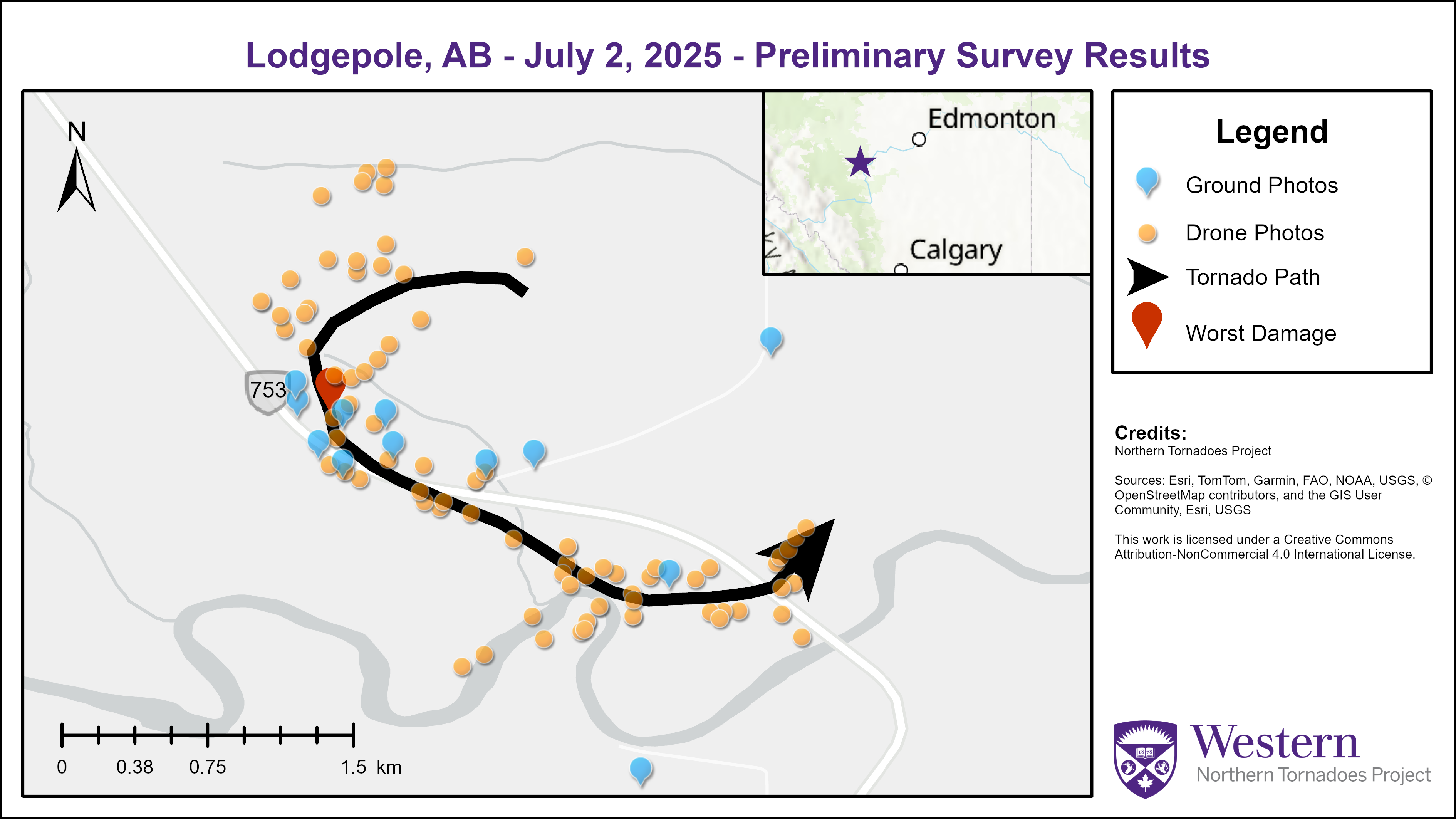
Survey map showing the track of the Lodgepole EF2 tornado.
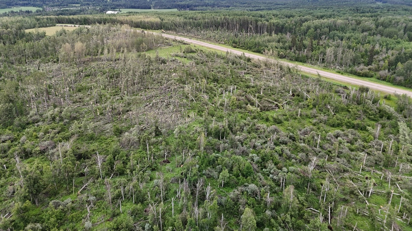
Oblique drone image of the worst damage location along the path of the Lodgepole EF2 tornado.
Nadir drone image of trees snapped from multiple directions along the damage path.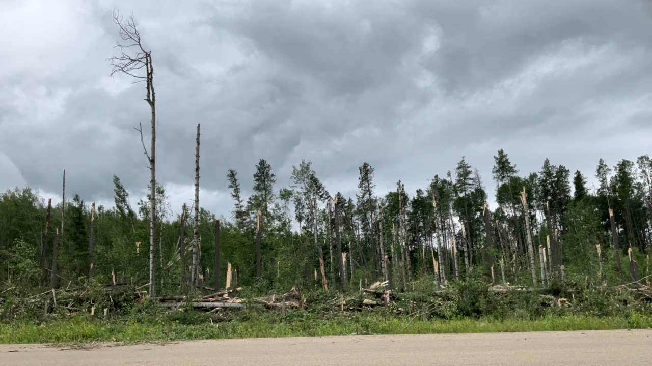
Ground photo showing numerous snapped trees along the damage path of the tornado.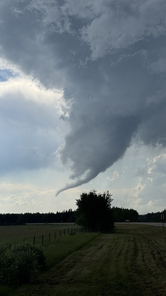
Photo of the funnel cloud associated with the Lodgepole supercell tornado, taken by NHP field director Jack Hamilton.