Two more tornadoes near Thunder Bay, ON on Aug 31
The NTP has confirmed two tornadoes near Thunder Bay, ON from the storms in that area on August 31. These are in addition to the previously confirmed tornado in the region at Marks Lake. In each case, there is a long, narrow path of damage rated at EF1.
Details are provided in the event summaries below, along with maps and photos. The tornadoes can be plotted on a map via the NTP Dashboard here.
====
Event Name: South Gilles, ON
Date: August 31, 2024
Start Time: 5:15 PM EDT (2115 UTC)
Final Classification: Tornado (Over Land)
Final EF-Scale Rating: EF1
EF-Scale Damage Indicator / Degree of Damage: C-T/DOD-5
Start of damage track: 48.2444N, 89.7765W
End of damage track: 48.2122N, 89.6977W
Location of worst damage: 48.2269N, 89.7380W
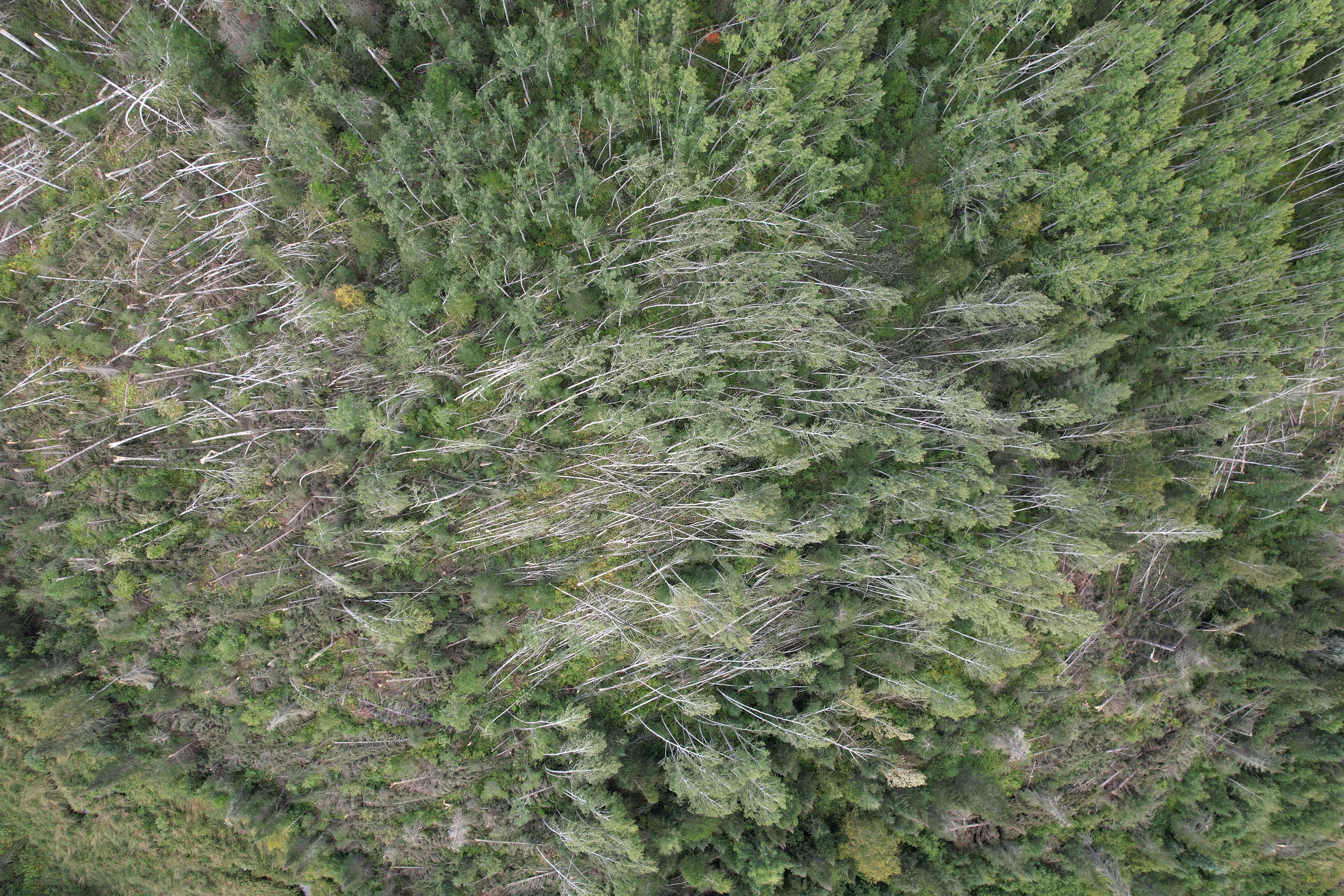
Description: Satellite imagery review of a storm track of interest revealed tornado damage in a forested area west of South Gillies. An NTP ground and drone survey was completed on September 5-6, 2024. Damage assessed as EF1 tornado, with an estimated max. wind speed of 145 km/h, track length of 6.86 km and max. path width of 480 m. Tornado motion was from the WNW (approx. 300 degrees). Start time is radar estimated.
Event Name: Oliver Lake, ON
Date: August 31, 2024
Start Time: 5:20 PM EDT (2120 UTC)
Final Classification: Tornado (Over Land)
Final EF-Scale Rating: EF1
EF-Scale Damage Indicator / Degree of Damage: SBO/DOD-7
Start of damage track: 48.2534N, 89.6438W
End of damage track: 48.2068N, 89.4677W
Location of worst damage: 48.2365N, 89.5874W
Description: Damage to trees and several structures was reported south of Oliver Lake (east of South Gilles, west of Moose Hill) after a storm passed through the area. No injuries were reported. An NTP ground and drone survey was completed on September 5-6, 2024, documenting the reported damage to homes, outbuildings and a storage barn, along with additional tree damage. Satellite imagery review revealed visible tree damage along the path. Damage assessed as EF1 tornado, with an estimated max. wind speed of 140 km/h, track length of 14.08 km and max. path width of 910 m. Tornado motion was from the WNW (approx. 290 degrees). Start time is radar estimated.
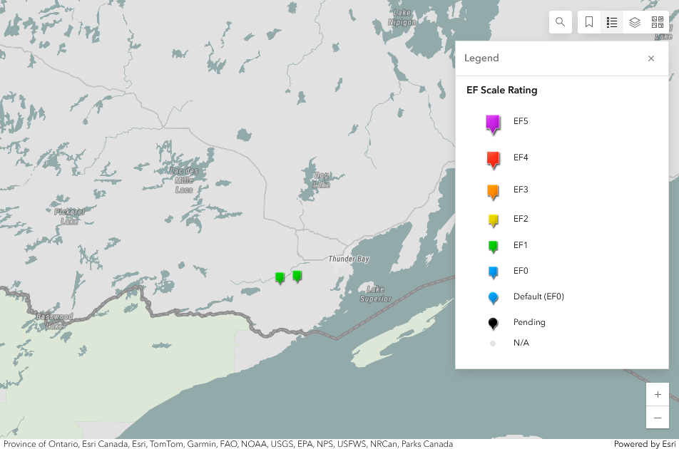
Regional map showing the locations of the two EF1 tornadoes southwest of Thunder Bay, ON.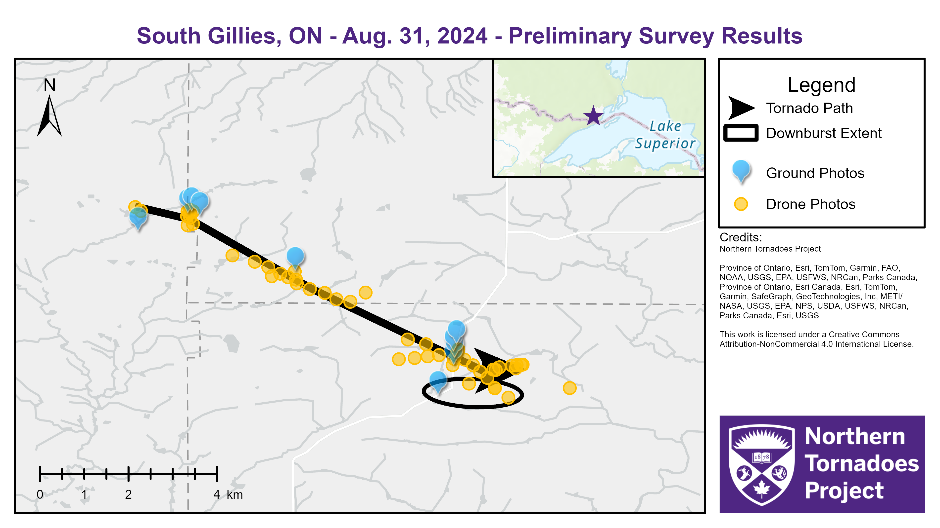
Survey map for the South Gillies tornado showing locations of ground and drone photos. Likely downburst damage is also shown.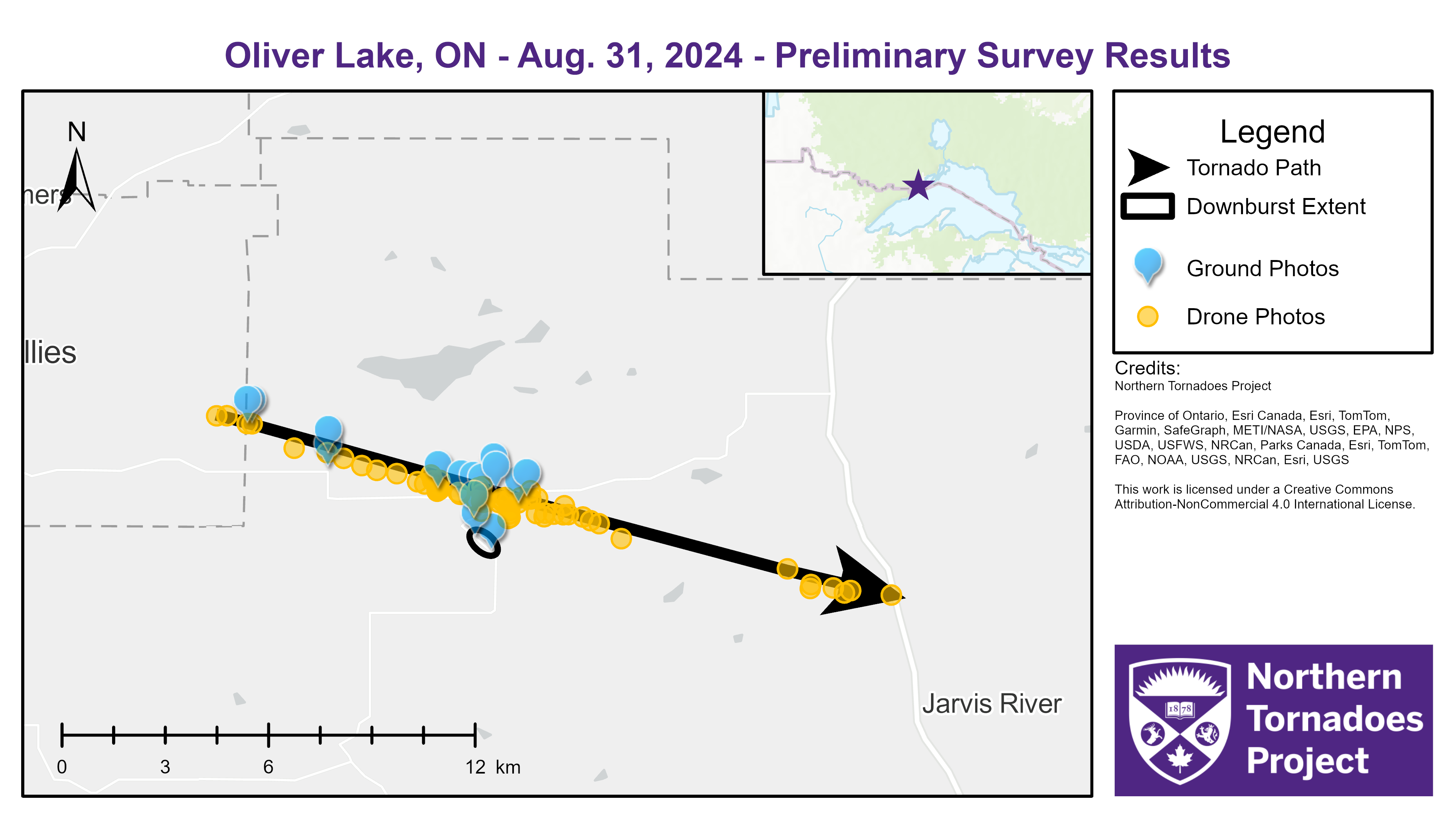
Survey map for the Oliver Lake tornado showing locations of ground and drone photos. Likely downburst damage is also shown.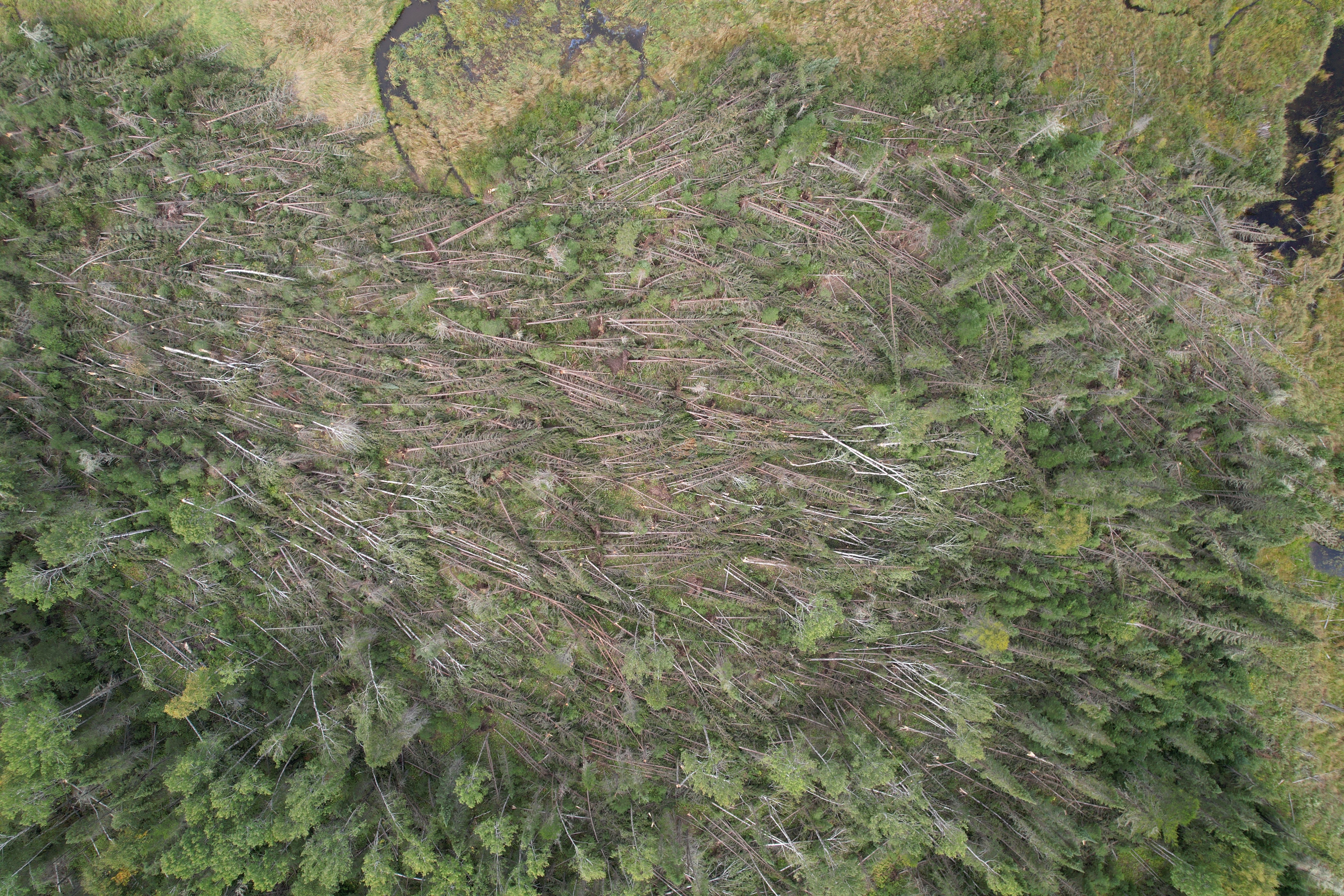
Drone photo showing treefall at the location of worst damage for the South Gillies EF1 tornado.
Drone photo showing treefall at the location of worst damage for the Oliver Lake EF1 tornado.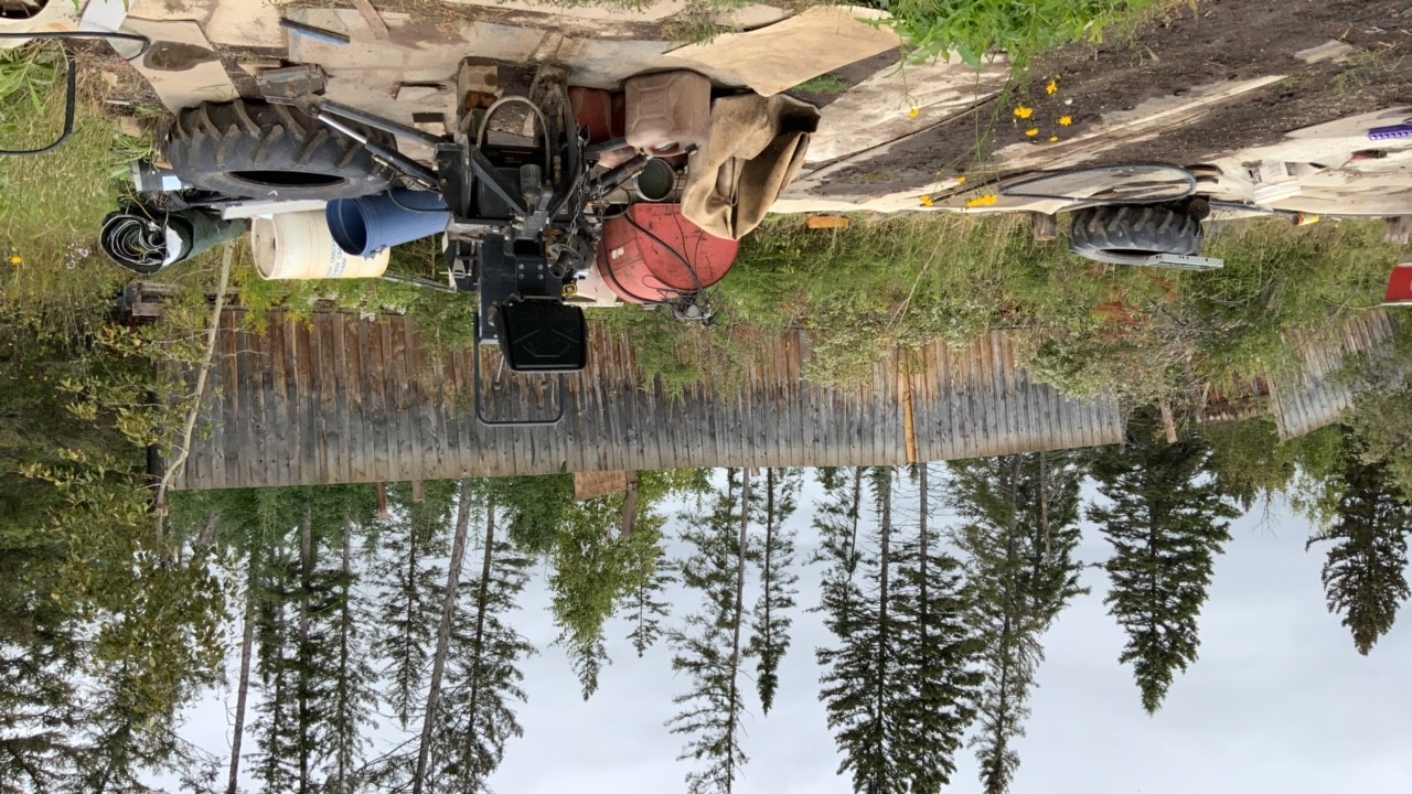
Ground photo of storage barn that was picked up and flipped upside-down downwind of the foundation.