First Canadian tornado of 2024 in ON
The first Canadian tornado of 2024 hit Malden Centre, ON on March 16. That ties the record for earliest recorded Ontario tornado - in Clifford, ON in 2016.
Photo evidence of potential tornado damage sent to NTP led to a storm damage survey on Saturday April 13th. The roof had been removed from a well-anchored double-wide mobile home (max wind of 150 km/h giving an EF1 rating), there was shingle damage and a downed tree at another residence, and numerous pine and spruce trees were downed in a woodlot further along the track. More tree damage would likely have occurred if the trees had been leafed out.
Radar evidence from the nearby tower Doppler radar at Detroit Metro Airport clearly shows an area of tight rotation in the exact location where the damage occurred. The rotation was located along the leading edge of thunderstorm outflow, making this a QLCS tornado. No tornado warning had been issued, and there were no reports of severe weather upstream in Michigan. In Ontario, the storm also generated severe hail.
The tornado event summary is provided below as well as a map, photos and a radar image. The event can also be plotted on the NTP Dashboard here.
====
Event Name: Malden Centre, ON
Date: March 16, 2024
Start Time: 7:25 PM EDT (2325 UTC)
Final Classification: Tornado (Over Land)
Final EF-Scale Rating: EF1
EF-Scale Damage Indicator / Degree of Damage: DWMH/DOD-6
Start of damage track: 42.0479N, 83.0417W
End of damage track: 42.0422N, 83.0310W
Location of worst damage: 42.0473N, 83.0410W
Description: Notable roof damage to a manufactured home was reported after a storm passed through the Malden Centre area. Nearby tree damage and minor damage to a second manufactured home was also reported. Damage occurred in an area where rotation was apparent on radar (seen by TDTW). An NTP ground and drone survey was completed on April 13, 2024, documenting the reported damage and some additional tree damage. Damage assessed as EF1 tornado, with an estimated max. wind speed of 150 km/h, track length of 1.10 km and max. path width of 100 m. Tornado motion was from the NW (approx. 305 degrees). Start time is radar estimated. Satellite imagery review did not reveal any visible damage.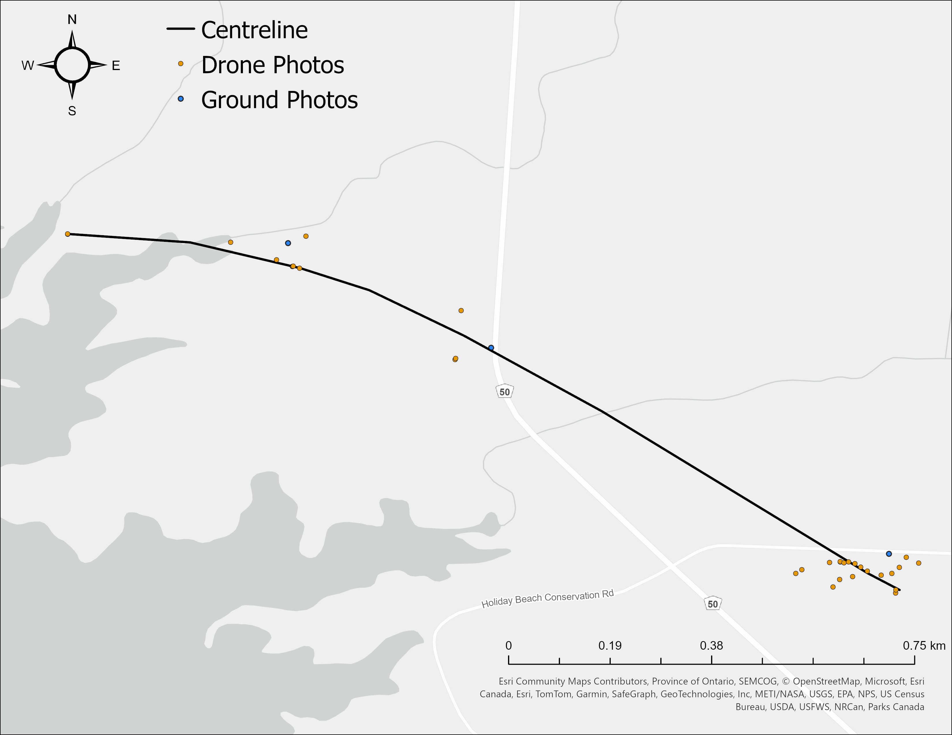
Map showing the tornado track just south of Malden Centre, and points where damage was documented.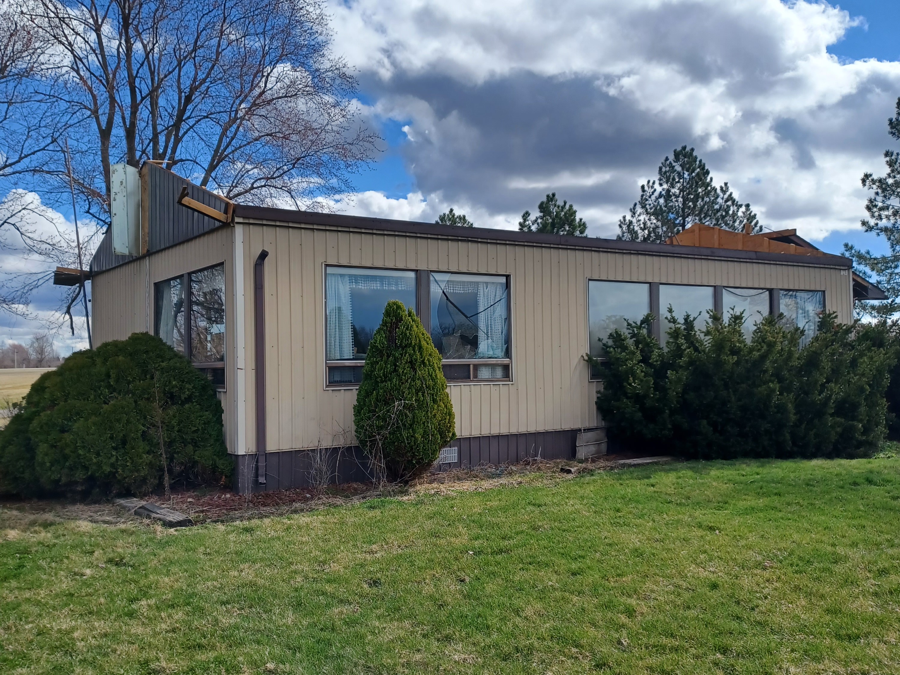
Roof removed from one of two attached double-wide mobile homes. Photo by Kevin Sprague (used with permission).
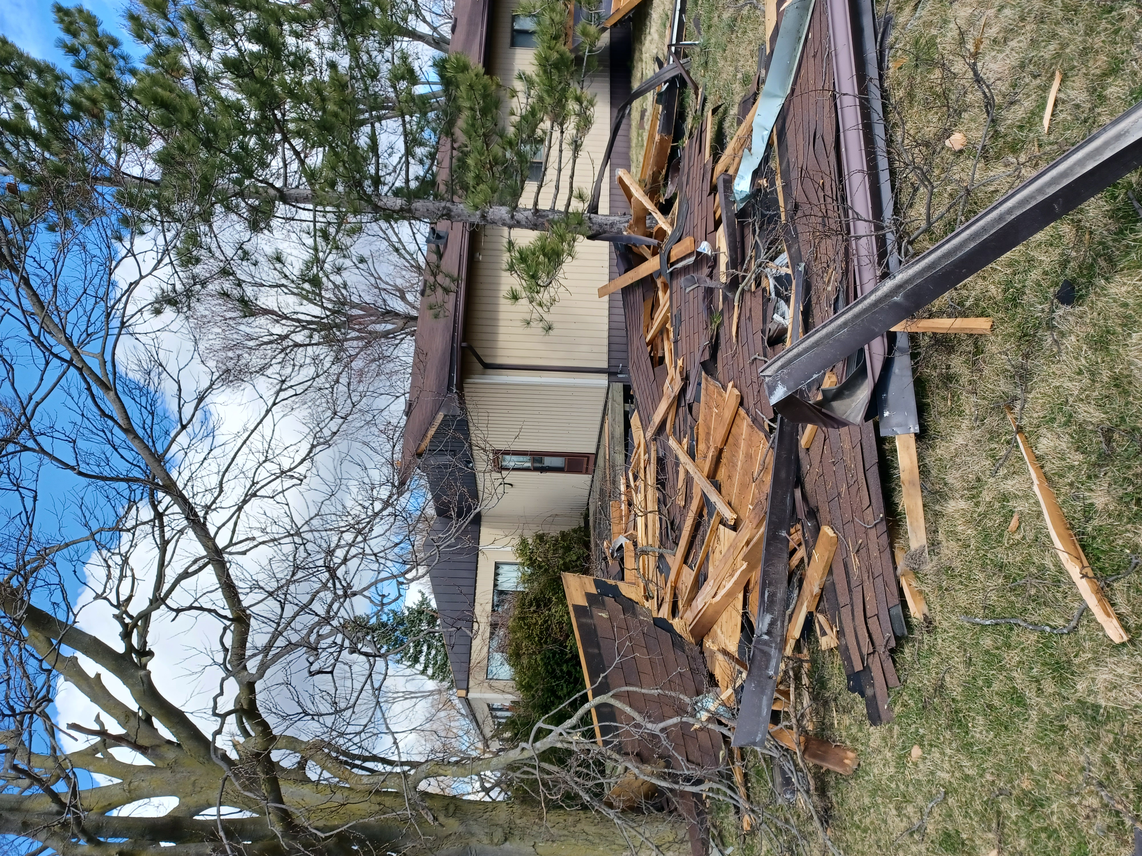
Roof debris downwind, and roof of second double-wide mobile home with half of its roof off. Photo by Kevin Sprague (used with permission).
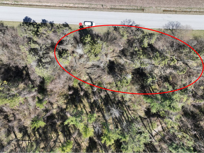
Drone image showing trees down to the ESE along the path of the tornado (circled).
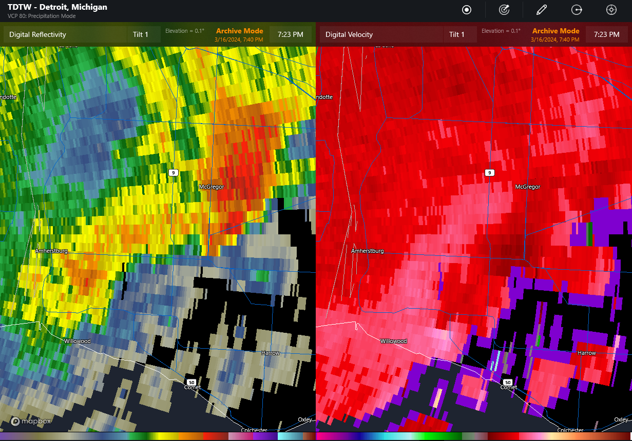
TDTW radar at 7:23 pm EDT showing main storm near Essex producing severe hail (left image), and gust front trailing back to the southwest with embedded area of rotation right over the location with the roof removed (lower middle of image at right). The rotation is apparent only in the two lowest tilts (second tilt not shown).