Windsor tornado update
Further NTP investigation has resulted in updates to the event information for the Windsor EF0 tornado of August 24. New damage was reported at the shore of the Detroit River, and drone imagery collected along the path of the tornado was fully analyzed.
Updated information is provided in the event summary below, along with an updated event map. Event information can also be viewed and plotted via the NTP Dashboard at https://uwo.ca/ntp/dashboard.
====
Event Name: Windsor, ON (updates in italics)
Date: August 24, 2023
Start Time: 10:30 PM EDT (0230 UTC)
Final Classification: Tornado (over land)
Final EF-Scale Rating: EF0
EF-Scale Damage Indicator / Degree of Damage: FR12/DOD-2
Start of damage track: 42.3005N, 83.0811W
End of damage track: 42.2093N, 82.9992W
Location of Worst Damage: 42.2638N, 83.0401W
Description: Damage to houses, fences, trees and a warehouse was reported in Windsor after a storm passed through the area. No injuries were reported. An NTP ground and drone survey was completed on August 25-26, 2023, documenting the reported damage along with crop damage. Damage assessed as EF0 tornado, with an estimated max. wind speed of 125 km/h, track length of 12.5 km and max. path width of 580 m. Tornado motion was from the NW (approx. 325 degrees). Satellite imagery review is pending. Start time is based on radar.
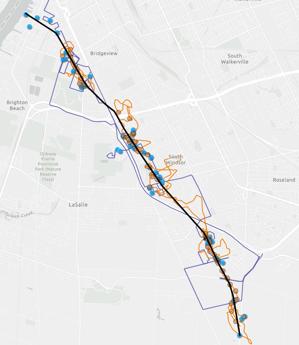
Updated map for the Windsor tornado showing locations of ground (blue) and drone (orange) photos, drone flight paths (orange lines) and the survey route (blue lines). The black line is the preliminary centreline of the tornado, with motion from top-left to bottom-right. See original blog post for other images.