Two tornadoes in Manitoba
Following the intense storms of the evening of June 20th in southwest Manitoba, NTP has been busy collecting public reports, analyzing radar and satellite imagery, and having two teams conducts ground/drone surveys (a third and final survey is underway). The results are that two EF1 tornadoes occurred between William Lake Provincial Park at the border to the Ninette area to the northeast. More review is needed to ensure exact locations and times, lengths and widths, etc. so results should be considered preliminary. Summaries for these tornadoes, plus a map and representative photos for each tornado are provided below. The events can also be plotted using the NTP Dashboard here.
===
Event Name: East Boundary Lake (William Lake PP), MB
Date: June 20, 2023
Start Time: 9:35 PM CDT (0235 UTC)
Final Classification: Tornado (Over Land)
Final EF-Scale Rating: EF1
EF-Scale Damage Indicator / Degree of Damage: C-T/DOD-5
Start of damage track: 48.9993N, 99.9597W
End of damage track: 49.0488N, 99.9148W
Location of worst damage: 49.0067N, 99.9553W
Description: A storm track of interest was identified after a compact radial velocity couplet and tornado debris signature were observed near William Lake Provincial Park along the North Dakota - Manitoba border via KMBX radar products. Satellite imagery review revealed a tornado damage path in a forested area that likely started approximately 100 m south of the Canadian border near Carpenter, ND (start point 48.9983N, 99.9603W), with most of the damage (including the worst) occurring in Canada. An NTP drone survey of the Canadian portion of the tornado track was completed on June 23, 2023. A preliminary analysis of the Canadian portion of the track was completed by NTP. Event was assessed as EF1 tornado, with an estimated max. wind speed of 145 km/h, track length of 6.50 km and max. path width of 210 m. Tornado motion was from the SSW (approx. 210 degrees). NWSFO Bismarck has been notified as there may be more damage on the US side of the border. Further investigation is pending, including additional review of drone imagery.
Event Name: Killarney, MB
Date: June 20, 2023
Start Time: 9:55 PM CDT (0255 UTC)
Final Classification: Tornado (Over Land)
Final EF-Scale Rating: EF1
EF-Scale Damage Indicator / Degree of Damage: SBO/DOD-6
Start of damage track: 49.2331N, 99.7480W
End of damage track: 49.3513N, 99.5969W
Location of worst damage: 49.2343N, 99.7458W
Description: Structural and tree damage was reported in the Killarney - Ninette area following a storm passing though. An NTP ground and drone survey was completed on June 21 and 22, 2023. The damage lined up with moderately strong radial velocity couplet via KMBX radar products. Event was assessed as EF1 tornado, with an estimated max. wind speed of 155 km/h, track length of 17.5 km and max. path width of 1.2 km. Tornado motion was from the SW (approx. 220 degrees). Further investigation is pending, including satellite imagery review and additional drone imagery review.
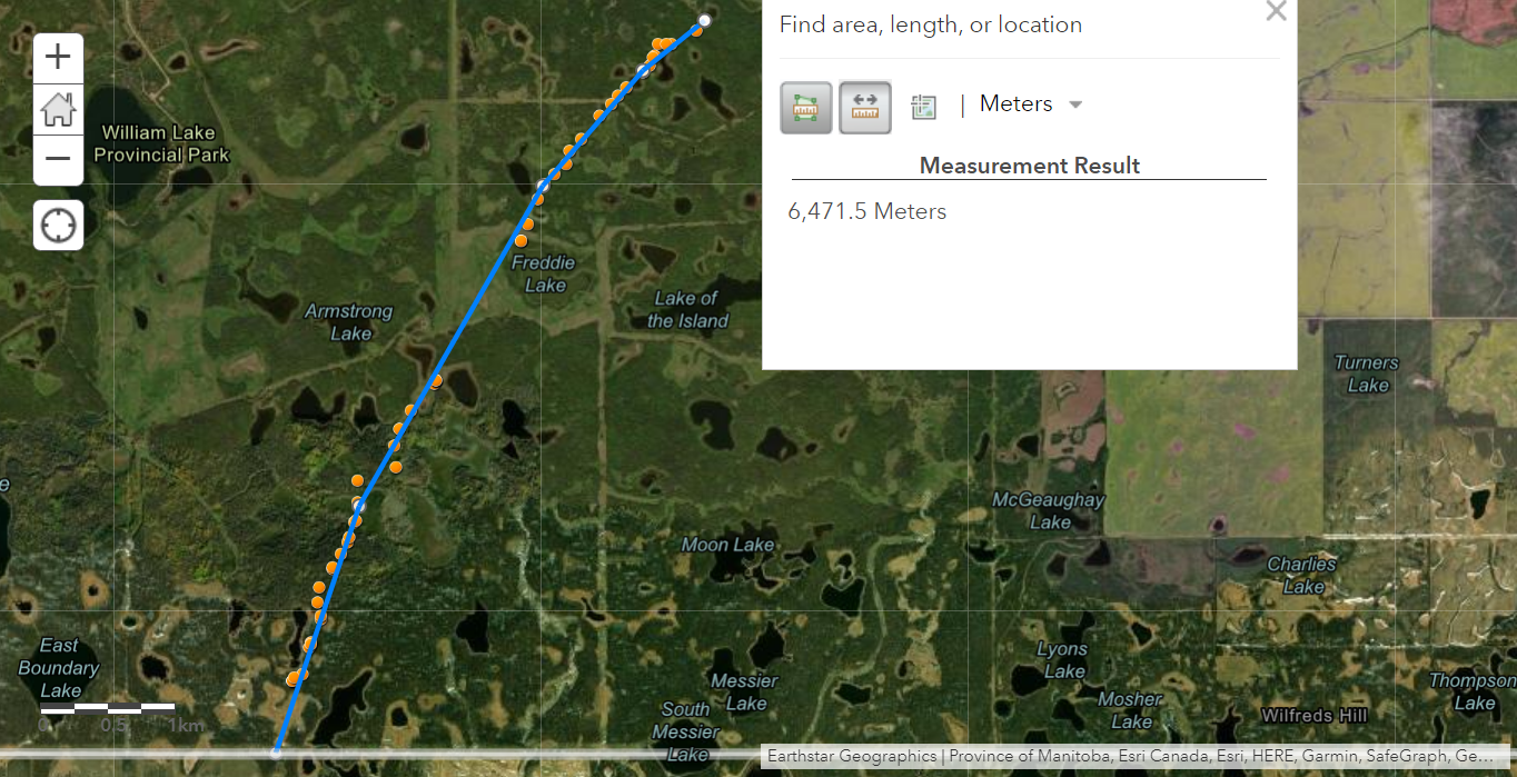
Map showing tornado track starting near East Boundary Lake and locations of drone images. Not the US border at bottom. Sidenote: the survey team had to bushwack for hour to get closer enough to the track to obtain drone imagery - that's commitment :)
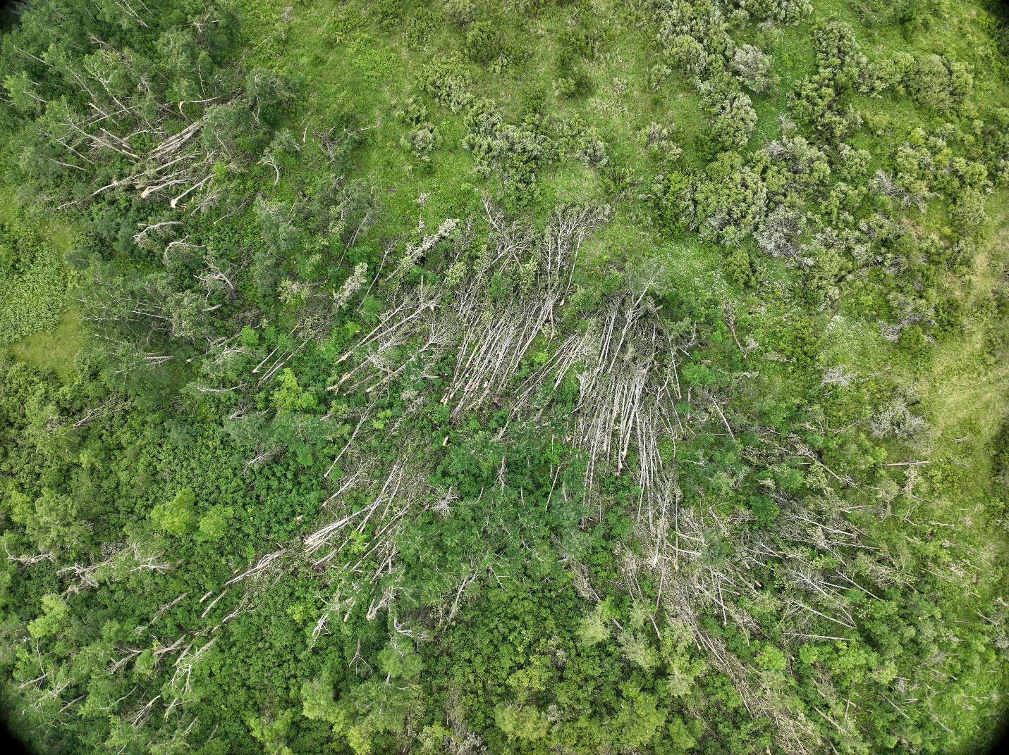
Drone image of clearly convergent treefall along the tornado path.
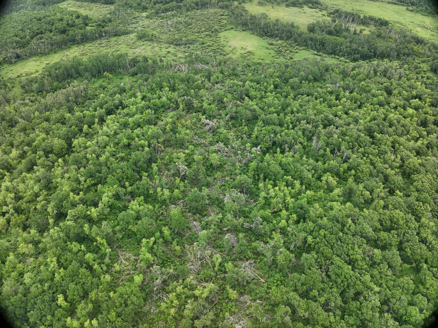
Drone image showing a section of the tornado path looking NE.
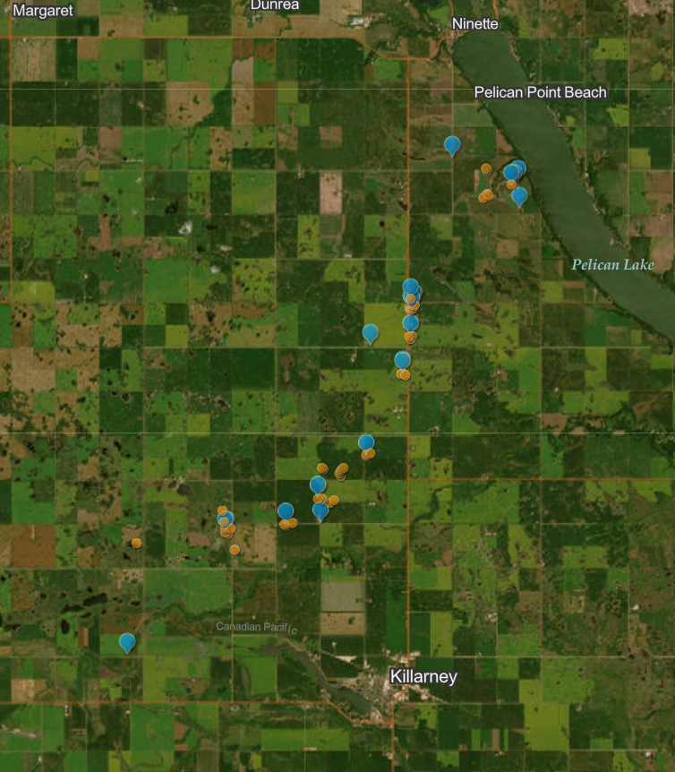
Map of showing the locations of ground photos (blue) and drone photos (orange) along the tornado damage path near Killarney.
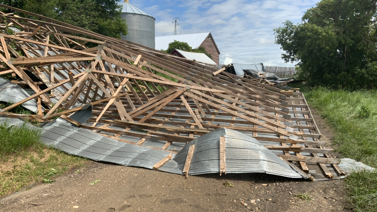
Farm structure damage along tornado path.
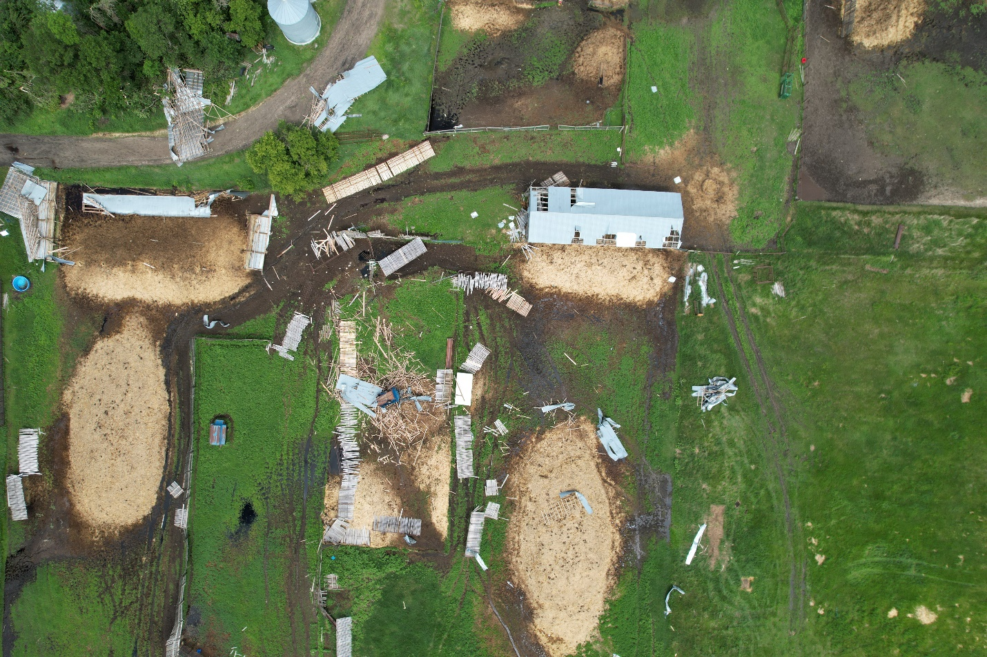
Drone image showing damage to the same farm along tornado path.