Tornado in NW Ontario
Preliminary investigation of the supercell storms from the evening of July 9th in NW Ontario has resulting in the confirmation of at least one tornado. Partially clear satellite imagery has revealed a long, narrow path of tree damage that can be rated at least EF1. Preliminary details on the tornado are provided below, in addition to a map and satellite image. Further investigation of this tornado, and others that may have occurred that day, is required. An aircraft survey may be necessary.
====
Preliminary Event Name: Hine Lake, ON
Date: July 9, 2023
Preliminary Start Time: 7:25 PM EDT (2325 UTC)
Final Classification: Tornado (over land)
Preliminary EF scale rating: EF1
Start of visible damage track: 49.3028N, 89.9400W
End of visible damage track: 49.2934N, 89.7724W
Description: Partial satellite imagery review of a storm track of interest revealed a visible tornado damage path in forested areas, however clouds in satellite imagery obscure the damage path start and end points. The visible damage track is least 12 km long and up to 400 m wide. Track details along with the EF-scale rating and max. wind speed will be finalized pending the availability of cloud-free satellite imagery for review. Further analysis may include aerial imagery review. Preliminary event name and start time may be updated when tornado start point is confirmed.
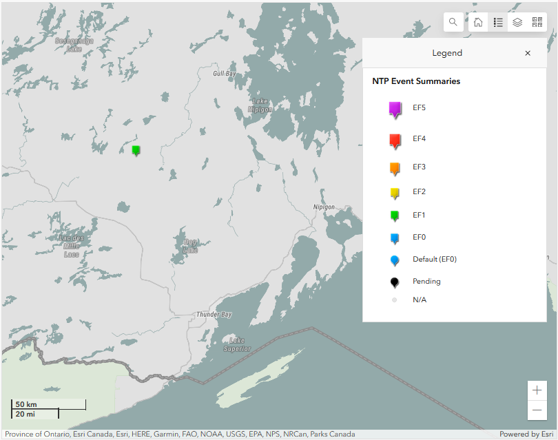
Map from the NTP Dashboard showing the preliminary start location of the tornado in NW Ontario.
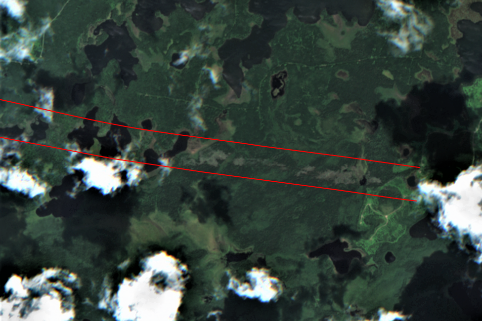
Sentinel-2 satellite imagery showing evidence of a long, narrow path of damage in clear areas between clouds (located between red lines).