Tornado data on NTP Dashboard now 'complete'
The years 2017 and 2018 were pilot seasons for the Northern Tornadoes Project, with the project scope limited to mostly the forested regions of Ontario and Quebec. Only significant tornadoes in other regions of Canada were investigated by NTP during that time (e.g. the Alonsa, MB EF4 tornado). So NTP's open data and dashboard did not include all tornadoes that were confirmed during 2017 and 2018 across Canada - just ones that were investigated by NTP. That has now been addressed!
Also added are several tornadoes in 2019 and 2020 that were only found recently upon systematic satellite investigation.
The result is that we have added another 79 tornado events to our open data. Here's how it breaks down:
* 12 tornadoes from 2017-2020 found during systematic satellite investigation
* 27 tornadoes from 2017-2019 found during historical review (mainly by satellite)
* 40 tornadoes investigated by ECCC
* Four of these required updated track details as a result of the NTP satellite analysis
* Two were surveyed by Western students though not as part of NTP
* By province: 2 in BC, 10 in AB, 25 in SK, 7 in MB, 17 in ON, and 18 in QC
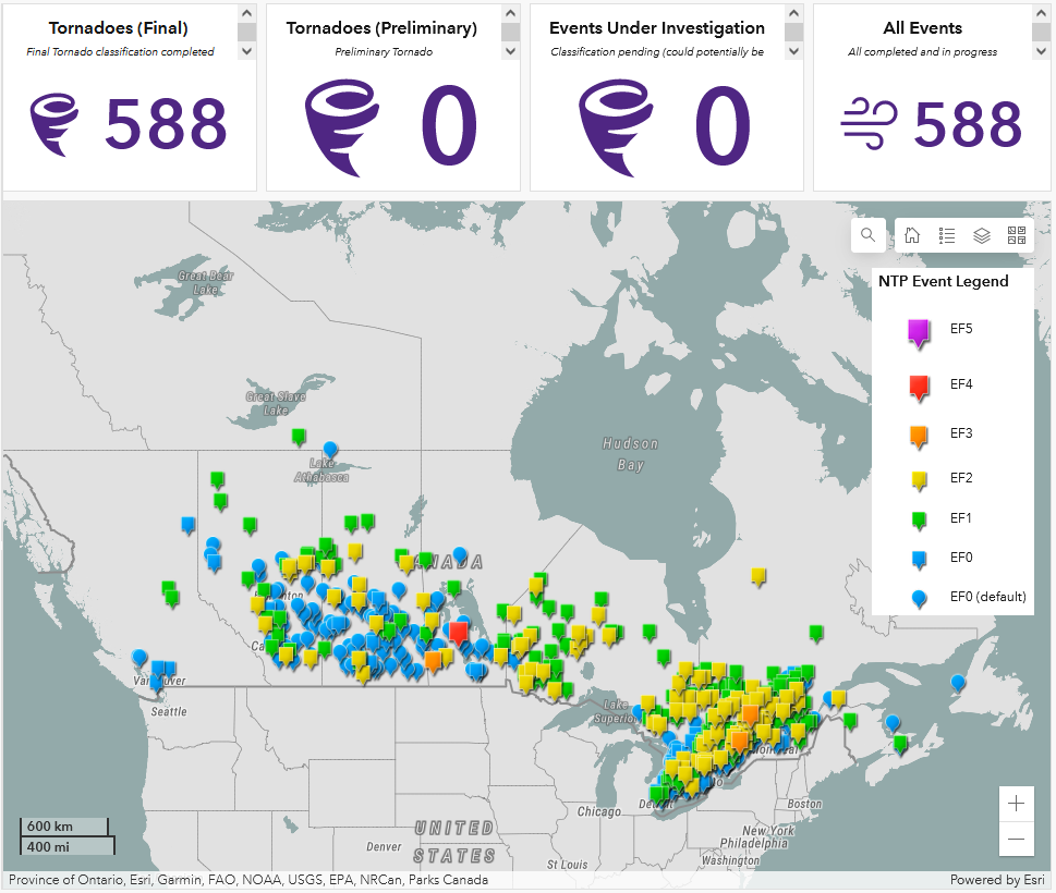
That brings the total number of tornadoes in NTP's open data from 2017 to 2022 to 588 - giving an average of 98 tornadoes per year. Recall that the official average from the last published 30-year tornado climatology (1980-2009) is 61.3 per year. The impact of NTP's efforts on finding Canada's 'missing tornadoes' is pretty clear.
Here's a map from the dashboard showing all 588 tornado events. If you go to the dashboard and zoom in, there are some really interesting 'holes' with little to no tornado activity over the last 6 years. For some of these, we know why (e.g., downwind of a Great Lake). For others, for future study...