Tornado and downburst in SW ON on July 26
An NTP investigation has concluded that a tornado and a downburst caused the reported damage in SW ON on July 26. At Blenheim, an EF1 tornado cut through the northern end of town while in the Harrow and Kingsville areas, a downburst also caused EF1 damage.
More details are provided in the summaries below, as well as survey maps and images. Event information can also be viewed and plotted via the NTP Dashboard at https://uwo.ca/ntp/dashboard.
====
Event Name: Blenheim, ON
Date: July 26, 2023
Start Time: 4:35 PM EDT (2035 UTC)
Final Classification: Tornado (over land)
Final EF-Scale Rating: EF1
EF-Scale Damage Indicator / Degree of Damage: SBO/DOD-7
Start of damage track: 42.3073N, 82.0649W
End of damage track: 42.3520N, 81.9641W
Location of worst damage: 42.3402N, 82.0014W
Description: Damage to homes, sheds and trees was reported in Blenheim after a storm passed through. No injuries were reported. An NTP ground and drone survey was completed on July 27, 2023, documenting a long narrow track of damage, including some crop damage. Damage assessed as EF1 tornado, with an estimated max. wind speed of 160 km/h, track length of 9.77 km and max. path width of 300 m. Tornado motion was from the WSW (approx. 240 degrees). Satellite imagery review is pending. Start time is radar estimated.
Event Name: Harrow-Kingsville, ON
Date: July 26, 2023
Start Time: 3:55 PM EDT (1955 UTC)
Final Classification: Downburst
Final EF-Scale Rating: EF1
EF-Scale Damage Indicator / Degree of Damage: C-ETL/DOD-4
Location of worst damage: 42.0141N, 82.9245W
Description: Damage to power poles and trees was reported in the Harrow-Colchester area and eastward to Kingsville after a storm passed through. No injuries were reported. An NTP ground and drone survey was completed on July 27, 2023, documenting the reported damage along with damage to barns and crops. Damage assessed as EF1 downburst, with an estimated max. wind speed of 145 km/h. Satellite imagery review is pending. Event start time is radar estimated.
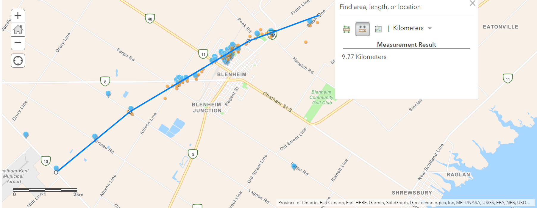
Map of tornado track through Blenheim, with blue pins indicating where damage was documented from the ground and orange circles indicating where drone images were taken.
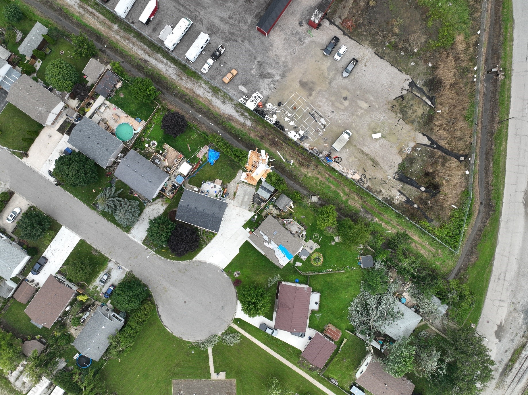
Drone photo of worst damage on Vander Ave in Blenheim.
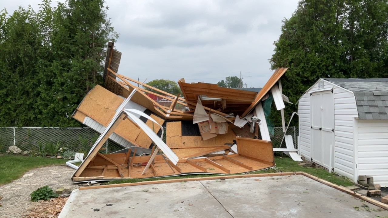
Ground photo of worst damage seen in drone image. Shed nailed and anchored to foundation.
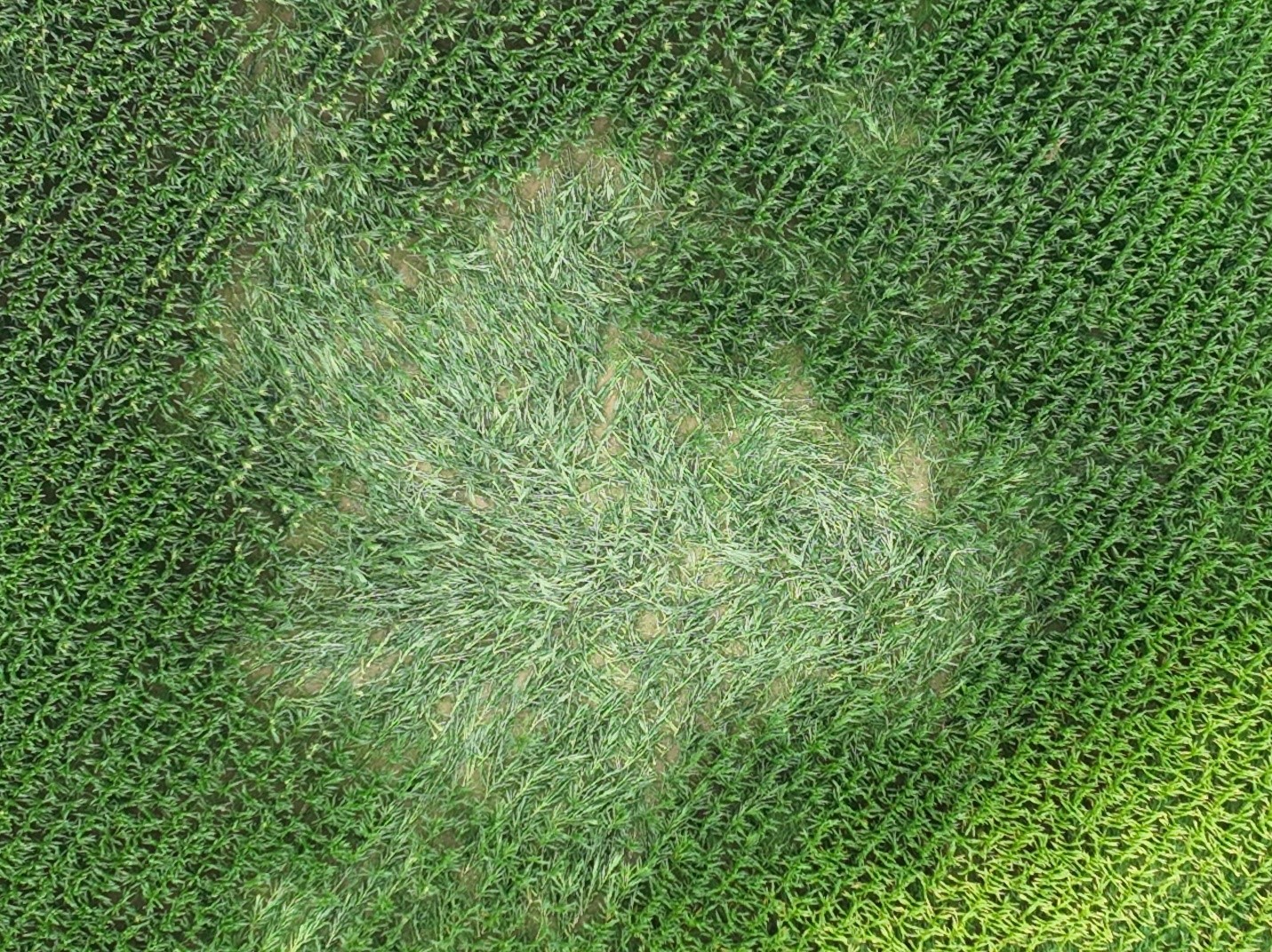
Tornadic swirl patterns in crops north of Mango Lane in Blenheim.
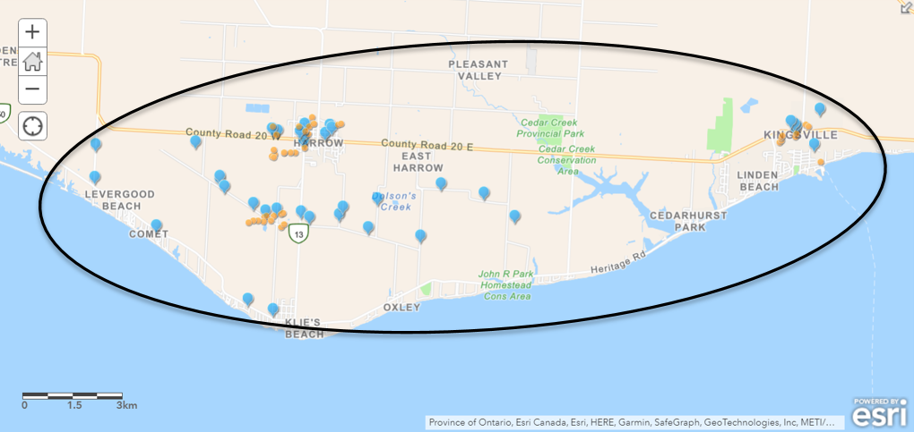
Map showing the location of the downburst that caused damage in the Harrow/Kingsville area, with blue pins indicating where damage was documented from the ground and orange circles indicating where drone images were taken.
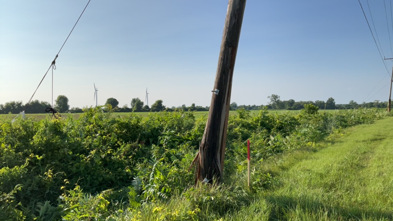
A snapped power pole SW of Harrow. A number of power poles were snapped in the area.
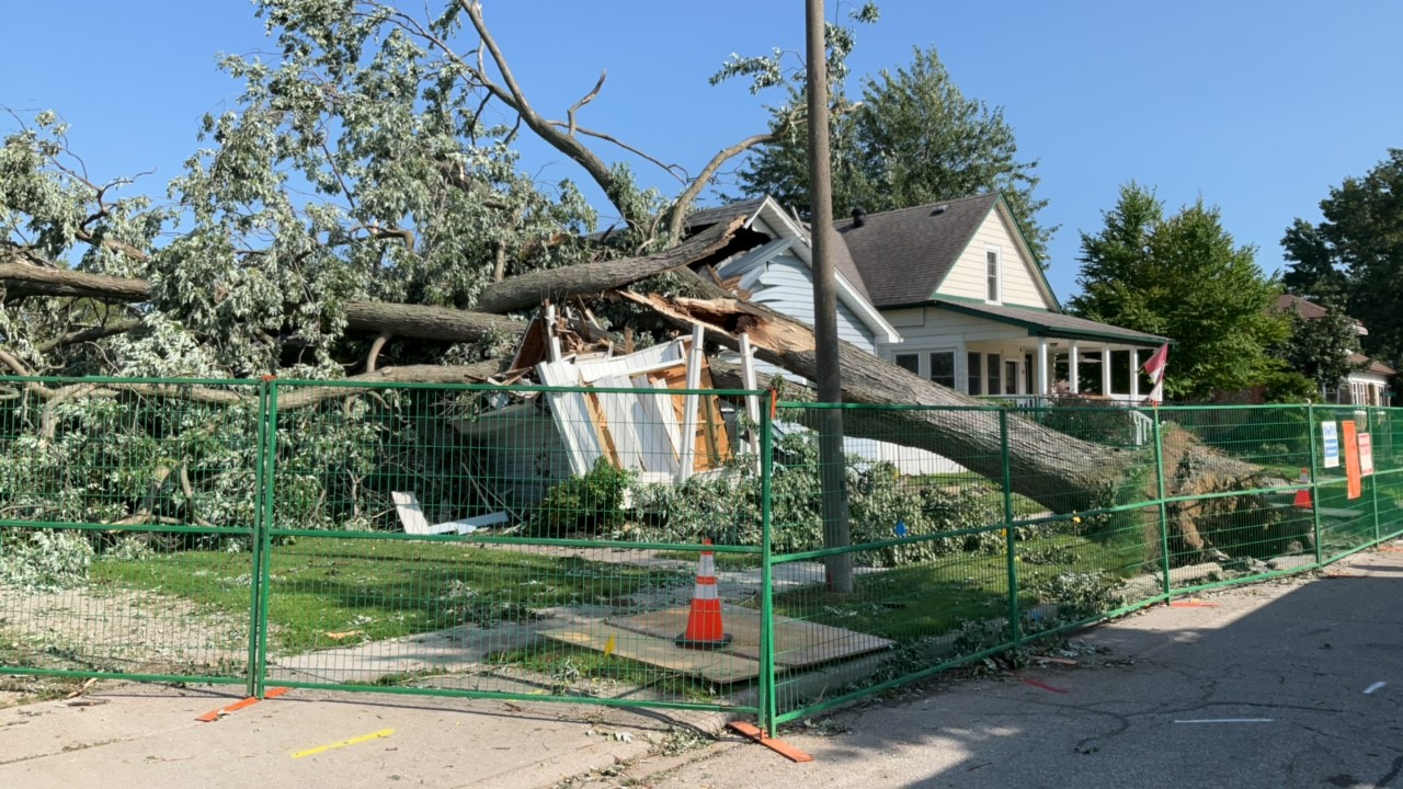
A large tree in Kingsville that unfortunately did severe damage to a home when it fell.
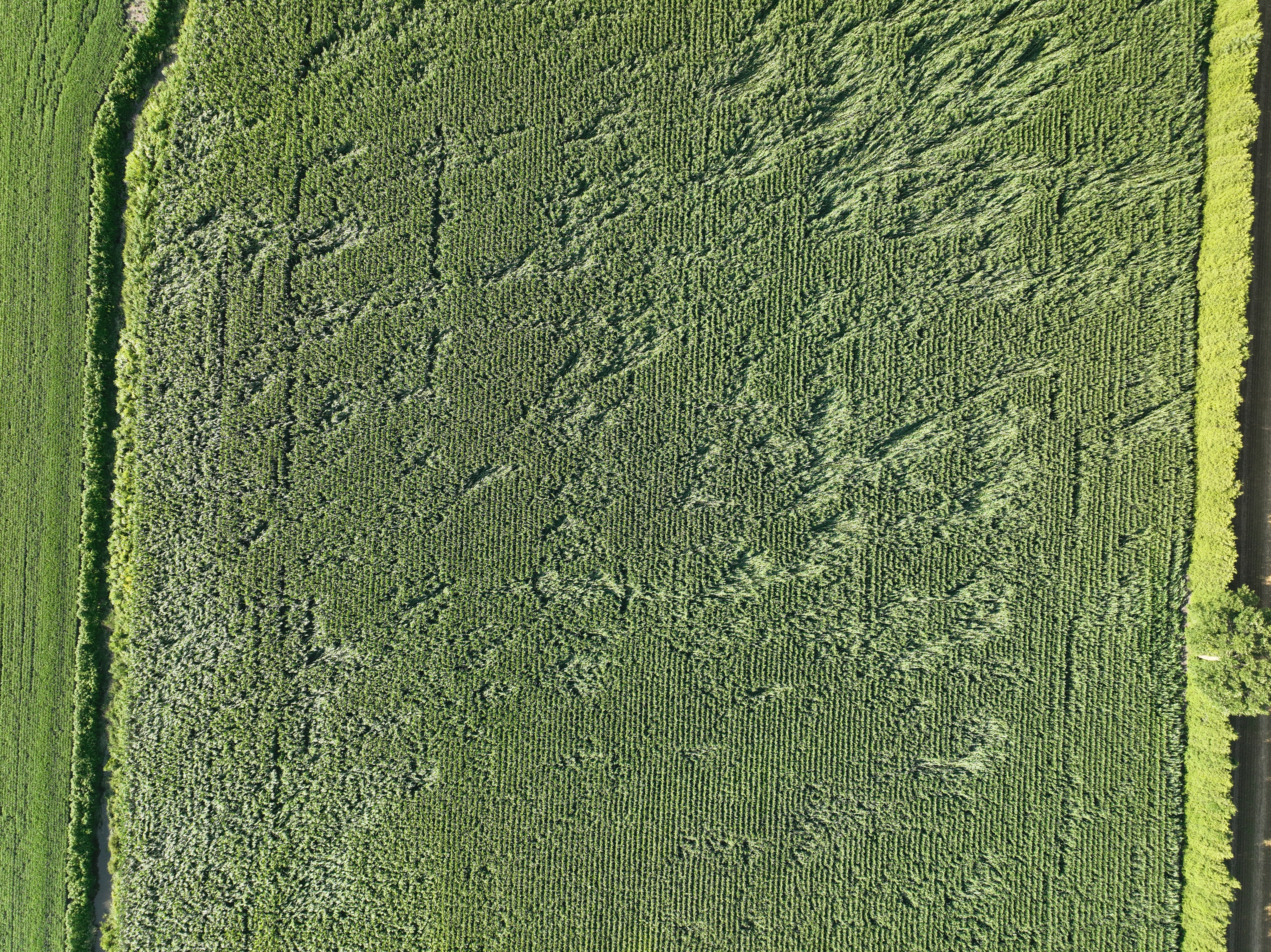
Crops markings near Harrow indicating straight-line downburst winds.