Tornado and downburst in Manitoba on July 26
NTP investigations have concluded that a tornado and a downburst occurred in southern Manitoba on July 26. The tornado was initially confirmed based on photo/video evidence, but analysis of satellite imagery (partially clear) has allowed at least a preliminary track and intensity estimate (EF1). The University of Manitoba NTP team conducted a ground/drone survey in the Beausejour, MB area on July 27th and found evidence for an EF1 downburst.
Summary details for the tornado and the downburst, and a map and photos from the Beausejour survey are provided below. Event information can also be viewed and plotted via the NTP Dashboard at https://uwo.ca/ntp/dashboard.
The survey team also investigated reports of damage at Rennie, MB (further to the SE of Beausejour) and Beaver Creek, MB (N of Arborg). Significant tree damage was found at Rennie but the lack of road access restricted the assessment of the spatial dimensions of the event. At Beaver Creek, evidence for a downburst was found but again the lack of road access prevented the assessment of the size of the event.
Further investigation using high-resolution satellite imagery will be undertaken so that the unknowns around the Rennie and Beaver Creek events can be resolved. Results for these events will be released once that analysis has been completed. The Ranger Lakes tornado information will also be updated after analysis of fully clear satellite imagery.
====
Event Name: Ranger Lakes, MB
Date: July 26, 2023
Start Time: 6:23 PM CDT (2323 UTC)
Final Classification: Tornado (Over Land)
Preliminary EF-Scale Rating: EF1
Start of visible damage: 51.3597N, 97.1247W
Description: Witnesses captured video and photos of a tornado near Ranger Lakes, west of Beaver Creek. An NTP ground and drone survey was completed on July 28, 2023, documenting downburst damage north of Beaver Creek. With a limited road network in the area, no damage associated with the tornado was found during the survey. Partial satellite imagery review of the storm track revealed some visible tornado damage in forested areas, however clouds obscure the damage path start and end points. The visible damage track is at least 2 km long and up to 190 m wide, and preliminary EF-Scale rating is EF1. Track details along with the EF-scale rating and max. wind speed will be finalized pending the availability of cloud-free satellite imagery for review. Preliminary event name and start time may be updated when tornado start point is confirmed.
Event Name: Beausejour, MB
Date: July 26, 2023
Start Time: 6:45 PM CDT (2345 UTC)
Final Classification: Downburst
Final EF-Scale Rating: EF1
EF-Scale Damage Indicator / Degree of Damage: FR12/DOD-4
Location of worst damage: 50.0551N, 96.5048W
Description: Damage to a home, warehouse and several outbuildings and sheds was reported in Beausejour after a storm passed through. Tree and power pole damage was also reported. No injuries were reported. An NTP ground and drone survey was completed on July 27, 2023, documenting the damage in Beausejour eastward to Saint Ouens. Damage assessed as EF1 downburst, with an estimated max. wind speed of 155 km/h, track length of 6.4 km and max. path width of 3.4 km. Satellite imagery review is pending. Event start time is radar estimated.
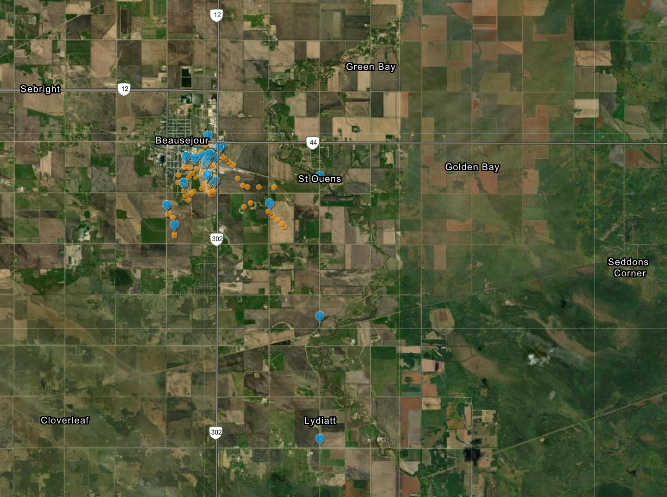
Map of the Beausejour area showing the locations of documented damage (blue pints) as well as drone photos (orange circles).
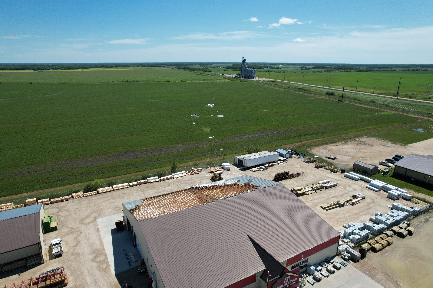
Metal rool of industrial building pulled off and deposited downwind to the southeast.
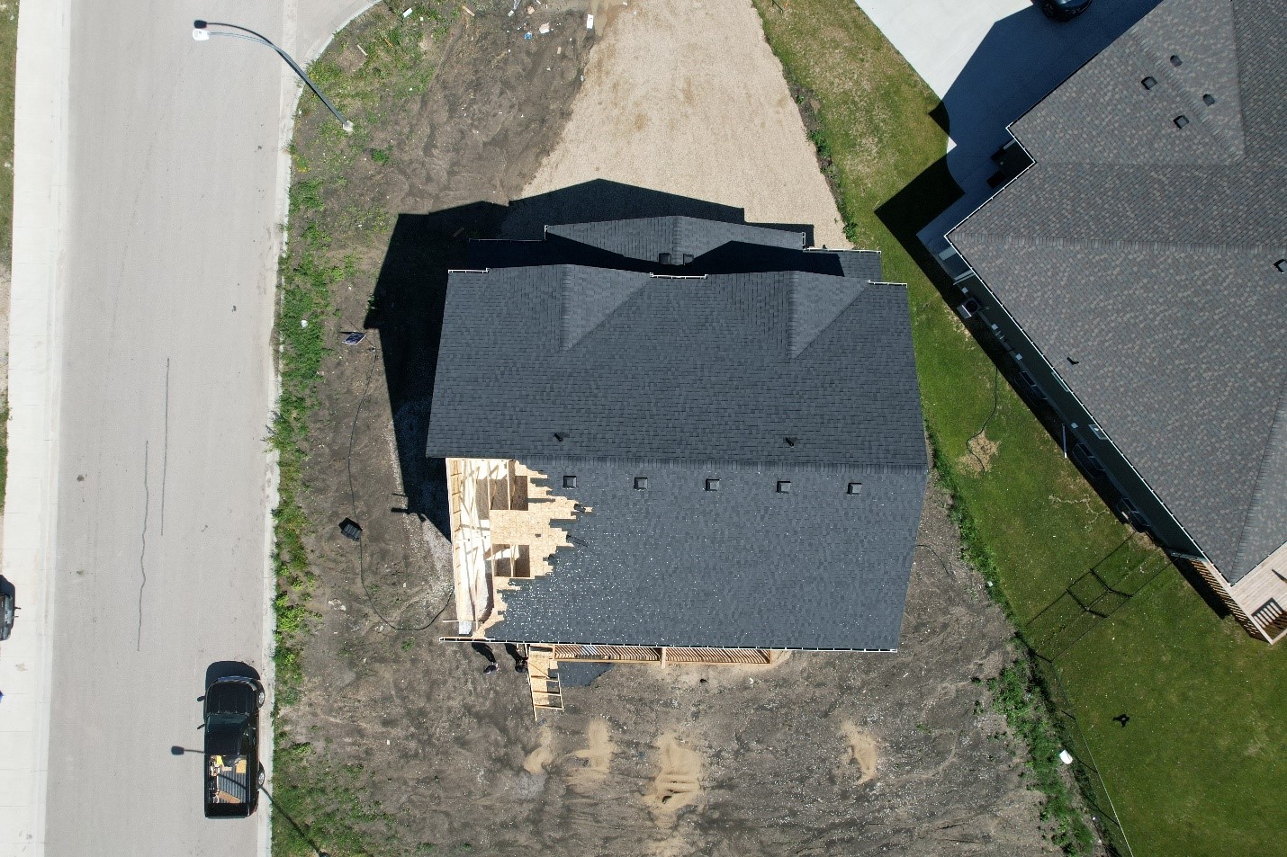
Residential two-story home with part of roof deck removed from the northwest.
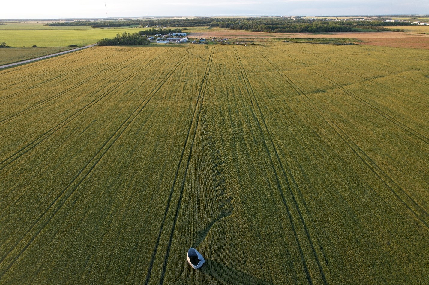
Rolled grain bin south of Beausejour.