Three new tornadoes in Quebec
NTP investigations have resulted in an additional three tornadoes in Quebec between July 13 and August 2. An NTP ground/drone survey was undertaken for the July 28 Inverness tornado. The other events were confirmed via satellite imagery analysis and/or social media posts with follow-up.
Details for these tornadoes are provided in the summaries below, along with representative images. Event information can also be viewed and plotted via the NTP Dashboard at https://uwo.ca/ntp/dashboard.
====
Event Name: Laurence, QC
Date: July 13, 2023
Start Time: 4:10 PM EDT (2010 UTC)
Final Classification: Tornado (Over Land)
Final EF-Scale Rating: EF1
EF-Scale Damage Indicator / Degree of Damage: C-T/DOD-5
Start of damage track: 45.8956N, 73.5731W
End of damage track: 45.8922N, 73.5464W
Location of worst damage: 45.8931N, 73.5544W
Description: Satellite imagery review of a storm track of interest revealed a tornado damage path through cropland and forested areas near Laurence, north of Saint-Roch-de-l'Achigan. No damage was reported. Damage assessed as EF1 tornado, with an estimated max. wind speed of 145 km/h, track length of 2.17 km and max. path width of 270 m. Tornado motion was from the W (approx. 280 degrees). Start time is radar estimated.
Event Name: Inverness, QC
Date: July 28, 2023
Start Time: 6:15 PM EDT (2215 UTC)
Final Classification: Tornado (over land)
Final EF-Scale Rating: EF0
EF-Scale Damage Indicator / Degree of Damage: SBO/DOD-6
Start of damage track: 46.2887N, 71.4535W
End of damage track: 46.2871N, 71.4461W
Location of Worst Damage: 46.2871N, 71.4484W
Description: Witness captured video of a suspected tornado northeast of Inverness, where isolated tree and barn damage was reported. An NTP ground and drone survey was completed on August 2, 2023, documenting the reported damage along with crop damage in the vicinity. Damage assessed as EF0 tornado, with an estimated max. wind speed of 130 km/h, track length of 0.59 km and max. path width of 70 m. Tornado motion was from the WNW (approx. 290 degrees). Satellite imagery review showed some crop damage at the property. Start time is based on witness reports.
Event Name: Gulf of St. Lawrence (Bassin, QC)
Date: August 2, 2023
Start Time: 6:22 AM ADT (0922 UTC)
Final Classification: Tornado (Over Water)
Final EF-Scale Ratings: EF0-Default
Estimated tornado locations: 47.25N, 61.87W
Description: Witness in Bassin on Les Îles-de-la-Madeleine captured photos of a waterspout over the Gulf of the St. Lawrence. No damage reported.
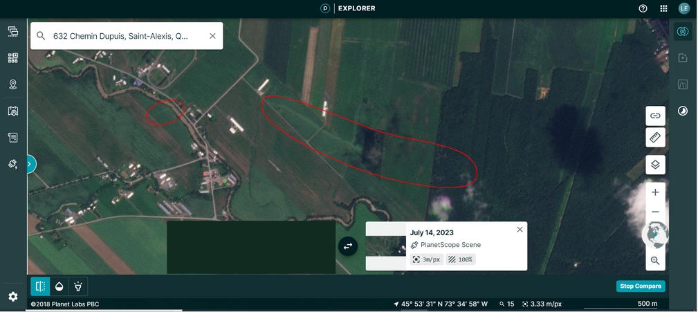
Planet Labs satellite image in the Laurence, QC area valid for July 14th, the day after the tornado. The narrow damage path through crops and trees is apparent in the areas circled in red.
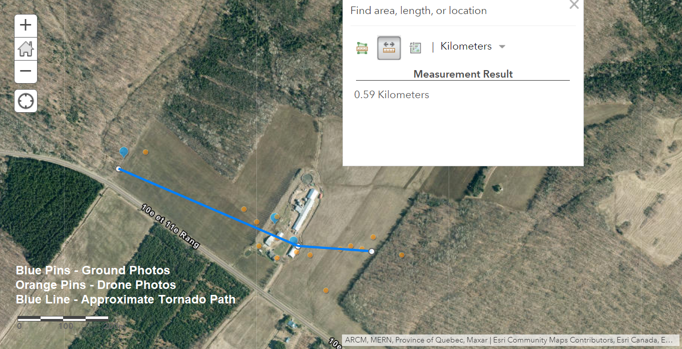
Map showing the track of the Inverness, QC tornado as determined via the NTP ground/drone survey.
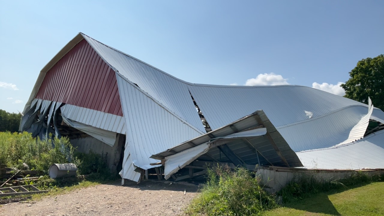
Photo of a collapsed barn along the tornado's damage path.
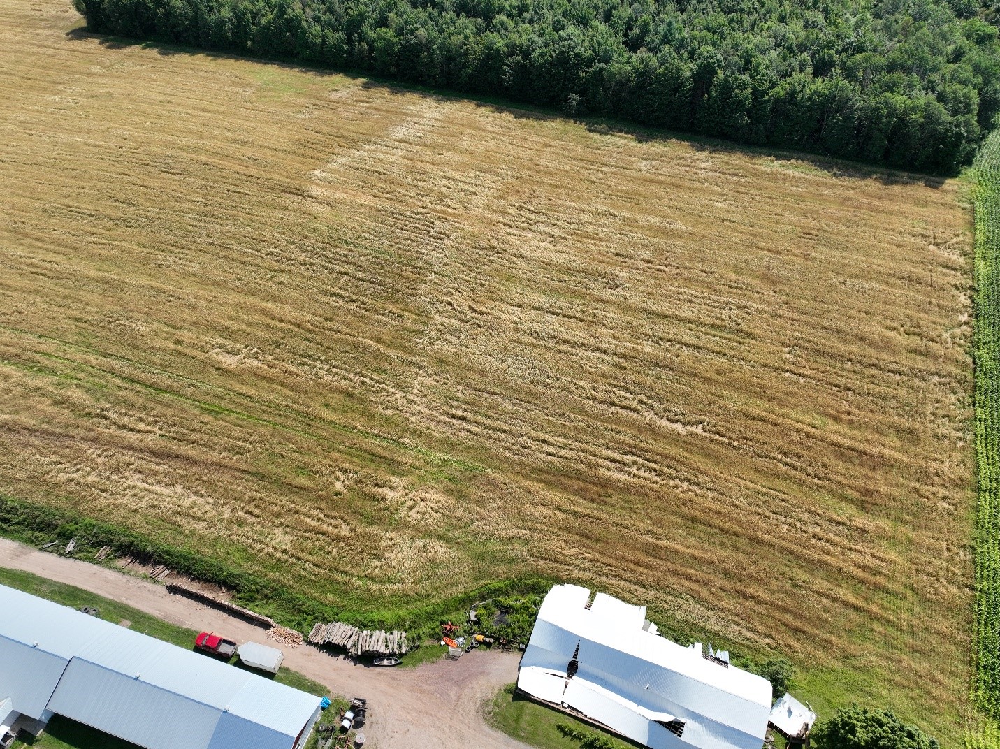
Drone image showing the collapsed barn and crop markings caused by the tornado.
Photos of the waterspout over the Gulf of the St. Lawrence taken from Bassin on Les Îles-de-la-Madeleine can be found on Facebook here: https://www.facebook.com/groups/10541971438/permalink/10159597698101439/.