Ontario adds a tornado and two downbursts
NTP investigations have concluded that a tornado and two downbursts occurred in southern Ontario with the storms on August 3. NTP ground/drone surveys were completed for all three events, resulting in an EF0 rating in each case. Social media reports of a tornado in the Kaladar, ON area on this day are still being investigated.
Details are provided in the event summaries, with additional relevant images below. Event information can also be viewed and plotted via the NTP Dashboard at https://uwo.ca/ntp/dashboard.
====
Event Name: Lindsay, ON
Date: August 3, 2023
Time: 5:00 PM EDT (2100 UTC)
Final Classification: Downburst (Microburst)
Final EF-Scale Rating: EF0
EF-Scale Damage Indicator / Degree of Damage: SBO/DOD-2
Location of worst damage: 44.3648N, 78.7394W
Description: Wind damage to trees was reported in the Lindsay area after a storm passed through. Several homes under construction were damaged as well. No injuries were reported. An NTP ground and drone survey was completed on August 5, 2023, documenting the damage. Damage assessed as EF0 downburst (microburst), with an estimated max. wind speed of 115 km/h. Satellite imagery review is pending. Event time is radar estimated.
Event Name: Findlay Creek, ON
Date: August 3, 2023
Start Time: 6:41 PM EDT (2241 UTC)
Final Classification: Tornado (over land)
Final EF-Scale Rating: EF0
EF-Scale Damage Indicator / Degree of Damage: FR12/DOD-4
Start of damage track: 45.2880N, 75.6262W
End of damage track: 45.3267N, 75.5714W
Location of Worst Damage: 45.3113N, 75.5922W
Description: Witnesses captured video of a tornado in the Findlay Creek area (south Ottawa). The tornado caused damage to multiple homes and sheds, tossed debris and flipped a trailer at construction site. Tree damage was also reported. No injuries were reported. An NTP ground and drone survey was completed on August 4, 2023. Damage assessed as EF0 tornado, with an estimated max. wind speed of 130 km/h, track length of 6.10 km and max. path width of 130 m. Tornado motion was from the SW (approx. 225 degrees). Satellite imagery review is pending. Start time is radar estimated.
Event Name: Gordonville, ON
Date: August 3, 2023
Time: 9:45 PM EDT (0145 UTC)
Final Classification: Downburst (Microburst)
Final EF-Scale Rating: EF0
EF-Scale Damage Indicator / Degree of Damage: SBO/DOD-2
Location of worst damage: 43.8955N, 80.5496W
Description: Damage to trees and a barn roof was reported in the Gordonville area after a storm passed through. No injuries were reported. An NTP ground and drone survey was completed on August 5, 2023, documenting the damage. Damage assessed as EF0 downburst (microburst), with an estimated max. wind speed of 120 km/h. Satellite imagery review is pending. Event time is radar estimated.
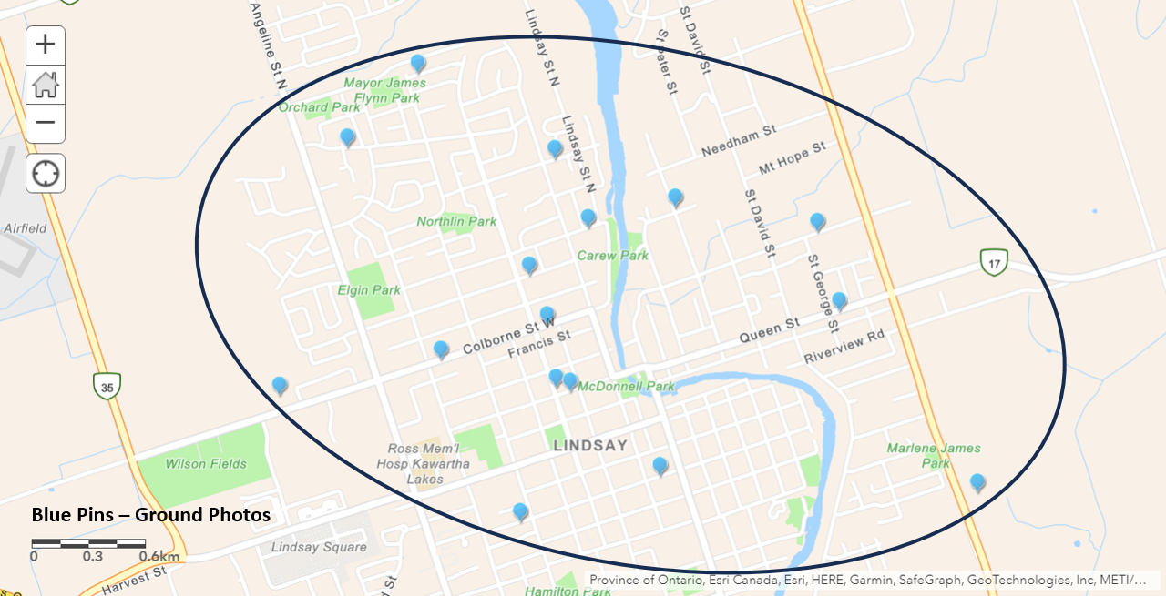
Map showing damage survey documentation locations (blue pins) in Lindsay. Mark Robinson of The Weather Network) provided initial guidance on damage locations.
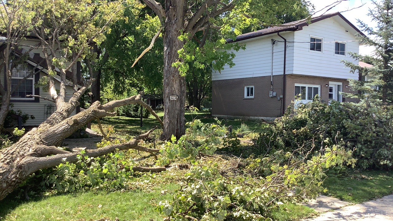
Ground photo showing snapped tree falling to the south, impacting the corner of the house, in the area with the worst wind damage.
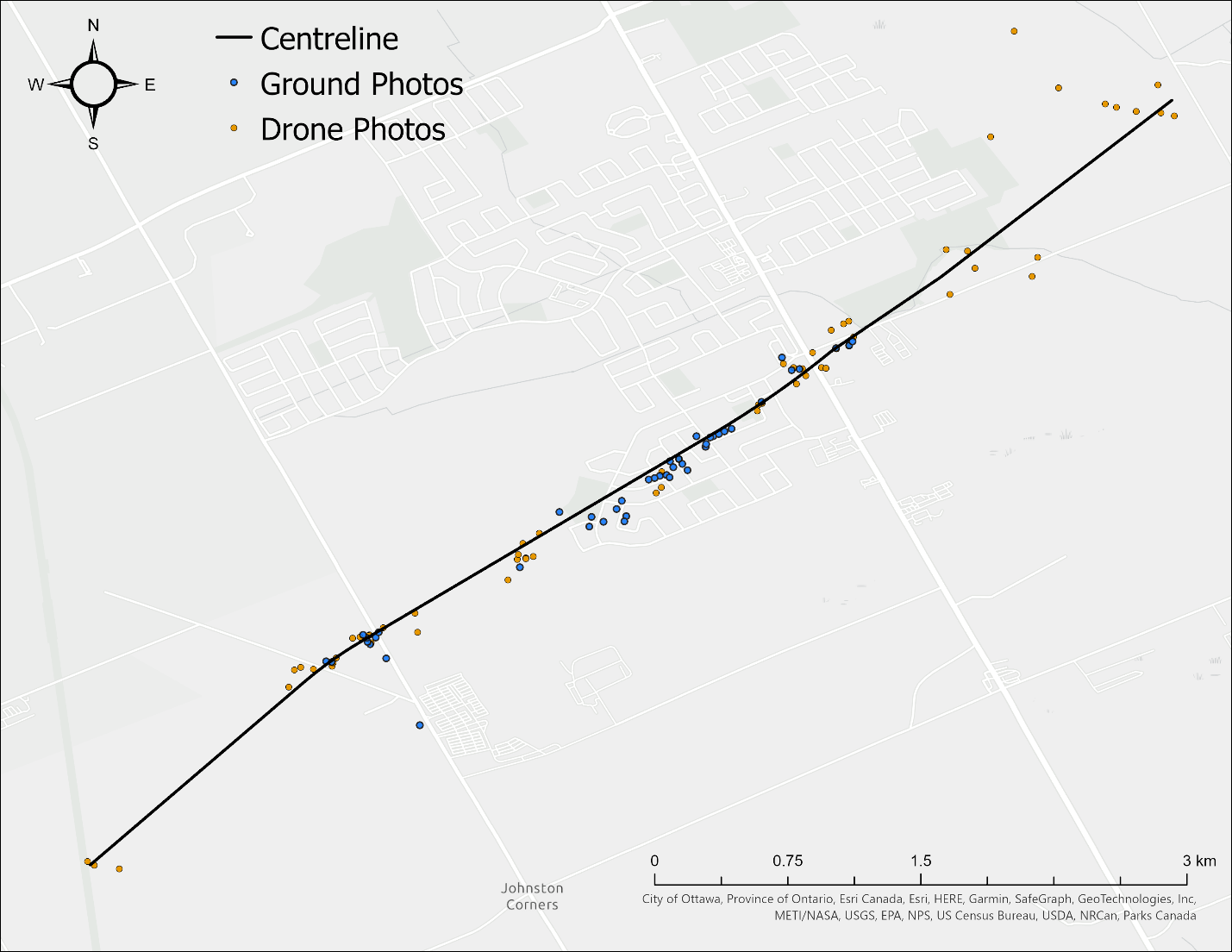
Map of surveyed area showing the locations of ground photos, drone photos, and the centreline for the Ottawa (Findlay Creek) tornado. Thanks to Mark Robinson at The Weather Network for providing initial guidance on damage locations.
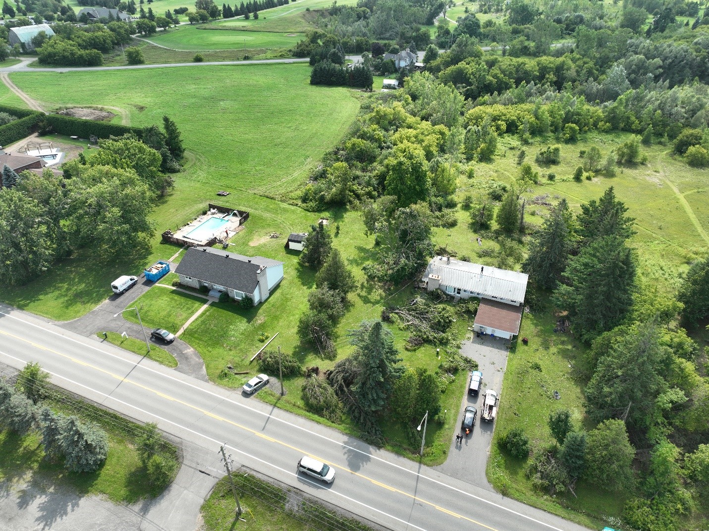
Drone photograph showing convergent tree damage on Albion Road South, as well as fence damage and shed destruction at neighbouring property.
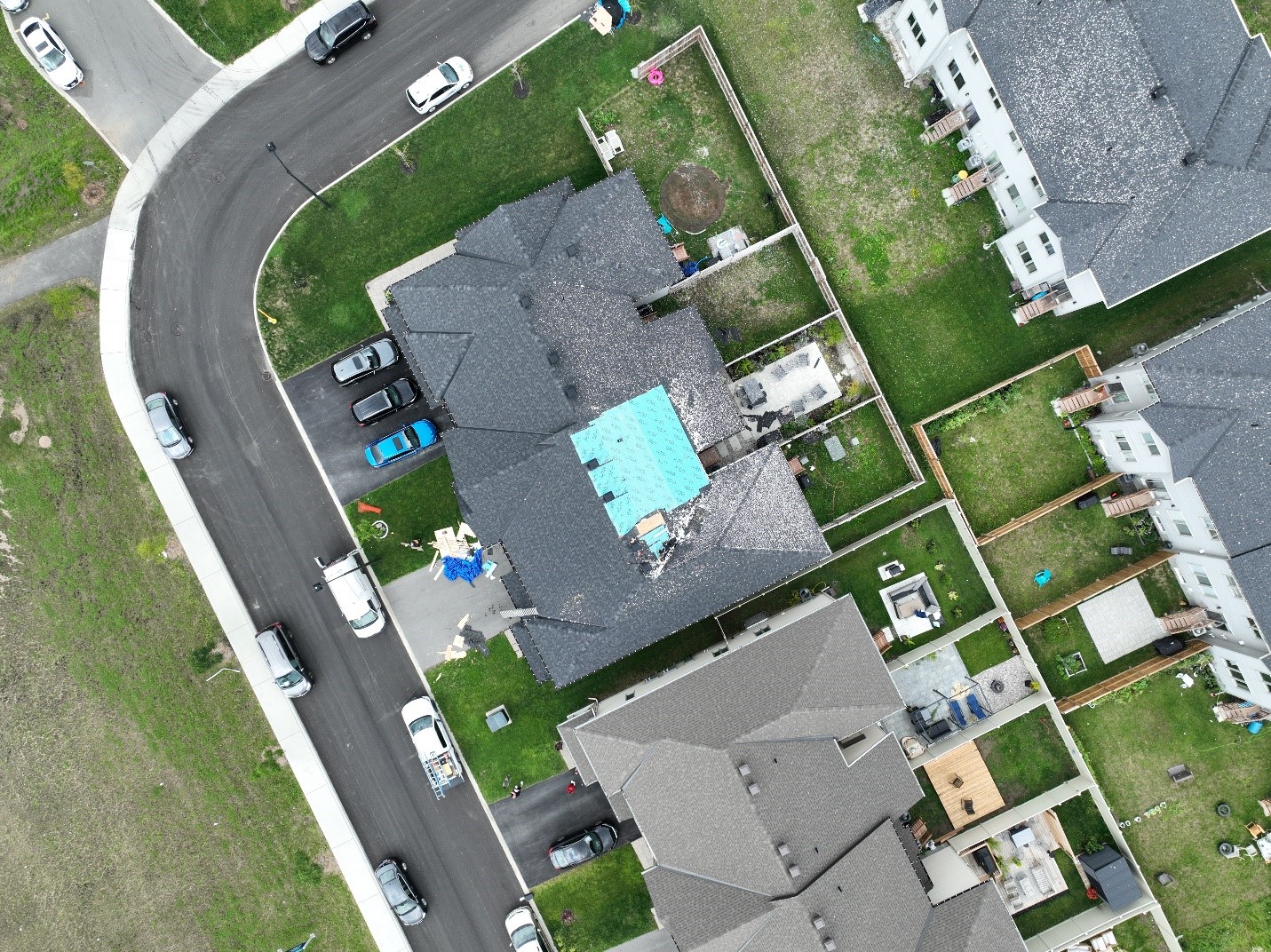
Drone photo showing FR12/DOD-4 LB damage on Salamander Way.
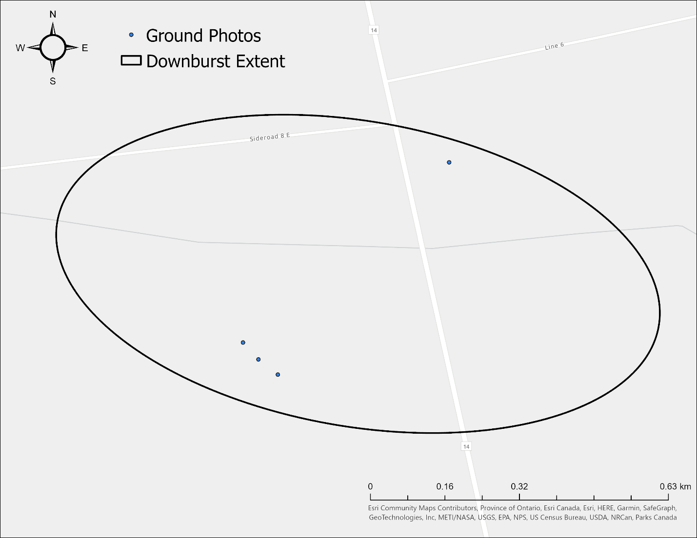
Map of surveyed area showing the locations of ground photos, and the extent of Gordonville, ON downburst (technically a microburst given the dimensions less than 4 km).
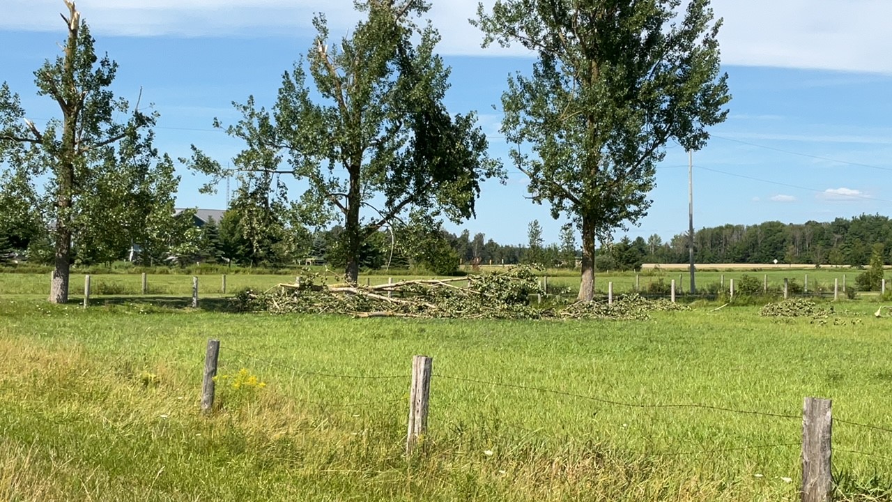
Ground photo showing downed tree in a SE direction. Drone data also captured more trees down in a similar direction.