More Events from July 13 in Quebec
NTP investigations have been able to confirm a number of new events in Quebec from the July 13th storms. Analysis of the results from the NTP ground/drone surveys done in southern Quebec have led to the confirmations of a weak downburst in the Saint-Anicet area, three weak downbursts in the Sainte-Anne-des-Plaines area, and one weak tornado and another weak downburst in the Sorel-Tracey area. No damage has been found with the tornado confirmed at Mirabel so that event was assigned a default rating. Summary details for each event are provided below, followed by maps and ground/drone images.Event information can also be viewed and plotted via the NTP Dashboard at https://uwo.ca/ntp/dashboard.
====
Event Name: Saint-Anicet, QC
Date: July 13, 2023
Start Time: 3:00 PM EDT (1900 UTC)
Final Classification: Downburst (Microburst)
Final EF-Scale Rating: EF0
EF-Scale Damage Indicator / Degree of Damage: FR12/DOD-2
Location of worst damage: 45.1365N, 74.3598W
Description: Tree damage was reported in the Saint-Anicet area after a storm passed through. No injuries were reported. An NTP ground and drone survey was completed on July 17, 2023, documenting the tree damage as well as minor roof damage to several homes. Damage assessed as EF0 downburst (microburst), with an estimated max. wind speed of 125 km/h. Satellite imagery review is pending. Event time is radar estimated.
Event Name: Mirabel, QC
Date: July 13, 2023
Start Time: 3:23 PM EDT (1923 UTC)
Final Classification: Tornado (over land)
Preliminary EF-Scale Rating: EF0-Default
Estimated tornado location: 45.70N, 74.07W
Description: A meteorological observer at the Montréal–Mirabel International Airport reported a tornado near the airport. No damage has been found associated with this tornado. Further investigation also includes satellite imagery review.
Event Name: Saint-Jérôme, QC
Date: July 13, 2023
Time: 3:30 PM EDT (1930 UTC)
Final Classification: Downburst (Microburst)
Final EF-Scale Rating: EF0
EF-Scale Damage Indicator / Degree of Damage: SBO/DOD-2
Location of worst damage: 45.7487N, 73.9498W
Description: Tree damage was reported southeast of Saint-Jérôme after a storm passed through the area. No injuries were reported. An NTP ground and drone survey was completed on July 15, 2023, documenting the tree damage as well as minor roof damage to a barn. Damage assessed as EF0 downburst (microburst), with an estimated max. wind speed of 120 km/h. Satellite imagery review is pending. Event time is radar estimated.
Event Name: Saint-Sophie, QC
Date: July 13, 2023
Time: 3:40 PM EDT (1940 UTC)
Final Classification: Downburst (Microburst)
Final EF-Scale Rating: EF0
EF-Scale Damage Indicator / Degree of Damage: C-T/DOD-3
Location of worst damage: 45.7862N, 73.9069W
Description: Tree damage was discovered south of Saint-Sophie during an NTP ground and drone survey on July 15-16, 2023. No injuries were reported in the area. Damage assessed as EF0 downburst (microburst), with an estimated max. wind speed of 115 km/h. Satellite imagery review is pending. Event time is radar estimated.
Event Name: Sainte-Anne-des-Plaines, QC
Date: July 13, 2023
Time: 3:40 PM EDT (1940 UTC)
Final Classification: Downburst (Microburst)
Final EF-Scale Rating: EF1
EF-Scale Damage Indicator / Degree of Damage: SBO/DOD-8
Location of worst damage: 45.7902N, 73.8158W
Description: Damage to two barns and snapped power poles were reported north of Sainte-Anne-des-Plaines after a storm passed through the area. No injuries were reported. An NTP ground and drone survey was completed on July 16, 2023, documenting the reported damage along with tree damage and minor roof damage to a home. Damage assessed as EF1 downburst (microburst), with an estimated max. wind speed of 150 km/h. Satellite imagery review is pending. Event time is radar estimated.
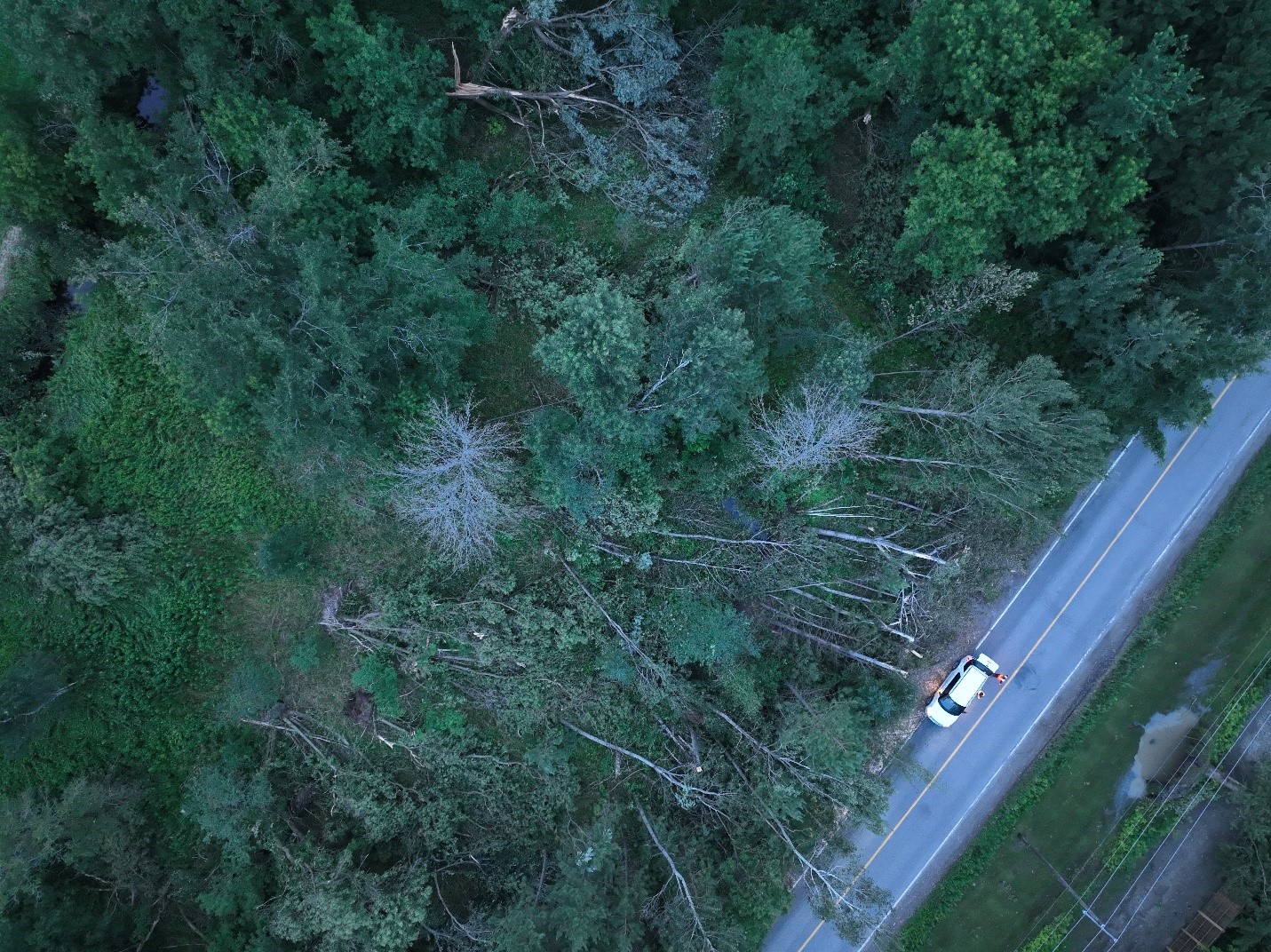
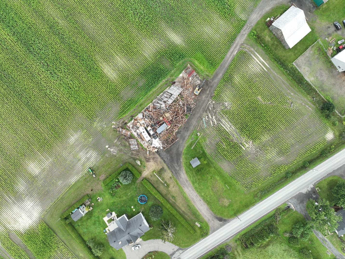
Event Name: Saint-Thomas, QC
Date: July 13, 2023
Start Time: 4:25 PM EDT (2025 UTC)
Final Classification: Tornado (over land)
Final EF-Scale Rating: EF0
EF-Scale Damage Indicator / Degree of Damage: SBO/DOD-6
Start of damage track: 45.9952N, 73.3631W
End of damage track: 45.9944N, 73.2785W
Location of worst damage: 45.9984N, 73.3112W
Description: Tree damage was reported in the Saint-Thomas area after a storm passed through. No injuries were reported. An NTP ground and drone survey was completed on July 16-17, 2023, documenting the tree damage, along with damage to two barns and minor roof damage to a home. A visible tornado track through crops was also documented. Damage assessed as EF0 tornado, with an estimated max. wind speed of 130 km/h, track length of 6.61 km and max. path width of 200 m. Tornado motion was from the W (approx. 270 degrees). Developing south of the tornado track, a downburst caused up to EF1 damage in the areas of Lanoraie and Sorel-Tracy. Satellite imagery review is pending. Start time is radar estimated.
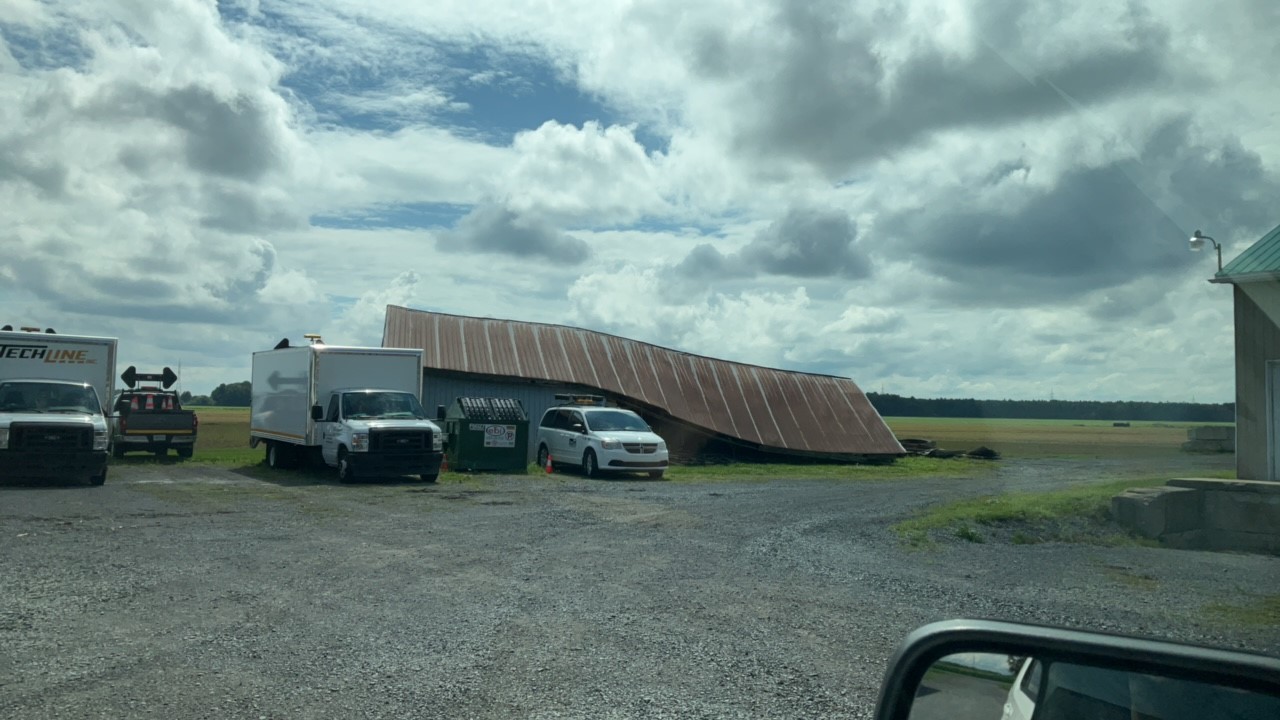
Event Name: Lanoraie, QC
Date: July 13, 2023
Start Time: 4:30 PM EDT (2030 UTC)
Final Classification: Downburst
Final EF-Scale Rating: EF1
EF-Scale Damage Indicator / Degree of Damage: C-T/DOD-4
Location of worst damage: 45.9845N, 73.2503W
Description: Tree damage along with roof damage to several structures was reported in Sorel-Tracy after a storm passed through. No injuries were reported. An NTP ground and drone survey was completed on July 16-17, 2023, documenting widespread tree damage east of the St. Lawrence River in the Lanoraie area along with the reported damage in Sorel-Tracy. Damage assessed as EF1 downburst, with an estimated max. wind speed of 150 km/h. The downburst developed south of the Saint-Thomas EF0 tornado (northwest of Lanoraie). Satellite imagery review is pending. Start time is radar estimated.
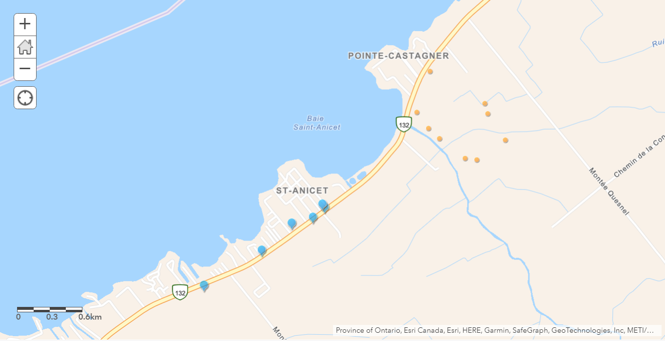
Map showing the locations of damage documentation points (blue pins) and drone images (orange dots) related to the EF0 downburst at Saint-Anicet.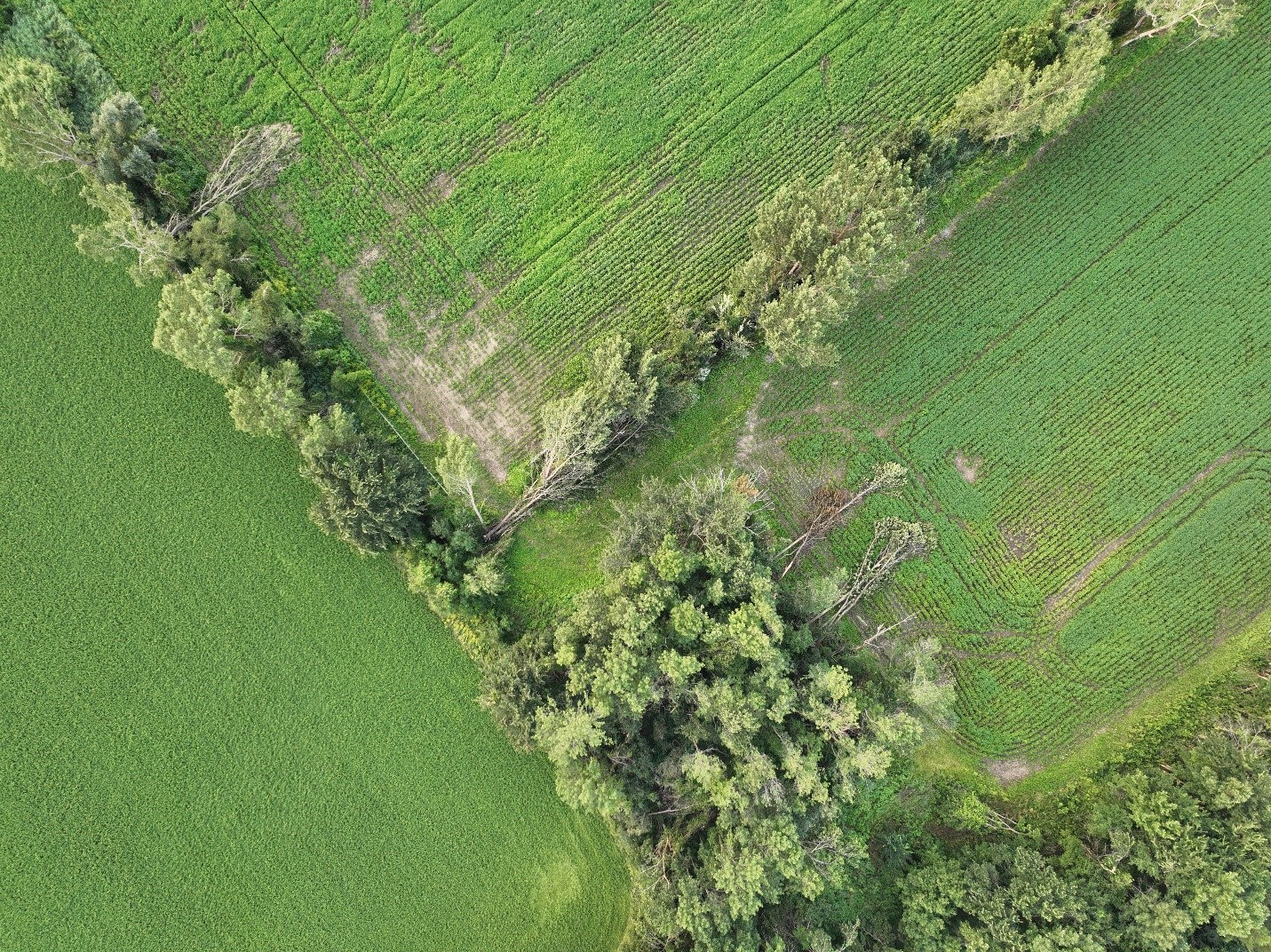
Drone image showing the worst tree damage caused by the EF0 downburst at Saint-Anicet.

Ground photo showing the worst structural damage (roof damage) caused by the Saint-Anicet EF0 downburst.
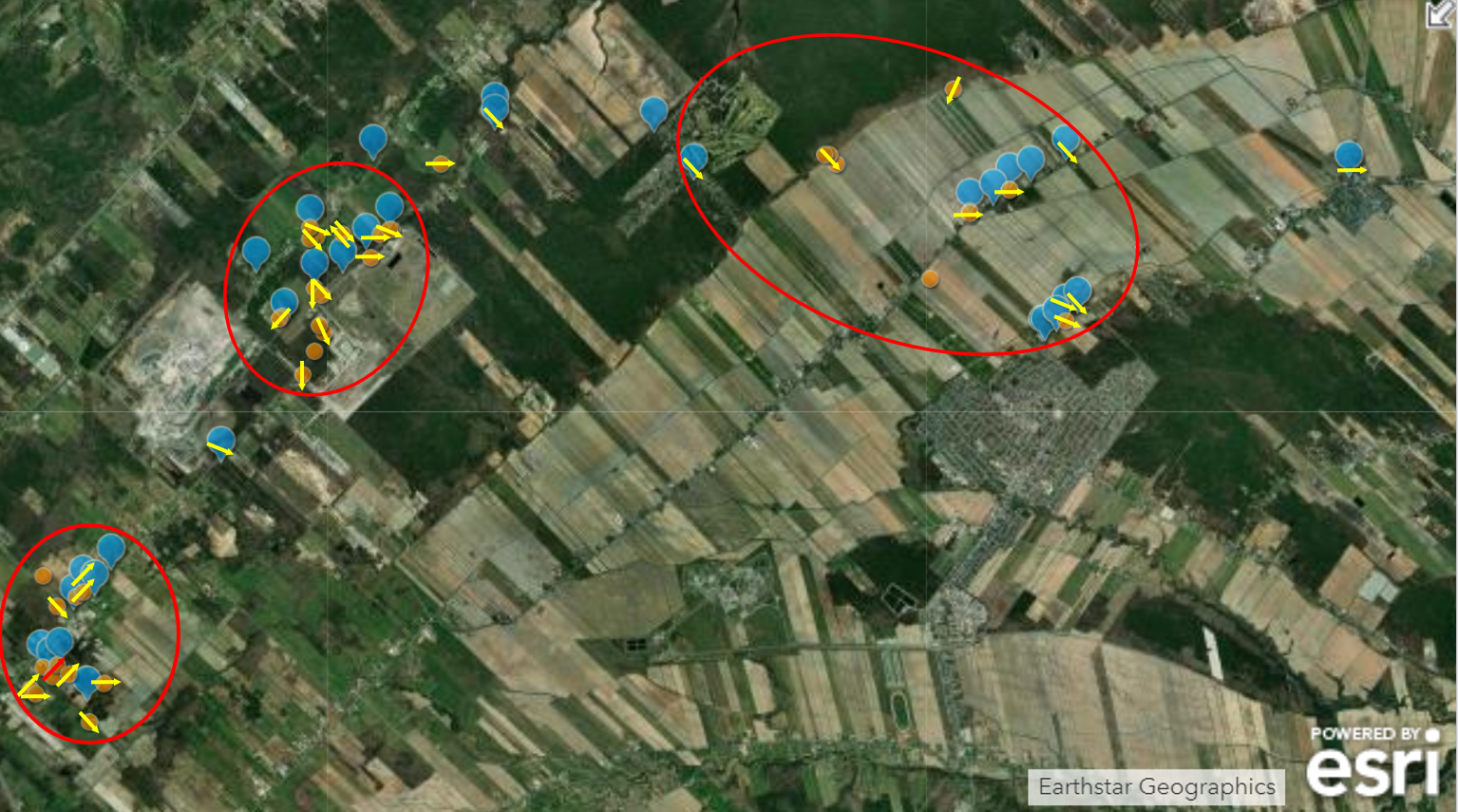
Map showing the locations of the Saint-Jérôme (EF0, left), Sainte-Sophie (EF0, centre), and Sainte-Anne-des-Plaines (EF1, right) microbursts NW of Montreal. Yellow arrows show the directions of the damage wind gusts according toe the damage observed. Blue dots indicate where a ground damage point was documented.
Worst damage, to roof of garage, observed in the Saint-Jérôme area.
Worst damage observed in the Sainte-Sophie area.
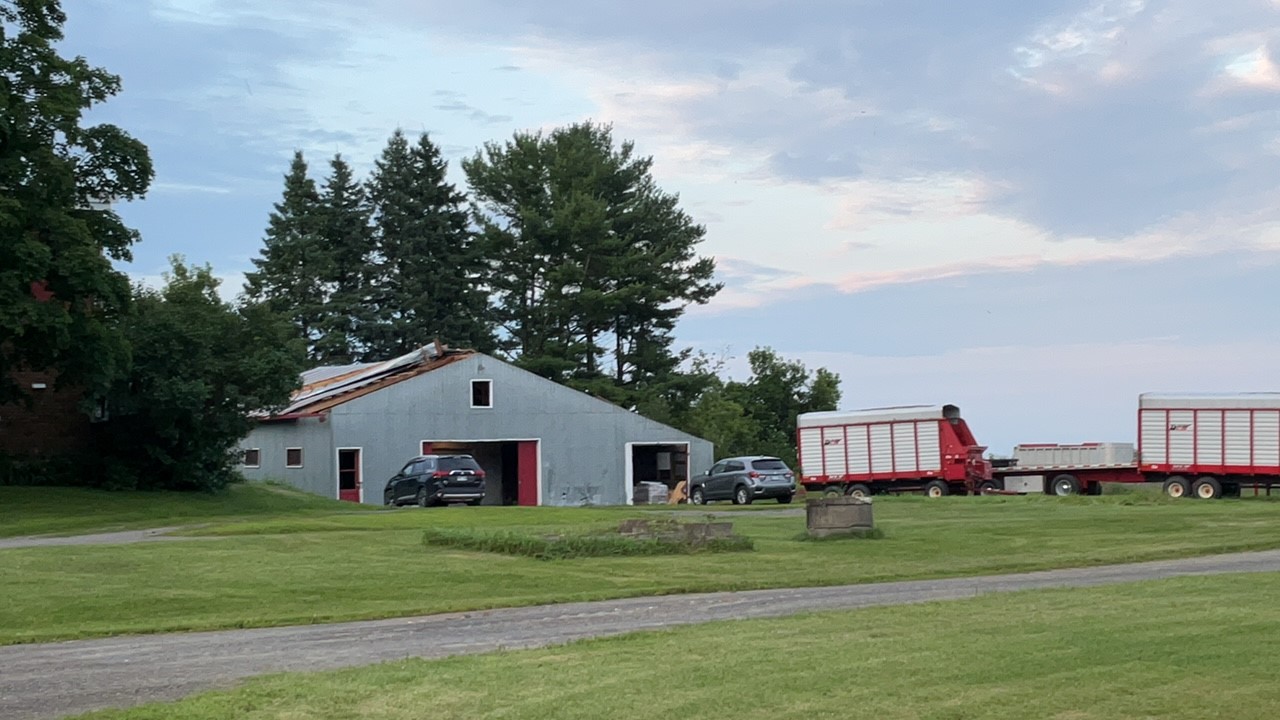
Worst damage, barn with walls down, observed in the Sainte-Anne-des-Plaines area. A lower wind speed was used here due to the quality of construction.
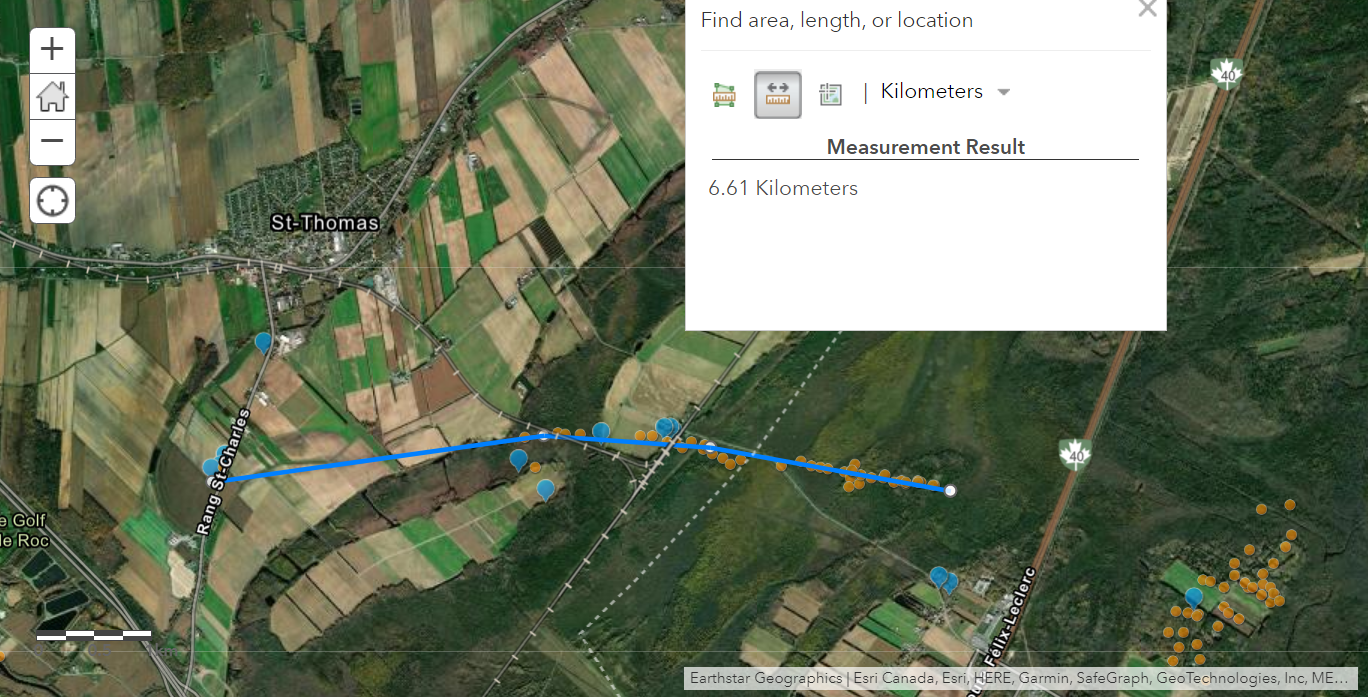
Map showing the track of the Saint-Thomas EF0 tornado.
Some of the worst damage, a collapsed garage, from the Saint-Thomas EF0 tornado.
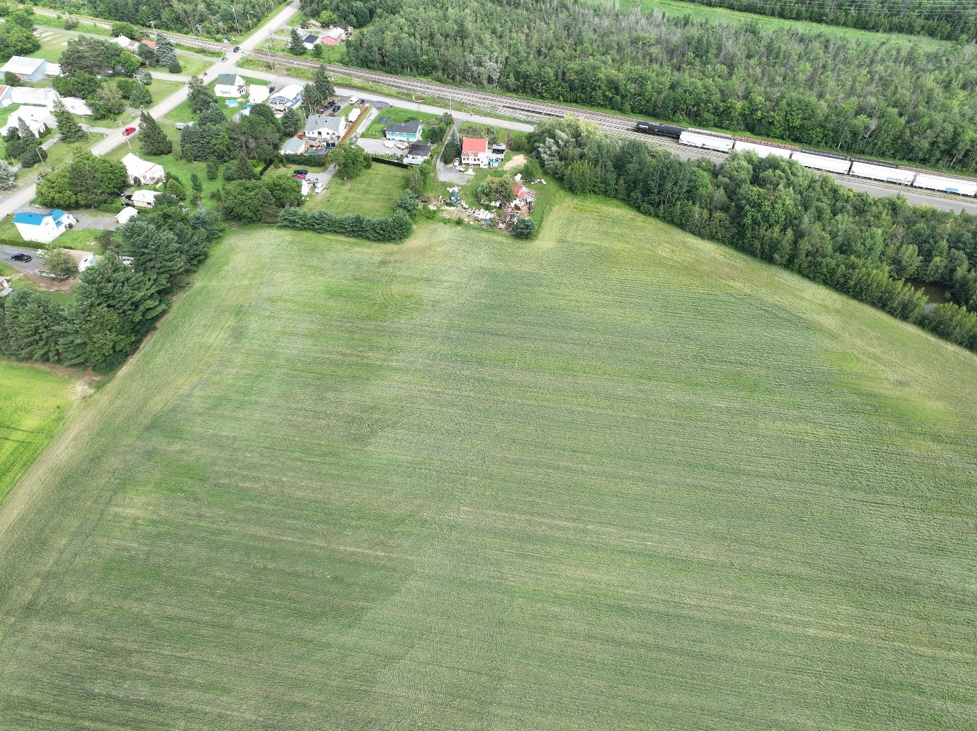
Site of some roof damage, and visible track of the Saint-Thomas EF0 tornado through crops.
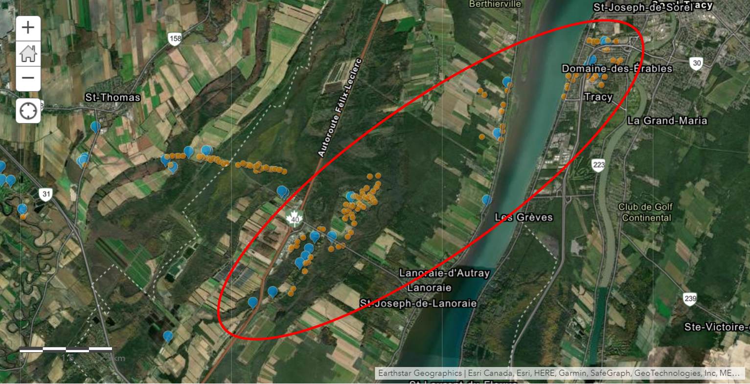
Map showing the location of the Lanoraie EF1 downburst (the damage points of the Saint-Thomas tornado can be see off to the left (west). Damage extended into Sorel-Tracey.
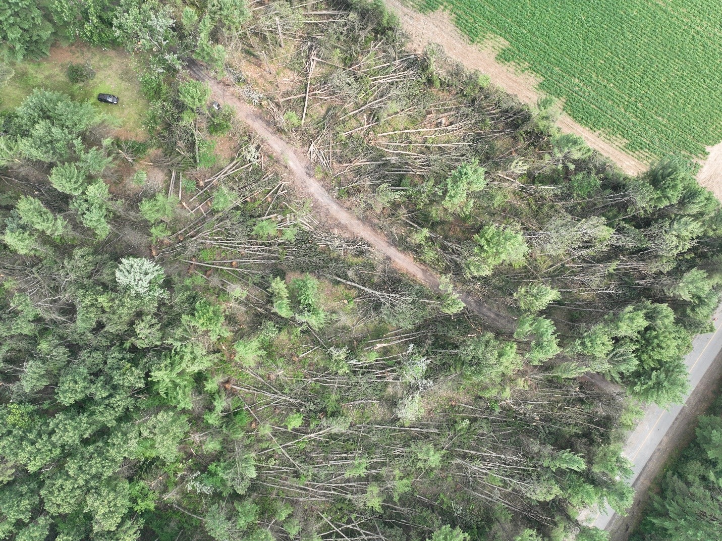
Some of the worst damage along the path of the Lanoraie EF1 downburst.
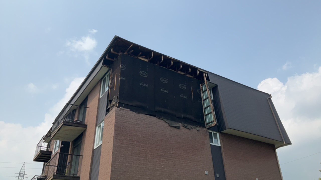
Minor structural damage caused by the Lanoraie EF1 downburst.