More Events from July 13 in Ontario
NTP investigations have determined that two weak tornadoes occurred in eastern Ontario on July 13, in addition to the Ottawa EF1 tornadoes that were previously confirmed. An NTP ground/drone survey team visited damage sites at Embrun and between Fournier and St-Bernadin. The analysis of the survey results has led to the confirmation of the tornadoes. Summary details are provided below, followed by maps and images.
Event information can also be viewed and plotted via the NTP Dashboard at https://uwo.ca/ntp/dashboard.
====
Event Name: Embrun, ON
Date: July 13, 2023
Start Time: 1:17 PM EDT (1717 UTC)
Final Classification: Tornado (over land)
Final EF-Scale Rating: EF0
EF-Scale Damage Indicator / Degree of Damage: FR12/DOD-2
Start of damage track: 45.2715N, 75.2880W
End of damage track: 45.2797N, 75.2792W
Location of worst damage: 45.2775N, 75.2815W
Description: Tree damage was reported in Embrun after a storm passed through. Witnesses also captured photos of a possible funnel cloud. No injuries were reported. An NTP ground and drone survey was completed on July 15, 2023, documenting a narrow track of tree damage, along with minor roof damage to several homes. Damage assessed as EF0 tornado, with an estimated max. wind speed of 125 km/h, track length of 1.14 km and max. path width of 80 m. Tornado motion was from the SW (approx. 215 degrees). Satellite imagery review is pending. Start time is radar estimated.
Event Name: Fournier, ON
Date: July 13, 2023
Start Time: 1:55 PM EDT (1755 UTC)
Final Classification: Tornado (over land)
Final EF-Scale Rating: EF0
EF-Scale Damage Indicator / Degree of Damage: C-T/DOD-3
Start of damage track: 45.4379N, 74.9346W
End of damage track: 45.4581N, 74.8168W
Location of worst damage: 45.4415N, 74.9299W
Description: Tree and crop damage was reported in the Fournier and Fenaghvale areas after a storm passed through. No injuries were reported. An NTP ground and drone survey was completed on July 15, 2023, documenting the tree damage and visible tornado damage in crops. Damage assessed as EF0 tornado, with an estimated max. wind speed of 115 km/h, track length of 9.62 km and max. path width of 510 m. Tornado motion was from the WSW (approx. 255 degrees). Satellite imagery review is pending. Start time is radar estimated.
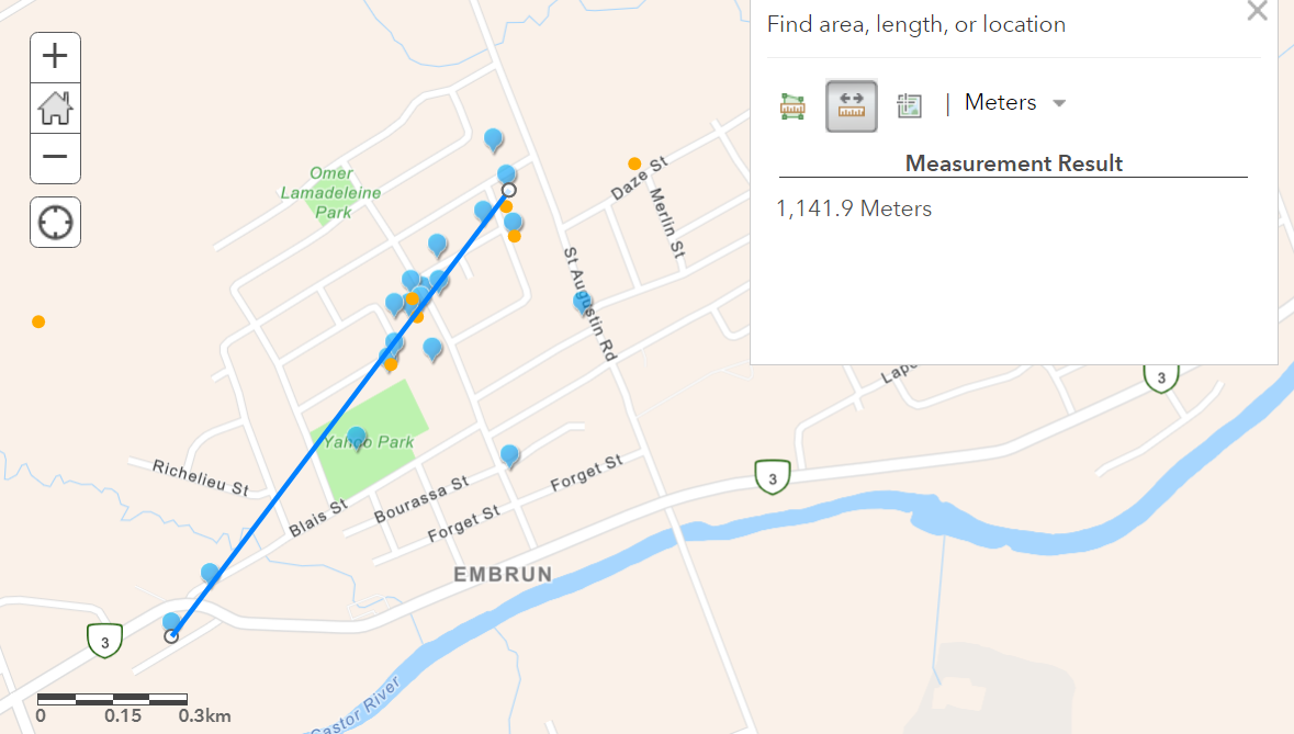
Map showing the path of the Embrun EF0 tornado, with blue pins being locations of documented damage and orange pins the locations of drone images.
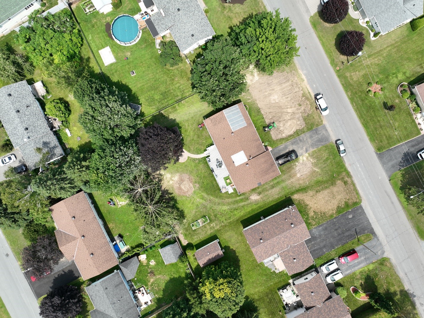
Photo of worst damage area. Minor shingle damage to house, and at least three trees snapped or uprooted (all of which had been cleanup up for the most part).
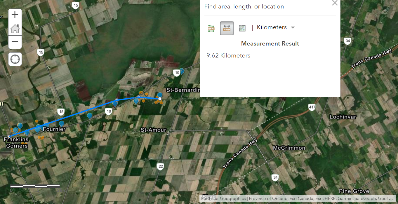
Map showing the path of the Fournier EF0 tornado, with blue pins being locations of documented damage and orange pins the locations of drone images.
The area with the worst tree damage caused by the Fournier EF0 tornado.
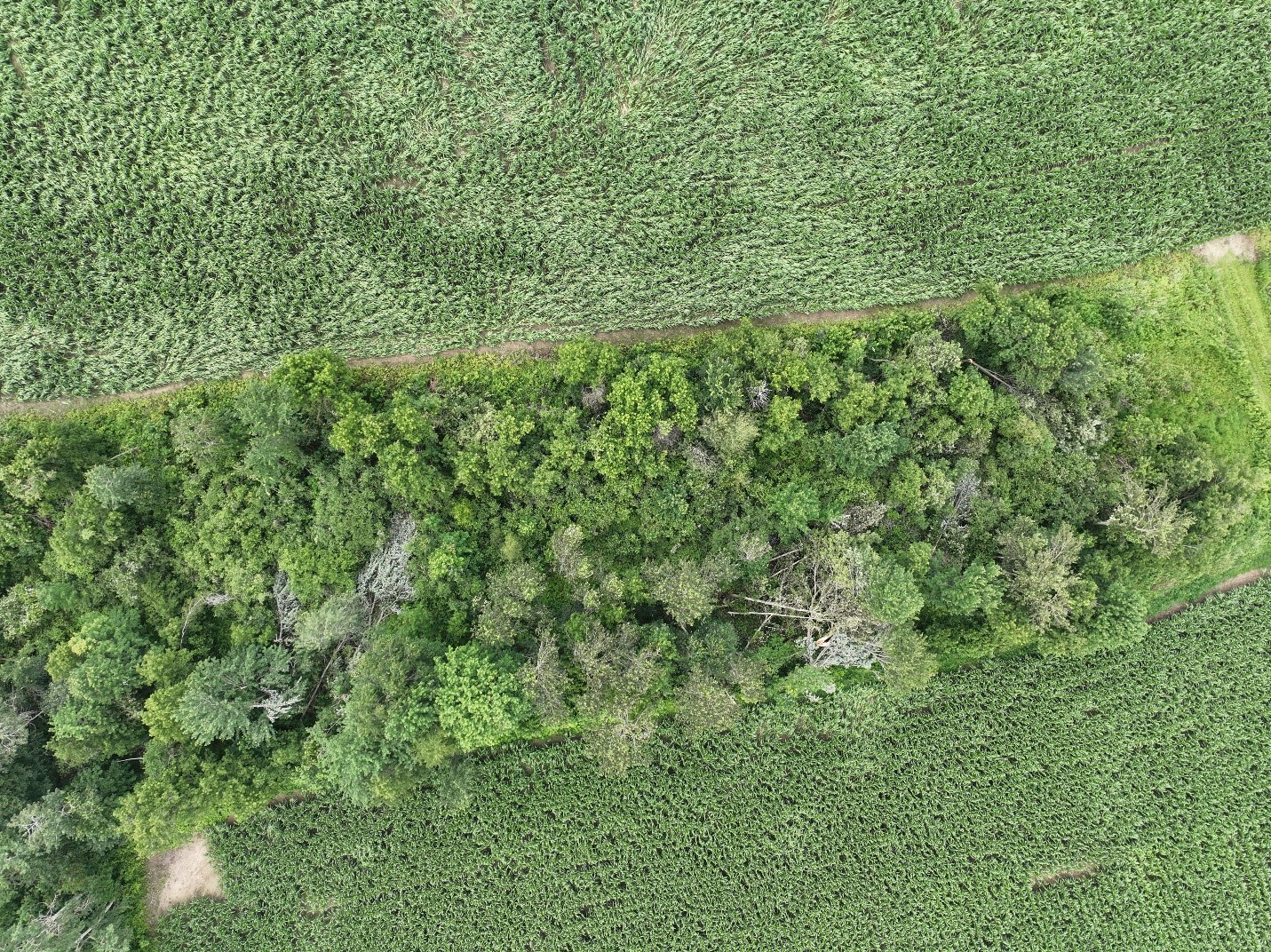
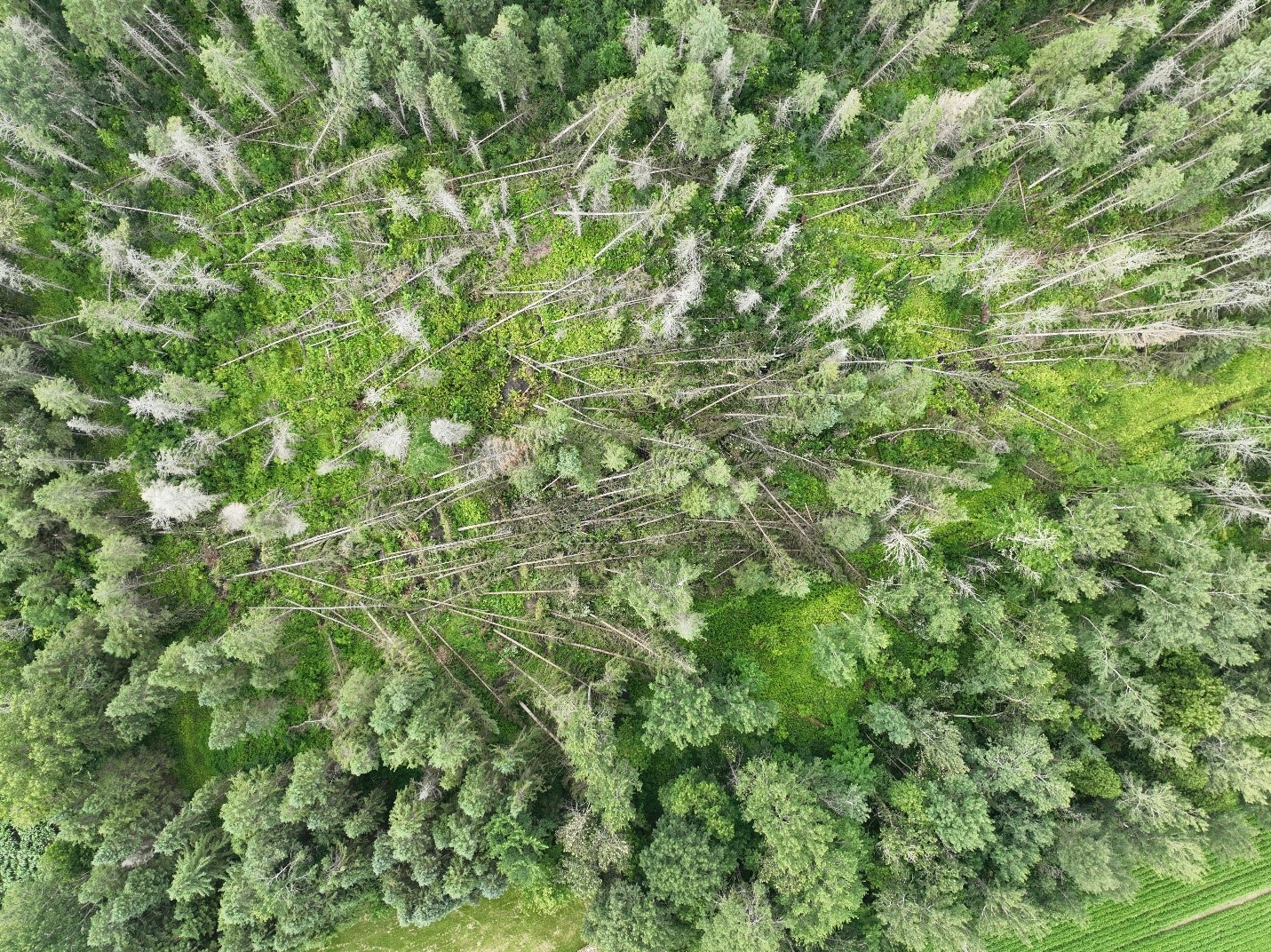
Another area of tree damage caused by the Fournier EF0 tornado, with damage to a corn crop to the north (top). Tree and corn were both down from multiple directions in this location.